The best waterfall hikes and walks in Newton County
4.7
(25)
550
hikers
10
hikes
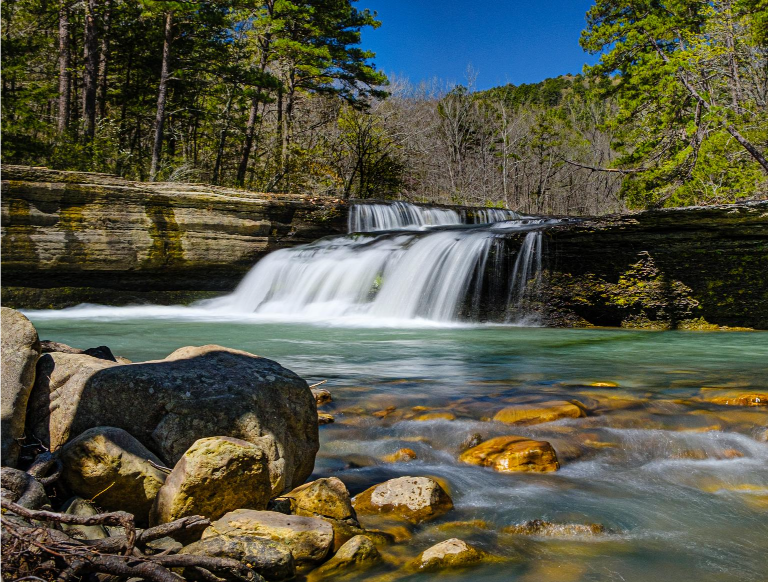
Waterfall hiking trails in Newton County traverse the rugged Ozark Mountains, characterized by dramatic bluffs and dense forests. The region is shaped by the free-flowing Buffalo National River, with many routes following its banks. Numerous waterfalls are a prominent feature, often found within gorges or along forest paths.
Best waterfall hiking trails in Newton County
- The most popular waterfall hiking route is Glory Hole Waterfall Trail, a 1.0 mile (1.6 km) trail that takes about 30 minutes to complete. This easy path leads to the unique Glory Hole Falls, where water plunges through a natural rock formation.
- Another top favourite among local hikers is Lost Valley Trail, an easy 2.4 miles (3.8 km) path. This route features Eden Falls, cascading into a clear pool, and includes rock shelters along the way.
- Local hikers also love the Glory Hole Falls Trail, a 1.9 miles (3.1 km) trail leading through forested terrain, often completed in about 45 minutes. This easy route provides access to the distinctive Glory Hole Falls.
- Hiking in Newton County is defined by rugged Ozark Mountains, the Buffalo National River, and numerous waterfalls. The network offers options for different ability levels, from easy strolls to more challenging treks.
- The routes in Newton County are highly rated by the komoot community with an average score of 4.8 stars from over 10 reviews. More than 400 hikers have used komoot to explore Newton County's varied terrain.
Last updated: November 8, 2026
6
hikers
8.51km
02:26
200m
210m
Embark on the Smith Creek and Elise Falls Loop, a moderate hike covering 5.3 miles (8.5 km) with an elevation gain of 651 feet (199 metres). You can expect to complete this route in about 2 hours and 26 minutes. The trail guides you through a beautiful Ozark forest, revealing scenic bluffs and the striking 21-foot Elise Falls, which dramatically drops through a rock slot. Along the way, you will also encounter Smith Creek, featuring many small cascades and large boulders. The path offers a mix of well-maintained dirt roads and narrower sections, providing a varied hiking experience.
When planning your visit, be aware that the trail includes sections with loose stones, exposed tree roots, and potentially slippery, weathered limestone rocks. This is especially true when you are walking in or alongside the creek bed. The return journey from Elise Falls involves a considerable uphill climb, so pace yourself accordingly. Consider visiting in spring for abundant wildflowers or in fall to witness a vibrant canopy of autumn colors.
This route offers a rewarding experience within the Smith Creek Preserve in Newton County, Arkansas. The preserve is known for its diverse natural beauty, making this loop a great way to immerse yourself in the region's unique landscape. The combination of waterfalls, creek features, and forest scenery makes it a notable destination for hikers seeking a moderate challenge in the Ozarks.
3
hikers
1.57km
00:27
0m
120m
Embark on the Glory Hole Waterfall Trail for an easy hike through a lush forest, following Dismal Creek. This unique route covers 1.0 miles (1.6 km) with no elevation gain, making it a perfect quick adventure you can complete in about 27 minutes. As you walk, you'll encounter smaller cascades and interesting rock formations before reaching the main attraction: the Glory Hole Falls, where the creek dramatically plunges through a circular hole in a rock ledge.
The trail begins on an old ATV road, which is generally wide and straightforward to navigate. However, as you approach the waterfall, the path becomes rockier, so be prepared for varied terrain. The area directly around the falls can be slippery, and if you wish to reach the bottom, you might need to scramble down a rocky slope. For your comfort and safety, wear sturdy shoes, especially if you visit after rainfall when the waterfall is at its most impressive.
Located within the expansive Ozark-St. Francis National Forest, the Glory Hole Waterfall Trail is a distinctive natural wonder. This area is part of the Dismal Creek Special Interest Area, recognized for its unique botanical features. If you visit in the spring, you'll find it's an excellent spot for observing wildflowers, adding another layer of natural beauty to your hiking experience.

5.70km
01:47
210m
200m
Embark on the Triple Falls via Kyles Landing Trail, a moderate hike that guides you through diverse and picturesque scenery. You will traverse wooded sections and encounter impressive rock formations along the way. The highlight is Triple Falls, a beautiful 48-foot waterfall that can showcase up to three distinct cascades, especially after heavy rains. This route covers 3.5 miles (5.7 km) with an elevation gain of 682 feet (208 metres), typically taking about 1 hour and 47 minutes to complete. You can also explore the stream above the falls, offering a different perspective of the area.
When planning your trip to Triple Falls, be aware that the road to the Camp Orr parking area can be quite challenging. It is often steep and rough, so a 4-wheel-drive vehicle might be necessary, particularly if there has been recent rain. For the best opportunity to witness all three waterfalls flowing powerfully, consider visiting during the wetter winter and spring seasons. This timing ensures the cascades are at their most impressive.
Beyond the falls, the trail offers glimpses of the Buffalo River from above during late fall and winter, adding another layer to the scenic experience. The entire area is part of the Buffalo National River, known for its pristine natural beauty and unique geological features. This trail provides a rewarding outdoor adventure within a significant natural landscape, making it a notable destination in the region.
70.8km
21:12
1,680m
1,590m
Embark on the Buffalo River Trail: Boxley to Pruitt, a challenging 44.0-mile (70.8 km) hike that immerses you in the Ozark wilderness. You will navigate rugged and rocky paths, ascend steep bluffs, and follow river banks, gaining 5525 feet (1684 metres) in elevation. Expect around 21 hours and 11 minutes of hiking to complete this difficult route, passing notable landmarks like the historic Parker-Hickman cabin.
When planning your visit, be aware that cell phone service is very spotty along the trail, so do not rely on it for emergencies. While backcountry camping is permitted, remember that pets are generally not allowed on trails within the Ponca Wilderness area. For the best views of the river valley, consider hiking in the fall, winter, or early spring, as summer can bring overgrown vegetation. Always check current trail conditions and regulations before you go.
This point-to-point route explores the western part of America's first National River, offering deep immersion into its unique environment. You will encounter typical Ozarks topography, characterized by thick forests and sinkholes, and discover viewpoints like the Pearly Springs Waterfall. The varied terrain and wild setting make this trail a distinctive experience for those seeking a true wilderness adventure.
5.0
(4)
122
hikers
4.33km
01:01
120m
120m
Embark on an easy hike along the Whitaker Point Trail, a 2.7-mile (4.3 km) route that takes about 1 hour to complete. You'll gain 406 feet (124 metres) in elevation as you wander through a lush forest filled with old ash, walnut, and oak trees. The path offers continuous views of the Ozark National Forest, building anticipation for the main attraction. The highlight of your journey is Whitaker Point, also known as Hawksbill Crag, a prominent rock formation that provides panoramic views of the valley below.
Before you head out, be aware that accessing the trailhead involves driving on a rough, unpaved, and winding gravel road. A truck or 4x4 vehicle might be necessary, especially if conditions are wet. The trail itself is well-marked and sees a lot of foot traffic, making it easy to follow. Consider planning your visit for spring to see wildflowers or in the fall for vibrant foliage, as these are often the best times to experience the route.
This trail is a standout in the Ozark National Forest, celebrated for its accessible beauty and the iconic Hawksbill Crag. Beyond the stunning views, you might spot various wildflowers during spring or enjoy the rich colors of autumn leaves. In wetter periods, several waterfalls can be found just off the main path, adding another layer of natural wonder to your hiking experience.
Get access to more routes and recommendations from other explorers.
Already have an account?
Our route recommendations are based on thousands of hikes, rides, and runs completed by other people on komoot.
Start today with a free account
Your next adventure awaits.


Other adventures in Newton County

Tips from the Community

Triple Falls is a waterfall near the Buffalo River that also goes by the name Twin Falls. Since there are so many waterfalls in Arkansas that go by the name Twin Falls, people usually just refer to these falls as Triple Falls. The trail to get to the viewing area beneath the falls is well-marked and well taken care of, but it is steep in spots, so be prepared to have to really hike to get to and from the water.
0
0

A short hike takes you to this iconic natural Arkansas landmark also known as the "Hawksbill". From here you get beautiful views of the Upper Buffalo Wilderness.
0
0
Unique waterfall that flows through the ceiling of an overhanging cave.
0
0
Frequently Asked Questions
How many waterfall hiking trails are available in Newton County?
Newton County offers a selection of hiking trails that feature waterfalls. Our guide currently highlights three distinct routes, all rated as easy, allowing you to explore the region's beautiful cascades.
What is the best time to visit Newton County for waterfall hikes?
Spring is often considered the best time to visit, as the spring rains ensure the waterfalls are at their fullest flow, and the Ozark forests are vibrant with wildflowers. However, the region offers beauty year-round, with winter providing a unique, serene perspective on the trails.
Are there any easy waterfall hikes suitable for beginners or those seeking a relaxed walk?
Yes, Newton County has several easy waterfall trails. The Glory Hole Waterfall Trail is a short, easy hike leading to a unique waterfall plunging through a rock overhang. Another excellent option is the Lost Valley Trail, which features Eden Falls and rock shelters.
Can I bring my dog on these waterfall trails?
While many trails in the Ozarks are dog-friendly, it's always best to check specific regulations for each trail or park area, especially within the Buffalo National River boundaries. Always keep your dog on a leash and pack out any waste.
Are there family-friendly waterfall hikes in Newton County?
Absolutely. The Lost Valley Trail to Eden Falls is particularly popular with families, offering an easy path, a serene waterfall, and even an opportunity to explore an underground waterfall within a cave. Triple Falls (Twin Falls) is also known for its accessibility and family appeal.
What unique natural features can I see along the waterfall hiking trails, besides the waterfalls themselves?
Newton County is rich in natural wonders. Along with waterfalls like Eden Falls and Magnolia Falls, you can discover impressive rock formations and natural bridges. The Alum Cove Natural Bridge and Rock Formations is a notable highlight, and trails often feature dramatic bluffs and unique rock shelters.
Where can I find the tallest waterfall in the Newton County region?
The region is home to Hemmed-in Hollow Falls, which, at 209 feet, is the tallest waterfall between the Appalachian and Rocky Mountains. The hike to reach it is challenging but incredibly rewarding. You can find more information about the trail to it via the Hemmed-In Hollow Trail highlight.
Are there any circular routes that feature waterfalls?
While many waterfall trails are out-and-back, some sections or combinations can create circular experiences. For instance, the Glory Hole Falls Trail offers a loop option to experience the unique waterfall. Always check the route details for specific circular path information.
Is parking available at the trailheads for these waterfall hikes?
Yes, parking is generally available at the trailheads for popular waterfall hikes in Newton County. However, during peak seasons or holidays, spaces can fill up quickly, so it's advisable to arrive early. Specific parking details are often provided on individual route pages.
What do other hikers enjoy most about Newton County's waterfall trails?
The area is highly rated by the komoot community, with an average score of 4.8 stars. Reviewers often praise the stunning natural beauty, the unique geological features like the Glory Hole Falls, and the serene experience of hiking through the Ozark forests to discover hidden cascades like Eden Falls.
Can I swim or wade near the waterfalls in Newton County?
While some waterfalls may have pools suitable for wading, it's important to exercise caution. Water levels and currents can vary, and rocks can be slippery. Always prioritize safety and be aware of any posted regulations regarding swimming or wading in specific areas.
Are permits required for hiking to waterfalls in Newton County?
Generally, permits are not required for day hiking on most public trails in Newton County, including those leading to waterfalls. However, if you plan to camp or engage in other specific activities, it's always wise to check with the relevant land management agency, such as the National Park Service for areas within the Buffalo National River.
Most popular routes in Newton County
Most popular attractions in Newton County

Get inspired with the komoot mobile app


Didn’t find what you were looking for?
Check out more Hikes throughout Newton County below and find the perfect route in your destination.
Explore more
Browse the best Hikes in other regions.
