The best walks and hikes in Upper Stevens Creek County Park
4.7
(398)
5,080
hikers
205
hikes
Hiking in Upper Stevens Creek County Park explores a section of the Santa Cruz Mountains, characterized by oak woodlands, stands of Douglas fir, and chaparral-covered hills. The park's trail system features a mix of single-track and multi-use routes with varied elevation, connecting to a larger network of open space preserves. Many trails are well-shaded, offering routes with views across the surrounding valleys and towards the bay side of the peninsula.
Best hiking trails in Upper Stevens Creek County Park
- The most popular hiking route is Table Mountain – Turtle Rock loop from La Honda, a 10.6 miles (17.1 km) trail that takes about 5 hours 10 minutes to complete. This challenging route features significant elevation gain and passes named rock formations.
- Another top favourite among local hikers is Turtle Rock – Long Ridge Trail loop from Saratoga, a moderate 8.5 miles (13.7 km) path. The trail combines sections of the Long Ridge Trail with ascents through varied terrain.
- Local hikers also love the Long Ridge Trail loop — Long Ridge Open Space Preserve, a 4.2 miles (6.7 km) trail leading through open grasslands and oak forests, often completed in about 1 hour 55 minutes.
- Hiking in Upper Stevens Creek County Park is defined by shaded oak woodlands, open grasslands, and chaparral-covered ridges. The interconnected trail network provides options for different ability levels, from short loops to more strenuous climbs.
- The routes in Upper Stevens Creek County Park are highly rated by the komoot community with an average score of 4.7 stars from over 390 reviews. More than 5,200 hikers have used komoot to explore Upper Stevens Creek County Park's varied terrain.
Last updated: July 8, 2026
10
hikers
16.4km
04:55
520m
520m
The Table Mountain via Long Ridge trail is a fantastic moderate hike that takes you on a diverse journey through the Long Ridge Open Space Preserve. You'll traverse shady woodlands with moss-covered trees and lush ferns, then emerge into expansive grasslands offering sweeping views of the Santa Cruz Mountains. This 10.2-mile (16.4 km) route, with its 1703 feet (519 metres) of elevation gain, typically takes about 4 hours and 55 minutes, making it a rewarding day out for hikers who appreciate varied terrain and stunning vistas, including the Table Mountain summit.
When planning your visit, aim for spring to witness spectacular wildflower displays in the meadows, or choose a clear day for the best chance to see the Pacific Ocean from viewpoints like the Wallace Stegner Bench. The trails are generally well-signed and maintained, though some sections can be rocky or uneven. While the preserve offers a beautiful escape, be mindful that some ambient noise from Skyline Boulevard or a nearby gun club might occasionally carry to parts of the trail.
This trail is a great way to experience the natural beauty of the Santa Cruz Mountains, showcasing a rich mix of environments from cool creekside forests to sun-drenched hilltops. Beyond the scenic beauty, you can also look for unique features like Turtle Rock and the Bodhidharma Cave. It's a solid choice for those looking for a substantial hike with a good workout and plenty of visual interest, providing a true sense of journey through California's diverse landscape.
6
hikers
11.0km
03:14
300m
330m
If you are seeking a hike that blends varied terrain with expansive views, the Long Ridge Loop is a fantastic option. This moderate 6.8-mile (11.0 km) route, with 984 feet (300 metres) of elevation gain, takes about 3 hours and 14 minutes to complete. You will wander through cool, creekside forests, then emerge onto open grasslands and ridgetop meadows, where panoramic vistas of the Santa Cruz Mountains and Pescadero Valley unfold, often revealing the Pacific Ocean on clear days. The trail's diverse scenery, including redwood trees and oak woodlands, makes it a rewarding experience for many.
Planning your visit to the Long Ridge Loop is straightforward, though it is wise to consider the seasons. The trail can be dusty during summer months but becomes lush and green in winter. While generally not as crowded as other Bay Area trails, arriving earlier in the day is always a good idea, especially on weekends, to ensure parking and a more serene experience. Remember that you will be sharing the path with mountain bikers and equestrians, so stay aware of your surroundings.
The Long Ridge Loop is part of the larger Bay Area Ridge Trail and connects to other protected lands like Skyline Ridge Open Space Preserve, highlighting its significance in the regional trail network. It is considered an underrated gem, offering a rich diversity of ecosystems from forest to grassland. Keep an eye out for local wildlife, including wild turkeys, feral pigs, and coyotes, adding to the natural charm of this unassuming spot. The Wallace Stegner Bench provides a perfect spot to soak in the views.

Sign up for free
2
hikers
6.51km
01:48
100m
130m
The Long Ridge Loop offers a delightful escape into the Santa Cruz Mountains, guiding you through a captivating mix of open grasslands and serene, shady woodlands. You'll find yourself winding along old roadbeds and singletrack paths, with sections like the Peters Creek Trail immersing you in lush, fern-filled forest. Along the ridgeline, prepare for continuous, sweeping views of the Santa Cruz Mountains, the Pescadero Valley, and even the distant Pacific Ocean, making it a rewarding experience for minimal effort.
This easy 4.0-mile (6.5 km) hike, with its modest 337 feet (103 metres) of elevation gain, is typically completed in about 1 hour and 47 minutes, making it an ideal choice for a leisurely outing. While some segments might have gentle inclines, the overall difficulty is low, suitable for beginners or those seeking a relaxed walk. Conditions can range from dusty in the summer to beautifully vibrant and green in the winter, so plan your visit accordingly, and consider arriving early to secure parking at this popular preserve.
Beyond the scenic beauty, the Long Ridge Loop is part of the larger Bay Area Ridge Trail network, offering connections to other open spaces for those looking to extend their adventure. Keep an eye out for wildlife such as wild turkeys and coyotes, and don't miss the Wallace Stegner Bench, a dedicated viewpoint offering spectacular vistas. This trail provides a diverse and accessible hiking experience, blending natural beauty with historical elements within the Long Ridge Open Space Preserve.
1
hikers
14.3km
04:01
240m
380m
If you're seeking a varied hiking experience in the Santa Cruz Mountains, the Bay Area Ridge Trail: Saratoga Gap to Skyline Ridge delivers. This moderate 8.9-mile (14.3 km) route guides you through a mosaic of moist evergreen forests, oak-madrone woodlands, and high grasslands. You'll encounter attractive moss-covered trees and lichen-covered boulders, particularly within Long Ridge Open Space Preserve, making for a visually engaging journey that takes about 4 hours to complete.
Planning your visit means being ready for diverse conditions; expect potential wind and fog on exposed ridgetops, and heat on west- and south-facing slopes. The trail involves 788 feet (240 metres) of elevation gain, spread across a series of ups and downs rather than one big climb. Access is typically from Saratoga Gap, and arriving early is a good strategy, especially on busy days, to secure parking.
This segment is a notable part of the larger Bay Area Ridge Trail, connecting several open space preserves and offering panoramic views of the coastal mountains. Historically, the route roughly follows old Summit Road, a wagon trail used by early settlers. From higher elevations, you might even catch glimpses of Monterey Bay and Big Basin on a clear day, adding to the trail's unique appeal.
6.18km
01:49
50m
420m
The Grizzly Flat Trail to Canyon Trail offers an easy hiking experience, covering 3.8 miles (6.2 km) with a gentle elevation gain of 151 feet (46 metres). You can expect to complete this route in about 1 hour and 49 minutes. As you hike, you will move through pleasant woodlands and dense mixed conifer forest, encountering both non-technical fire roads and steeper singletrack sections, especially near the Stevens Creek crossing where the terrain becomes more technical.
For your visit, parking is generally available within Upper Stevens Creek County Park, which provides convenient access to the trailhead. Be aware that if you choose to explore beyond the main route, the Grizzly Flat Trail South might be less traveled or maintained. Planning your trip during daylight hours will ensure you have ample time to enjoy the varied scenery.
This route is located within Upper Stevens Creek County Park, offering a diverse outdoor experience. The trail's blend of fire roads and singletrack, along with its passage through different forest types, makes it a notable option for a relatively short and accessible hike in the area. The Stevens Creek crossing is a distinct feature, adding a touch of ruggedness to an otherwise easy path.
Get access to more routes and recommendations from other explorers.
Sign up for free
Already have an account?
Our route recommendations are based on thousands of hikes, rides, and runs completed by other people on komoot.
Start today with a free account
Your next adventure awaits.
Login or Signup

Tips from the Community

Turtle Rock is the highest and most prominent mountain in the area. From this viewpoint, you can enjoy a panoramic view of the surrounding mountains, especially stunning at sunset. Be cautious, as the trail is popular and often busy with hikers.
1
0

Long Ridge Open Space Preserve is a 2,035-acre preserve that follows Long Ridge in the Santa Cruz Mountains. There are a variety of trails that can be used for hiking, biking, or horse riding. This is a dirt trail area, so it is more suited for gravel bikes or a stout touring bike; a hardtail would be ideal. In addition, this is a preserve and not a park, so there are no facilities that you would normally expect in a park, such as bathrooms, drinking water fountains, picnic tables, snack bars, or stores.
1
0
At the convergence of the Long Ridge Trail and Long Ridge Road, you will find the Wallace Stegner Bench. This overlook was one of the favorite places of author and conservationist Wallace Stegner. There are panoramic views of the Santa Cruz Mountains and the Pacific Ocean to be had from here. However, if you come up by bike, the dirt trail is best suited for a touring bike with decent tires or a gravel bike.
1
0

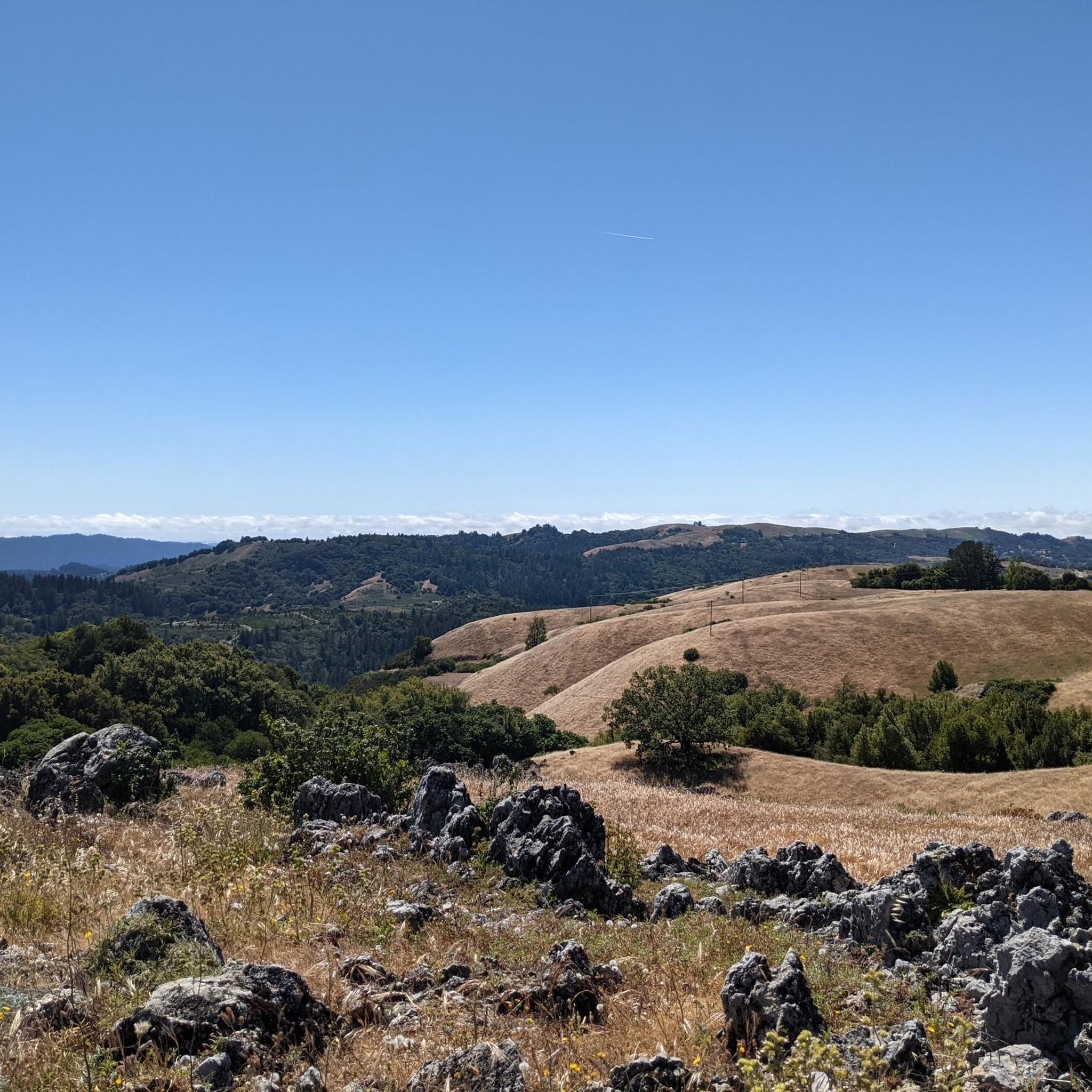
Turtle Rock gets its name because it looks like a little turtle with its head sticking up. This is a stunning spot to take a break and enjoy the overlook of the rolling hills and clouds roaming through the valleys.
0
0

This beautiful small lake is a picturesque, quiet, tranquil spot with blue-eyed grass surrounding the shoreline in early spring. It is a great spot to bring a picnic basket, sit and enjoy the peaceful setting while listening to the birds in the trees.
0
0
This bench commemorates author and conservationist Wallace Stegner, one of his favorite places. Open fields surround the stone bench and offer sweeping views of the Santa Cruz Mountains and the Pacific Ocean. Big leaf maples turn yellow in the fall, and the madrone trees produce bright red berries, adding to the landscape's beauty. With luck, you may see wild turkeys foraging for acorns. It's a great spot to take a break and enjoy the scenery.
1
0

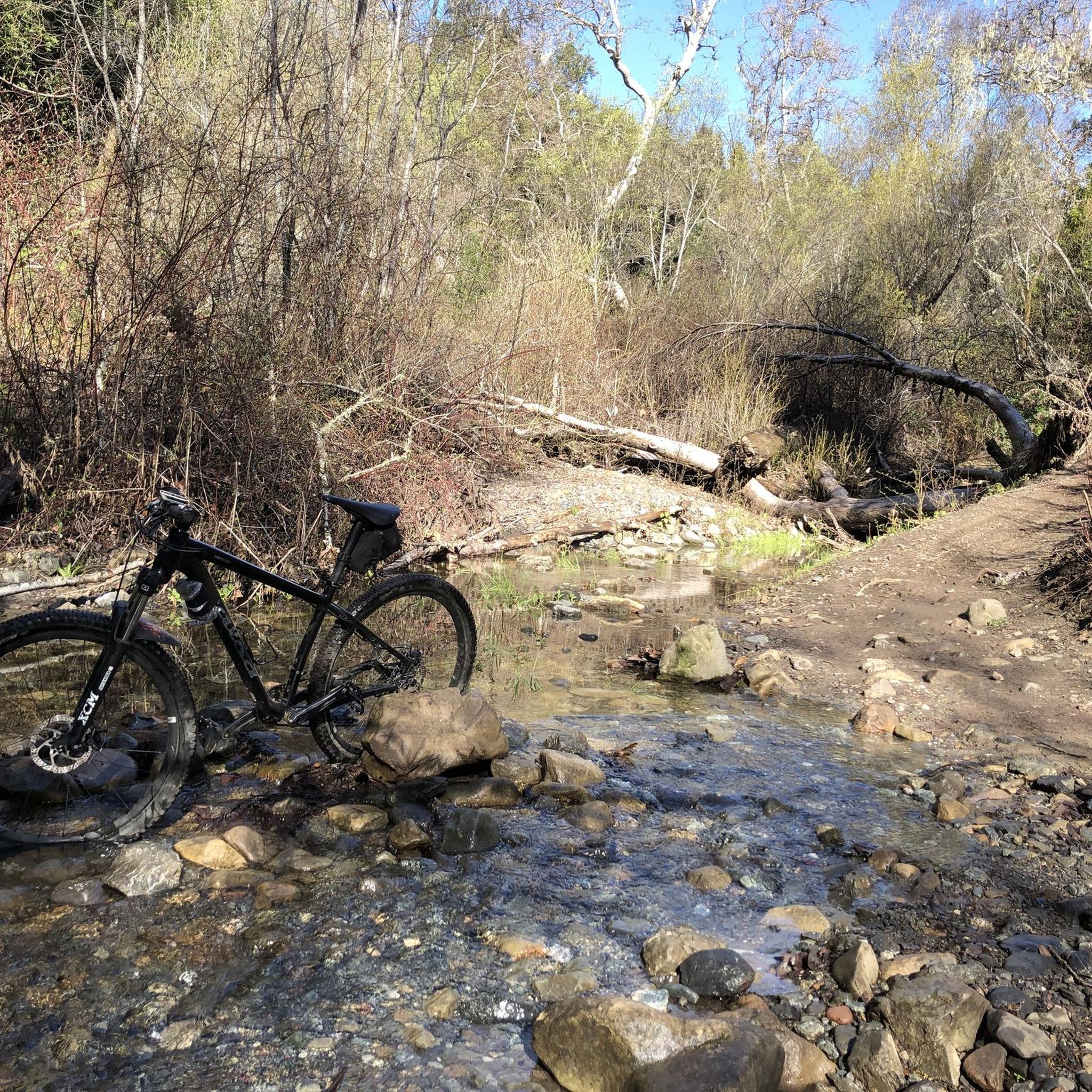
Canyon Trail crosses Stevens Creek here. Flow is normally low, but waters might be high during wet winters.
1
0

Frequently Asked Questions
Are dogs allowed in Upper Stevens Creek County Park?
Yes, dogs are permitted in Upper Stevens Creek County Park, but they must be kept on a leash no longer than six feet at all times. Remember to bring water for your pet and to clean up after them to keep the trails enjoyable for everyone.
What's the difference between Upper Stevens Creek and Stevens Creek County Park?
Upper Stevens Creek County Park is a more remote, wilderness-focused area located higher up in the Santa Cruz Mountains along Skyline Boulevard. It's known for its extensive network of hiking and equestrian trails through woodlands and chaparral. The main Stevens Creek County Park is located further down Stevens Canyon Road and is centered around the Stevens Creek Reservoir, offering activities like picnicking, fishing, and non-powered boating, in addition to its own set of trails.
Are there any easy, family-friendly hikes in the park?
Yes, the park offers several easier options suitable for families. A great choice is the Peters Creek Trail – Long Ridge Trail loop from Saratoga. It's a relatively short and flat walk that still provides a wonderful experience of the area's beautiful oak woodlands.
What is the parking situation at Upper Stevens Creek County Park?
Parking is available at trailheads along Skyline Boulevard (CA-35), but it is limited. These are typically small, unpaved pullouts. The park is less crowded than some other nearby preserves, but on weekends it's still a good idea to arrive early to secure a spot.
Can I get to the park using public transport?
Due to its remote location along Skyline Boulevard in the Santa Cruz Mountains, there is no direct public transportation to the trailheads for Upper Stevens Creek County Park. Accessing the park requires a private vehicle.
Are there any waterfalls in the park?
While the park doesn't have large, year-round waterfalls, small, seasonal cascades can appear along the creeks and ravines after significant winter and spring rains. The experience varies greatly depending on recent precipitation.
How many trails are there to choose from?
There are over 180 different routes to explore within and connected to Upper Stevens Creek County Park. The trail system includes everything from short, easy loops to strenuous all-day treks, with 79 trails rated as easy, 72 as moderate, and 32 as difficult.
What do other hikers think of the trails in this area?
The trails in and around Upper Stevens Creek County Park are highly regarded by the komoot community, with an average rating of 4.7 out of 5 stars. Hikers frequently praise the well-shaded paths through mature forests, the scenic valley vistas, and the peaceful, less-crowded atmosphere.
Are there any good circular hikes?
The park is excellent for loop hikes. For a rewarding moderate challenge, consider the Turtle Rock – Long Ridge Trail loop from Saratoga. This 8.5-mile (13.7 km) route takes you through a variety of landscapes, from shaded forests to open ridges, and includes the notable Turtle Rock formation.
What kind of wildlife might I see?
The park's diverse habitats of oak woodland, fir forests, and chaparral support a variety of wildlife. It's common to see deer, squirrels, and many species of birds. Coyotes and bobcats also inhabit the area, though they are more elusive. As always, keep a respectful distance from any wildlife you encounter.
Are horses allowed on the trails?
Yes, Upper Stevens Creek County Park is very popular with equestrians. Most of the trails are multi-use and open to horseback riding. The interconnected trail system allows for long, enjoyable rides through the Santa Cruz Mountains.
What is the best time of year to visit?
Spring is a fantastic time to visit, with pleasant temperatures and vibrant wildflowers. Autumn offers beautiful fall colors from the black oaks and big-leaf maples. Summer can be hot, but the many shaded trails provide relief. Winter is cooler and can be a great time to see the landscape rejuvenated by rain.
Are there picnic areas or restrooms in the park?
Upper Stevens Creek County Park is a rustic, wilderness-style park and does not have developed facilities like picnic tables, restrooms, or drinking water at its trailheads. You should plan to bring all the water and food you will need for your hike and pack out everything you bring in.
How do the trails connect to other parks?
The park's trails are part of a larger, interconnected network. You can hike from Upper Stevens Creek into adjacent preserves like Long Ridge Open Space Preserve and Saratoga Gap Open Space Preserve. For example, the Long Ridge Trail to Wallace Stegner Bench hike is a great way to experience this connectivity.
Most popular routes in Upper Stevens Creek County Park

Get inspired with the komoot mobile app


Explore more
Browse the best Hikes in other regions.
