The best running trails in Coyote Ridge Open Space Preserve
3.0
(2)
155
runners
47
runs
Jogging routes in Coyote Ridge Open Space Preserve offer diverse terrain in the Diablo Range foothills, south of San Jose. The preserve features a mix of accessible paths and more challenging trails, traversing unique serpentine grasslands and woodlands. Runners can experience varied landscapes, from open spaces to wetlands, with elevations ranging from gentle inclines to significant climbs. The area is also known for its sweeping views of the Santa Clara Valley and its role as a crucial biodiversity hotspot.
Best…
Last updated: July 8, 2026
4.72km
00:30
10m
10m
Easy run. Great for any fitness level. Mostly paved surfaces. Suitable for all skill levels.
5.79km
00:40
20m
20m
Hard run. Good fitness required. Sure-footedness, sturdy shoes and alpine experience required.

Sign up for free
12.2km
01:19
170m
170m
Moderate run. Good fitness required. Mostly paved surfaces. Suitable for all skill levels.
17
runners
11.9km
01:13
30m
30m
Moderate run. Good fitness required. Mostly paved surfaces. Suitable for all skill levels.
2
runners
8.18km
00:51
30m
30m
Moderate run. Good fitness required. Mostly paved surfaces. Suitable for all skill levels.
Get access to more routes and recommendations from other explorers.
Sign up for free
Already have an account?
Our route recommendations are based on thousands of hikes, rides, and runs completed by other people on komoot.
Start today with a free account
Your next adventure awaits.
Login or Signup
Popular around Coyote Ridge Open Space Preserve

Tips from the Community

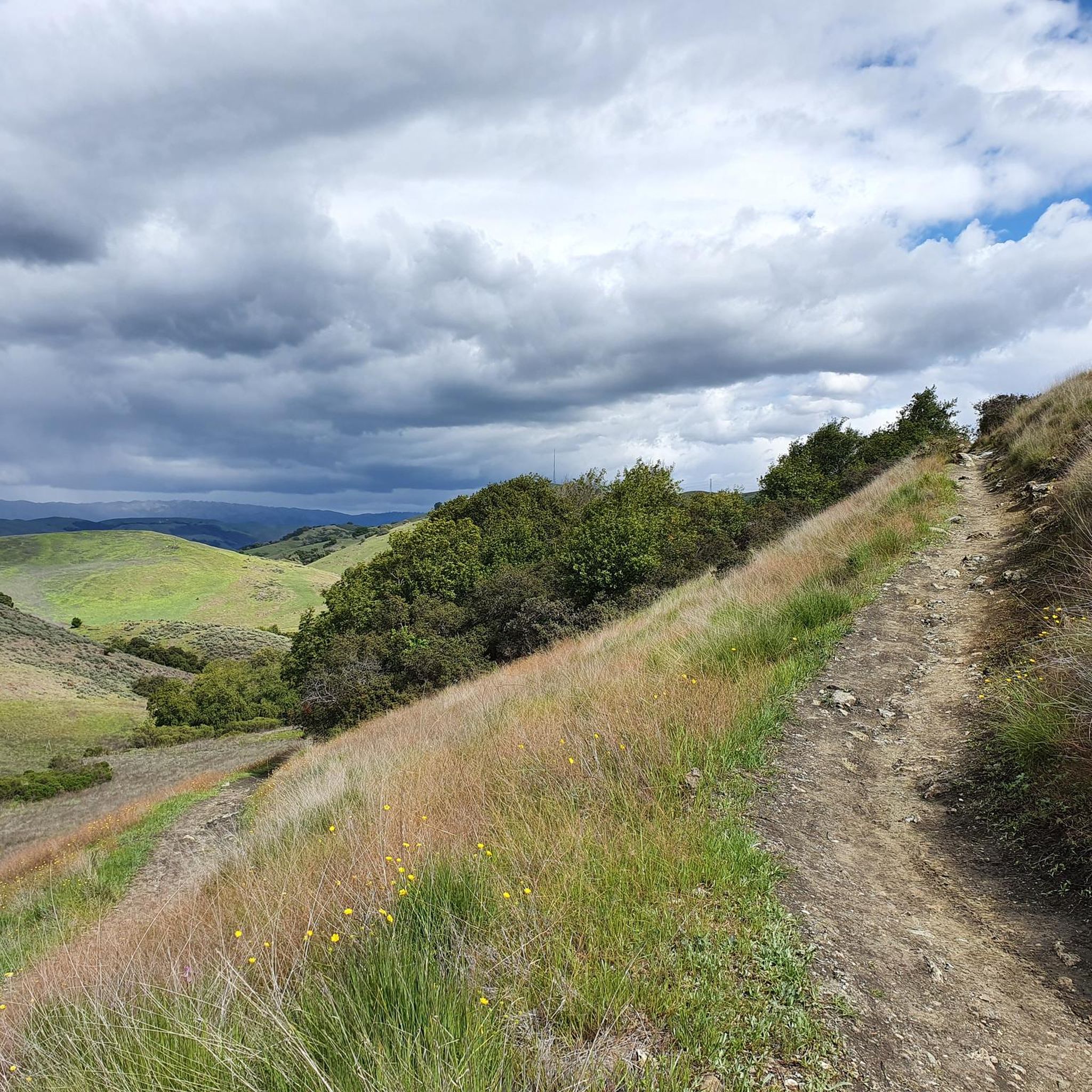
Bailey Road is a nice gradual uphill section of tarmac with a dirt shoulder. This spot would be great for some intervals on the hill and you can enjoy some nice views at the top. On the sharp hairpin, there are some dirt trails you could tie in to extend your run.
0
0
The Coyote Creek Trail, also called the Bay Area Ridge Trail, is a stunningly paved multi-use path that slowly transitions to gravel. The trail winds in between a number of ponds and has a little more shade at the turnaround loop.
0
0
This is a great spot to stop along Coyote Creek to sit under the large oak trees and enjoy the sounds of the flowing water. There are picnic tables, a bridge, and plenty of grass area to play.
0
0

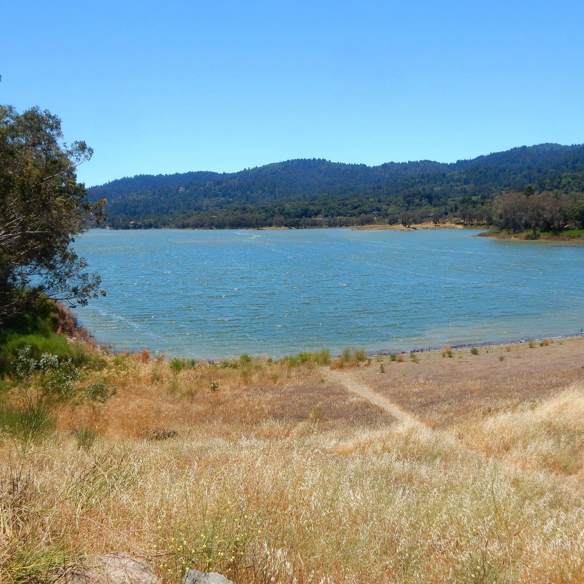
Anderson Lake is actually a reservoir, built in 1950. In 2009 a study showed that the dam was at risk of collapse if subjected to the forces expected from an earthquake from a nearby fault. The water level has been lowered considerably due to this while the water company take down and then re-build the dam. It's a massive project!
0
0

If you’re not parking and riding and need to use the restroom, there’s one located at the entrance a 100ft or so from the Anderson Lake Visitor Center (not the one located at the center, but the one on the other side of the parking lot): 19245 Malaguerra Ave, Morgan Hill, CA 95037
0
0
Frequently Asked Questions
What kind of terrain can I expect on the running routes in Coyote Ridge Open Space Preserve?
The preserve offers a diverse range of terrain, from easily accessible paths to more challenging routes. You'll encounter unique serpentine grasslands, woodlands, and sections of both paved and gravel surfaces, particularly along the Coyote Creek Trail. The trails also feature gradual inclines and significant climbs, providing varied experiences for runners.
Are there any beginner-friendly jogging routes in Coyote Ridge Open Space Preserve?
Yes, there are several options suitable for beginners. The preserve offers paths up to 3 miles with around 330 feet of elevation gain that are considered easy. An excellent choice is the Coyote Creek to Cochrane Road loop, an easy 2.9-mile (4.7 km) route with a flat path along the creek, perfect for a gentle run.
What are the typical distances and elevation gains for running trails in the preserve?
Running routes in Coyote Ridge Open Space Preserve vary significantly. You can find shorter, easier paths up to 3 miles with about 330 feet of elevation gain. For those seeking a more strenuous workout, there are routes exceeding 10 miles with over 1000 feet of elevation gain. For example, the Bailey Road route is 7.6 miles (12.2 km) with an elevation gain of approximately 170 meters.
Can I bring my dog on the running trails in Coyote Ridge Open Space Preserve?
Due to the preserve's sensitive habitat, which protects rare and endangered species, dogs are generally not permitted on the trails. This policy helps preserve the crucial biodiversity of the area.
Are there any scenic viewpoints or landmarks to see while running?
Absolutely! Joggers can experience stunning panoramic views, especially when climbing to the ridgeline, offering expansive vistas of the Santa Clara Valley and the surrounding region. The Máyyan Wáayi (Coyote Valley) Overlook Trail provides excellent views of Coyote Valley nestled amidst serpentine rock outcroppings. You might also spot unique serpentine grasslands and, in spring, vibrant wildflower displays.
What kind of wildlife might I encounter on the trails?
Coyote Ridge Open Space Preserve is a vital wildlife habitat. It provides refuge for species such as the Bay checkerspot butterfly, California red-legged frogs, tiger salamanders, and even tule elk. Golden eagles and Western burrowing owls are also present. Remember to observe wildlife from a distance and respect their natural environment.
Are there any circular running routes available?
Yes, the preserve offers several loop options for runners. A popular choice is the Coyote Creek Trail Loop, a 3.6-mile (5.8 km) path that provides varied scenery and views of Coyote Pond. Another is the Coyote Creek to Cochrane Road loop, an easy 2.9-mile (4.7 km) option.
Is there parking available at Coyote Ridge Open Space Preserve?
Yes, parking facilities are available for visitors accessing the preserve's trails. It's always a good idea to check specific trailhead information for parking details before your visit.
What is the best time of year to go running in Coyote Ridge Open Space Preserve?
Spring is particularly beautiful, as the hillsides are blanketed with colorful wildflowers, a direct result of the rare serpentine habitat. However, the preserve offers enjoyable running conditions throughout much of the year, with varied landscapes to appreciate in different seasons. Always check local weather conditions before heading out.
Are there any special permits or passes required to access certain areas?
Yes, some trails within the Habitat Protection Area require a free 'Butterfly Pass' due to the sensitivity of the ecosystem, particularly for species like the Bay checkerspot butterfly. However, trails like the Máyyan Wáayi (Coyote Valley) Overlook Trail do not require this pass.
What amenities are available for runners in the preserve?
The preserve offers accessible all-gender restrooms and picnic tables. However, drinking water and trash cans are not available, so visitors are encouraged to bring their own water and practice a 'pack it out' policy to help maintain the natural beauty of the area.
What do other runners enjoy most about jogging in Coyote Ridge Open Space Preserve?
The area is highly rated by the komoot community, with an average score of 3.0 stars. Reviewers often praise the diverse terrain, the unique serpentine grasslands, and the sweeping views of the Santa Clara Valley. The variety of routes, from easy paths to more strenuous climbs, is also frequently highlighted.
Most popular routes in Coyote Ridge Open Space Preserve

Get inspired with the komoot mobile app


Explore more
Browse the best Running Trails & Routes in other regions.
