The best walks and hikes in Teague Hill Open Space Preserve
4.7
(240)
3,657
hikers
139
hikes
Hikes in Teague Hill Open Space Preserve are centered around a section of the Bay Area Ridge Trail that passes through the area. Located in the Santa Cruz Mountains above Woodside, the preserve is characterized by oak and madrone woodlands. While public access within the preserve is limited, it serves as a key connector to the extensive trail systems in adjacent parks, including Huddart County Park and Wunderlich Park.
Best hiking trails in Teague Hill Open Space Preserve
- The most…
Last updated: August 17, 2026
7
hikers
7.01km
02:20
330m
320m
The Summit Springs to Teague Hill Loop offers a moderate 4.4-mile (7.0 km) hike through the diverse woodlands of the Santa Cruz Mountains. You'll gain 1083 feet (330 metres) in…
1.96km
00:39
90m
110m
Hike the 1.2-mile Archery Fire Road and Dean Trail in Huddart Park for an easy route through redwoods with bay views.

Sign up for free
21
hikers
18.4km
05:32
610m
620m
Hard hike. Very good fitness required. Easily-accessible paths. Suitable for all skill levels.
6
hikers
Easy hike. Great for any fitness level. Easily-accessible paths. Suitable for all skill levels.
5.0
(7)
88
hikers
24.0km
07:23
790m
1,070m
The Purisima Creek, Craig Britton, Whittemore Gulch, and Borden Hatch Mill Loop offers a deep dive into the Santa Cruz Mountains' varied ecosystems. You'll trek through dense second-growth redwood forests,…
Get access to more routes and recommendations from other explorers.
Sign up for free
Already have an account?
Our route recommendations are based on thousands of hikes, rides, and runs completed by other people on komoot.
Start today with a free account
Your next adventure awaits.
Login or Signup


Tips from the Community

Richards Road Trail is a popular trail through the redwoods in Huddart County Park. The trail is actually a fire road and is not a particularly challenging hike.
0
0

This charming park is just 3.5 miles west of Highway 84. There are barbecue pits, a playground, spacious grassy meadows, and plenty of hiking and riding trails. It's an ideal destination for a picnic or a peaceful stroll through the enchanting redwood forest along the park's beautiful winding paths. Dogs are not allowed in the park, so you'll need to leave your pup at home.
0
0
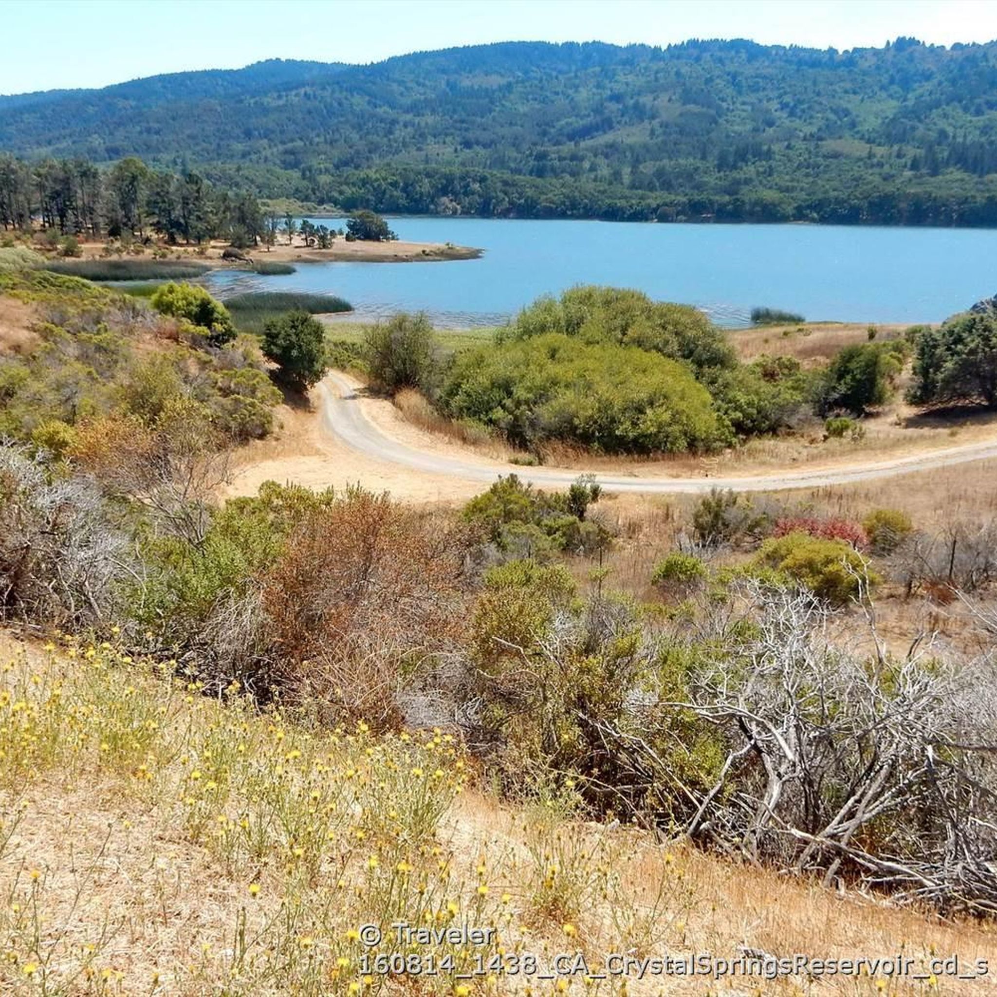
Crystal Springs Trail runs along the park's northern section and is a lovely path winding through madrone, redwood and oak trees. It connects to several other trails in the park, so you have plenty of options to extend your hike through this beautiful area.
0
0

This trail offers awe-inspiring beauty of the second-growth redwoods that adorn it. As the trail gracefully traces the hillside, you'll be treated to pleasant shade throughout the journey. Make sure to make use of the conveniently placed benches along the creekside, offering perfect spots to pause, relax, and fully absorb the picturesque surroundings.
0
0
You can enjoy the variety of trees the park has to offer, including redwoods, madrone, and oak trees. Take a moment to sit down at the picnic bench and enjoy the sights and sounds of the McGarvey Gulch Creek.
0
0
As you explore, you will find yourself surrounded by a dense canopy of trees that offer ample shade all day long. Feel free to make use of the nearby stream to take a break and fully immerse yourself in the breathtaking surroundings.
1
0

Popular essential trailhead for hikes into the open space preserves and parks on both side of Skyline Boulevard: to the west the wild and beautiful Purisima Redwoods OSP, and to the east Huddart Park.
0
0

You arrive at the road called Skyline Boulevard. It's a good landmark. Interesting houses built in the giant trees can be found just 500 meters away from this intersection.
0
0
Frequently Asked Questions
Are dogs allowed in Teague Hill Open Space Preserve?
No, dogs are not permitted within Teague Hill Open Space Preserve to protect the sensitive habitats and local wildlife, including the rare Kings Mountain Manzanita.
Is Teague Hill Open Space Preserve suitable for family hikes?
The accessible trail within Teague Hill itself is a very short and flat 0.2-mile walk, which is great for all ages. For a longer but still easy family outing, consider the nearby Huddart County Park – Crystal Springs Trail loop from Woodside, which offers a gentle path through the neighboring park.
Where can I park to access the trails?
There is limited roadside parking available. The main trailhead can be found on the south side of Kings Mountain Road, about 0.25 miles east of Skyline Boulevard. Parking can fill up, so arriving early is recommended.
Are there any circular or loop hikes available?
While the trail through Teague Hill itself is a linear connector, it links to parks with excellent loop options. For a substantial loop hike that explores the surrounding redwood and fir forests, you can try the Kings Mountain Trail & Richards Road loop in the adjacent Huddart County Park.
What kind of scenery and nature can I expect?
The preserve features a beautiful landscape of oak and madrone woodlands, which are typical of the Santa Cruz Mountains. It's a great place to see the rare Kings Mountain Manzanita. By connecting to adjacent parks, you can extend your hike into groves of towering redwoods and firs.
Are there restrooms available at the preserve?
No, there are no restroom facilities within Teague Hill Open Space Preserve. You should plan accordingly before your visit.
How many hiking trails are in the Teague Hill area?
While Teague Hill itself contains just one short, accessible trail segment, it serves as a gateway to a much larger network. The surrounding area, including connected parks, offers over 100 different routes for hiking.
What do other hikers think of the trails around Teague Hill?
The trails in and around the preserve are highly regarded by the komoot community. Hikers often praise the serene forest setting, the well-maintained paths, and the excellent connections to the broader trail systems of Wunderlich and Huddart parks.
Can I go trail running here?
Yes, the trails in the region are popular for trail running. For a challenging run with significant elevation, the Raymundo Trail loop offers a great workout through the forested landscape of the neighboring Phleger Estate.
How does Teague Hill connect to other parks?
The preserve's main trail is a segment of the Bay Area Ridge Trail. This trail acts as a vital link, connecting directly to San Mateo County's Wunderlich Park and the Midpeninsula Regional Open Space District's El Corte de Madera Creek Preserve, allowing for much longer and more varied hikes.
Are there any long-distance hiking options?
Yes, the connecting trails make longer hikes possible. For a challenging day out, you could tackle the Huddart County Park – Skyline Trailhead & Boulevard loop, a nearly 15 km route that explores the wider network of trails accessible from the area.
What is the best way to navigate the trails?
The main trail through Teague Hill is part of the well-marked Bay Area Ridge Trail. However, as you connect to the larger, more complex trail systems in adjacent parks, using a digital map on an app like komoot is highly recommended to navigate the various junctions and loops.
Most popular routes in Teague Hill Open Space Preserve

Get inspired with the komoot mobile app


Explore more
Browse the best Hikes in other regions.
