The best walks and hikes in Huddart County Park
4.7
(184)
3,083
hikers
24
hikes
Hiking in Huddart County Park offers access to 973 acres of diverse landscapes within the Santa Cruz Mountains. The park features magnificent second-growth redwood and mixed evergreen forests, deep shady canyons, and riparian corridors. Elevations range from 550 to 2000 feet, providing varied terrain for hikers. The trail network includes paths through chaparral and grasslands, often shaded by towering redwood, oak, and Douglas fir trees.
Best hiking trails in Huddart County Park
- The most popular hiking route is Crystal Springs & Dean Trail loop — Huddart County Park, a 4.7 miles (7.6 km) moderate trail that takes about 2 hours 18 minutes to complete, winding through redwood and mixed evergreen forests.
- Another top favourite among local hikers is Raymundo Trail loop — Phleger Estate, a moderate 6.7 miles (10.8 km) path. This route connects to the neighboring Phleger Estate, offering varied landscapes and forest sections.
- Local hikers also love the Whittemore Gulch and Purisima Creek Loop Trail, a 7.5 miles (12.0 km) trail leading through redwood forests and deep canyons, often completed in about 3 hours 43 minutes.
- Hiking in Huddart County Park is defined by second-growth redwood forests, mixed evergreen woodlands, and deep shady canyons. The network offers options for both leisurely strolls and more challenging climbs, with trails catering to various ability levels.
- The routes in Huddart County Park are highly rated by the komoot community with an average score of 4.7 stars from over 200 reviews. More than 3000 hikers have used komoot to explore Huddart County Park's varied terrain.
Last updated: June 24, 2026
5.0
(7)
81
hikers
24.0km
07:23
790m
1,070m
The Purisima Creek, Craig Britton, Whittemore Gulch, and Borden Hatch Mill Loop offers a deep dive into the Santa Cruz Mountains' varied ecosystems. You'll trek through dense second-growth redwood forests, where the Craig Britton Trail provides exceptional scenery, and then climb to higher ridges for sweeping coastal views of the Pacific Ocean. Expect a mix of smooth singletrack and challenging old logging roads, with the Purisima Creek Canyon providing a lush, shaded contrast to the more open, sunnier sections.
This difficult hiking route spans 14.9 miles (24.0 km) with a substantial 2594 feet (791 metres) of elevation gain, typically requiring around 7 hours and 23 minutes to complete. Parking is available at trailheads like Higgins Canyon Road or Skyline Boulevard, but arrive early on weekends as it's a very popular destination. Be prepared for muddy conditions if hiking during the wetter winter and spring months.
This extensive loop is a fantastic way to experience the ecological diversity of the Purisima Creek Redwoods Open Space Preserve, combining towering redwoods with open meadows and creek-side paths. The presence of old logging roads and stumps also hints at the area's rich history. It's a rewarding challenge for those seeking a long, varied day on the trails.
4.8
(4)
50
hikers
12.1km
03:42
420m
480m
The Crystal Springs, Summit, Chinquapin and Dean Loop offers a journey through the lush redwood gulches of Huddart County Park, where sunlight filters through second-growth redwoods, madrone, and Douglas fir. You'll find yourself on mostly single-track dirt trails, winding through varied terrain that includes both gentle grades and some notably steep climbs, particularly along the Crystal Springs Trail. Seasonal creeks and wildflowers add to the natural beauty, creating a serene and engaging forest experience.
This moderate hiking route covers 7.5 miles (12.1 km) with 1373 feet (418 metres) of elevation gain, typically taking around 3 hours and 41 minutes to complete. Huddart Park provides picnic sites and restrooms, making it a convenient day trip. Remember that dogs are generally not allowed on the trails within Huddart Park, so plan accordingly.
While some sections near major roads might have traffic noise, the northern and eastern parts of the park offer a much quieter escape into nature. The trail provides glimpses of the San Francisco Bay through the trees, adding an extra layer of scenic reward to this challenging hike. It's a great option for those seeking a substantial forest trek with a good workout.

Sign up for free
17
hikers
11.6km
03:43
490m
480m
The Richards Road, Lonely Trail, and Miramontes Trail Loop offers a fantastic escape into the redwood and mixed hardwood forests of Huddart County Park and the Phleger Estate. You'll traverse varied terrain, from dense Coast Redwood groves along West Union Creek to quieter, lusher sections on the Lonely Trail, known for its peaceful solitude. This moderate 7.2-mile (11.6 km) hike, with 1592 feet (485 metres) of elevation gain, typically takes about 3 hours and 42 minutes, making it a rewarding half-day adventure.
When planning your visit, be sure to check the current status of the Miramontes Trail, as parts of it were affected by a past trail collapse and a reroute is still in progress. Parking is readily available at Huddart County Park, which is the primary access point for this loop. The trail offers plenty of shade, making it a comfortable option even on warmer days, and the forest can be particularly vibrant and serene during light rain.
This loop is a great way to experience the natural beauty of San Mateo County, showcasing majestic redwood and madrone trees. You might even spot local wildlife like black-tailed deer or banana slugs. The area is also popular with equestrians, particularly on sections like the Miramontes Trail and Richards Road. It's a diverse route that provides a good sense of the region's forest ecosystems and offers a quiet retreat from city life.
7
hikers
13.2km
03:58
430m
430m
Hike the 8.2-mile Purisima Creek, Craig Britton and Skyline Trail Loop through redwoods to ocean views in Purisima Creek Redwoods Open Space
7
hikers
8.39km
02:46
390m
410m
If you're seeking a peaceful escape into the redwoods with a good dose of climbing, the Lonely, Raymundo and Mount Redondo Trail Loop is a solid pick. This moderate 5.2-mile (8.4 km) hike takes you through varied terrain, from packed earth to rocky sections, often following West Union Creek. You'll experience the quiet solitude of the aptly named Lonely Trail as it winds uphill through a mixed redwood and hardwood forest, eventually leading to lusher, larger redwoods and offering scenic views near Skyline Ridge.
Planning your visit is straightforward, but keep in mind that the trail can get muddy and slippery after rain, so checking the weather is a smart move. The area is popular, so arriving early for parking is recommended, especially on busy days. While the trail is generally quiet, some lower sections might have traffic noise from Highway 280. The estimated time to complete this loop is around 2 hours and 45 minutes, with a total elevation gain of 1285 feet (391 metres).
This loop offers a fantastic way to explore the redwood forests of the Phleger Estate and Huddart County Park. The changing forest, from mixed hardwoods to increasingly lush and larger redwoods, adds to the aesthetic appeal, making it a visually rewarding experience. The Mount Redondo Trail section is particularly noted for its scenic beauty, providing a memorable journey through this beautiful part of California.
Get access to more routes and recommendations from other explorers.
Sign up for free
Already have an account?
Our route recommendations are based on thousands of hikes, rides, and runs completed by other people on komoot.
Start today with a free account
Your next adventure awaits.
Login or Signup
Tips from the Community

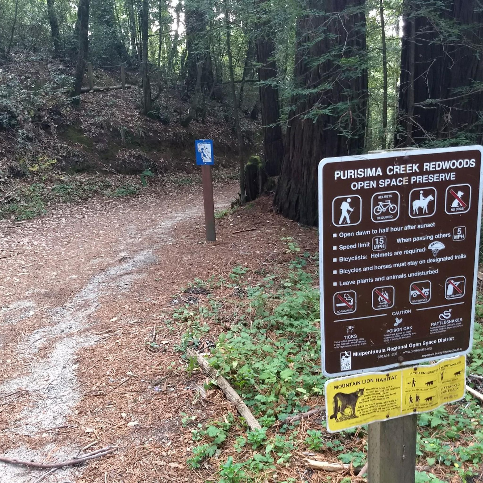
Phleger Estate is a 1,084 acre nature preserve that is popular with hikers and trail runners. The trails take you through beautiful redwood forest and give you great views of the nearby peaks and valleys.
0
0

This charming park is just 3.5 miles west of Highway 84. There are barbecue pits, a playground, spacious grassy meadows, and plenty of hiking and riding trails. It's an ideal destination for a picnic or a peaceful stroll through the enchanting redwood forest along the park's beautiful winding paths. Dogs are not allowed in the park, so you'll need to leave your pup at home.
0
0

As you explore, you will find yourself surrounded by a dense canopy of trees that offer ample shade all day long. Feel free to make use of the nearby stream to take a break and fully immerse yourself in the breathtaking surroundings.
1
0

Take the slow, winding and short Chris MacIntosh trail. the way the light pours through this tiny section of forest is lovely. You'll usually find birds and squirrels talking to one another and if you're lucky, you just might catch sight of a deer 🦌.
0
0

Popular essential trailhead for hikes into the open space preserves and parks on both side of Skyline Boulevard: to the west the wild and beautiful Purisima Redwoods OSP, and to the east Huddart Park.
0
0

You arrive at the road called Skyline Boulevard. It's a good landmark. Interesting houses built in the giant trees can be found just 500 meters away from this intersection.
0
0

Peaceful and gorgeous. Downhill is a breeze. Tickles the soul. It's compacted dirt all the way, so maybe 28mm tires would suffice if you have some dirt experience. I had 38s.
0
0
Frequently Asked Questions
What kind of terrain and landscapes can I expect when hiking in Huddart County Park?
Huddart County Park offers diverse landscapes, primarily characterized by magnificent second-growth redwood and mixed evergreen forests. You'll find deep shady canyons, riparian corridors, chaparral, and grasslands. The trails feature varied terrain, from soil to gravel to pavement, with elevations ranging from 550 to 2000 feet, providing both leisurely strolls and more challenging climbs.
Are there trails suitable for families with children in Huddart County Park?
Yes, Huddart County Park is family-friendly. While specific 'easy' routes are not highlighted in the data, the park offers 24 miles of trails with varied difficulty. Many trails are shaded and provide opportunities for leisurely walks. The park also features playgrounds and picnic areas, making it a great destination for families.
Can I bring my dog on the hiking trails in Huddart County Park?
The provided information does not explicitly state the park's dog policy. It's always best to check the official Huddart County Park website or signage at the park entrance for current regulations regarding dogs on trails, including leash requirements and restricted areas.
What are some notable natural features or attractions to look out for along the trails?
Huddart County Park is known for its towering redwood, oak, and Douglas fir trees. You can also spot diverse flora like madrone, tanoak, and various wildflowers. Evidence of the area's logging history, such as large redwood stumps, can still be seen. Additionally, the park features the Peninsula AIDS Memorial Grove. For specific trail features, consider exploring the Dean Trail or Crystal Springs Trail.
Are there any loop trails available for hiking in Huddart County Park?
Yes, Huddart County Park offers several loop trails. A popular option is the Crystal Springs & Dean Trail loop, which is a moderate 4.7-mile route winding through redwood and mixed evergreen forests. Another is the Kings Mountain Trail & Richards Road loop, a moderate 5.5-mile hike.
What is the best time of year to go hiking in Huddart County Park?
Many trails in Huddart County Park are shaded, making them appealing on warm days. The park's diverse ecosystems, including redwood and mixed evergreen forests, offer beauty year-round. For specific seasonal considerations like wildflowers or cooler temperatures, it's advisable to check local weather forecasts before your visit.
What kind of wildlife might I encounter while hiking?
Huddart County Park is home to various wildlife, including black-tailed deer, bobcats, coyotes, and raccoons. Birdwatchers might spot acorn woodpeckers, stellar jays, and red-tailed hawks. The understory also provides cover for creatures like the banana slug.
What do other hikers say about their experience in Huddart County Park?
The hiking routes in Huddart County Park are highly rated by the komoot community, with an average score of 4.7 stars from over 200 reviews. Hikers often praise the quiet woodlands, varied terrain, and the opportunity to explore magnificent redwood and mixed evergreen forests.
Are there options for longer or more challenging hikes that connect to other areas?
Yes, Huddart County Park provides access to longer hikes that connect to neighboring areas. For example, the Raymundo Trail loop connects to the adjacent Phleger Estate, offering varied landscapes and forest sections. The park also connects to Purisima Creek Redwoods Open Space Preserve and Wunderlich County Park, with the Bay Area Ridge Trail running through Huddart.
Are there any facilities or amenities available within Huddart County Park?
Yes, Huddart County Park offers several amenities to enhance your visit. These include well-maintained picnic areas with barbecue pits, restrooms with indoor plumbing, and water fountains. There are also reservable group picnic shelters, an amphitheater, playgrounds for children, and sand volleyball courts.
What is the typical elevation gain on trails in Huddart County Park?
The park's trails span elevations from 550 to 2000 feet. For example, the Crystal Springs & Dean Trail loop has an elevation gain of approximately 270 meters (886 feet), while the Whittemore Gulch and Purisima Creek Loop Trail involves about 453 meters (1486 feet) of ascent.
Most popular routes in Huddart County Park
Most popular attractions in Huddart County Park

Get inspired with the komoot mobile app


Explore more
Browse the best Hikes in other regions.
