The best walks and hikes in Cull Canyon Regional Recreation Area
4.6
(41)
644
hikers
58
hikes
If you've ever tried to plan hiking in Cull Canyon Regional Recreation Area, you know how quickly the options can feel overwhelming. With so many trails crisscrossing the landscape, it's tough to figure out which routes are genuinely worth your time and effort, and which ones are just filler. You want the highlights, not the guesswork.
That's exactly why we put this guide together. Our komoot community has explored, mapped, and reviewed countless routes here, sharing their honest experiences. We've sifted through all that collective wisdom to bring you a curated shortlist of the trails that truly deliver, saving you the hassle of endless research.
Hiking in Cull Canyon Regional Recreation Area offers a delightful mix of scenery, from densely wooded canyons to rolling grasslands and hills covered in oak trees. Cull Creek meanders through the area, often crossing the trails, adding to the natural charm. With elevations reaching up to 1,200 feet, you'll find everything from easy strolls to more demanding climbs, ensuring there's a path for every mood and fitness level.
If you're looking for a quick, rewarding outing, the Chabot to Garin Regional Trail and Lake View Trail Loop is a fantastic choice at just 1.9 miles (3.0 km) – it's easy and offers lovely views. For something a bit longer that still keeps things mellow, the Whispering Creek Trail, at 1.8 miles (2.9 km), is a local favorite for its peaceful atmosphere. If you're ready for a more substantial adventure, the Chabot-to-Garin Regional Trail offers a challenging 10.8 miles (17.4 km) with significant elevation gain, perfect for a longer day out. Dive in and discover your next favorite hike with komoot – over 500 hikers have already found their way here!
Last updated: May 10, 2026
4
hikers
3.00km
00:49
50m
50m
Discover a refreshing escape on the Chabot to Garin Regional Trail and Lake View Trail Loop, an easy 1.9-mile (3.0 km) hike that offers a surprising variety of scenery in just under an hour. This route guides you through a pleasant mix of shaded forests and open grassland, providing continuous views of Lake Chabot. You'll traverse both paved sections and dirt paths, with the chance to spot ancient oak trees and local wildlife like deer and wild turkeys.
This easy loop, with only 153 feet (47 metres) of elevation gain, is suitable for all fitness levels and can be completed in about 49 minutes. Parking is generally available at the trailheads, making it a convenient option for a spontaneous outing. Consider visiting in spring to enjoy wildflowers, or on a clear day for potential glimpses of the San Francisco Bay and downtown skyline from higher vantage points.
What makes this trail notable is its unique blend of natural landscapes and subtle urban glimpses, including sections that pass through a golf course. It offers a sense of tranquility as you move between different ecosystems, from wide-open spaces to more secluded, tree-lined paths. This trail provides a great introduction to the diverse outdoor experiences available within the East Bay Regional Park District.
9.63km
02:35
170m
10m
The Cull Canyon Bike Route offers a delightful hiking experience, guiding you through a diverse landscape that shifts from paved paths to dirt trails. You'll wander through lush, oak-carpeted hills, dense woods, and open grasslands, often paralleling the serene Cull Creek. This route provides a tranquil escape into rural Alameda County, far from the city bustle, with the chance to spot wildflowers like lupine in season.
Planning your visit is straightforward, as the route is easily accessible within the Cull Canyon Regional Recreation Area. While primarily a bike route, its well-maintained surfaces and varied terrain make it an excellent choice for hikers. Consider visiting during off-peak hours to fully appreciate the quiet and secluded atmosphere.
This moderate 6.0-mile (9.6 km) hike, with 553 feet (168 metres) of elevation gain and an estimated duration of 2 hours and 34 minutes, is a segment of the broader Chabot-to-Garin Regional Trail. After your hike, you can cool off at the popular swim lagoon within the Cull Canyon Regional Recreation Area, making it a great destination for a full day out.

Sign up for free
4.0
(1)
3
hikers
2.91km
00:47
30m
40m
The Whispering Creek Trail offers a delightful, easy escape into nature, even though it's nestled within an urban area. As you hike, you'll follow a lush creek through shaded paths, encountering abundant cattails, tule grass, and water lilies on the lake's surface. The highlight is undoubtedly the section crossing San Lorenzo Creek, where arching boughs create a wild, vibrant, and deeply shaded atmosphere, reminiscent of an enchanted forest.
This 1.8-mile (2.9 km) hiking route, with a minimal 109 feet (33 metres) of elevation gain, is perfect for a quick outing, taking only about 46 minutes to complete. It's considered easy and suitable for all skill levels, including families looking for a pleasant weekend stroll. Parking is available at the Don Castro Regional Recreation Area, which also offers other facilities like swimming and picnicking.
What makes the Whispering Creek Trail truly special is its serene natural beauty within an urban environment. You'll find rich flora, including eucalyptus trees, and might even catch fresh minty smells alongside the creek. The trail also features a small waterfall originating from a dam chute, adding another charming natural feature to this accessible and family-friendly path.
3
hikers
17.4km
05:06
460m
480m
The Chabot-to-Garin Regional Trail offers a unique blend of East Bay landscapes, guiding you through shaded forests, open grassy hills, and even parts of a golf course. You'll encounter a mix of paved and dirt paths, with consistent views of Lake Chabot and, from higher points like the High Ridge viewpoint, potential glimpses of the San Francisco Bay. Expect a dynamic experience with long descents and short, steep climbs, making it a rewarding journey for those who enjoy varied terrain.
When planning your visit, be aware that parking access is available, but it's wise to arrive early on busy days. The trail is accessible to dogs, provided they are kept on a leash. While the full 10.8 miles (17.4 km) with 1496 feet (456 metres) of elevation gain is rated difficult and takes about 5 hours and 6 minutes, the diverse scenery makes the effort worthwhile. Spring is an especially beautiful time to hike when the hills are lush and green.
This trail is notable for integrating natural landscapes with suburban areas, forming part of the extensive Bay Area Ridge Trail system. You might spot wildlife like deer and wild turkeys, adding to the natural appeal. Despite some sections being near development, parts of the trail can feel surprisingly quiet and remote, offering a peaceful escape within the East Bay.
10.6km
03:13
350m
350m
The Chabot to Garin Regional Trail offers a fascinating blend of landscapes, taking you from paved paths through a golf course to rugged dirt roads and singletrack in open grassland hills. You'll encounter shaded forests and enjoy views of Lake Chabot, with higher elevations providing glimpses of the San Francisco Bay and the downtown skyline on clear days. This moderate 6.6-mile (10.6 km) hike, with 1134 feet (346 metres) of elevation gain, is a great way to experience the varied terrain of the East Bay in about 3 hours and 12 minutes.
When planning your visit, be aware that the trail passes through active cattle grazing areas, so you might encounter livestock. Some sections can be rough and overgrown, particularly if you're looking for Chabot Garin terrain details. The trail is generally less crowded than other regional options, making it ideal for a tranquil outing. Spring offers lush green scenery, while summer brings a distinctive burnt gold landscape.
This route is a notable part of the East Bay Regional Park District system and integrates into the larger Bay Area Ridge Trail, showcasing a unique combination of urban and natural elements. It's an excellent choice for those interested in diverse scenery and wildlife spotting, as deer and wild turkeys are often seen. The Chabot to Garin Regional Trail features a dynamic hiking experience, moving from suburban areas into more remote open spaces.
Get access to more routes and recommendations from other explorers.
Sign up for free
Already have an account?
Our route recommendations are based on thousands of hikes, rides, and runs completed by other people on komoot.
Start today with a free account
Your next adventure awaits.
Login or Signup
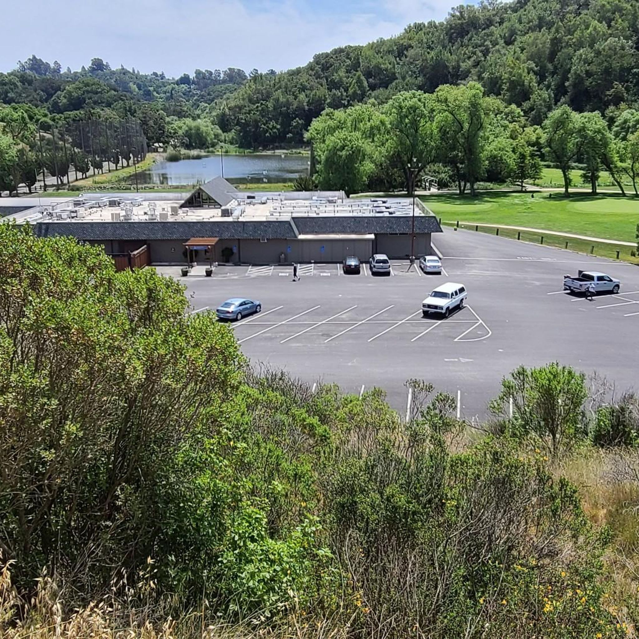
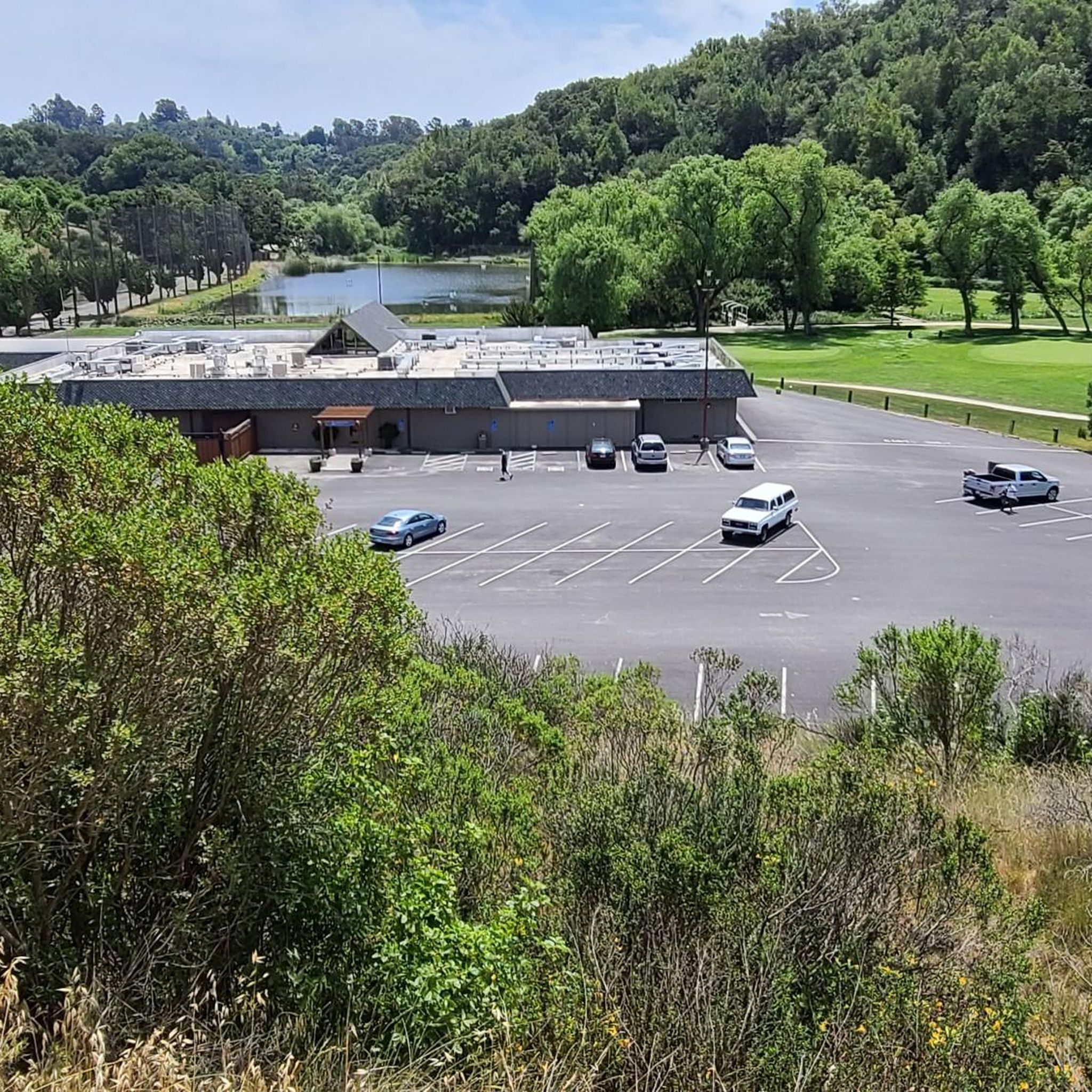
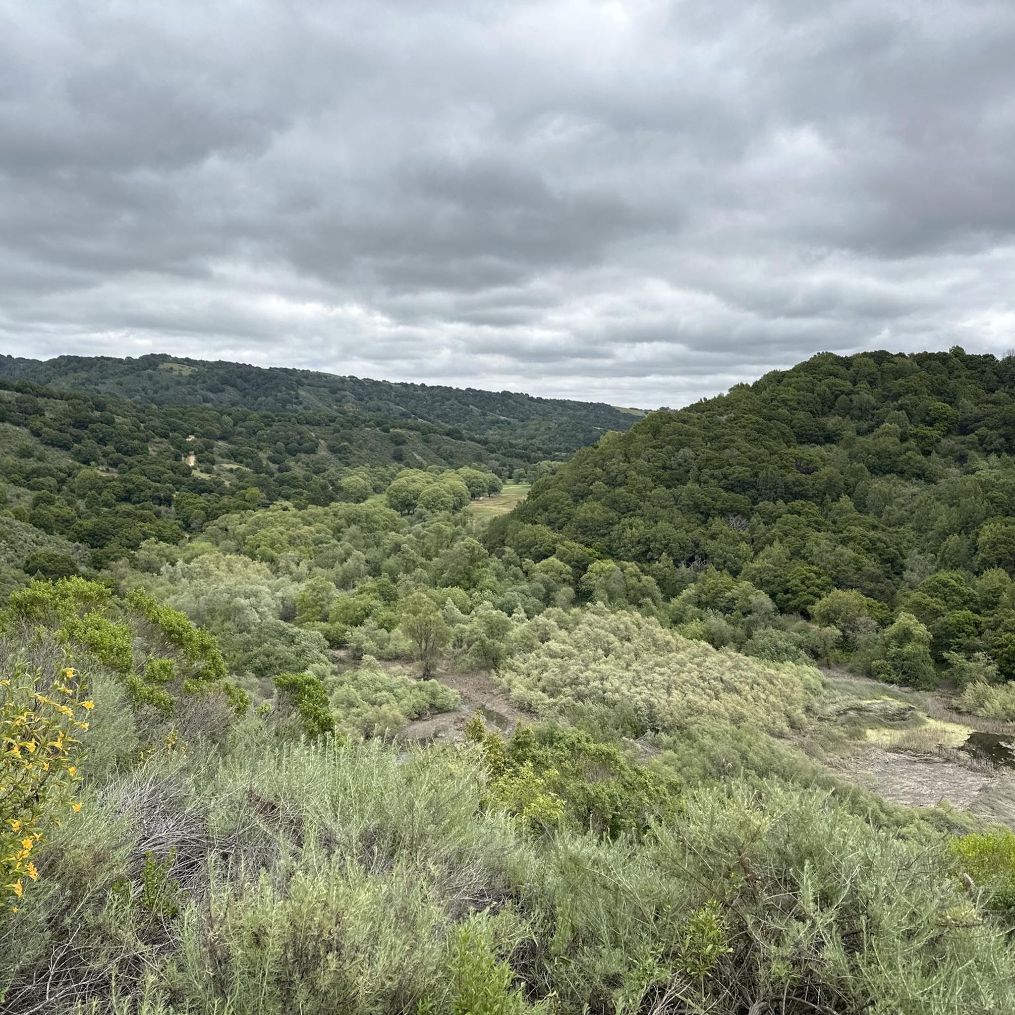
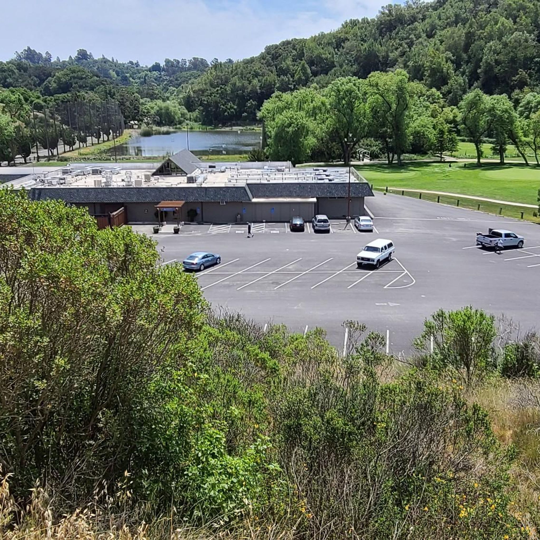
Tips from the Community

On a clear day you can see all the way across the bay, past the San Mateo-Hayward Bridge.
0
0


Don Castro Regional Park is a 101-acre park between Hayward and Castro Valley. It offers swimming in the lagoon, fishing, picnicking, as well as five miles of trails.
0
1

This is a good stop, where you can sit down on a bench and enjoy wonderful view of the area. Enjoy a cup of coffee (if you brought one with you} and rest your legs from the long climb.
0
0
Frequently Asked Questions
How many hiking trails are available in Cull Canyon Regional Recreation Area?
There are over 30 hiking routes in Cull Canyon Regional Recreation Area. These include a diverse range of options, with 19 easy trails, 13 moderate trails, and 3 more challenging routes, ensuring there's something for every skill level.
Are there easy hikes suitable for beginners or families in Cull Canyon Regional Recreation Area?
Yes, Cull Canyon Regional Recreation Area is very family-friendly, offering 19 easy trails. A great option for a gentle walk is the Ten Hills Trail loop from Castro Valley, which is 3.1 km long and features minimal elevation gain, making it perfect for a relaxed outing.
Can I bring my dog on the hiking trails in Cull Canyon Regional Recreation Area?
Yes, dogs are welcome on the hiking trails within Cull Canyon Regional Recreation Area. However, they must be kept on a leash at all times. Please note that dogs are not permitted in the swim lagoon area.
Are there any circular hiking routes in Cull Canyon Regional Recreation Area?
Many trails in the area are designed as loops, offering varied scenery without retracing your steps. For example, the Ten Hills Trail – Cameron Loop Trail loop from Castro Valley is a 6.4 km circular route that provides a good workout with moderate elevation changes.
What kind of landscapes can I expect to see while hiking in Cull Canyon Regional Recreation Area?
Hikers can experience a variety of landscapes, from densely wooded canyons that offer shade and a sense of immersion, to oak-carpeted hills and rolling grasslands. Cull Creek meanders through the area, with trails often crossing it. Higher points provide expansive views of the surrounding hills, including the distant Diablo Mountains and Lake Chabot.
What is the best time of year to visit Cull Canyon Regional Recreation Area for hiking?
The spring and fall months are generally ideal for hiking in Cull Canyon, offering pleasant temperatures and vibrant natural scenery. Spring brings wildflowers like three-cornered leek, red columbine, and vivid lupine. While summer can be warm, especially in open grassland areas, the wooded canyons provide cooler, shaded sections. The swim lagoon is particularly popular from May to August.
Are there any notable landmarks or attractions along the trails?
A significant feature for hikers is a section of the long-distance Chabot-to-Garin Regional Trail, which is also part of the larger Bay Area Ridge Trail. This trail offers diverse experiences, from singletrack through wooded canyons to dirt roads winding through oak-covered hills. From higher elevations, you can enjoy views of the Diablo Mountains and Lake Chabot.
What do other hikers enjoy most about Cull Canyon Regional Recreation Area?
The area is highly rated by the komoot community, with an average score of 4.6 stars from over 30 reviews. Hikers often praise the diverse terrain, from quiet wooded sections to open hillsides with scenic views, and the sense of escape despite its proximity to urban areas. The variety of trail difficulties also makes it appealing to a wide range of visitors.
Is there parking available at Cull Canyon Regional Recreation Area?
Yes, parking is available at Cull Canyon Regional Recreation Area. Specific trailhead information and parking details can often be found on individual route pages or through the park's official resources. It's advisable to check for any parking fees or specific regulations before your visit.
Are there any public transport options to reach Cull Canyon Regional Recreation Area?
While the region is primarily accessed by car, some public transport options may exist to nearby areas. For detailed information on public transport routes and stops that serve Cull Canyon Regional Recreation Area, it is best to consult local transit authority websites or journey planners.
What kind of wildlife might I spot on the trails?
While hiking, you might encounter various local wildlife. In damp areas, you could spot banana slugs. The diverse habitats, from woodlands to grasslands, support a range of birds and small mammals. Keeping an eye out for tracks and listening for calls can enhance your wildlife spotting experience.
Are there facilities like restrooms or picnic areas in Cull Canyon Regional Recreation Area?
Yes, the recreation area offers amenities to enhance your visit. Besides the popular Swim Lagoon with its bathhouse, you'll find picnic tables, BBQ pits, a volleyball court, and horseshoe pits, making it suitable for group gatherings and family outings.
Most popular routes in Cull Canyon Regional Recreation Area

Get inspired with the komoot mobile app


Explore more
Browse the best Hikes in other regions.
