The best walks and hikes in Ohlone Regional Wilderness Preserve
4.7
(52)
694
hikers
53
hikes
If you've ever tried planning a hike in Ohlone Regional Wilderness Preserve, you know how quickly the options can feel overwhelming. With 53 routes to choose from, it's hard to tell which trails are genuinely worth the effort and which are just filler. You want to make the most of your time, not spend it guessing.
That's where we come in. Our komoot community has explored, mapped, and reviewed these routes, so we've done the legwork to bring you a curated shortlist of the best hiking in Ohlone Regional Wilderness Preserve, saving you the guesswork. This guide is your shortcut to the trails that truly deliver.
Ohlone Regional Wilderness Preserve is a rugged, diverse landscape, defined by significant elevation changes, from 400 to 3,800 feet, across its 9,737 acres. Expect everything from extensive oak woodlands and rolling grassy uplands to challenging ridges and canyons. The terrain here can be demanding, but the reward is expansive views and a real sense of wilderness. For the most comfortable hiking experience, we recommend visiting in spring for wildflowers or in fall and winter when temperatures are cooler and the hills are green.
If you're looking for a rewarding, moderate challenge that showcases the preserve's varied terrain, we'd start with the Indian Joe, Cave Rocks, High Valley, and Flag Hill Loop, a 4.6 miles (7.4 km) route that offers great views without being overly strenuous. For those ready to tackle a more difficult, longer day out, the Little Yosemite, McCorkle Trail, and Vista Grande Overlook Loop is an 11.2 miles (18.0 km) journey that truly earns its place, taking you through the unique "Little Yosemite" area and up to stunning overlooks. With over 700 hikers having explored Ohlone Regional Wilderness Preserve using komoot, you're in good company.
Last updated: May 28, 2026
1
hikers
2.51km
00:40
0m
70m
The Camp Ohlone Road trail offers a delightful, easygoing journey through the Sunol Regional Wilderness, following the picturesque Alameda Creek. You'll experience a mix of paved asphalt and wider, uneven dirt and gravel sections underfoot, all while enjoying constant views of the waterway and the surrounding oak woodlands. It's a particularly vibrant scene after good rainfall, when the creek is flowing well, and the "Little Yosemite" highlight provides a charming focal point along the way.
Planning your visit to this popular trail is straightforward, with parking available at the trailhead within the Sunol Regional Wilderness. Given the limited shade along the route, cooler days are often the best time to hike, ensuring a more comfortable experience. This 1.6-mile (2.5 km) hiking route is rated easy, with 0 feet (0 metres) of elevation gain, and takes about 40 minutes to complete, making it a perfect quick escape.
This accessible and family-friendly trail is a gem for those seeking a gentle outdoor adventure, welcoming dogs on leash. While Camp Ohlone Road itself is a mellow walk, it also serves as a gateway to more challenging trails deeper within the Ohlone Wilderness, which are often used for training. The area is rich in natural beauty and historical significance, being part of the traditional territory of the Ohlone people.
5
hikers
5.70km
01:47
230m
230m
The Vista Grande Road – Cave Rocks Road loop in Sunol Regional Wilderness delivers a rewarding experience with stunning panoramic views. You'll traverse wide dirt roads and some single-track, passing the unique Cave Rocks formations before reaching the Cerro Este Overlook, which offers expansive vistas of High Valley, Mission Peak, and even a glimpse of the San Francisco Bay. This easy 3.5-mile (5.7 km) hike involves 740 feet (226 metres) of elevation gain, typically taking around 1 hour and 46 minutes, making it a great option for a relatively quick yet scenic outing.
Planning your visit is straightforward, but be aware that much of this route is exposed to the sun, so spring and winter are often the best times to hike. Always carry ample water and sun protection, especially if you venture out during warmer months. The Sunol Regional Wilderness is also home to grazing cattle, so you might encounter them along the path.
This trail is notable for its connection to larger loops within Sunol Regional Wilderness, offering a taste of the park's diverse landscapes and viewpoints. Beyond the stunning views, keep an eye out for wildflowers like lupine in season and raptors soaring overhead. The unique Cave Rocks provide an interesting natural feature for exploration, adding a distinctive element to the hike.

Sign up for free
2
hikers
4.80km
01:35
230m
240m
The Vista Grande and Eagle View Loop offers a delightful hiking experience, taking you on a continuous ascent to ridgetops with expansive views. You'll traverse natural, unpaved, and some paved sections, starting on a gravel service road before climbing a grassy ridgetop. The route provides panoramic scenery of rolling hills, blue oaks, the sparkling Los Vaqueros Reservoir, and the vast Central Valley plain, including the California Delta, making this easy 3.0-mile (4.8 km) hike with 751 feet (229 metres) of elevation gain a high-reward option that takes about 1 hour and 35 minutes.
Planning your visit requires a check of the Contra Costa Water District's Los Vaqueros hiking page, as the trails are usually closed from January to August for golden eagle nesting. There's a $6 parking fee, which contributes to the trail's quiet atmosphere. For the most vibrant scenery, aim to visit in the spring when the hills are lush and green.
This trail is ecologically significant due to its focus on golden eagle nesting, which is why seasonal closures are in place. The parking fee helps maintain the remarkably quiet trails, offering a peaceful escape. True to its name, the Vista Grande and Eagle View Loop is renowned for its "big vistas and wide-open spaces," providing superb views throughout your journey.
4.8
(5)
28
hikers
18.0km
05:49
910m
530m
The Little Yosemite, McCorkle Trail, and Vista Grande Overlook Loop offers a truly immersive experience in the Sunol Regional Wilderness, guiding you through oak-studded canyons and over rolling hills. You'll encounter varied terrain, from narrow dirt paths to wider fire roads, with the highlight being the dramatic Little Yosemite gorge, known for its climbable boulders and seasonal waterfalls. From higher elevations, particularly the Vista Grande Overlook, you'll be treated to panoramic views stretching across the San Francisco Bay and the Calaveras Reservoir.
This challenging hiking route spans 11.2 miles (18.0 km) with a substantial 2979 feet (908 metres) of elevation gain, typically requiring 5 hours and 49 minutes to complete. Be ready for steep inclines and descents, and note that rocky sections near Little Yosemite can be slippery. Parking is available at the trailhead, but it's always a good idea to arrive early, especially on busy days, and carry ample water for this demanding trek.
The Sunol Regional Wilderness is a diverse ecosystem, and you might spot wildlife like ground squirrels, deer, and various birds, including hawks and golden eagles, along the way. The park is also known for its vibrant wildflowers in spring, adding another layer of beauty to the already stunning landscape. This loop is a fantastic option for those seeking a significant workout combined with some of the best notable landmarks and natural features the Bay Area has to offer.
4.7
(3)
17
hikers
7.43km
02:22
300m
310m
The Indian Joe, Cave Rocks, High Valley, and Flag Hill Loop offers a dynamic hiking experience through the Sunol Regional Wilderness, blending shaded creek beds with exposed ridgelines. You'll traverse oak-dotted meadows and open grasslands, with the highlight being the panoramic vistas from Flag Hill, where you can see the Sunol Wilderness mountains, Calaveras Reservoir, and even the San Francisco Bay. In spring, the descent into High Valley is particularly scenic, with vibrant green landscapes and grazing cattle.
This moderate 4.6-mile (7.4 km) hike involves a significant 995 feet (303 metres) of elevation gain, taking approximately 2 hours and 22 minutes to complete. Be ready for some steep sections, especially on the climb to Flag Hill, and varied trail surfaces ranging from narrow singletrack to wider gravel roads. If you're planning to hike after rain, be aware that parts of the Indian Joe Creek Trail can become steep and slippery.
Beyond the stunning views, the trail offers unique geological features like the fossil-rich sandstone of Flag Hill and the distinctive granite rock formations of "Little Yosemite" along Alameda Creek, known for its rapids. Keep an eye out for wildlife, including red-tailed hawks and golden eagles soaring above. This loop provides a challenging yet rewarding outdoor adventure in Alameda County.
Get access to more routes and recommendations from other explorers.
Sign up for free
Already have an account?
Our route recommendations are based on thousands of hikes, rides, and runs completed by other people on komoot.
Start today with a free account
Your next adventure awaits.
Login or Signup
Popular around Ohlone Regional Wilderness Preserve
Tips from the Community

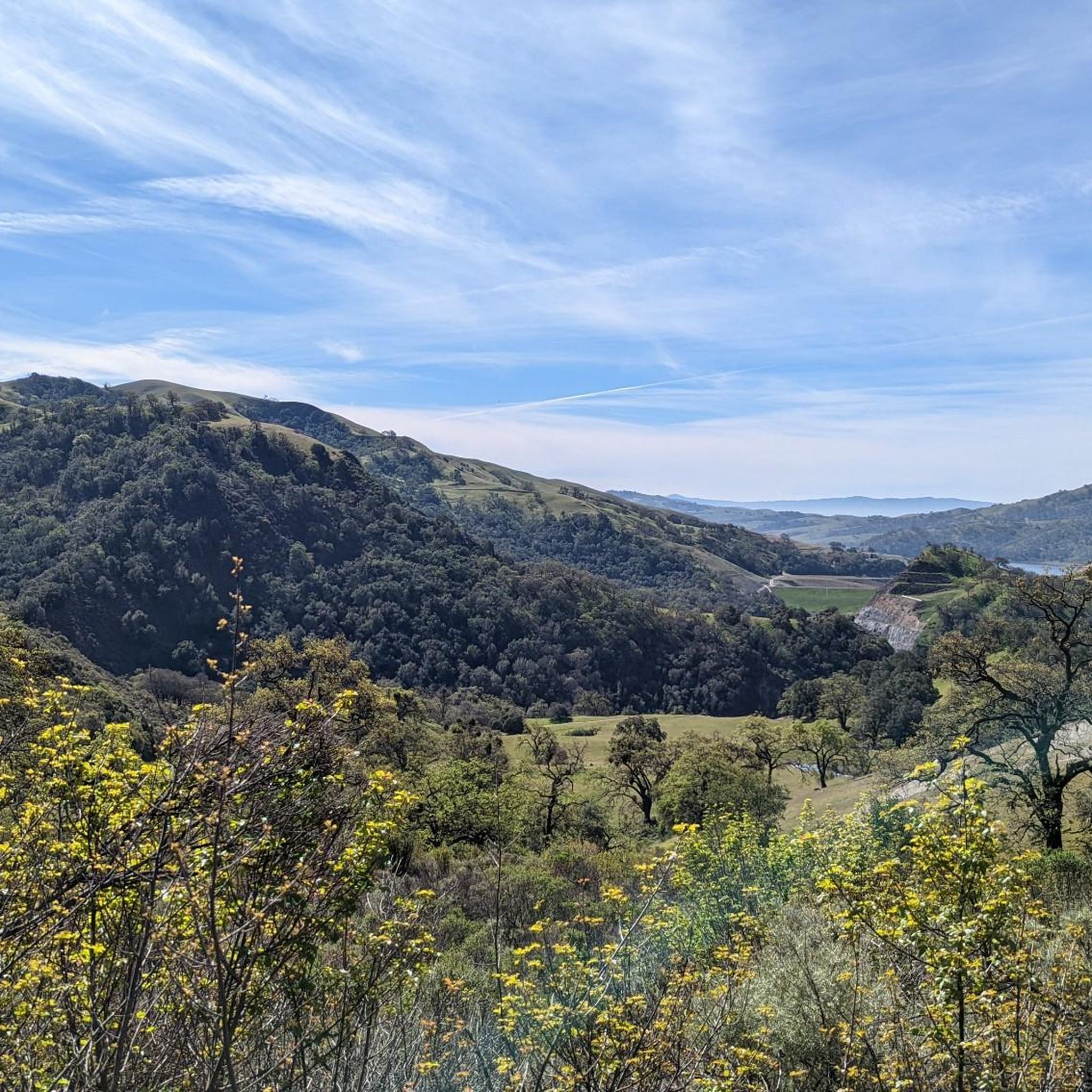
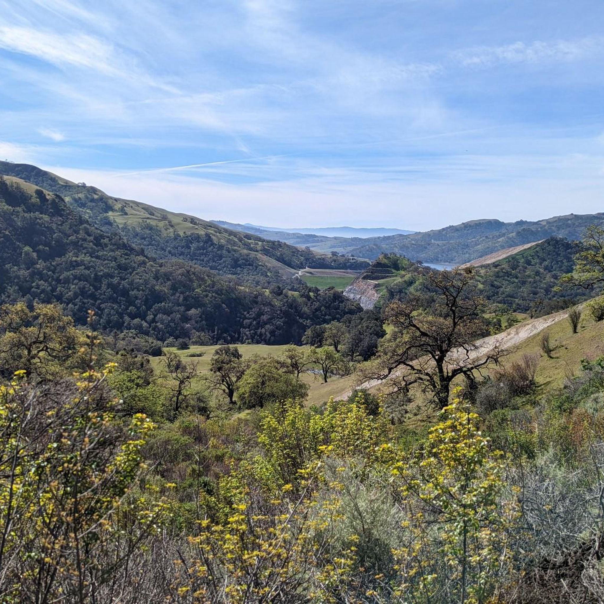
From this viewpoint, you can enjoy stunning views of rolling hills and valleys. If you come here in the spring, and more specifically late May, you will be able to bask in the full bloom of the wildflowers in the area.
0
0

This park is considered to be a mini Yosemite with creeks, boulders and sometimes waterfalls. It costs $5 to get access the site and if you go during peak times, it is normally fairly busy.
0
0

As soon as you get to the junction where you arrive at this trail, you'll be at one of the most scenic spots of Sunol Regional Wilderness park. Conveniently, you'll find a bench positioned right there, which might entice you to spend extra time taking it in. Not only is this spot scenic, but the one mile you'll be covering on your way down this trail is probably the cutest stretch of trail on this hike, because the trail precisely follows the spine of this knife's-edge ridgetop all the way to its end.
0
0
The hike on Cave Rocks Road offers great views of High Valley, a small green meadow surrounded by hills. An old barn and some campground buildings sit in the meadow, looking like something out of a movie filmed in the Swiss Alps.
0
0
The Big Live Oaks are an iconic feature of this hike. You can spot these majestic Live Oak trees throughout the hike. Pause and seek refuge from the sun beneath these majestic trees. As you do, reflect on their age, ranging from hundreds of years old to over a thousand, serving as living witnesses to the region's history and ecological changes.
0
0
This natural oasis is the perfect stop if you're willing to pay the $5 entrance fee (cash only). Here you will find lots of small to moderate waterfalls, making the hike around the area not only visually stunning but also very relaxing as the sounds coming from the waterfalls can be heard from every direction.
0
0
From this viewpoint you can enjoy stunning views of rolling hills and valleys. If you come here in the spring, and more specifically late May, you will be able to bask in the full bloom of the wildflowers in the area.
0
0
Frequently Asked Questions
How many hiking trails are available in Ohlone Regional Wilderness Preserve?
Ohlone Regional Wilderness Preserve offers over 50 hiking routes. These range from easy loops to challenging multi-day treks, catering to various experience levels. The komoot community has rated these trails highly, with an average score of 4.8 stars.
Are there any easy, family-friendly hiking trails in Ohlone Regional Wilderness Preserve?
Yes, there are several easier options suitable for families. For instance, the Camp Ohlone Road is an easy route. Another great choice is the Vista Grande Road – Cave Rocks Road loop from Sunol Regional Wilderness, which is 3.5 miles long and offers pleasant views.
What are the best times of year to hike in Ohlone Regional Wilderness Preserve?
The best times to visit are during winter, especially after rains when the hills are lush and green, and in March-April when wildflowers are in full bloom. These periods offer cooler temperatures and vibrant scenery. Summers can be very hot and dry, making early mornings or late afternoons preferable if hiking during this season.
Are dogs allowed on the trails in Ohlone Regional Wilderness Preserve?
Yes, dogs are generally permitted in Ohlone Regional Wilderness Preserve, but they must be kept on a leash at all times. It's always a good idea to check the specific rules and regulations for individual trails or areas within the preserve before you go, as policies can vary.
Are there any waterfalls in Ohlone Regional Wilderness Preserve?
Yes, Murietta Falls is a notable feature within the preserve. It flows beautifully after significant rainfall, offering a refreshing sight. During drier periods, it may only be a trickle, so plan your visit accordingly if seeing the waterfall is a priority.
What kind of views can I expect on the trails?
Ohlone Regional Wilderness Preserve offers breathtaking panoramic views from its prominent peaks. From Rose Peak (3,817 feet) and Discovery Peak (3,837 feet), you can enjoy 360-degree vistas of hidden valleys, rolling ridges, and the scrubby landscapes of the central Diablo Range. Mission Peak also provides expansive views.
Are there any challenging long-distance hikes in the preserve?
Absolutely. The Ohlone Wilderness Trail, a 28 to 29-mile route, is the centerpiece of the preserve and is known for its significant elevation changes, often compared to backpacking in the Sierras. It can be tackled over two or three days. For a challenging day hike, consider the Little Yosemite, McCorkle Trail, and Vista Grande Overlook Loop, which is 11.2 miles long with substantial elevation gain.
Do I need a permit to hike in Ohlone Regional Wilderness Preserve?
Yes, a permit is required for day use and camping on the Ohlone Wilderness Trail. It's essential to obtain this permit in advance to ensure compliance with preserve regulations. For detailed information on how to acquire a permit, you can visit the East Bay Regional Park District website.
What are the parking options for accessing the trails?
Access points to Ohlone Regional Wilderness Preserve, such as Del Valle Regional Park and Sunol Regional Wilderness, typically offer designated parking areas. These often require a parking fee. It's advisable to check the specific park entrance you plan to use for current parking information and fees.
Is public transport available to reach Ohlone Regional Wilderness Preserve?
Public transport options directly to the preserve are limited due to its wilderness nature. Access is primarily by car, often through entry points like Del Valle Regional Park or Sunol Regional Wilderness. Planning for private transportation is generally recommended.
What kind of wildlife might I encounter while hiking?
The preserve is a vital corridor for diverse wildlife. You might spot golden eagles, foxes, bobcats, and coyotes. Mountain lions and endangered bald eagles are also present, though less commonly seen. Hikers may also observe cows grazing in certain areas, contributing to the pastoral landscape.
Are there any loop hikes available?
Yes, the preserve offers several loop hikes. An example is the Little Yosemite via McCorkle Trail & Camp Ohlone loop, a moderate 6.1-mile path that explores varied terrain. Another option is the Vista Grande and Eagle View Loop, which is an easy 3-mile route.
What do other hikers enjoy most about hiking here?
The komoot community highly rates the trails in Ohlone Regional Wilderness Preserve, with an average score of 4.8 stars. Hikers frequently praise the challenging terrain, the diverse landscapes ranging from oak woodlands to rolling hills, and the stunning panoramic views from peaks like Rose Peak. The sense of wilderness and solitude is also a common highlight.
Most popular routes in Ohlone Regional Wilderness Preserve

Get inspired with the komoot mobile app


Explore more
Browse the best Hikes in other regions.
