The best walks and hikes in California Coastal National Monument
4.7
(207)
2,445
hikers
118
hikes
Hiking in California Coastal National Monument offers routes along the state's coastline, featuring a mix of sandy coves, coastal prairies, and rocky shorelines. The terrain is characterized by coastal bluffs, marine terraces, and access to beaches. The monument protects numerous islets and rock outcroppings, providing a distinct landscape for coastal walks.
Best hiking trails in California Coastal National Monument
- The most popular hiking route is Clifftop Coastal Trail loop — Coast Dairies State Park, a 3.5 mile (5.7 km) trail that takes about 1 hour 30 minutes to complete. This route follows the clifftops with views over the Pacific Ocean.
- Another top favourite among local hiking enthusiasts is Bonny Doon Beach & Shark Fin Cove loop — Coast Diaries State Park, an easy 2.1 mile (3.4 km) path. The trail provides access to Bonny Doon Beach and views of the Shark Fin Cove rock formation.
- Local hiking enthusiasts also love the Davenport Beach loop — Davenport Beach County Park, a 1.1 mile (1.7 km) trail leading through coastal bluffs, often completed in about 30 minutes.
- Hiking in California Coastal National Monument is defined by coastal paths, sandy beaches, and dramatic sea arches. The network of trails offers options suitable for different ability levels, from short walks to longer coastal treks.
- The routes in California Coastal National Monument are highly rated by the komoot community with an average score of 4.6 stars from over 150 reviews. More than 1,900 hikers have used komoot to explore California Coastal National Monument's varied terrain.
Last updated: August 31, 2026
5.0
(2)
19
hikers
6.06km
01:44
170m
100m
Embark on the Káknu (Hawk) Trail for an easy hiking adventure through the natural landscapes of the Cotoni-Coast Dairies National Monument. This route spans 3.8 miles (6.1 km) with a gentle elevation gain of 572 feet (174 metres), making it accessible for many. You can expect to complete the hike in about 1 hour and 43 minutes, enjoying the serene atmosphere and potential glimpses of the California coastline as you traverse the area.
Planning your visit to the Káknu (Hawk) Trail is straightforward, with parking generally available at the trailhead. The trail's moderate popularity means you can often enjoy the experience without encountering large crowds. This makes it an ideal choice if you are looking for a peaceful outing in the Santa Cruz area. Consider starting your hike in the morning to make the most of the tranquil environment.
The Káknu (Hawk) Trail is a notable feature within the Cotoni-Coast Dairies National Monument, showcasing the typical natural beauty of the Santa Cruz region. It is designed to be adaptive accessible, welcoming a wide range of visitors, and you can also bring your dog along, provided it is on a leash. This trail offers a wonderful opportunity to connect with nature in a supportive and inclusive environment.
1.80km
00:29
20m
20m
This easy 1.1-mile hike offers tranquil coastal views and impressive bluffs at Bonny Doon Beach, perfect for a quick scenic stroll.

Sign up for free
3
hikers
3.36km
00:53
30m
30m
The Shark Fin Cove Loop offers a truly unique coastal experience, winding along dramatic bluffs and descending to a pristine beach. You'll be treated to inspiring views of the Pacific and the iconic "shark fin-shaped" rock formation that gives the cove its name. Keep an eye out for the fascinating sea cave, which is safely explorable at low tide, and enjoy the expansive birds-eye views from the bluffs.
This easy 2.1-mile (3.4 km) hike with only 100 feet (30 metres) of elevation gain can be completed in about 53 minutes, making it a great option for a quick outing. However, the short descent to the beach is steep, rocky, and often slippery with loose sand, so careful footing is essential. There are no restrooms or amenities, so plan accordingly, and consider dressing in layers due to potential wind and fog.
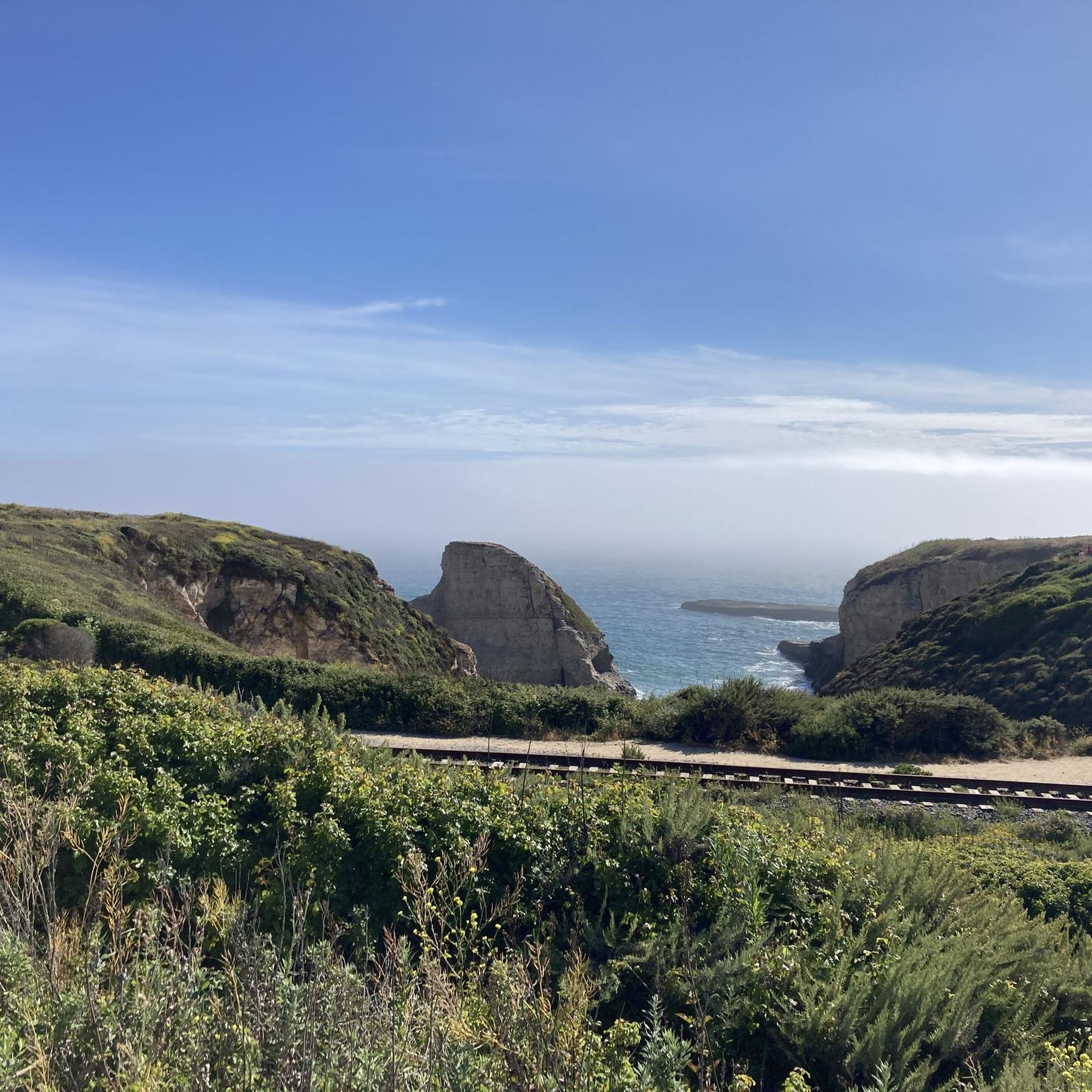
Beyond the striking geology, the trail also crosses old, decommissioned railroad tracks, adding a touch of history to your journey. The area is known for its photography opportunities, especially at sunset when the golden light illuminates the rock formations. This trail is a fantastic choice for those seeking a memorable coastal adventure with a distinctive natural landmark.
5.68km
01:30
50m
50m
Easy 3.5-mile loop on the Clifftop Coastal Trail in Coast Dairies State Park, offering panoramic coastal views and prairie landscapes.
1.74km
00:28
20m
20m
Hike the easy 1.1-mile Davenport Beach loop in Coast Dairies State Park, featuring ocean views and Shark Fin Cove.
Get access to more routes and recommendations from other explorers.
Sign up for free
Already have an account?
Our route recommendations are based on thousands of hikes, rides, and runs completed by other people on komoot.
Start today with a free account
Your next adventure awaits.
Login or Signup
Popular around California Coastal National Monument

Tips from the Community

Bonny Doon Beach is a beautiful beach surrounded by high cliff walls and is known as a clothing-optional beach.
0
0

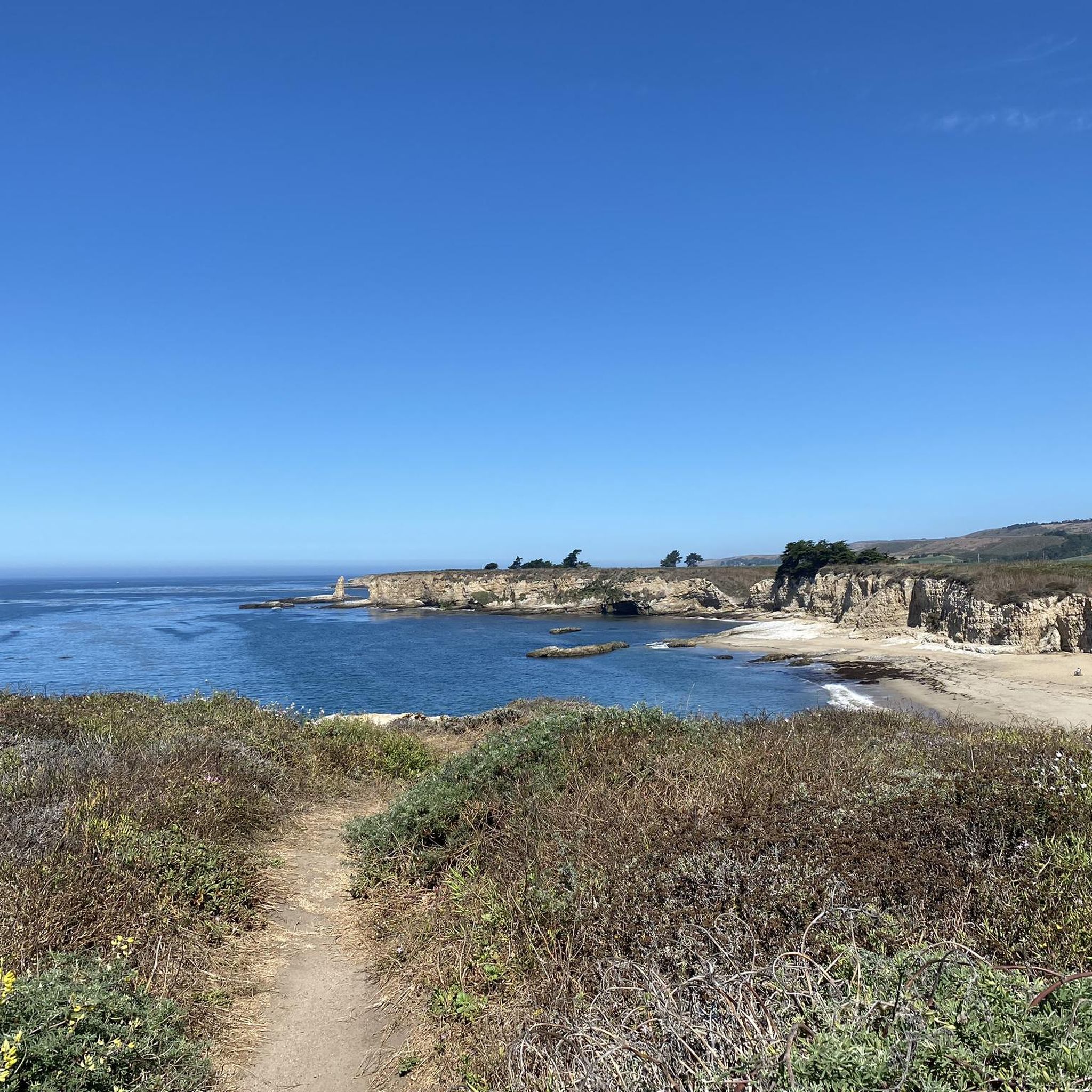
This point features one of the several pocket beaches in the area and offers impressive views of the cliffs, cove, and the ocean waves crashing on the shore.
0
0
This area features several undeveloped pocket beaches nestled between cliffs, offering stunning views of rock formations and the ocean. The park derives its name from its history as dairy farms in the past.
0
0
This place is named after an impressive rock formation that resembles a shark fin emerging from the ocean. It offers truly breathtaking views of the rock formations, beach, and the ocean.
1
0
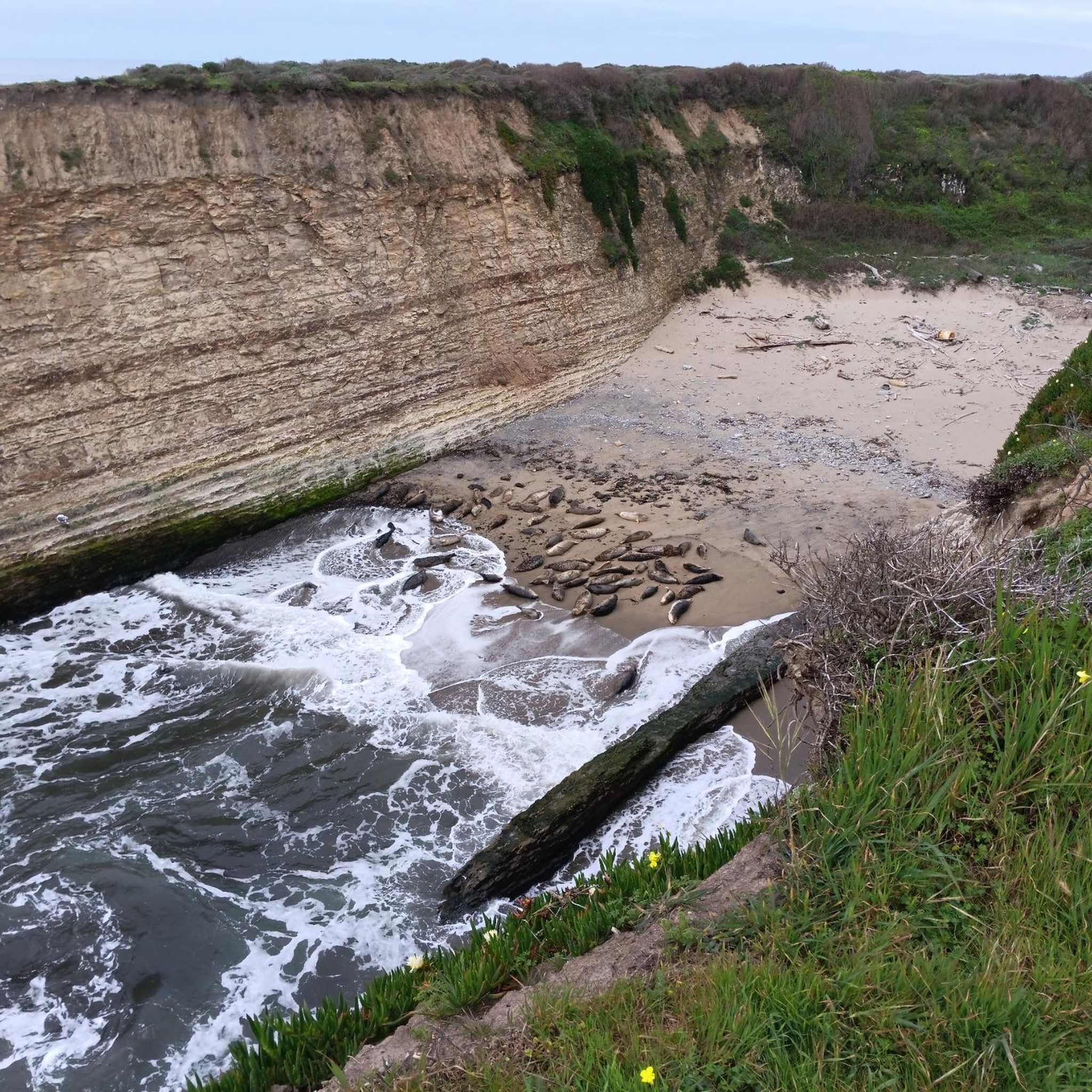
These stunning cliffs offer panoramic views of the Pacific Ocean and Davenport Beach below. While there is beach access, it can be treacherous, so it is recommended to enjoy the views from the safety of the cliffs.
0
0

After crossing the trail tracks trail lead along the cliffs and along the tracks in both northern and southern directions. The cliff trails give superb views down to the coast, and an unmapped trail leads down to the beach cove.
0
0
The Williams brothers bought a large piece of an old Spanish/Mexican Land grant in 1847 and over the next 10 years developed logging, saw mill, lime kiln, cattle and dairy operations with varying success. The landing was to ship products to markets in San Francisco, Santa Cruz, etc. An attempt to reconstruct the history is at https://history.santacruzpl.org/omeka/items/show/134516#
0
0
Beautiful views from the trails along the cliffs, and here a sandy trail leads down to the beach
0
0
Frequently Asked Questions
Where are some popular places to start a hike in the California Coastal National Monument?
There are several well-regarded starting points for exploring the monument. The Cotoni-Coast Dairies National Monument Trailhead is a popular choice for accessing coastal prairie and ocean view trails. Further north, the Point Arena-Stornetta Unit offers dramatic scenery and is praised by visitors for its beautiful coastal views. For a widely accessible and highly-rated experience, many people enjoy the California Coastal Trail sections, known for stunning Pacific vistas and easy-to-follow paths.
Are there any easy, family-friendly hikes available?
Yes, the monument has many options for easier walks. The Davenport Beach loop is a very short walk of just over a mile, perfect for a quick outing with views of the coastal bluffs. It typically takes around 30 minutes to complete.
Can I bring my dog on the trails?
Dog policies vary by location within the monument. In areas managed by the Bureau of Land Management (BLM), such as the Point Arena-Stornetta Public Lands, dogs are generally permitted but must be on a leash to protect wildlife and other visitors. However, in state parks or other jurisdictions, rules may be stricter. Always check the specific regulations for the trail you plan to hike before you go.
Are there any circular or loop trails?
Yes, there are several loop trails that bring you back to your starting point. A great option is the Hiking loop from Coast Dairies State Park. This easy 2.7-mile (4.4 km) route offers a complete circuit with consistent coastal scenery.
What is the terrain like in the Cotoni-Coast Dairies unit?
The terrain at Cotoni-Coast Dairies consists of marine coastal terraces and coastal prairies with some steeper slopes. Trails here, like the Bonny Doon Beach & Shark Fin Cove loop, often follow clifftops with expansive ocean views and provide access down to sandy coves and unique rock formations.
What should I pack for a hike along the coast?
Layered clothing is essential as coastal weather can change rapidly, with fog and wind appearing suddenly even on sunny days. Sturdy walking shoes are recommended for uneven or sandy paths. Also, bring water, snacks, sunscreen, and a hat. It's wise to carry a map or have your route downloaded, as cell service can be unreliable in some areas.
How many hiking trails are in the California Coastal National Monument?
There are over 80 designated hiking routes throughout the various units of the California Coastal National Monument. These range from short, easy walks under an hour to more challenging multi-hour treks, offering something for every fitness level.
What do other hikers think of the trails here?
The trails in the California Coastal National Monument are highly rated by the komoot community, with an average score of 4.6 stars. Hikers frequently praise the stunning Pacific Ocean vistas, the dramatic coastal bluffs, and the accessibility of the trails.
Besides hiking, what other activities can I do in the monument?
The monument is a hub for many outdoor activities. Tide pooling is very popular along the rocky shorelines, revealing diverse marine life at low tide. The area is also excellent for wildlife and bird watching, photography, and whale watching during the winter migration season. Some beaches are suitable for surfing and kayaking.
Is there parking available at the trailheads?
Most major trailheads, such as the Cotoni-Coast Dairies National Monument Trailhead and access points for the Point Arena-Stornetta Unit, have designated parking areas. However, these lots can fill up quickly, especially on weekends. It's always a good idea to arrive early to secure a spot.
What are the main features of the Point Arena-Stornetta Public Lands?
This unit is famous for its dramatic coastal scenery, including rugged bluffs, sea stacks, and natural arches carved by the ocean. The trails here follow the coastline, offering continuous views of the Pacific. It's a prime location for whale watching in season and exploring the unique geology of the coast.
Where can I find official information about the monument?
The California Coastal National Monument is managed by the Bureau of Land Management (BLM). For the most current official information, including alerts, closures, and regulations, you can visit the official BLM website.
Most popular routes in California Coastal National Monument

Get inspired with the komoot mobile app


Explore more
Browse the best Hikes in other regions.
