The best walks and hikes in Wilder Ranch State Park
4.7
(242)
3,669
hikers
39
hikes
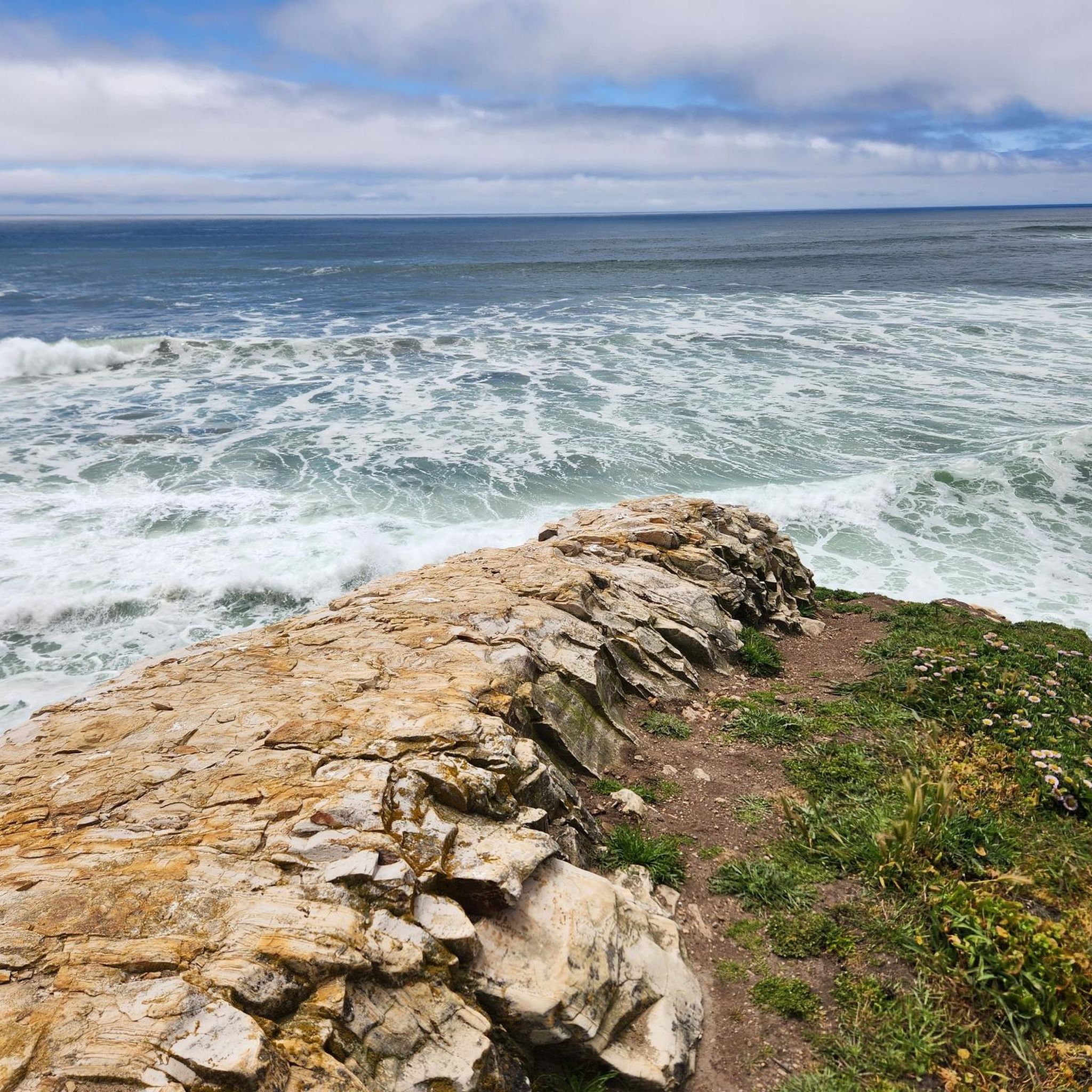
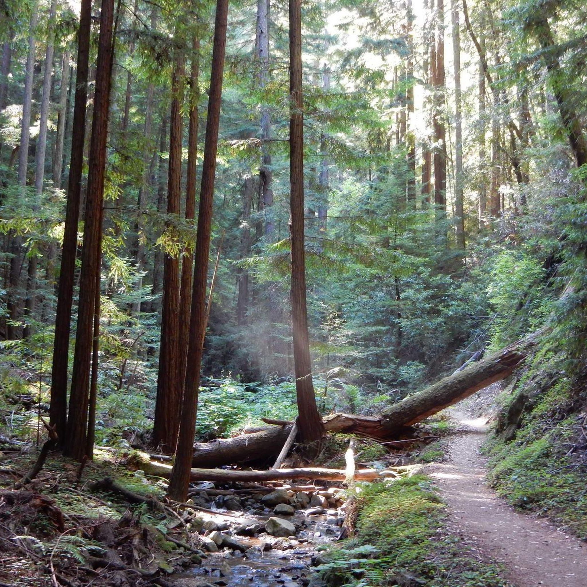
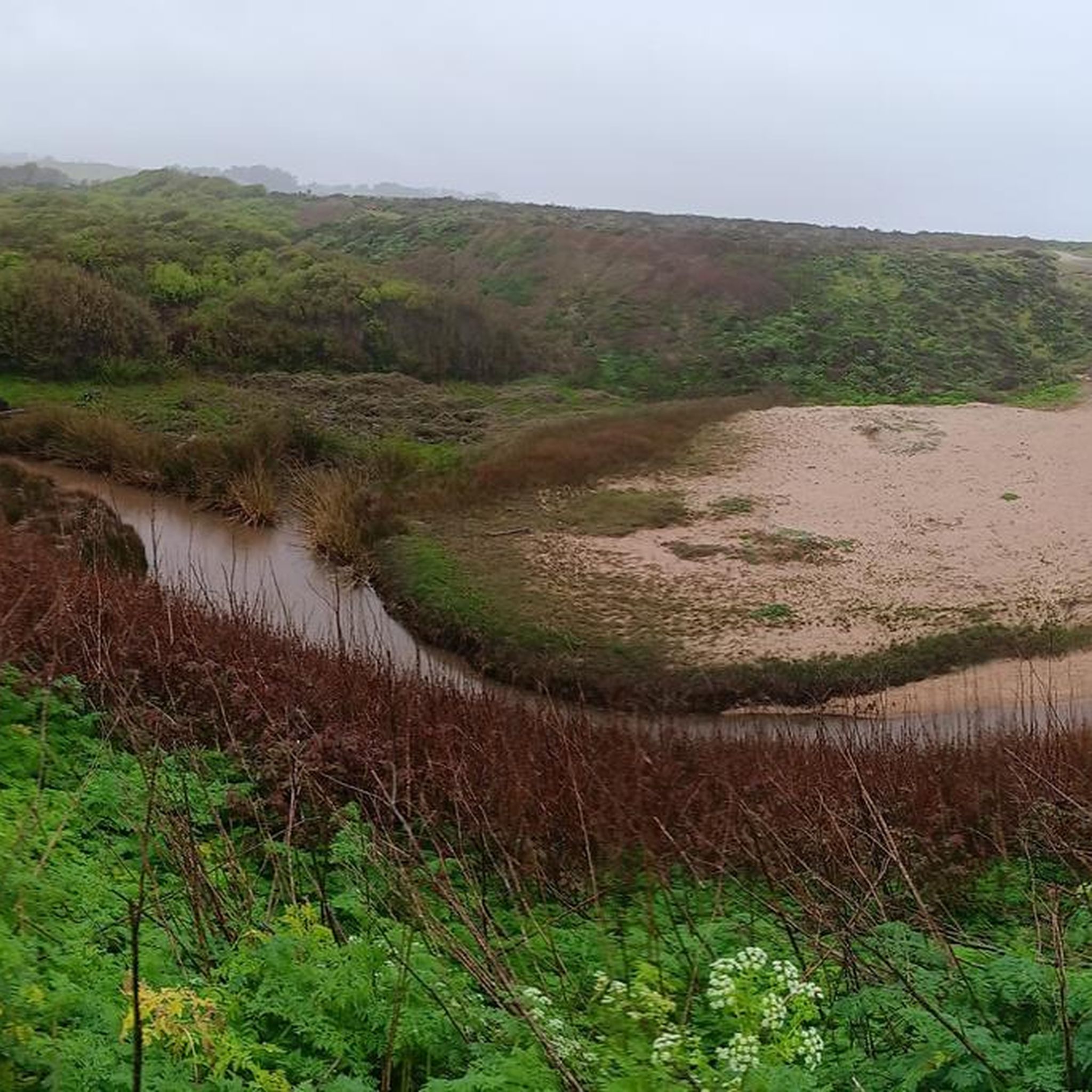
Hiking in Wilder Ranch State Park offers diverse landscapes along the Pacific Ocean coast. The park features dramatic coastal bluffs with ocean vistas, rolling grasslands that ascend inland, and serene oak woodlands. Further into the park, hikers can explore lush redwood-timbered canyons and significant marshland areas. This varied topography provides a range of environments for outdoor exploration.
Best hiking trails in Wilder Ranch State Park
- The most popular hiking route is Old Cove Landing Trail loop — Wilder Ranch State Park, an easy 2.4 miles (3.8 km) trail that takes 59 minutes to complete. This coastal path offers sweeping views of the Pacific Ocean and Monterey Bay.
- Another top favourite among local hikers is Englesman Loop Trail — Wilder Ranch State Park, a moderate 5.0 miles (8.0 km) path. This route showcases varied ecosystems, including oak woodlands, open grasslands, and redwood canyons.
- Local hikers also love the Wilder Ridge loop — Wilder Ranch State Park, a 7.3 miles (11.7 km) trail leading through rolling grasslands with ocean panoramas, often completed in about 3 hours 17 minutes.
- Hiking in Wilder Ranch State Park is defined by coastal bluffs, rolling grasslands, and redwood-timbered canyons. The extensive trail network offers options for various ability levels, from easy coastal walks to more challenging inland routes.
- The routes in Wilder Ranch State Park are highly rated by the komoot community with an average score of 4.6 stars from over 80 reviews. More than 1500 hikers have used komoot to explore Wilder Ranch State Park's varied terrain.
Last updated: September 28, 2026
4.0
(3)
16
hikers
14.4km
04:01
230m
350m
Embark on the Wilder Ridge Loop, a moderate hiking route that takes you through diverse landscapes within Wilder Ranch State Park. This 8.9-mile (14.4 km) trail involves a 751-foot (229 metres) elevation gain, typically completed in about 4 hours and 1 minute. You'll experience open grasslands dotted with coast live oaks, transitioning into cool, shaded redwood ravines. Look out for expansive views of Monterey Bay from the Wilder Ranch Overlook, offering a stunning panorama on clear days.
Before you head out, remember that the Wilder Ridge Loop is a multi-use trail, so you will encounter mountain bikers and equestrians. It is wise to carry plenty of water and wear sun protection, particularly on the exposed, western-facing parts of the route. The trail is dog-friendly, but be prepared for leash requirements in certain areas. Starting your hike earlier in the day can help you avoid the midday sun and potential crowds.
As you explore, keep an eye out for local wildlife such as deer and hawks, which are often seen along the route. While most of the trail offers a natural escape, a short section does run alongside a recycling facility. This loop provides a good workout and a varied natural experience, making it a popular choice for those looking to explore the Santa Cruz coastline.
5.0
(1)
13
hikers
6.06km
01:44
140m
140m
Embark on the Engelsman Loop Trail, an easy hiking route spanning 3.8 miles (6.1 km) with a gentle elevation gain of 458 feet (139 metres). You can expect to complete this loop in about 1 hour and 43 minutes, making it a perfect choice for a refreshing outing. The path winds through varied terrain, transitioning from sun-drenched open grasslands to the cool shade of oak woodlands, offering consistently beautiful views of Monterey Bay, especially from the bench at the loop's highest point.
To begin your hike, access the trail through the historic ranch buildings and a tunnel that passes under Highway 1. This convenient entry point makes planning your visit straightforward. Remember that dogs are not permitted on any trails within Wilder Ranch State Park, so plan accordingly if you usually hike with a canine companion. The trail is generally accessible and well-marked, suitable for most skill levels.
This route provides a unique opportunity to experience the natural beauty and ecological diversity of Wilder Ranch State Park. As you hike, keep an eye out for local wildlife such as red-tailed hawks soaring overhead and deer grazing in the fields. In spring, the trail comes alive with vibrant wild lilacs, adding a splash of color to the landscape and enhancing the overall experience of this scenic coastal loop.

5
hikers
15.6km
04:23
330m
320m
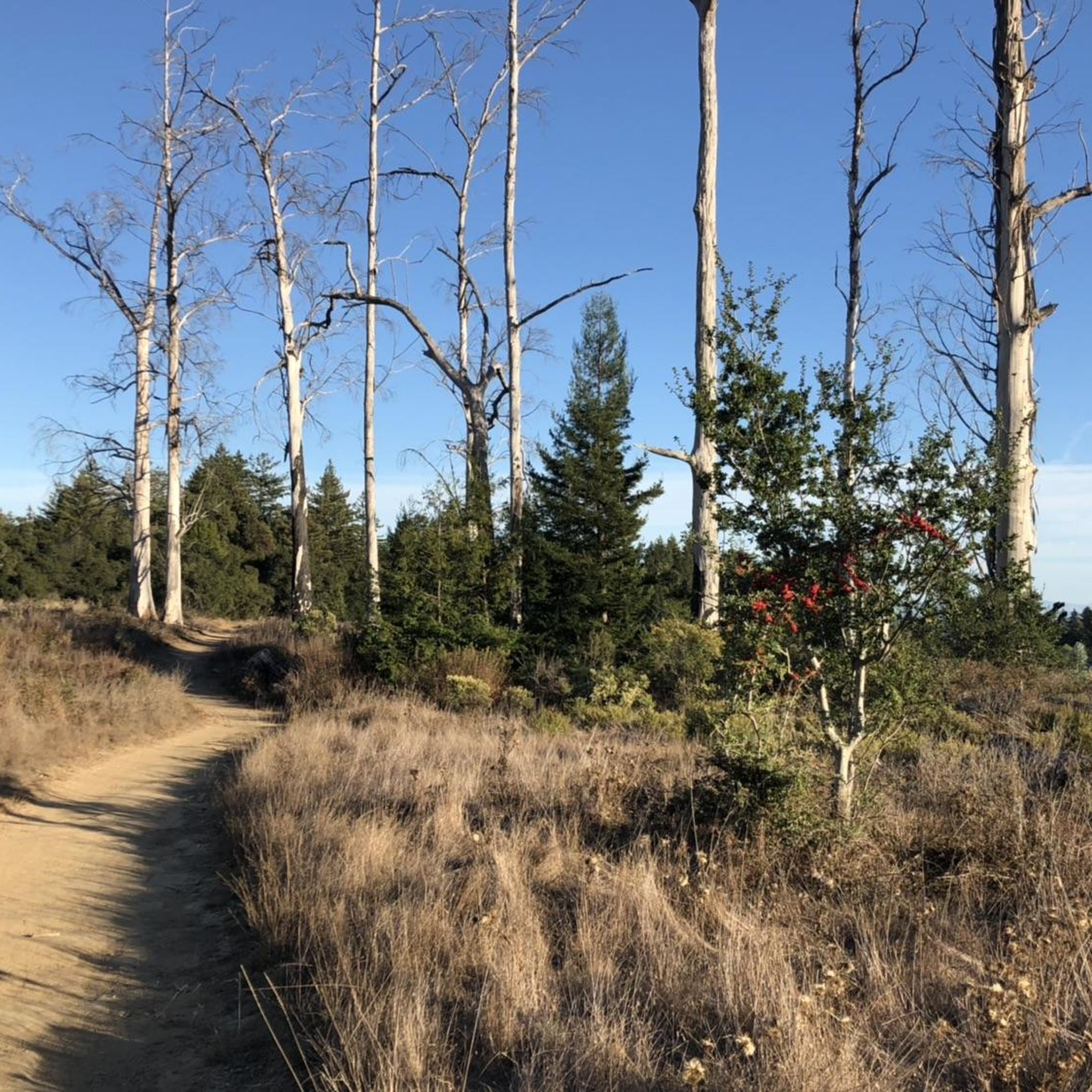
Embark on the Engelsman, Long Meadow, Eucalyptus and Wilder Ridge Loop, a moderate hiking adventure spanning 9.7 miles (15.6 km) with an elevation gain of 1088 feet (332 metres). This route typically takes around 4 hours and 23 minutes to complete. As you hike, you will traverse varied terrain, from open grasslands and shady oak woodlands to fragrant eucalyptus groves, often on narrow singletrack paths or wider fire roads. Keep an eye out for expansive views of Monterey Bay, which become more prominent as you gain elevation, offering a rewarding visual experience throughout your journey.
When planning your visit, note that the trailhead is conveniently located near historic ranch buildings, accessible via a tunnel beneath Highway 1. This is a multi-use trail, so you should be prepared to share the path with mountain bikers and equestrians. It is important to remember that dogs are not permitted on any trails within Wilder Ranch State Park, so plan accordingly if you usually hike with a canine companion. Allow ample time to enjoy the full duration of the hike.
This loop offers a unique glimpse into the natural and historical tapestry of Wilder Ranch State Park. Beyond the diverse ecosystems you will encounter, the trail also leads you past intriguing historical ruins from old lime production, particularly near the end of the Long Meadow Trail section. These remnants provide a fascinating connection to the region's past, adding another layer of discovery to your outdoor experience in this scenic state park.
7
hikers
18.4km
05:16
440m
440m
Embark on the Baldwin, Enchanted, Wilder Ridge, Twin Oaks, Eucalyptus Loop for a challenging hike that spans 11.4 miles (18.4 km) and climbs 1429 feet (435 metres). This difficult route, estimated to take 5 hours and 16 minutes, offers a dynamic journey through varied terrain. You will traverse everything from smooth dirt paths to rocky sections and areas with loose gravel, experiencing a constant shift in scenery.
As you hike, you will move through quiet redwood forests, sunny oak woodlands, and expansive open grasslands. Keep an eye out for sweeping views of Monterey Bay from various overlooks, and you might even spot local wildlife like deer or hawks. The Eagle Cutoff stands out as a specific highlight along the way, providing a memorable point on this extensive loop.
This comprehensive loop is located within Wilder Ranch State Park, so be prepared for park regulations and potential parking fees. The trails are multi-use, meaning you will share them with mountain bikers and equestrians. Pay close attention to your footing, especially on the western part of the Eucalyptus Loop, where you might encounter loose gravel and ruts.
3
hikers
6.32km
01:47
80m
240m
The Enchanted Loop offers an easy hiking experience, guiding you through a captivating shift in scenery. You'll begin in open, sunny meadows, then transition into the deep shade of dense redwood groves, creating a truly "enchanted" atmosphere with dappled light filtering through the canopy. This 3.9-mile (6.3 km) route involves a gentle 258-foot (79 metres) elevation gain, making it an accessible hike that typically takes about 1 hour and 47 minutes to complete. The trail features a notable steep descent into the redwood forest, followed by a winding climb out, showcasing diverse ecosystems.
Planning your visit to the Enchanted Loop is straightforward. The trail is located within Wilder Ranch State Park, where parking is generally available for visitors. This popular route attracts many people, so arriving earlier in the day might offer a more serene experience. While it's open to hikers, mountain bikers, and trail runners, be aware that some sections have technical elements like rocks and roots. Always check local park conditions before you head out to ensure a smooth trip.
What makes the Enchanted Loop special is the dramatic contrast in its natural environment. You'll experience a journey from sun-drenched fields to the cool, shaded redwood canopy, highlighting the diverse ecosystems present in the park. This trail is a prime example of the varied landscapes found within Wilder Ranch State Park, offering a unique blend of coastal and forest environments. It's a great option if you're looking for a relatively short and easy outing that still provides a rich natural experience.
Get access to more routes and recommendations from other explorers.
Already have an account?
Our route recommendations are based on thousands of hikes, rides, and runs completed by other people on komoot.
Start today with a free account
Your next adventure awaits.


Other adventures in Wilder Ranch State Park

Tips from the Community

Views all across the ranch, now a state park, south to the old cove at the ocean.
1
0
The Eagle shortcut connects the lower part of Baldwin loop trail, which is a double-track farm road, to the upper section, where the views stretch all the way down to the ocean.
1
0
The access trail from the Hwy 1 parking to the beach, it also makes for a good bailout option if biking along the railway line dirt road.
0
0
Frequently Asked Questions
How many hiking trails are available in Wilder Ranch State Park?
Wilder Ranch State Park offers a comprehensive network of over 35 miles of trails. On komoot, you can find 26 curated hiking routes, ranging from easy coastal walks to more challenging inland excursions.
What types of terrain can I expect when hiking in Wilder Ranch State Park?
The park's diverse topography includes dramatic coastal bluffs with ocean vistas, rolling grasslands that ascend inland, serene oak woodlands, and lush redwood-timbered canyons. Trails vary from wide fire roads to narrower singletrack paths, offering a mix of environments.
Are there any easy, family-friendly hikes in Wilder Ranch State Park?
Yes, Wilder Ranch State Park has several easy trails suitable for families. The Old Cove Landing Trail loop is an excellent option, offering a relatively flat, 2.4-mile coastal path with sweeping ocean views. It's one of 11 easy routes available in the park.
Can I bring my dog on the hiking trails in Wilder Ranch State Park?
Generally, dogs are restricted from the hiking trails within Wilder Ranch State Park. It's always best to check the official park regulations for the most current information regarding pet access. You can find more details on the California State Parks website: www.parks.ca.gov/wilderranch/.
What are some notable natural features or viewpoints to see in the park?
Wilder Ranch State Park is rich in natural beauty. Along the coast, you can find impressive sea caves, particularly near Fern Grotto Beach, and dramatic coastal bluffs offering expansive views of the Pacific Ocean and Monterey Bay. Inland, trails provide panoramic ocean views from rolling grasslands and lead through serene oak woodlands and redwood-filled canyons. Don't miss highlights like Needle Rock or the Sand Point Beach Overlook.
Are there any historical landmarks or attractions within Wilder Ranch State Park?
Beyond its natural beauty, Wilder Ranch State Park preserves a fascinating early dairy ranch from the late 1800s. You can explore restored historical buildings, including an 1897 Victorian home, an 1859 Gothic Revival farmhouse, and an 1896 water-powered machine shop. Public tours are often available to learn about the region's ranching history.
What is the best time of year to go hiking in Wilder Ranch State Park?
Wilder Ranch State Park offers enjoyable hiking year-round. The coastal climate means mild temperatures, though conditions can vary. Spring brings wildflowers to the grasslands, while fall often provides clear skies and pleasant temperatures. Winter can be a good time for fewer crowds, but be prepared for potential rain. Summer is popular, but coastal fog can sometimes obscure views.
Are there any loop trails for hikers who prefer circular routes?
Yes, many trails in Wilder Ranch State Park are designed as loops, allowing for varied scenery without retracing your steps. Popular options include the Englesman Loop Trail, which showcases varied ecosystems, and the Wilder Ridge loop, known for its ocean panoramas.
What do other hikers say about their experience in Wilder Ranch State Park?
The trails in Wilder Ranch State Park are highly rated by the komoot community, with an average score of 4.6 stars from over 80 reviews. Hikers often praise the park's diverse landscapes, from stunning coastal views to serene inland woodlands, and the well-maintained trail system that caters to various fitness levels.
Is parking available at Wilder Ranch State Park, and are there any fees?
Yes, parking is available at Wilder Ranch State Park. There is a main parking lot near the historic ranch complex, which also serves as a trailhead for many routes. State parks in California typically charge a day-use fee for parking. It's advisable to check the official California State Parks website for current fee information and operating hours: www.parks.ca.gov/wilderranch/.
Are there any challenging hikes for experienced hikers in the park?
For experienced hikers seeking a challenge, Wilder Ranch State Park offers more strenuous options. The Wilder Ridge Trail, for example, is a difficult 12.5-mile route with significant elevation changes, providing a rewarding experience through varied terrain.
Most popular routes in Wilder Ranch State Park
Most popular attractions in Wilder Ranch State Park

Get inspired with the komoot mobile app


Explore more
Browse the best Hikes in other regions.
