The best running trails in Skyline Regional Park
5.0
(3)
87
runners
21
runs
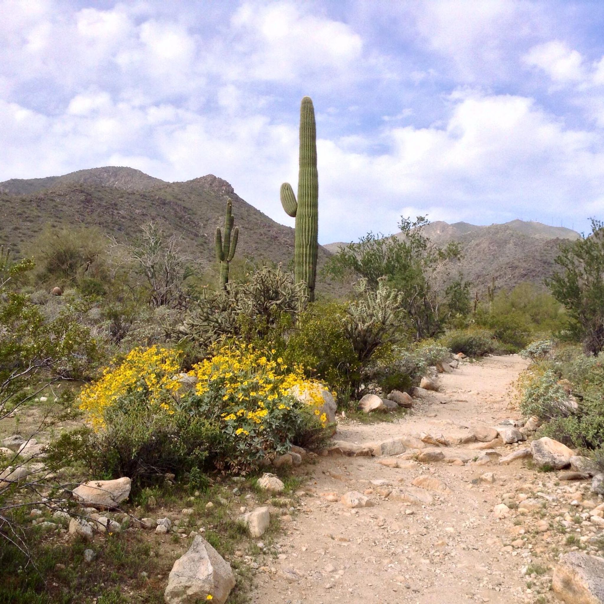
Jogging in Skyline Regional Park offers a network of trails through a desert landscape characterized by rolling hills and scenic vistas. The park features a mix of moderate climbs and gentle descents, providing varied terrain for runners. Trails often traverse washes and offer views of the surrounding mountains, making it a popular destination for outdoor activity.
Best jogging routes in Skyline Regional Park
- The most popular jogging route is Turnbuckle Loop Trail, a 4.3 miles (7.0 km) trail that…
Last updated: May 11, 2026
5
runners
7.01km
00:49
220m
220m
Jog the Turnbuckle Loop Trail, a 4.4-mile moderate route in Skyline Regional Park with desert scenery and valley views.
4
runners
5.50km
00:44
170m
170m
Moderate run. Good fitness required. Mostly paved surfaces. Suitable for all skill levels.

Sign up for free
3
runners
6.93km
00:57
220m
220m
Moderate run. Good fitness required. Mostly paved surfaces. Suitable for all skill levels.
3
runners
11.2km
01:30
360m
360m
Hard run. Very good fitness required. Mostly paved surfaces. Suitable for all skill levels.
2.87km
00:23
90m
90m
An easy 1.8-mile jogging route in Buckeye, Arizona, featuring the Victory Stairs at Verrado with 293 feet of elevation gain.
Get access to more routes and recommendations from other explorers.
Sign up for free
Already have an account?
Our route recommendations are based on thousands of hikes, rides, and runs completed by other people on komoot.
Start today with a free account
Your next adventure awaits.
Login or Signup
Popular around Skyline Regional Park

Tips from the Community


There are over 300 steps climbing up almost 200 feet in elevation. This is a tough hike up, but if you can keep your rhythm, you can see how many steps you can run before having to stop. The trails down the back side are much more runnable. The loop is only about a mile total, but the stairs alone are a workout.
1
0
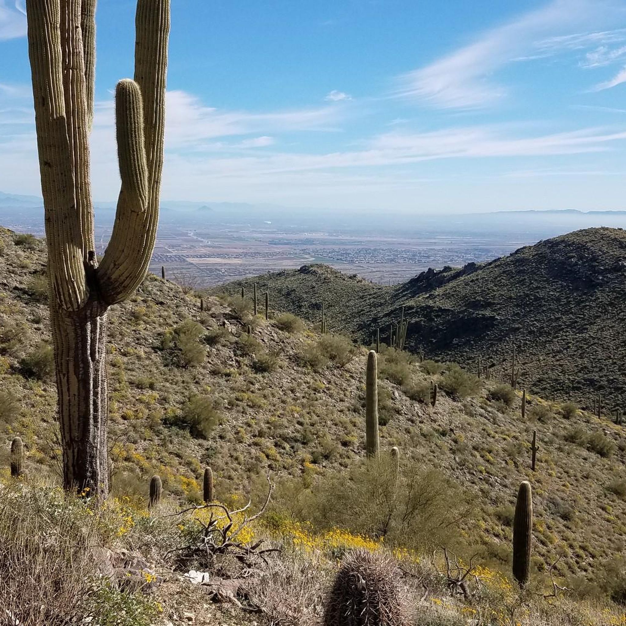
The loop around Valley Vista on the Turnbuckle Trail is probably the most popular route in Skyline Regional Park. It offers continuous mountain views, desert flowers, and challenging but doable terrain. This is a well marked trail that can be added on to other trails and routes in the park.
0
0
The Valley Vista overlook in Skyline Regional Park offers 360 degree views of various wilderness areas and mountain ranges scattered around the suburbs of Phoenix. This rocky outcrop has pretty steep cliff edges and is only an extension of the summit area.
0
0
The Valley Vista overlook in Skyline Regional Park offers 360 degree views of various wilderness areas and mountain ranges scattered around the suburbs of Phoenix. This rocky outcrop has pretty steep cliff edges and is only an extension of the summit area.
0
0

Here stairs lead the way to a beautiful view. After that, hiking trails continue in different directions.
0
0
Frequently Asked Questions
How many running trails are available in Skyline Regional Park?
Skyline Regional Park offers a network of over 20 running trails. These routes vary in difficulty, providing options for different fitness levels, from easy paths to more challenging ascents through the desert landscape.
Are there easy running routes suitable for beginners in Skyline Regional Park?
Yes, Skyline Regional Park has several easy running routes perfect for beginners. One such option is the Mountain View Trail, which is approximately 1.8 miles (2.9 km) long with moderate elevation changes, offering a gentle introduction to the park's terrain.
What are some challenging running routes for advanced runners in Skyline Regional Park?
For advanced runners seeking a challenge, the Valley Vista Overlook – Quartz Mine Trail loop from Crest Summit is a great option. This route spans about 6.9 miles (11.2 km) and features significant elevation gains, providing a demanding workout with rewarding views.
Are there any loop trails for jogging in Skyline Regional Park?
Absolutely, many of the running routes in Skyline Regional Park are loops, allowing you to start and finish at the same point. Popular loop options include the Turnbuckle Loop Trail and the Running loop from Valley Vista, both offering varied terrain and scenic overlooks.
What is the best time of year to go running in Skyline Regional Park?
The cooler months, from late fall through early spring (roughly October to April), are generally the best time for running in Skyline Regional Park. During these months, temperatures are more moderate, making for a more comfortable and enjoyable experience in the desert environment. Summer can be extremely hot, so early morning or late evening runs are recommended if visiting then.
Are dogs allowed on the running trails in Skyline Regional Park?
Yes, dogs are generally welcome on the trails in Skyline Regional Park, but they must be kept on a leash at all times. It's also crucial to bring plenty of water for both yourself and your dog, especially given the desert climate, and to clean up after your pet.
What kind of views or points of interest can I expect on the running routes?
The running routes in Skyline Regional Park offer expansive views of the surrounding mountains and the Sonoran Desert landscape. You'll encounter desert hills, mountain washes, and various viewpoints that provide panoramic vistas. The park's natural beauty, including its unique flora and fauna, is a constant highlight.
Is there parking available at the trailheads in Skyline Regional Park?
Yes, Skyline Regional Park provides designated parking areas at various trailheads. These facilities are typically well-marked and offer convenient access to the running routes. It's always a good idea to check the park's official website for any specific parking fees or regulations before your visit.
What do other runners enjoy most about jogging in Skyline Regional Park?
The komoot community highly rates the running experience in Skyline Regional Park, with an average score of 5.0 stars. Runners often praise the park's varied terrain, the stunning desert scenery, and the well-maintained trails that offer a balanced running experience with moderate climbs and gentle descents.
Are there any family-friendly running trails in Skyline Regional Park?
While many trails offer moderate challenges, some shorter, less strenuous sections can be suitable for families looking to jog together. The Mountain View Trail, for example, is an easier option that could be enjoyed by families with older children or those looking for a more relaxed pace.
What should I wear for running in Skyline Regional Park?
Given the desert environment, it's recommended to wear lightweight, breathable athletic clothing, preferably moisture-wicking. Sturdy trail running shoes with good grip are essential for navigating the varied terrain. Don't forget a hat, sunglasses, and sunscreen for sun protection, and always carry ample water.
Are there any less crowded running routes in Skyline Regional Park?
While popular routes like the Turnbuckle Loop can see more activity, exploring some of the park's less-trafficked trails or visiting during off-peak hours (early mornings on weekdays) can offer a more solitary running experience. The park's extensive network means you can often find quieter sections away from the main trailheads.
Most popular routes in Skyline Regional Park

Get inspired with the komoot mobile app


Explore more
Browse the best Running Trails & Routes in other regions.
