The best running trails in Indian Creek Wilderness Study Area
20
runners
2
runs
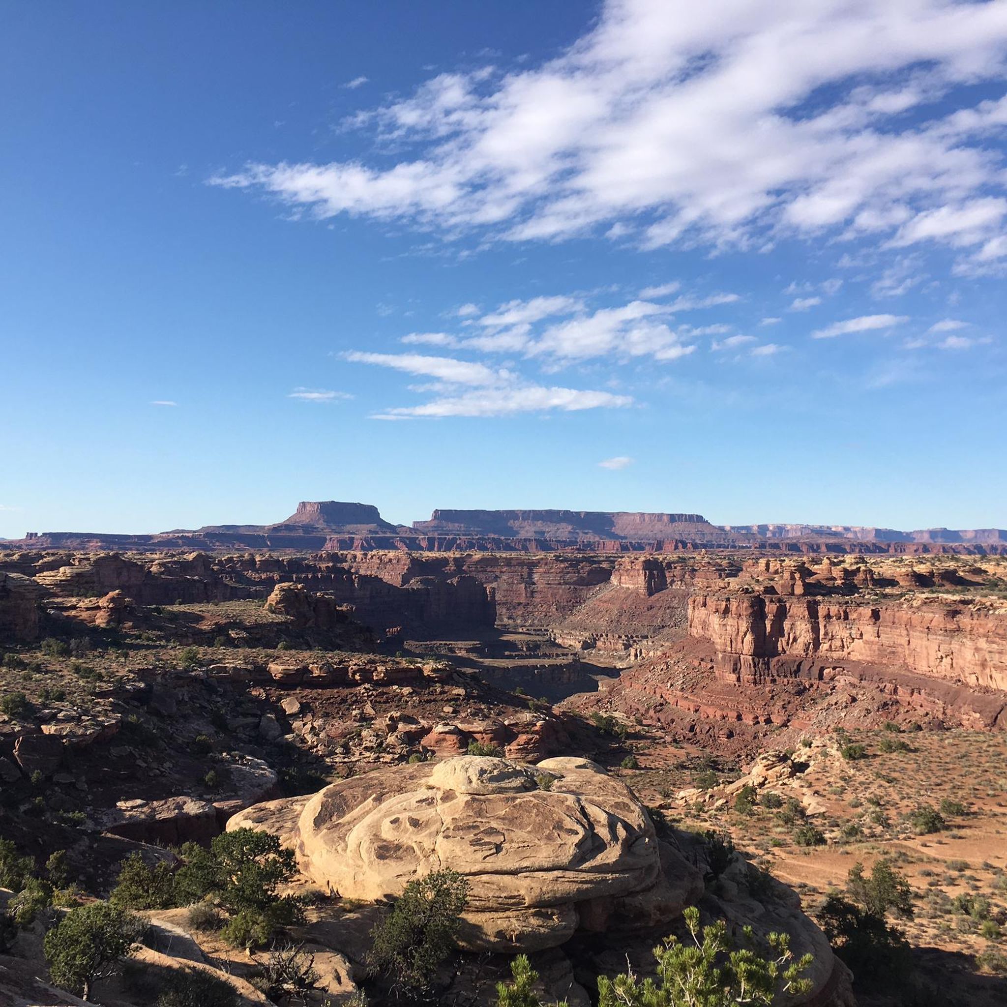
Jogging in Indian Creek Wilderness Study Area offers routes through a rugged desert landscape characterized by red rock canyons and towering sandstone formations. The terrain features northward-sloping canyons up to 300 feet deep and narrow, twisting tributary canyons. Approximately 75% of the area consists of bare rock, with notable geological highlights including Wingate Sandstone cliffs and the North and South Six Shooter Peaks. This environment provides a challenging setting for physical activity, with trails often leading to scenic viewpoints.
Best…
Last updated: September 28, 2026
8
runners
15.9km
02:03
320m
320m
Hard run. Very good fitness required. Mostly paved surfaces. Suitable for all skill levels.
5
runners
20.2km
02:37
420m
420m
Hard run. Very good fitness required. Mostly paved surfaces. Suitable for all skill levels.

7
runners
15.5km
02:01
310m
310m
Hard run. Very good fitness required. Mostly paved surfaces. Suitable for all skill levels.
Our route recommendations are based on thousands of hikes, rides, and runs completed by other people on komoot.
Start today with a free account
Your next adventure awaits.
Popular around Indian Creek Wilderness Study Area
Tips from the Community

What a wonderful overlook over the Needles - worth every drop of sweat!
0
0

This memorable section of the popular Chesler Park Trail takes you through a smooth, narrow slot canyon. This shaded spot is a nice break from the sun as you explore the Needles District.
1
0

Tree trunk as a staircase and it's really old
0
1
Nice loop, with a good option to hike it
1
0

Beautiful view over Chesler Park with its unique rock formations! Towards the east a trail leads to Devils Pocket.
5
0
On a park-like area there are numerous rock formations, which gave the Needles District its name. A total of five campsites are located here, which can only be reached on foot. A permit is needed to stay overnight.
4
0
A small canyon, but it runs the length of the Needles District from north to south and extends to Druid Arch.
5
0
On the way to Elephant Canyon, you will encounter rock formations next to Elephant Hill that are reminiscent of the proboscis.
2
0
Frequently Asked Questions
What kind of terrain can I expect on running routes in the Indian Creek Wilderness Study Area?
The Indian Creek Wilderness Study Area is characterized by a rugged desert landscape, featuring dramatic red rock canyons and towering sandstone formations. Approximately 75% of the area is bare rock, with trails often traversing Wingate Sandstone cliffs and offering views of peaks like North and South Six Shooter. Expect a mix of challenging, uneven surfaces and some trails that may be more rugged, requiring sturdy footwear.
Are there any easy running trails suitable for beginners in the Indian Creek Wilderness Study Area?
While many routes in the Indian Creek Wilderness Study Area are considered moderate to difficult, there are options for various skill levels. For example, the Squaw Flat Trailhead loop from Salt Flat Trailhead is a moderate 11.3 km path with a 170m elevation gain, offering a good introduction to the area's distinctive desert landscape.
What are the best times of year to go jogging in the Indian Creek Wilderness Study Area?
The most favorable seasons for outdoor activities, including running, in the Indian Creek Wilderness Study Area are generally March through late May and September through October. During these periods, temperatures are more moderate, making for a more enjoyable experience.
Can I find long-distance running trails in the Indian Creek Wilderness Study Area?
Yes, the area offers several longer routes for endurance runners. For instance, the View over Chesler Park – Chesler Park loop from Salt Flat Trailhead is a challenging 20.2 km trail, and the Squaw Flat Trailhead – Distance view of Elephant Hill loop from Salt Flat Trailhead extends to 20.7 km, both providing extensive exploration of the unique rock formations.
Are there any circular running routes available?
Many of the popular running routes in the Indian Creek Wilderness Study Area are loops, allowing you to start and finish at the same point. Examples include the Confluence Overlook loop from Needles District and the Squaw Flat Trailhead loop from Salt Flat Trailhead.
What kind of natural features or viewpoints can I see while running in the area?
Jogging in the Indian Creek Wilderness Study Area offers stunning natural features. You can expect panoramic views of red rock spires, sandstone canyons, and expansive desert vistas. Notable sights include the impressive North and South Six Shooter Peaks, and the unique rock formations of Chesler Park. Some routes, like the Confluence Overlook loop, provide views of the Green and Colorado Rivers.
Are there any historical or cultural landmarks accessible from the running trails?
While not directly on the running trails themselves, the Indian Creek Corridor Scenic Byway (UT SR-211), which passes through the area, offers access to Newspaper Rock. This significant rock art panel features petroglyphs created by multiple cultures over 2,000 years, making for an interesting stop before or after your run.
What is the difficulty level of running trails in the Indian Creek Wilderness Study Area?
The running trails in this region range from moderate to difficult. Out of the routes highlighted, one is moderate and three are classified as difficult, indicating that many trails involve significant elevation changes and rugged terrain. Runners should be prepared for challenging conditions and good to very good fitness is often recommended.
How many running routes are available in the Indian Creek Wilderness Study Area?
Komoot features several running routes in the Indian Creek Wilderness Study Area. Currently, there are 4 distinct routes detailed, offering a variety of distances and difficulty levels for runners to explore this unique landscape.
What do other runners enjoy most about the Indian Creek Wilderness Study Area?
Runners frequently praise the Indian Creek Wilderness Study Area for its dramatic scenery, diverse trail options, and opportunities for solitude. The unique red rock canyons, towering sandstone formations, and expansive desert vistas provide a truly memorable backdrop for any run. Over 50 runners have used komoot to explore this varied terrain.
Are there any routes that offer views of Chesler Park?
Yes, Chesler Park is a prominent feature in the area. The View over Chesler Park – Chesler Park loop from Salt Flat Trailhead and the Chesler Park Viewpoint – Chesler Park Trail loop from Soda Spring are two excellent options that lead through or offer beautiful views of Chesler Park's unique rock formations.
What wildlife might I encounter while running in the Indian Creek Wilderness Study Area?
The Indian Creek Wilderness Study Area is home to various desert wildlife. While running, you might spot desert bighorn sheep, mule deer, peregrine falcons, golden eagles, and even Mexican spotted owls. Maintaining a respectful distance and observing from afar is always recommended.
Most popular routes in Indian Creek Wilderness Study Area

Get inspired with the komoot mobile app


Explore more
Browse the best Running Trails & Routes in other regions.
