The best MTB trails in West Needles Contiguous Wilderness Study Area
5.0
(1)
52
riders
7
rides
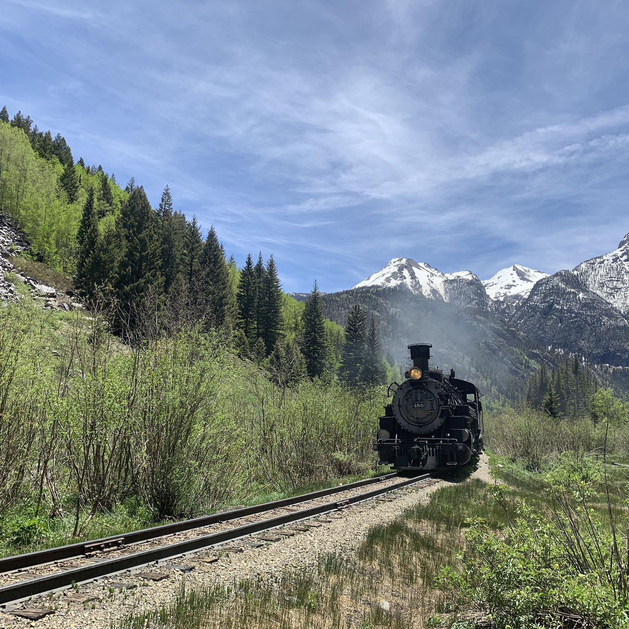
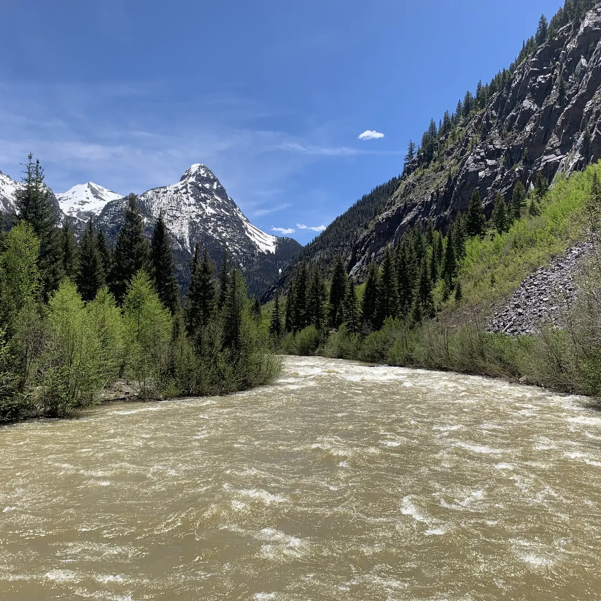
Mountain biking in West Needles Contiguous Wilderness Study Area offers routes through rugged mountainous terrain within the San Juan National Forest. The region is characterized by dramatic elevation changes, with altitudes ranging from 7,800 feet along the Animas River to over 13,000 feet on the Twilight Peaks. Natural boundaries include the Animas River Canyon to the east and south, and various creeks to the west and north. This area provides a backcountry experience amidst high-alpine and canyon environments.
Best mountain…
Last updated: May 11, 2026
11
riders
29.8km
03:10
770m
770m
Ride the Colorado Trail: Twin Sisters, a moderate mountain biking route that winds through forested sections and open grasslands. You will cover 18.5 miles (29.8 km) with a significant elevation…
5.0
(1)
5
riders
64.5km
07:06
2,030m
2,030m
Embark on a challenging mountain biking adventure with the Engineer Mountain and Colorado Trail Loop, a difficult 40.1 miles (64.5 km) route that demands 6648 feet (2026 metres) of elevation…

Sign up for free
3
riders
52.1km
05:21
1,620m
1,620m
Hard mountain bike ride. Very good fitness required. Suitable for all skill levels.
4
riders
28.9km
03:31
1,130m
1,130m
Hard mountain bike ride. Very good fitness required. Advanced riding skills necessary.
7
riders
37.6km
04:07
1,210m
1,210m
Hard mountain bike ride. Very good fitness required. Advanced riding skills necessary. Some portions of the route may require you to push your bike.
Get access to more routes and recommendations from other explorers.
Sign up for free
Already have an account?
Our route recommendations are based on thousands of hikes, rides, and runs completed by other people on komoot.
Start today with a free account
Your next adventure awaits.
Login or Signup
Popular around West Needles Contiguous Wilderness Study Area
Tips from the Community

Lime Creek is the last decent and reliable water source if you hike the Colorado Trail southbound. There is a nicely shaded spot to take a break and filter the water. Campspots are not too easy to find here though.
1
0
Segment 25 of the Colorado Trail leads into the stunning, colorful San Juan Mountains and takes you along small lakes and to bubbling creeks and rushing rivers. The ascents and descents are not as steep as further north (east) along the trail.
1
0

Molas Pass sits a few yards below where the Colorado Trail passes the US 550 highway. Walk south 250 feet to the spur trail to the parking area and find Molas Overlook, a pit toilet, and parking at an elevation of 10,910 feet.
0
0

This uphill section of the Engineer Mountain Trail is not very technical, but due to the elevation and the steepness of the trail you'll breath heavily. But the good thing is: You'll pedal slowly and have plenty of time to enjoy the beautiful scenery.
1
0

Little Molas Lake is a high-altitude body of water at about 11,000 feet. It is located nearby parking lots and provides easy access to the Colorado Trail. It is the ideal place to enjoy a packed lunch before or after your ride.
0
0
It is a popular trail with great panoramic views. It is located just east of Engineer Mountain, which is easily recognisable by its two cone-like peaks. The climbs are challenging and bring you to beautiful alpine meadows at the base of the peaks.
0
0
Deer Creek is a mostly peaceful, flowy and fun trail. However, once you get to this last section (in the downhill direction), you will find that the difficulty drastically changes. The descent suddenly includes very tight corners on steep terrain. It is great fun if you are able to tackle the technical challenges, but is also something to keep in mind for less daring bikers, as this is an unavoidable section of the trail.
0
0
This is a fun and long trail which extends north and south beyond this section between its intersections with Coal Creek and Engine Creek Trails. The northern part is more technical, while the southern one is considered to be the more fun one. The views are beautiful and the trail is easily accessed via multiple entry points.
0
0
Frequently Asked Questions
What is the overall character of mountain biking in the West Needles Contiguous Wilderness Study Area?
Mountain biking in this area is defined by rugged mountainous terrain, dramatic canyons, and high-alpine environments within the San Juan National Forest. You can expect significant elevation changes, with altitudes ranging from 7,800 feet along the Animas River to over 13,000 feet on the Twilight Peaks, offering a true backcountry experience.
Are there mountain bike trails suitable for beginners in the West Needles Contiguous Wilderness Study Area?
The West Needles Contiguous Wilderness Study Area primarily features moderate to difficult mountain bike trails. There are no trails specifically categorized as easy. Riders should be prepared for challenging terrain and significant elevation changes.
What are some of the more challenging mountain bike routes in the area?
For experienced riders seeking a challenge, routes like the Engineer Mountain and Colorado Trail Loop, a difficult 40.1-mile path, or the Engineer Mountain Trail – Durango, a 32.3-mile difficult trail, offer demanding terrain and significant climbs.
Are there any loop trails for mountain biking in the West Needles Contiguous Wilderness Study Area?
Yes, there are loop options available. For example, the Engineer Mountain and Colorado Trail Loop is a popular difficult route that allows you to explore the prominent Engineer Mountain area in a circular fashion.
What is the best time of year to go mountain biking in this region?
Given the high altitudes and rugged terrain, the best time for mountain biking in the West Needles Contiguous Wilderness Study Area is typically during the summer months, once snow has melted and trails are clear. Always check local weather and trail conditions before heading out, as conditions can change rapidly in mountain environments.
What are the rules regarding mountain biking in a Wilderness Study Area?
Wilderness Study Areas (WSAs) are managed to preserve their wilderness characteristics, which generally means primitive recreation. While federally designated Wilderness Areas explicitly ban mechanical transport like bicycles, some WSAs *may* permit mountain biking on primitive roads. It's crucial to verify specific regulations with the Bureau of Land Management (BLM) or the San Juan National Forest for the West Needles Contiguous WSA before planning your ride, as rules can vary.
Are the mountain bike trails in West Needles Contiguous Wilderness Study Area dog-friendly?
Regulations for dogs in Wilderness Study Areas can vary. While many areas within the San Juan National Forest allow dogs on trails, they typically require them to be on a leash. It is always best to confirm specific dog regulations with the Bureau of Land Management or the San Juan National Forest office for the West Needles Contiguous WSA to ensure compliance.
What kind of natural features can I expect to see along the mountain bike trails?
The area is rich in dramatic natural features. You'll encounter rugged mountain peaks, deep canyons like the Animas River Canyon, and various creeks such as Lime and Cascade Creeks. The landscape offers stunning high-alpine and canyon environments, providing a sense of solitude and wildness.
How many mountain bike trails are available in the West Needles Contiguous Wilderness Study Area?
There are several mountain bike routes available in the West Needles Contiguous Wilderness Study Area, with a total of 7 tours listed. These range from moderate to difficult in terms of challenge.
What do other mountain bikers say about the trails in West Needles Contiguous Wilderness Study Area?
The routes in West Needles Contiguous Wilderness Study Area are highly rated by the komoot community, with an average score of 5.0 stars from 1 review. Over 50 mountain bikers have used komoot to explore the varied and challenging terrain, often praising the rugged beauty and backcountry experience.
Are there any moderate difficulty mountain bike trails available?
Yes, there are moderate options for mountain bikers. The Colorado Trail: Twin Sisters is an 18.5-mile trail that offers a moderate challenge through varied mountain landscapes.
What are the typical distances for mountain bike trails in this area?
Trail distances vary significantly, reflecting the diverse and challenging terrain. You can find routes like the Colorado Trail: Twin Sisters at 18.5 miles (29.8 km), or longer, more demanding loops such as the Engineer Mountain and Colorado Trail Loop, which spans 40.1 miles (64.5 km).
Most popular routes in West Needles Contiguous Wilderness Study Area

Get inspired with the komoot mobile app


Explore more
Browse the best MTB trails in other regions.
