The best cycling routes in Behind The Rocks Wilderness Study Area
4.8
(16)
1,478
riders
28
rides
If you've ever tried to plan touring cycling in Behind The Rocks Wilderness Study Area, you know how overwhelming the options can be. With so many routes crisscrossing this unique landscape, it's tough to tell which ones are genuinely worth your time and effort, and which are just filler. That's where we come in. Our komoot community has mapped, ridden, and reviewed countless routes here, and we've distilled that collective wisdom into a curated shortlist of the very best, saving…
Last updated: May 28, 2026
4.5
(2)
28
riders
39.9km
02:31
410m
410m
The Bridge over the Colorado River – Matrimony Spring loop from JayCee Park offers a fantastic touring cycling experience through Moab's iconic red rock canyons. You'll pedal along paved pathways,…
4.7
(7)
121
riders
42.3km
02:56
380m
380m
The Courthouse Wash – Moab Canyon Pathway loop from Moab is a difficult touring cycling route that truly tests your versatility, covering 26.3 miles (42.3 km) with 1260 feet (384…

Sign up for free
26
riders
102km
07:06
1,790m
1,790m
Embark on an unforgettable touring cycling adventure with the La Sal Mountains Lookout Point – La Sal Loop Road from Moab, a challenging 63.6-mile (102.3 km) loop that climbs 5871…
3
riders
17.0km
01:20
260m
260m
For a taste of Moab's iconic desert scenery on two wheels, the Sand Flats gravel road touring cycling loop Moab offers a fantastic moderate ride. You'll climb steadily on a…
14
riders
18.1km
01:04
90m
90m
The Moab Canyon Pathway offers a truly immersive experience into the stunning red rock landscape of Utah, providing a safe and scenic touring cycling route away from highway traffic. As…
Get access to more routes and recommendations from other explorers.
Sign up for free
Already have an account?
Our route recommendations are based on thousands of hikes, rides, and runs completed by other people on komoot.
Start today with a free account
Your next adventure awaits.
Login or Signup
Tips from the Community

Parts of the cycle path along US-191
1
0
A super bike path that is well maintained. Super usable for training
1
0


Moab is a desert gateway town built for adventurers, framed by red-rock arches and mesas all set along the Colorado River. It’s the ideal base for exploring world-famous landscapes like Arches and Canyonlands National Parks, plus slickrock mountain biking, rafting excursions, and scenic drives through rugged canyon country. Downtown offers a nice mix of good food, galleries, gear shops, and local hospitality.
0
0


This paved, off-the-road bike trail runs all the way from just north of Moab to the entrance for Arches National Park, and a few miles beyond. If you have enough power in your quads, you can even use this as a link-up to ride all the way to Canyonlands National Park.
1
0
You can get amazing views without ever going past the visitor center, but you're also allowed to bike down the main park road if you like. Or, for a different but equally scenic experience, you can bike the paved roadside path between here and Moab.
0
0
Frequently Asked Questions
How many touring cycling routes are available in the broader Behind The Rocks area?
There are over 25 touring cycling routes available in the areas surrounding the Behind The Rocks Wilderness Study Area. These routes cater to various skill levels, from easy to difficult, offering diverse experiences across the rugged desert landscape.
Is the Behind The Rocks Wilderness Study Area itself suitable for touring cycling?
No, the Behind The Rocks Wilderness Study Area (WSA) itself is not suitable for touring cycling. Its extreme topography, characterized by slickrock, fins, domes, and deeply cut canyons, makes it challenging for foot travel, and bikes are explicitly not allowed within the WSA. However, the broader recreational lands immediately surrounding the WSA offer extensive opportunities for off-road touring and gravel cycling.
What kind of terrain can I expect on touring cycling routes around Behind The Rocks?
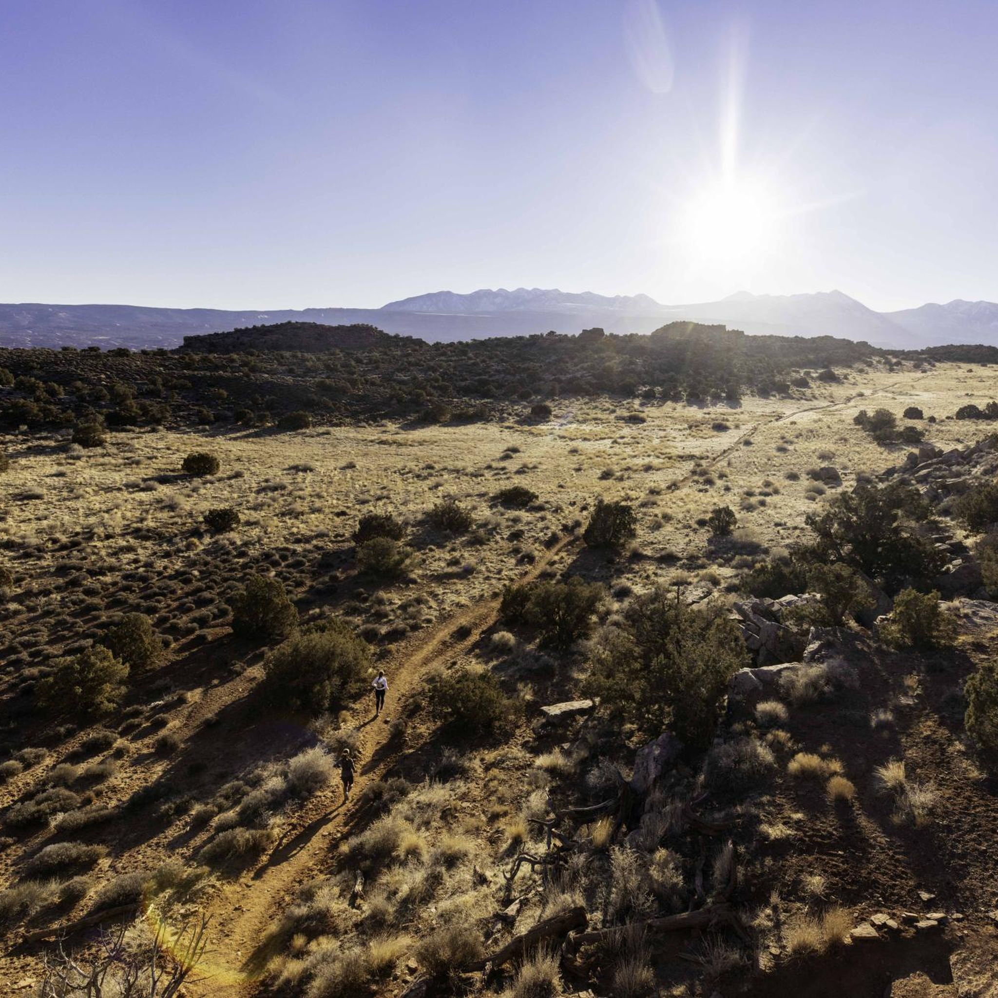
The terrain around Behind The Rocks is characterized by rugged desert landscapes, massive Navajo sandstone domes, towering cliffs, and distinctive rock fins. Routes primarily follow networks of dirt and gravel roads, which can include sandy sections. While challenging, modern equipment like larger tires and e-bikes can make these routes more accessible. You'll experience slickrock formations, deep canyons, and extensive gravel road networks.
Are there touring cycling routes suitable for beginners or families in the area?
While many routes are challenging, there are easier options available, particularly on paved pathways in the broader Moab region. For instance, the Moab Canyon Pathway is an easy 11.3-mile route with minimal elevation gain, making it suitable for beginners and families looking for a more relaxed ride away from the rugged gravel roads.
What are some of the more challenging touring cycling routes near Behind The Rocks?
For experienced touring cyclists seeking a challenge, routes like the La Sal Mountains Lookout Point – La Sal Loop Road - Info Kiosk loop from Moab offer extensive views and significant elevation gain over 63.6 miles. Another difficult option is the Moab Canyon Pathway to Navajo Rocks, which covers 37.7 miles through varied desert scenery.
What geological features or landmarks can I see while cycling near Behind The Rocks?
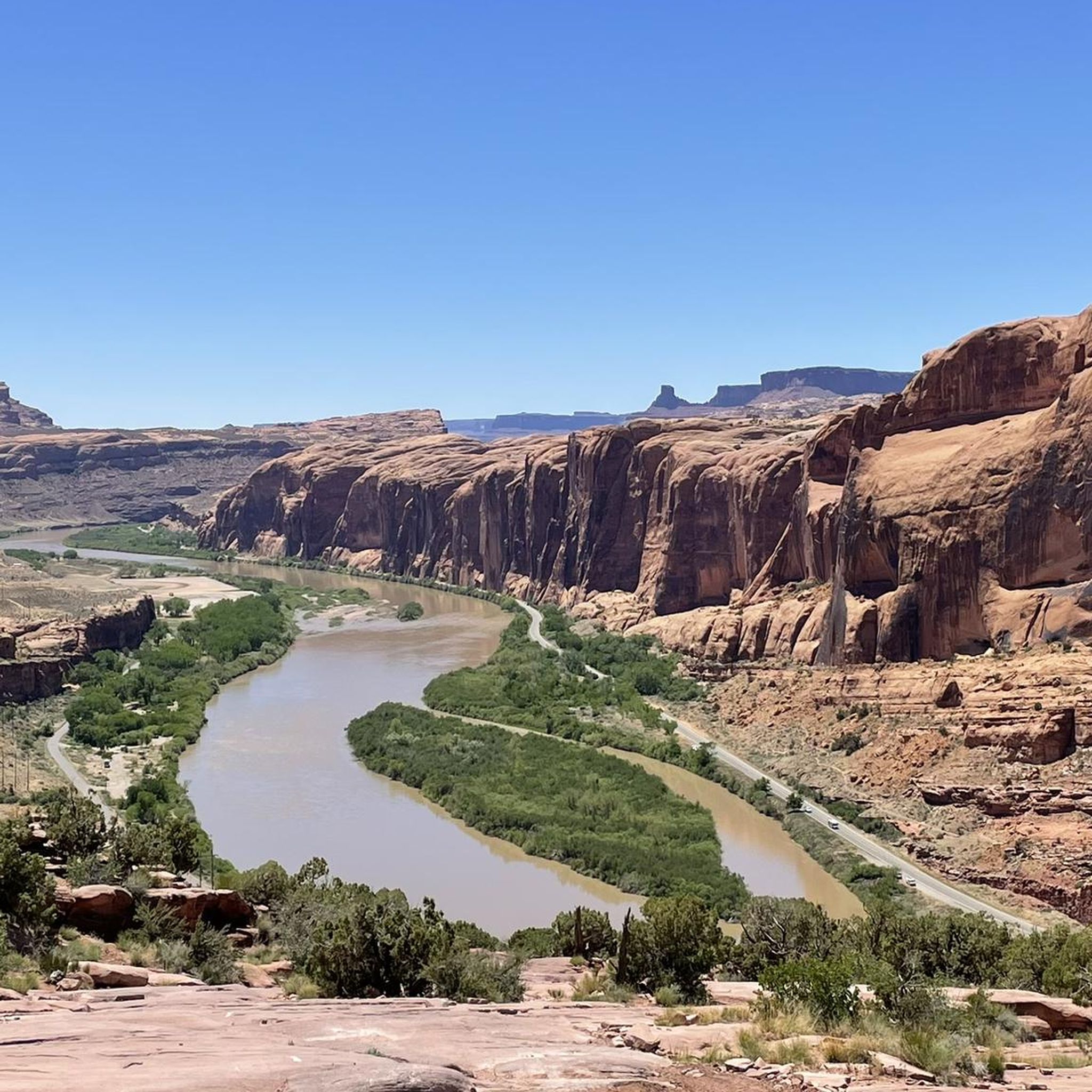
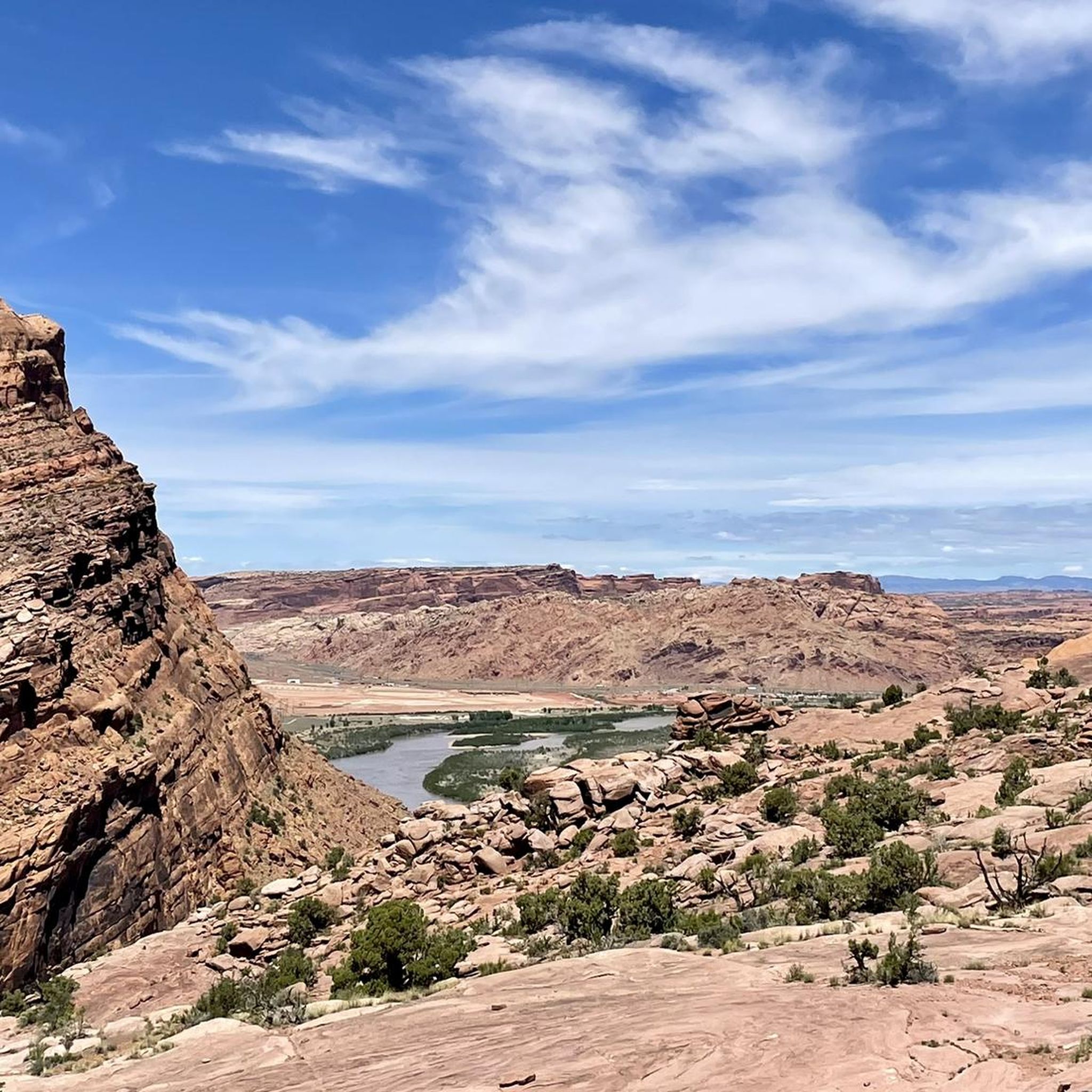
While cycling in the surrounding areas, you can enjoy stunning views of the WSA's fins, various natural arches, and the highly technical Pritchett Canyon. Other notable features include the Hidden Valley and numerous viewpoints offering panoramic vistas of the desert landscape and the Colorado River, such as Views of the Colorado River.
What do other cyclists say about touring cycling in the Behind The Rocks area?
The routes in the broader Behind The Rocks area are highly rated by the komoot community, with an average score of 5.0 stars from over 8 reviews. Cyclists often praise the stunning desert scenery, the challenging nature of the gravel and dirt roads, and the unique geological formations encountered along the way. Over 900 touring cyclists have used komoot to explore this varied terrain.
When is the best time of year to go touring cycling near Behind The Rocks?
The best time for touring cycling near Behind The Rocks is typically during the spring (March to May) and fall (September to November). During these seasons, temperatures are more moderate, making the challenging routes more enjoyable. Summers can be extremely hot, and winters can bring cold temperatures, though snow is less common at lower elevations.
Are there any circular touring cycling routes available?
Yes, there are several circular routes. For example, the La Sal Mountains Lookout Point – La Sal Loop Road - Info Kiosk loop from Moab is a popular difficult loop. Another option is the moderate Slickrock Trailhead – Sand Flats gravel road loop from Wingate by Wyndham Moab, which traverses gravel roads through desert terrain.
Can I bring my dog on touring cycling routes in the Behind The Rocks area?
While specific regulations can vary, generally, dogs are permitted on leash on public lands outside the strict Wilderness Study Area boundaries. However, the rugged terrain, potential for extreme temperatures, and lack of water sources mean that cycling with dogs, especially on longer or more challenging routes, requires careful planning and consideration for their safety and well-being. Always check local signage and regulations.
Are there any specific permits required for cycling in the Behind The Rocks area?
No specific permits are generally required for cycling on the public roads and trails outside the Behind The Rocks Wilderness Study Area. However, it's always advisable to check the latest regulations from the Bureau of Land Management (BLM) for any updates, especially if you plan to access specific recreational sites or participate in organized events. You can find more information on the BLM website: blm.gov/visit/behind-rocks.
How accessible are the touring cycling routes by public transport or car parking?
Public transport options directly to the trailheads near Behind The Rocks are limited. Most visitors access the area by car. There are various parking areas available near popular trailheads and access points, particularly around Moab, which serves as a gateway to the region. Always ensure you park in designated areas and do not block access roads.
What should I pack for a touring cycling trip in the Behind The Rocks area?
Given the desert environment, essential items include plenty of water (more than you think you'll need), sun protection (sunscreen, hat, sunglasses), navigation tools (GPS device or komoot app with offline maps), a repair kit for your bike, and appropriate clothing for varying temperatures. Snacks and emergency supplies are also highly recommended due to the remote nature of some routes.
Are there places to eat or stay near the touring cycling routes?
The town of Moab, located nearby, serves as the primary hub for amenities. You'll find a wide range of cafes, restaurants, and accommodation options in Moab, from hotels and motels to campgrounds and vacation rentals. There are limited services directly adjacent to the more remote cycling routes, so it's best to plan your food and lodging in Moab.
Most popular routes in Behind The Rocks Wilderness Study Area
Most popular attractions in Behind The Rocks Wilderness Study Area

Get inspired with the komoot mobile app


Explore more
Browse the best Cycling routes in other regions.
