The best cycling routes in Klickitat State Park Trail
5.0
(3)
140
riders
9
rides
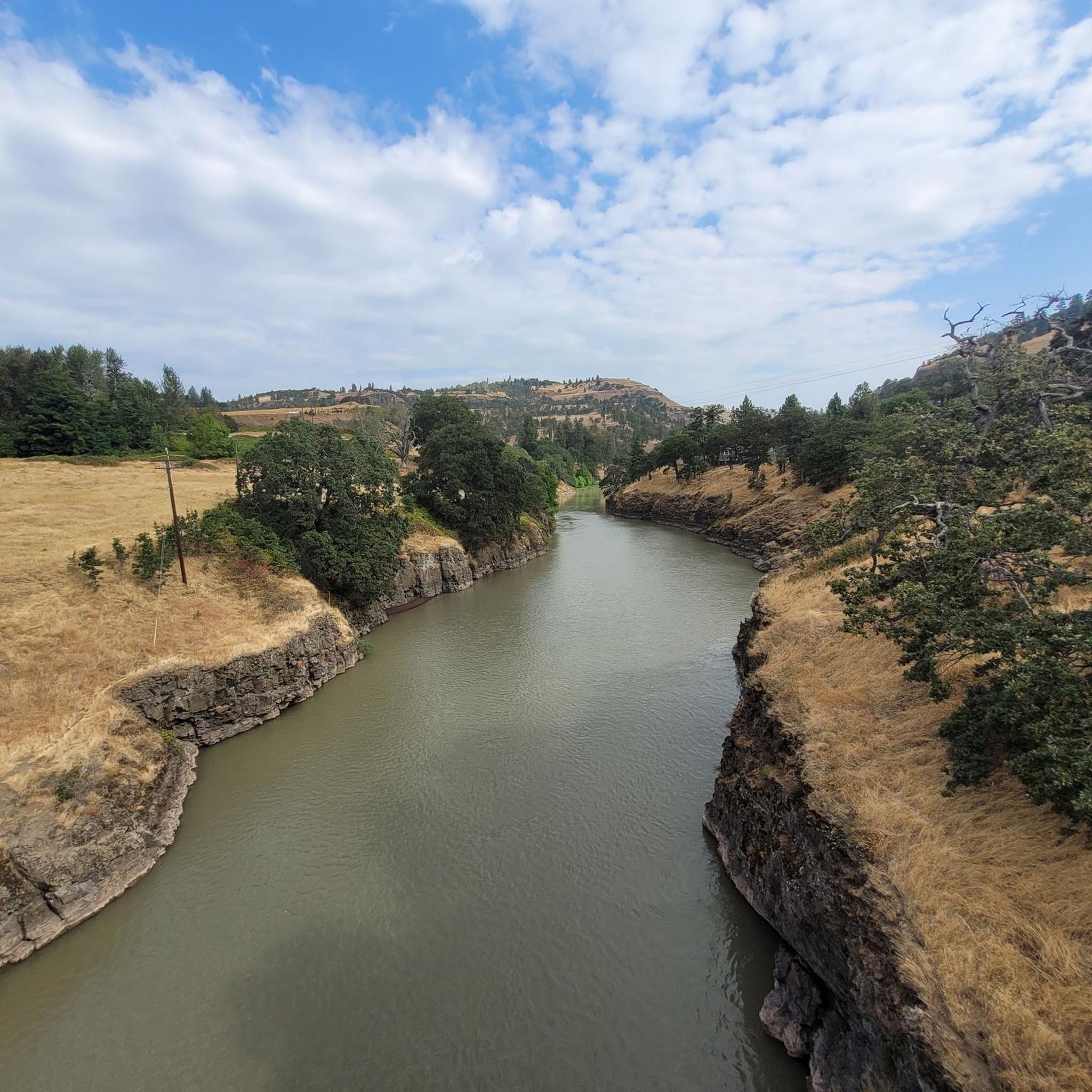
Touring cycling routes in Klickitat State Park Trail follow a gently graded rail-to-trail conversion along the nationally-designated Wild and Scenic Klickitat River. The terrain features a mix of gravel and dirt paths, winding through rolling hills, oak and Ponderosa pine woodlands, and high-desert landscapes. Cyclists can experience continuous river and canyon views, including the dramatic landscapes of Swale Canyon. The trail also offers impressive views of the Columbia River Gorge where the Klickitat River meets the Columbia.
Best touring cycling…
Last updated: June 28, 2026
12
riders
43.0km
03:26
320m
320m
Moderate bike ride. Good fitness required. Mostly paved surfaces. Suitable for all skill levels.
7
riders
70.5km
05:56
760m
760m
The Klickitat Park – View of the Klickitat Valley loop from Mayer State Park offers a rugged and rewarding touring cycling experience through the Columbia River Gorge. You'll navigate a…

Sign up for free
2
riders
85.9km
07:01
1,010m
1,010m
Hard bike ride. Very good fitness required. Mostly paved surfaces. Suitable for all skill levels.
5
riders
25.9km
01:48
440m
440m
Moderate bike ride. Good fitness required. Mostly paved surfaces. Suitable for all skill levels.
10
riders
76.9km
06:25
1,440m
1,440m
This challenging touring bicycle loop from Memaloose State Park takes you on a 47.8-mile (76.9 km) journey through the stunning Columbia River Gorge. You'll climb 4717 feet (1438 metres) over…
Get access to more routes and recommendations from other explorers.
Sign up for free
Already have an account?
Our route recommendations are based on thousands of hikes, rides, and runs completed by other people on komoot.
Start today with a free account
Your next adventure awaits.
Login or Signup

Tips from the Community

Klickitat Park is a picturesque and tranquil spot nestled right along the river. It is an ideal spot for a picnic along the water or a place to cool off on a hot day. There is plenty of parking and a vault toilet; however, you'll need to bring your own drinking water.
0
0
Mosier is a charming small town along the beautiful Columbia River, surrounded by stunning basalt cliffs. There are lovely restaurants, a cozy coffee shop and a small local market.
0
0

About 50 feet off the highway, the pavement takes riders to an overlook of the Memaloose Hills, called the Memaloose Lookout. Memaloose Overlook has a viewpoint of Memaloose Island and is a great photo opportunity, especially on a clear day.
0
0
Mosier is named after Jonah H. Mosier, who settled the area around 1821. Today, it is best known for apple, cherry, and prune production, and the town is only about 400 acres in size.
0
0
Look northward toward the Colombia River Gorge to see a separate lake called Tooley Lake sandwiched between the highway and the Colombia River. Tule Lake is fed by the Lost River, and at an elevation of 4,035 feet, this lake is popular for fishing.
0
0
The Rowena Crest is an impressive viewpoint for cyclists and drivers and has a trailhead. On the Historic Columbia River Highway, you can look down on Mayer State Park and the Columbia River Gorge. Riders will see the iconic Rowena Loops they just came up with and can be impressed on their efforts climbing the horseshoe curves that wind up and down. On a clear day, look south to see Mt. Hood.
0
0

At the end of the Twin Tunnels Trail you end up in Mosier, a small rustic town in the middle of Oregon on the Columbia River.
0
0

On the way to the High Prarie you have a beautiful view of the valley of Klickitat
0
0
Frequently Asked Questions
What is the typical terrain like for touring cyclists in Klickitat State Park Trail?
The Klickitat State Park Trail is primarily a rail-to-trail conversion, meaning it features gentle grades. The surface is a mix of gravel and dirt paths, making it suitable for adventure and gravel biking. Wide bike tires and front suspension are recommended for some rougher sections.
Are there any loop options for touring cyclists in the Klickitat State Park Trail area?
Yes, several loop options are available. For instance, the Klickitat Park loop from Mayer State Park offers a moderate 43 km ride. Another option is the 43-mile loop that utilizes the Centerville Highway, which can be combined with sections of the main trail.
What are some notable natural features or landmarks to see along the Klickitat State Park Trail?
The trail offers continuous views of the Wild and Scenic Klickitat River and the dramatic landscapes of Swale Canyon, known for its carved gorges and geological formations. You'll also pass through diverse oak and Ponderosa pine woodlands and high-desert areas. The Fisher Hill Trestle is a key feature near the Lyle trailhead, and the trail's start in Lyle provides impressive views of the Columbia River Gorge.
What is the best time of year to go touring cycling in Klickitat State Park Trail?
Early spring is particularly beautiful due to spectacular displays of wildflowers. However, it's important to note that Swale Canyon, a highlight of the trail, is typically closed during periods of high fire danger, usually from July to early October. For current conditions and closures, it's advisable to check with Washington State Parks.
Are there any specific regulations or permits required for cycling in Klickitat State Park Trail?
A Discover Pass is required for vehicle access to trailheads within Washington State Parks. For detailed regulations and any specific permits, especially concerning fire danger closures for sections like Swale Canyon, you can consult the official Washington State Parks website or their brochure for the Klickitat Trail. Washington State Parks Klickitat Trail page
What are the options for family-friendly cycling routes in Klickitat State Park Trail?
The rail-to-trail nature of the Klickitat State Park Trail means it generally has gentle grades, making it accessible. The first 1.5 miles from the Lyle trailhead up to the Fisher Hill Trestle are improved and ADA accessible, offering a good option for families or those seeking an easier ride.
Where can I find parking and trailheads for the Klickitat State Park Trail?
The most frequently used trailhead is located in Lyle, where the Klickitat River meets the Columbia River. There are multiple access points along the 31-mile trail, providing various options for starting your journey. Remember that a Discover Pass is needed for vehicle access.
What kind of wildlife or birdwatching opportunities can I expect along the trail?
The area is a haven for birdlife, offering excellent opportunities for birdwatching. Notably, the vicinity near the Lyle trailhead serves as a winter habitat for bald eagles, providing a chance to spot these majestic birds.
Are there any particularly challenging touring cycling routes in the area?
Yes, for those seeking a challenge, several difficult routes are available. The Klickitat Park – View of the Klickitat Valley loop from Mayer State Park is a difficult 70.5 km path offering expansive views. Another demanding option is the Klickitat Park – Eightmile Creek Falls loop from Pitt, which covers 85.9 km through varied terrain.
What do other touring cyclists enjoy most about cycling in Klickitat State Park Trail?
The area is highly rated by the komoot community, with an average score of 5.0 stars. Reviewers often praise the unique rail-to-trail experience, the continuous river and canyon views, and the diverse landscapes ranging from woodlands to high-desert.
Can I find cafes or accommodation near the Klickitat State Park Trail?
While the trail itself is quite remote, the towns of Lyle and Goldendale, located near different sections of the trail, offer amenities such as cafes, pubs, and accommodation options. It's advisable to plan your stops in these towns.
Is the Klickitat State Park Trail suitable for dogs?
While the trail is generally welcoming to outdoor enthusiasts, specific guidelines for dogs, such as leash requirements, are typically in place for state parks. It's best to check the official Washington State Parks website for the most current pet policies for Klickitat State Park Trail to ensure a pleasant experience for everyone.
Most popular routes in Klickitat State Park Trail

Get inspired with the komoot mobile app


Explore more
Browse the best Cycling routes in other regions.
