The best road cycling routes in Dabney State Recreation Area
4.3
(29)
488
riders
29
rides
Road cycling in Dabney State Recreation Area offers a variety of paved routes through a diverse natural landscape. The area is situated on a bend of the Sandy River, providing scenic views and access to the Historic Columbia River Highway. Cyclists encounter a mix of terrain, from relatively flat sections along the river to routes with significant elevation gain. The surrounding environment features lush forests with cottonwoods and alders, contributing to varied cycling conditions.
Best road cycling routes in Dabney…
Last updated: October 2, 2026
48
riders
100.0km
04:19
1,570m
1,570m
Hard road ride. Very good fitness required. Mostly well-paved surfaces and easy to ride.
5.0
(2)
13
riders
70.2km
02:57
1,150m
1,150m
Hard road ride. Very good fitness required. Mostly well-paved surfaces and easy to ride.

4.0
(3)
101
riders
72.3km
04:09
1,390m
1,390m
Hard road ride. Very good fitness required. Mostly well-paved surfaces and easy to ride.
15
riders
Moderate road ride. Good fitness required. Some segments of this route may be unpaved and difficult to ride.
4.2
(5)
12
riders
Moderate road ride. Good fitness required. Mostly well-paved surfaces and easy to ride.
Get access to more routes and recommendations from other explorers.
Already have an account?
Our route recommendations are based on thousands of hikes, rides, and runs completed by other people on komoot.
Start today with a free account
Your next adventure awaits.
Popular around Dabney State Recreation Area


Tips from the Community

The river is visible through the trees as you ride down the historic highway. The Sandy River begins at Reid Glacier on Mount Hood, and travels 56 miles to reach its confluence with the Columbia.
0
0

Boring, Oregon has become somewhat famous, or infamous, depending on how you look at it. In recent years it has become well known due to its humorous take on its name and partnering with Dull, Scotland as "sister cities" in order to promote tourism to both locations.
0
0

This is a great climb on a quiet, lightly trafficked road to the summit of Larch Mountain. Take a jacket for the long descent as it can get cold on the way down even on a warm day!
0
0

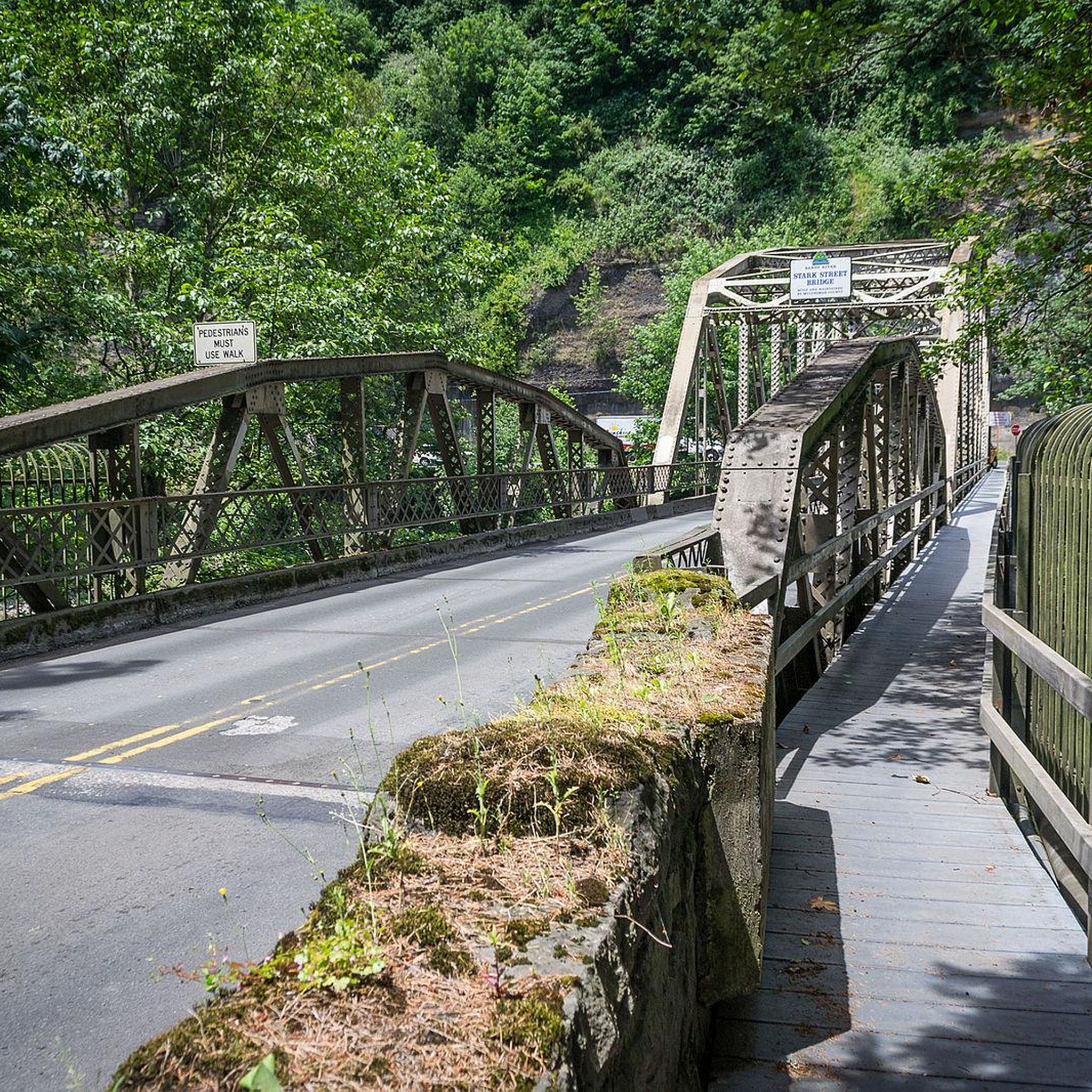
The Sandy River Bridge, also known as the Troutdale Bridge of the East Historic Columbia River Highway Bridge, provides bikers with a separate lane away from dangerous traffic, offering a scenic view of the Sandy River. Construction began in 1912 as part of the Columbia River Highway project. Before the bridge, locals used Stark Street or a small ferry, which at one point had a mishap in 1912, when a large auto miscalculated its approach into the ferry and drove into the Sandy River.
1
0

The 3.3 mile, Gresham Fairview Trail is a north–south corridor. It was built on the bed of a former railroad line. It gives riders a mainly stress free environment with views and access to natural areas. Access to the start of the trail in the north is from northeast Halsey Street at 201st Avenue. The southern access point is with the Springwater Trail at SW 10th Avenue.
1
0

Dabney State Recreation Area is a 138-acre park along the Sandy River. This area is a popular water recreation spot that has a sandy beach.
0
0
The Sandy River is a 56-mile river that flows into the Columbia River. The river starts at the Reid Glacier south of Mount Hood.
0
0

This 21.6-acre park, located right by historic downtown Gresham, offers picnic tables and lawn areas for relaxation and breaks. The main features of this park include the Gresham Skatepark, Gresham Japanese Garden, and Gresham Heroes Memorial.
0
0
Frequently Asked Questions
How many road cycling routes are available in Dabney State Recreation Area?
There are over 20 road cycling routes available in Dabney State Recreation Area, catering to various skill levels. These routes are highly rated by the komoot community, with an average score of 4.3 stars.
What are the difficulty levels of road cycling routes in Dabney State Recreation Area?
The routes offer a range of difficulty levels. You'll find 4 easy routes, 11 moderate routes, and 9 difficult routes, ensuring options for cyclists of all experience levels.
What kind of terrain can I expect on road cycling routes in Dabney State Recreation Area?
Road cycling in this area features a diverse mix of terrain. You can expect relatively flat sections along the Sandy River, as well as routes with significant elevation gain, especially those connecting to the Historic Columbia River Highway. The scenery includes lush forests with cottonwoods and alders.
Are there any long-distance road cycling routes for experienced riders?
Yes, experienced riders can tackle challenging long-distance routes. For example, the Bridge of the Gods Ride is a difficult 62.1-mile (100.0 km) route with substantial elevation changes, typically taking over 4 hours to complete. Another option is the Sandy River Loop, a difficult 43.6-mile (70.2 km) path following the river.
Are there any moderate road cycling routes that offer scenic views?
Absolutely. The Sandy River – Chanticleer Point loop from Troutdale is a popular moderate route, spanning 24.1 miles (38.9 km). It leads through river valleys and up to elevated viewpoints, offering great scenery and typically takes around 2 hours 20 minutes.
What are some notable natural features or landmarks along the cycling routes?
The most prominent natural feature is the Sandy River itself, which many routes follow or offer views of. You'll also cycle through diverse forest settings with tall bamboo, horsetail, cottonwoods, and alders. Routes often provide access to the Historic Columbia River Highway, known for its scenic vistas.
Are there any circular road cycling routes in the area?
Yes, several routes are designed as loops. The Sandy River Loop and the Sandy River – Chanticleer Point loop from Troutdale are excellent examples of circular routes that allow you to start and end in the same general area.
Is there parking available for cyclists at Dabney State Recreation Area?
Yes, Dabney State Recreation Area is well-equipped with parking facilities, making it a convenient starting point for many road cycling adventures. There are designated parking areas within the park.
What other activities can be enjoyed at Dabney State Recreation Area besides road cycling?
Beyond road cycling, Dabney State Recreation Area offers a wide array of outdoor activities. You can enjoy swimming or sunbathing on the 100-foot sandy beach along the Sandy River, boating, tubing, rafting, and fishing. There are also paved trails for hiking and nature walks, an 18-hole disc golf course, and numerous picnic areas with grills.
What is the best time of year for road biking in Dabney State Recreation Area?
The best time for road biking in Dabney State Recreation Area is generally during the spring, summer, and early fall months when the weather is mild and precipitation is lower. These seasons offer pleasant conditions for enjoying the scenic routes and river views.
Are there any routes that are relatively flat and suitable for a relaxed ride?
While many routes feature elevation changes, you can find sections that are relatively flat, particularly those that closely follow the Sandy River. Look for routes categorized as 'easy' for a more relaxed experience, such as the Springwater Corridor – West Lents Floodplain loop from Kelly Creek, which has minimal elevation gain.
What do other cyclists enjoy most about road cycling in Dabney State Recreation Area?
The komoot community highly rates the routes in Dabney State Recreation Area, with an average score of 4.3 stars from over 20 reviews. Cyclists often praise the diverse natural landscape, the scenic views of the Sandy River, and the varied terrain that offers both challenging climbs and enjoyable flat sections.
Most popular routes in Dabney State Recreation Area

Get inspired with the komoot mobile app


Explore more
Browse the best Road cycling routes in other regions.
