The best running trails in Lucky Peak State Recreation Area
110
runners
21
runs
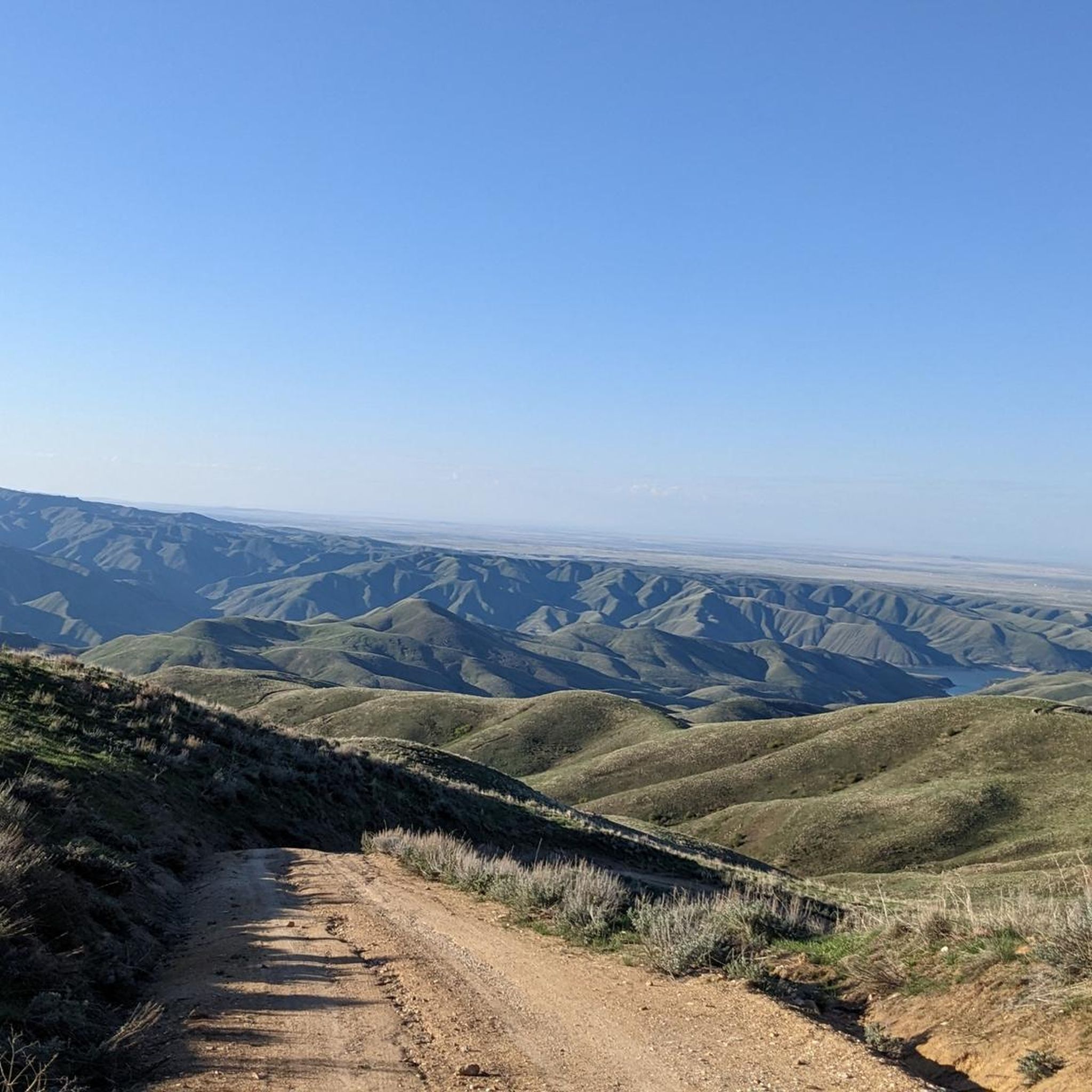
Jogging in Lucky Peak State Recreation Area offers diverse terrain for runners. The region features the mostly flat, paved Boise River Greenbelt, ideal for accessible running along the Boise River. Beyond the Greenbelt, the surrounding foothills provide an extensive network of trails with varied terrains and elevations. The landscape is characterized by the expansive Lucky Peak Lake, rugged basalt cliffs, and riparian ecosystems along the river.
Best jogging routes in Lucky Peak State Recreation Area
- The most popular jogging route…
Last updated: June 24, 2026
2
runners
14.2km
01:42
270m
270m
Moderate run. Good fitness required. Mostly paved surfaces. Suitable for all skill levels.
2.35km
00:18
40m
40m
Easy run. Great for any fitness level. Mostly paved surfaces. Suitable for all skill levels.

Sign up for free
4
runners
8.87km
00:55
20m
20m
Moderate run. Good fitness required. Mostly paved surfaces. Suitable for all skill levels.
5
runners
9.52km
01:23
420m
420m
Hard run. Very good fitness required. Mostly accessible paths. Some sure footedness required.
35
runners
Hard run. Very good fitness required. Mostly paved surfaces. Suitable for all skill levels.
Get access to more routes and recommendations from other explorers.
Sign up for free
Already have an account?
Our route recommendations are based on thousands of hikes, rides, and runs completed by other people on komoot.
Start today with a free account
Your next adventure awaits.
Login or Signup

Tips from the Community

The Boise River Greenbelt is 25 miles long and provides a road-bike worthy path on both sides. The path has a number of rest areas to stop and admire the views of the river.
0
0

This quiet double-track path leads from the Lucky Peak State Recreation Area to the Oregon Trail. There are a few intersecting roads and trails out in this area, so it's helpful to have your map downloaded and with you.
0
0
The Lydle Gulch Trail is a mostly double-track path with a mix of singletrack tossed in. The path is sandy with packed dirt and grass. It's a popular spot for biking, running, hiking, and dog walking. There are numerous other paths on the property that you can branch onto to make different length loops.
0
0

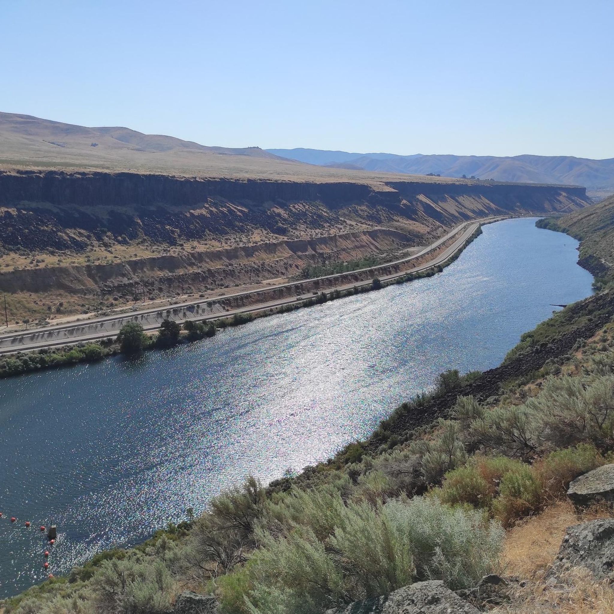
The Boise River is a 102-mile river that flows at elevations over 10,000 feet through the Sawtooth Mountain Range. It also flows through the city of Boise.
0
0

Follow the Boise River through the city, there are plenty of places to stop and enjoy its beauty. This unforgettable experience offers stunning scenery, diverse terrain, and numerous opportunities for adventure.
0
0

This is just a small portion of the 25 mile long Boise River Greenbelt. As the name suggests the trail travels along the banks of the Boise River through many of the cities best parks and green spaces. It also provides access to a number of great coffee shops & restaurants.
0
0

Located on the banks of the Boise River, Boise River Park is a great place for a run. It has green space, restrooms and access to the water if you need to cool down.
0
0
For generations Native Americans traveled along this route and in 1833 Captain Benjamin Bonneville became one of the first Europeans to reach this point. Later on this route would become part of the famous Oregon Trail. While there are some good views to be had, this area might be of more interest to those who are into history.
0
0
Frequently Asked Questions
How many running routes are available in Lucky Peak State Recreation Area?
There are 19 running routes available in Lucky Peak State Recreation Area, offering a variety of distances and difficulty levels. You'll find 4 easy routes, 11 moderate routes, and 4 difficult routes to choose from.
What kind of terrain can I expect on the running trails in Lucky Peak State Recreation Area?
The area offers diverse terrain for runners. You can expect mostly flat, paved paths along the Boise River Greenbelt, ideal for accessible running. Beyond the Greenbelt, the surrounding foothills provide an extensive network of natural trails with varied terrains and elevations, including challenging climbs and old dirt roads.
Are there any scenic viewpoints or natural features to see while jogging?
Yes, the area is rich in natural beauty. You can enjoy stunning views of the Boise River, Lucky Peak Lake, and the surrounding forests. Notable features include the blue waters of Lucky Peak Lake contrasting with steep black basalt cliffs, and riparian ecosystems along the river. The Lydle Gulch area also offers interesting natural landscapes.
What natural landmarks can I explore near the running paths?
While running, you can explore several natural landmarks. The expansive Lucky Peak Reservoir is a central feature, offering beautiful water views. You might also encounter the sandy shores of Sandy Point Beach, located at the base of the Lucky Peak Dam, which is perfect for a refreshing stop.
What do other runners appreciate most about the trails in Lucky Peak State Recreation Area?
Over 90 runners have used komoot to explore Lucky Peak State Recreation Area. They often praise the diverse terrain, from the accessible Boise River Greenbelt to the challenging foothill trails, and the beautiful scenery, including the Boise River and Lucky Peak Lake. The variety allows for different ability levels, from easy strolls to more challenging climbs.
Are there family-friendly running routes in Lucky Peak State Recreation Area?
Yes, there are 4 easy routes suitable for families or those looking for a less strenuous run. The Lydle Gulch Loop Trail, for example, is a shorter, easy option. The mostly flat Boise River Greenbelt also provides a pleasant experience for all ages.
Can I bring my dog on the running trails?
Yes, Lucky Peak State Recreation Area is generally dog-friendly. Specifically, Discovery Park, which is part of the recreation area, is noted as a dog-friendly spot. Always ensure your dog is on a leash and follow park regulations regarding pets.
Are there any loop trails for running?
Yes, there are loop trails available. A popular option is the Lydle Gulch Loop Trail, which is 1.5 miles (2.3 km) long and leads through varied terrain. Another longer option is the Boise River – Boise River Greenbelt loop from Lucky Harris 13.
What are the parking options for accessing the running trails?
Lucky Peak State Recreation Area offers various access points with parking. Specific parking areas are available at Sandy Point, Discovery Park, and Spring Shores Marina, providing convenient access to different sections of the Boise River Greenbelt and the foothill trails. Check signage for any day-use fees.
Is public transport available to Lucky Peak State Recreation Area?
While the area is just minutes from Boise, direct public transport options to all units of Lucky Peak State Recreation Area may be limited. It is generally recommended to access the park by car. For detailed information on local transport, it's best to check with Boise's public transit services.
Where can I find amenities like cafes or restrooms after a run?
Restrooms are available at the main units of Lucky Peak State Recreation Area, including Sandy Point, Discovery Park, and Spring Shores Marina. Spring Shores Marina also features a convenience store where you can purchase snacks and drinks. For cafes or more extensive dining options, you would typically head back into nearby Boise.
What are some longer running routes for experienced runners?
For experienced runners seeking a challenge, the Oregon Trail to Bonneville Point is an excellent choice, spanning 8.8 miles (14.2 km) with notable elevation gain. Another demanding option is the Running loop from Peace Valley Overlook Reserve, which is 9.5 km long and features significant elevation changes.
What is the best time of year for running in Lucky Peak State Recreation Area?
The spring and fall months generally offer the most pleasant running conditions with milder temperatures. Summer can be very warm, especially on exposed trails like the Lucky Peak Trail #6, requiring adequate hydration and sun protection. Winter running is possible, but conditions can vary, with some trails potentially being muddy or icy.
Most popular routes in Lucky Peak State Recreation Area
Most popular attractions in Lucky Peak State Recreation Area

Get inspired with the komoot mobile app


Explore more
Browse the best Running Trails & Routes in other regions.
