The best walks and hikes in Point Reyes National Seashore
4.8
(291)
4,555
hikers
104
hikes
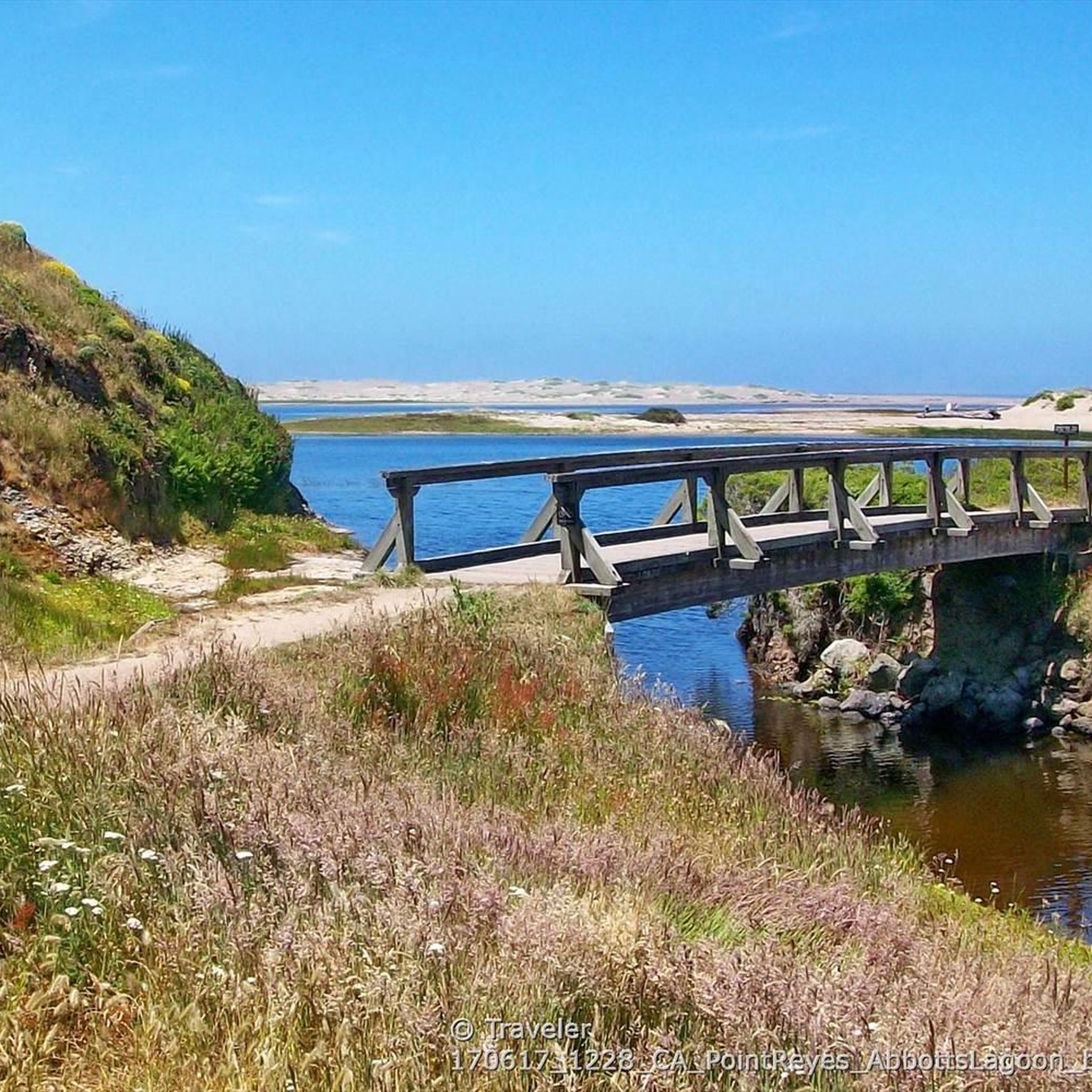
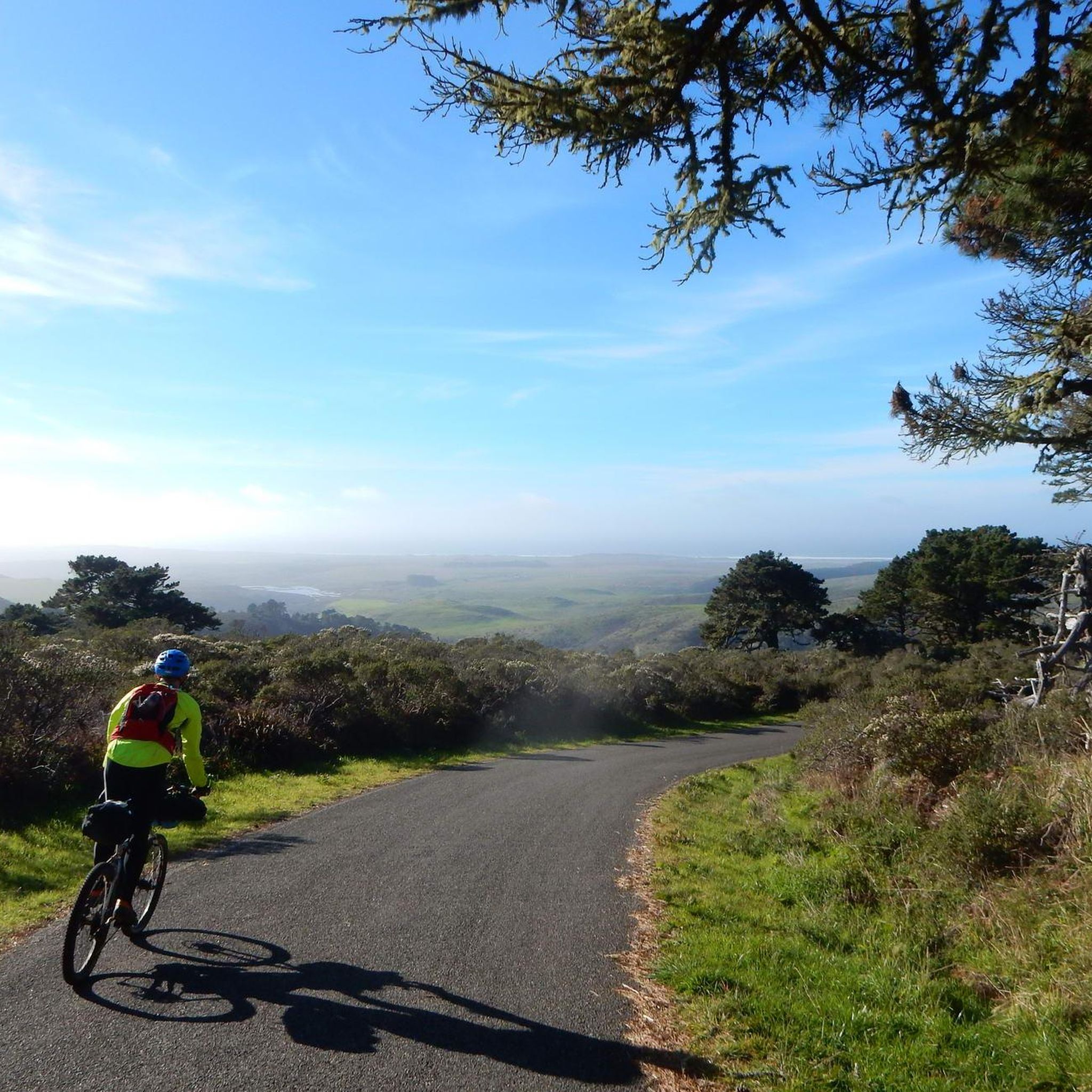
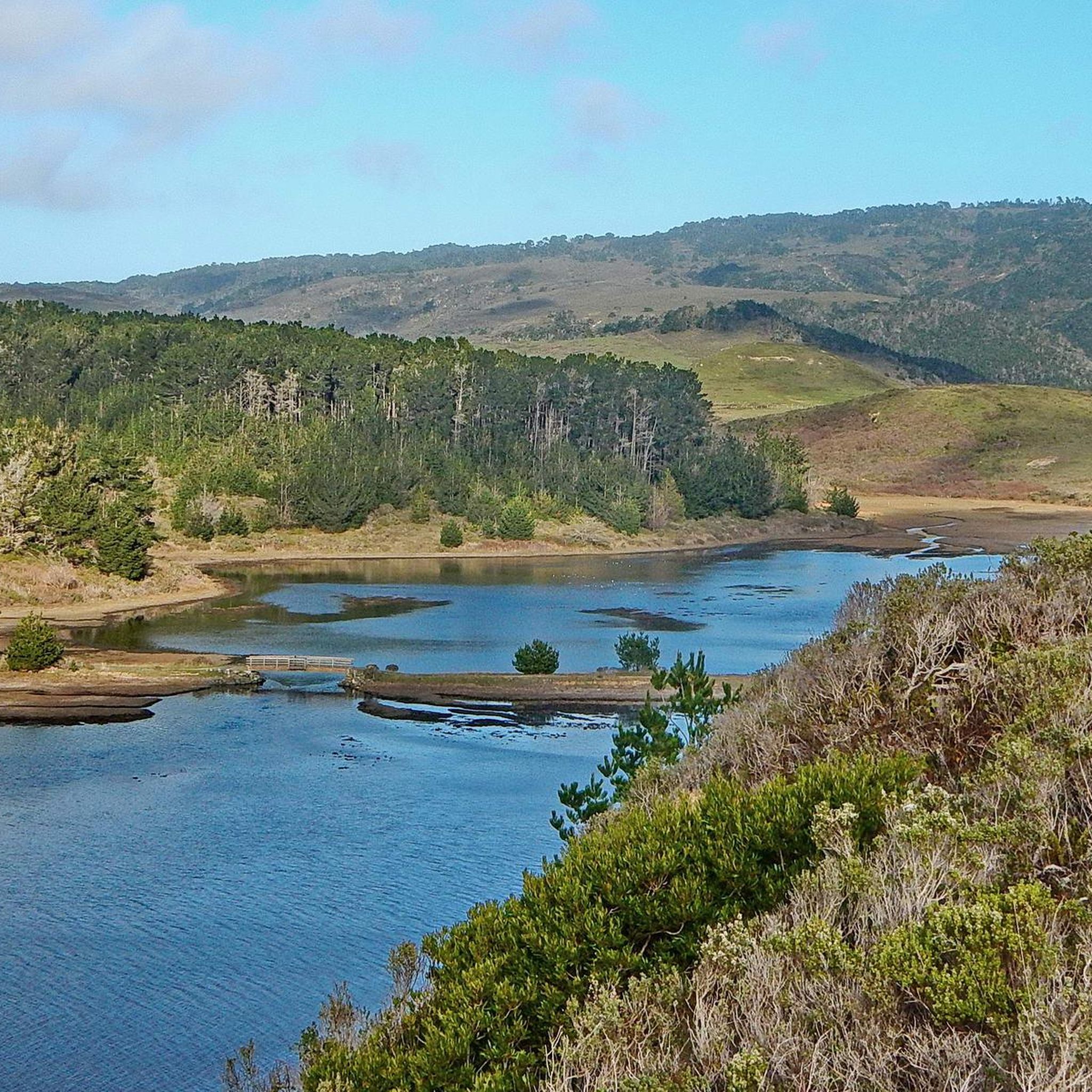
Hiking in Point Reyes National Seashore explores a protected coastal peninsula in Marin County, California. The region's landscape is characterized by a mix of windswept beaches, open grasslands, and dense Douglas fir forests. Separated from the mainland by a section of the San Andreas Fault, the area offers a variety of terrain from coastal bluffs to forested ridges. This diverse scenery includes dramatic cliffs, secluded beaches, and estuaries.
Best hiking trails in Point Reyes National Seashore
- The most popular hiking route is Alamere Falls via Coast Trail from Palomarin Trailhead, a 5.7 miles (9.1 km) trail that takes 2 hours 41 minutes to complete. This moderate path leads to a tidefall, a waterfall that flows directly onto the beach.
- Another top favourite among local hikers is Old Pine, Sky, and Meadow Loop, a moderate 7.9 miles (12.7 km) path. This route traverses varied terrain including forests and open meadows.
- Local hikers also love the Sky Trail and Bear Valley Loop, an 11.3 miles (18.2 km) trail leading through forested ridges and valleys, often completed in about 5 hours 23 minutes.
- Hiking in Point Reyes National Seashore is defined by coastal bluffs, open grasslands, and dense Douglas fir forests. The trail network provides options for various fitness levels, from short walks to longer, more demanding hikes.
- The routes in Point Reyes National Seashore are highly rated by the komoot community with an average score of 4.8 stars from over 200 reviews. More than 3,000 hikers have used komoot to explore Point Reyes National Seashore's varied terrain.
Last updated: July 8, 2026
48
hikers
9.12km
02:41
240m
300m
You can hike to Alamere Falls via the Coast Trail from Palomarin Trailhead, a moderate route covering 5.7 miles (9.1 km) with an elevation gain of 787 feet (240 metres). This journey typically takes about 2 hours and 41 minutes to complete. As you hike, you will experience diverse scenery, transitioning from open coastal scrub with continuous ocean views to shaded eucalyptus groves. The trail also leads you past scenic lakes such as Bass Lake and Pelican Lake, offering peaceful spots along the way. Your destination is Alamere Falls, a unique waterfall that cascades directly onto Wildcat Beach, providing a memorable coastal experience.
When planning your visit, be aware that the final 1.2 miles of Mesa Road to the Palomarin Trailhead is unpaved and often has potholes, so drive with care. Parking can be challenging, especially on weekends, so arriving early is highly recommended to secure a spot. It is also crucial to check tide charts before you go; high tide can make reaching the base of Alamere Falls unsafe or impossible. Consider starting your hike earlier in the day to avoid crowds and ensure you have ample time.
This trail is notable for leading to one of California's rare 'tidefalls', where fresh water plunges directly onto the beach. The route takes you through the Phillip Burton Wilderness, offering a chance to observe the natural coastal environment. On clear days, you might even catch a glimpse of the distant Farallon Islands from various points along the path. This unique combination of coastal views, serene lakes, and a dramatic waterfall makes the hike a distinctive experience in the region.
5.0
(1)
30
hikers
12.7km
03:47
370m
380m
Embark on the Old Pine, Sky, and Meadow Loop for a moderate hiking adventure through Point Reyes National Seashore. This 7.9-mile (12.7 km) route features varied terrain, from shady coastal woodlands filled with ferns and fir trees to expansive, open meadowlands. You'll gain 1223 feet (373 metres) in elevation over approximately 3 hours and 47 minutes, offering a good workout with rewarding views. Look forward to the tranquil atmosphere around Divide Meadow, where the landscape opens up to big skies.
When planning your hike, be ready for the coastal weather; conditions can be windy and foggy, so dressing in layers is a smart choice. The trail's varied terrain includes both gradual climbs and sloped sections, making good footwear essential. While the path is generally well-defined, carrying a GPS device is advisable to help with navigation and ensure you stay on track. Consider starting your hike earlier in the day to enjoy the full experience without rushing.
This loop is notable for its rich tapestry of scenery, transitioning between dense coastal forests and wide-open meadows. Keep an eye out for local wildlife, as the area is home to elk, deer, and various smaller creatures, especially near the tranquil Divide Meadow. The diverse flora, including huckleberry bushes and fir trees, adds to the unique character of this Point Reyes trail, making it a standout option for exploring the region's natural beauty.

Sign up for free
4.8
(5)
29
hikers
18.2km
05:23
510m
500m
If you're seeking a diverse hiking experience that transitions from lush, dew-dripping rainforests to expansive ocean views, the Sky Trail and Bear Valley Loop is a top contender. This difficult 11.3-mile (18.2 km) route takes you through varied terrain, including a rigorous uphill climb to Mount Wittenberg for stunning panoramas, before descending along the tranquil Bear Valley Trail beside Coast Creek. Expect around 1688 feet (514 metres) of elevation gain, making it a solid 5-hour and 23-minute commitment for those ready for a challenge.
You can hike this loop year-round, but be prepared for changing weather by dressing in layers. It's also wise to be aware of poison oak in the wooded areas and unstable bluffs along the coast; sticking to marked paths is crucial. While specific parking details aren't highlighted, planning an early start is always a good idea for popular trails in Point Reyes National Seashore.
This trail stands out for its incredible ecological diversity within Point Reyes National Seashore, allowing you to experience dramatic coastal treks and serene forest meanders in one go. The 2020 Woodward Fire, while impactful, has opened up even more far-reaching views from the Sky Trail, adding another layer to the scenic rewards. Keep an eye out for diverse wildlife, including tule elk and various bird species, that call this protected area home.
5.0
(2)
25
hikers
10.9km
03:10
280m
300m
The Bear Valley Trail to Wildcat Campground offers a delightful journey through the varied landscapes of Point Reyes National Seashore. You'll start in a lush, shaded valley reminiscent of a "FernGully," following a babbling creek through towering trees and abundant ferns. The path then opens into the wide expanse of Divide Meadow, a great spot for wildlife viewing, before continuing through a rich canyon and finally revealing spectacular coastal views as you approach Wildcat Campground. This moderate hike covers 6.8 miles (10.9 km) with 932 feet (284 metres) of elevation gain, typically taking around 3 hours and 10 minutes.
To plan your visit, head to the Bear Valley Visitor Center, where the trailhead is easily accessible. Parking is available, though it can fill up on busy days, so an early start is recommended. If you're considering camping at Wildcat Campground, be aware that permits are necessary. The trail's shaded sections make it a good choice for warmer weather, and spring brings a beautiful display of wildflowers.
This trail is a fantastic showcase of Point Reyes' diverse ecosystems, transitioning from riparian forests to open meadows and coastal bluffs. Wildcat Campground itself is a unique destination, situated on a bluff overlooking the ocean, and offers access to Wildcat Beach. From there, you can even walk to Alamere Falls at low tide, a rare waterfall that cascades directly onto the sand. It's a truly rewarding hike for those looking to experience the natural beauty of the California coast.
5.0
(1)
13
hikers
8.36km
02:12
70m
60m
Embark on the Muddy Hollow and Coast Trail Loop, a moderate hike spanning 5.2 miles (8.4 km) with an elevation gain of 220 feet (67 metres). You can expect to complete this scenic route in about 2 hours and 11 minutes. As you hike, you will traverse varied terrain, moving from wetlands and meadows into young Bishop pine woodlands, eventually reaching expansive views of the Pacific Ocean and Limantour Beach.
When planning your visit, be aware that the crossing of Muddy Hollow Creek does not have a bridge, so your feet might get wet, especially during the wetter months of winter and spring. Parking is available at the trailhead, making access straightforward. Remember that pets and bicycles are generally not allowed on the trails starting from the Muddy Hollow Trailhead.
This loop offers a rich tapestry of landscapes within Point Reyes National Seashore. Keep an eye out for diverse wildlife, including tule elk and various bird species, as you explore the natural features of this coastal area. The combination of inland and ocean vistas makes this trail a distinctive experience in the region.
Get access to more routes and recommendations from other explorers.
Sign up for free
Already have an account?
Our route recommendations are based on thousands of hikes, rides, and runs completed by other people on komoot.
Start today with a free account
Your next adventure awaits.
Login or Signup
Tips from the Community

Whether beginning or ending your journey here, Limantour Beach is a peaceful, evocative bookend to the cross-country American Discovery Trail. The sweeping ocean views area fitting beginning or end to the 5,000 mile trek.
0
0
Limantour Beach is a 4 mile long stretch of sand at the end of Limantour Spit. Though the water may look inviting visitors should use caution as the cold temperature can cause hypothermia and there are also intermittent rip tides.
1
0

This is a beautiful trail that takes you right up to the cliff side and you can peer down to the water below.
0
0
On a clear day the views from here are incredible. Sunset, of course, makes it even better.
0
0
A beautiful meadow surrounded by lush forest. It can be a destination on its own for a quick stop & picnic or part of a longer hike if you have more time to explore.
0
0

At this lowest section a gap in the coastal cliffs opens up an easy level trail to the long beach SF stretching from Santa Maria Beach at Coast Camp all the way to Limantour Spit
0
0
Long perfect sandy beach that offers great swimming and long walks behind undisturbed natural dunes
0
1
Starting point for hikes to the South for access to Limantour Beach, Limantour Spit, and to the North West to follow the Estero Trail winding along the bays and lagoons toward Sir Francis Drake Blvd and the main Point Reyes. Several Parking lots, restrooms, and drinking water make this a popular starting point.
0
0
Frequently Asked Questions
Are dogs allowed on the trails in Point Reyes National Seashore?
No, dogs are generally not permitted on most trails within Point Reyes National Seashore to protect the native wildlife and ecosystems. They are allowed on-leash on a few specific beaches, such as Kehoe Beach, Limantour Beach, and Point Reyes/Great Beach. Always check the official park regulations before bringing your pet.
What's a good hike for seeing a waterfall?
The most famous waterfall hike is to Alamere Falls, a rare tidefall that flows directly onto the beach. The Alamere Falls via Coast Trail is a challenging but rewarding 8.1-mile (13 km) trek. Be sure to check tide charts before you go, as high tide can make the final beach approach impassable and unsafe.
Are there any easy, family-friendly hikes in Point Reyes?
Yes, the Chimney Rock & Historic Lifeboat Station trail is an excellent choice. It's a relatively flat 2.2-mile (3.6 km) walk with fantastic coastal views, making it suitable for all ages. Another great option is the Earthquake Trail, a short, paved loop near the Bear Valley Visitor Center that is both accessible and educational.
What is a good trail for seeing wildflowers?
The Chimney Rock area is one of the best places for wildflower viewing, especially from April to August. The trail offers spectacular displays of colorful blooms against a backdrop of dramatic coastal cliffs. The hillsides throughout the park often come alive with flowers in the spring.
Where can I see wildlife in Point Reyes?
For a near-guaranteed sighting of tule elk, the Tomales Point Trail is your best bet as it traverses the Tule Elk Reserve. For marine mammals, the Elephant Seal Overlook near Chimney Rock and Drakes Beach are prime spots, especially during the winter pupping season. The headlands are also excellent for spotting migrating gray whales from January through April.
What are the parking conditions like at the trailheads?
Parking can be very challenging, especially on weekends and holidays. Popular trailheads like Palomarin (for Alamere Falls), Bear Valley, and Tomales Point fill up early in the morning. It's highly recommended to arrive before 9:00 AM or visit on a weekday to secure a parking spot.
How can I check for trail conditions and closures?
For the most current information on trail status, closures, and safety alerts, it is essential to check the official Point Reyes National Seashore website. You can find updates on trail maintenance, storm damage, or fire restrictions on the park's official hiking page.
Are there any good loop hikes with coastal views?
The Fire Line & Coast Trail loop is a great option. This 5-mile (8 km) moderate hike combines forested sections with stunning open views along the Coast Trail, offering a diverse taste of the Point Reyes landscape in a single circuit.
I'm looking for a challenging day hike. What do you recommend?
For a strenuous hike with significant elevation gain and rewarding views, consider the Mt. Wittenberg Loop. This trail climbs to the highest point in the park, offering panoramic vistas of the entire peninsula and Drakes Bay before descending back through lush forest.
Is it possible to hike to the Point Reyes Lighthouse?
You can't hike directly to the lighthouse on a trail, but you can drive to its parking lot. From there, it's a 0.4-mile walk to the visitor center and the top of the 313 steps that lead down to the lighthouse itself. Be prepared for strong winds, and note that the stairs have limited hours and may close in hazardous weather.
What do other hikers enjoy about Point Reyes National Seashore?
The area is highly rated by the komoot community, with an average score of 4.8 stars. Reviewers frequently praise the incredible diversity of the landscape, from the dramatic coastal bluffs and windswept beaches to the serene, forested ridges and the chance to see abundant wildlife like tule elk and elephant seals.
Are there any hikes that lead to a lake?
Yes, you can hike to Bass Lake, a popular spot for a rest and a swim on warm days. The hike to Bass Lake via the Coast Trail is a moderate 6.2-mile (10 km) round trip that starts from the Palomarin Trailhead and offers beautiful ocean views along the way.
Most popular routes in Point Reyes National Seashore
Most popular attractions in Point Reyes National Seashore

Get inspired with the komoot mobile app


Explore more
Browse the best Hikes in other regions.
