The best running trails in Mount Burdell Open Space Preserve
146
runners
37
runs
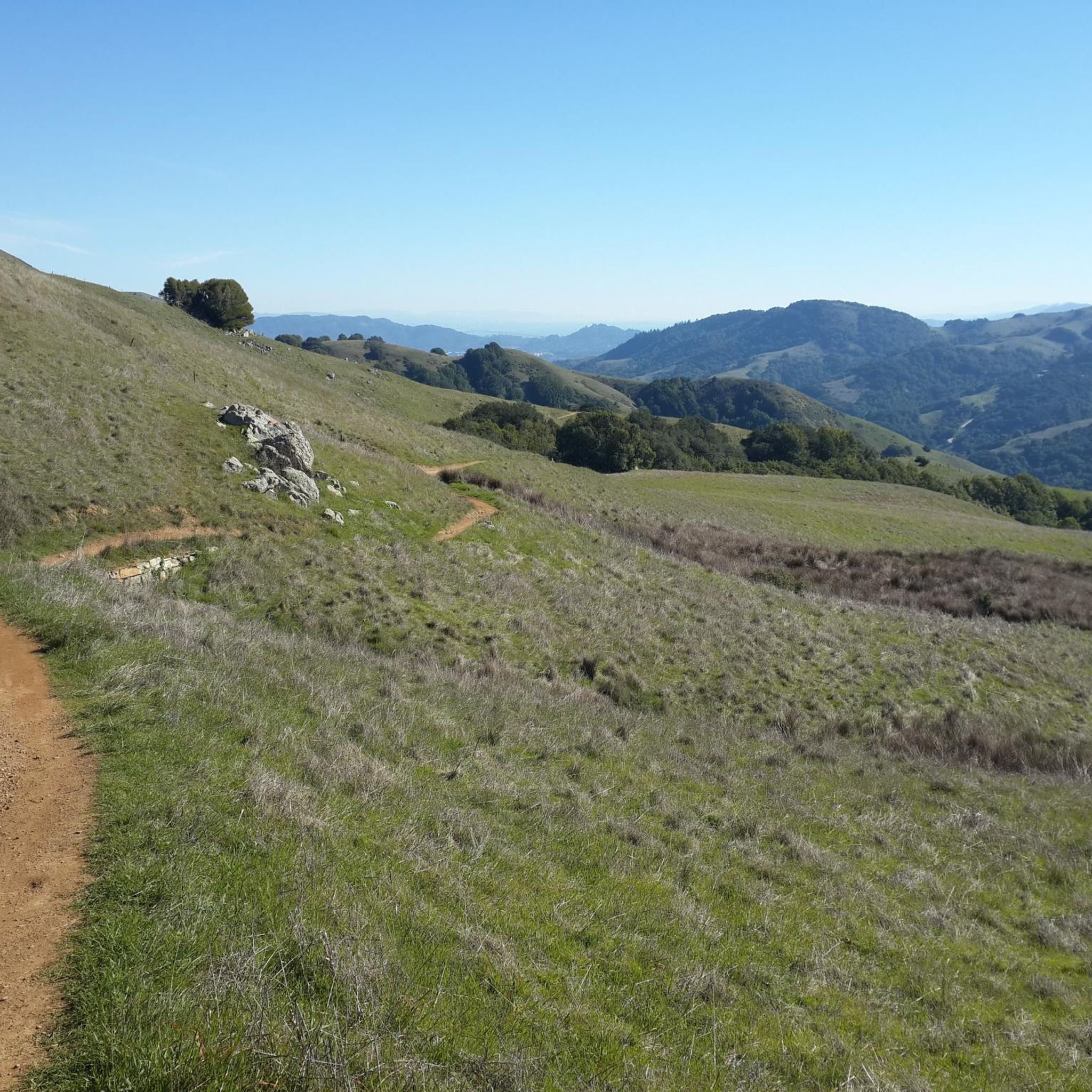
Jogging in Mount Burdell Open Space Preserve offers diverse terrain across open grasslands and dense woodlands, featuring classic California oaklands. The preserve's extensive trail network provides varied landscapes for running, including areas with serpentine soils and seasonal wildflower displays. From higher elevations, runners can experience panoramic views of the San Francisco Bay Area and surrounding hills. The area is characterized by its mix of gentle fire roads and more challenging ascents, making it suitable for various fitness levels.
Best jogging routes in Mount Burdell Open Space Preserve
- The most popular jogging route is Bay Area Ridge Trail to Burdell Mountain loop, a 5.6 miles (9.0 km) trail that takes 1 hour 16 minutes to complete. This difficult route offers sweeping grassland views and a climb towards the summit.
- Another top favourite among local runners is Miwok to Upper Mount Burdell Trail, a difficult 7.4 miles (11.9 km) path. This route features significant elevation gain and passes through varied forest sections.
- Local runners also love the Bahia Ridge, Bahia Trail, and Pinheiro Fire Road Loop, a 7.9 miles (12.8 km) trail leading through open grasslands and dense woodlands, often completed in about 1 hour 27 minutes.
- Jogging in Mount Burdell Open Space Preserve is defined by open grasslands, dense woodlands, and wide fire roads. The network offers options for different ability levels, from moderate paths to more challenging ascents.
- The guide includes highly-rated routes that showcase the best of the region's landscape. More than 100 runners have used komoot to explore Mount Burdell Open Space Preserve's varied terrain.
Last updated: July 7, 2026
8.96km
01:16
400m
400m
Hard run. Very good fitness required. Mostly paved surfaces. Suitable for all skill levels.
20.2km
02:42
570m
570m
Hard run. Very good fitness required. Mostly paved surfaces. Suitable for all skill levels.

Sign up for free
11
runners
12.8km
01:27
150m
150m
Moderate run. Good fitness required. Mostly paved surfaces. Suitable for all skill levels.
1
runners
11.9km
01:41
450m
450m
Hard run. Very good fitness required. Mostly paved surfaces. Suitable for all skill levels.
7
runners
10.6km
01:08
80m
80m
Moderate run. Good fitness required. Mostly paved surfaces. Suitable for all skill levels.
Get access to more routes and recommendations from other explorers.
Sign up for free
Already have an account?
Our route recommendations are based on thousands of hikes, rides, and runs completed by other people on komoot.
Start today with a free account
Your next adventure awaits.
Login or Signup

Tips from the Community

Climbing through Indian Tree Open Space Preserve in Novato, the Big Trees Trail rewards hikers with madrone forests, sweeping views of the hills and Stafford Lake, and a grove of towering redwoods, including the massive “Indian Tree” itself. The 6-mile round-trip loop gains significant elevation but is well graded with switchbacks and steady footing, making the climb both manageable and scenic. With a mix of open vistas and shady redwood stands, this trail offers one of the North Bay’s most memorable hikes.
0
0
Pierre Joske Grove offers hikers, mountain bikers, and equestrians a peaceful oak-shaded retreat amid sweeping grasslands. Sitting at roughly 800 feet elevation just off Deer Camp Fire Road, the grove’s mature oaks invite rest, birdwatching, and wildflower spotting in spring. It also serves as a community focal point for habitat restoration, most recently hosting milkweed planting events to support monarch butterflies.
1
0
Set across 700 acres just north of Novato, Olompali State Historic Park invites you to journey through layers of history, from a Coast Miwok village dating back thousands of years to a Mexican-era rancho, Victorian estate, and even a 1960s commune. There are easy loop trails past interpretive remnants of Coast Miwok dwellings, the famed “Kitchen Rock,” and the remains of the Burdell estate, including garden outlines and ranch buildings. You can enjoy sweeping views of Petaluma River Valley as you pause in oak-studded meadows or explore the visitor center housed in a historic ranch building.
1
0

The park derives its name from the Miwok language and can be translated as "southern village" or "southern people." It offers scenic views overlooking the Petaluma River and San Pablo Bay, with scattered history from the Miwok people throughout the park.
0
0
Eventually the Bay Area Ridge Trail will encircle the entirety of the San Francisco Bay. As it stands currently there are over 400 miles of trails and here you can find a small section to link up with other trails in the area.
0
0
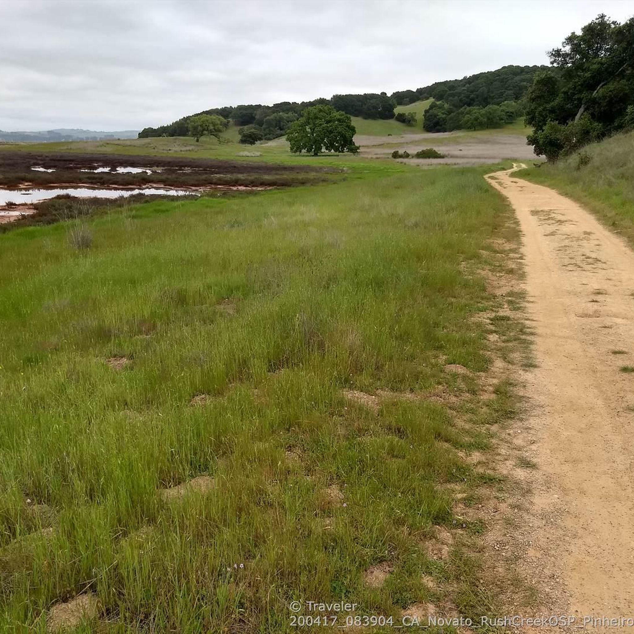
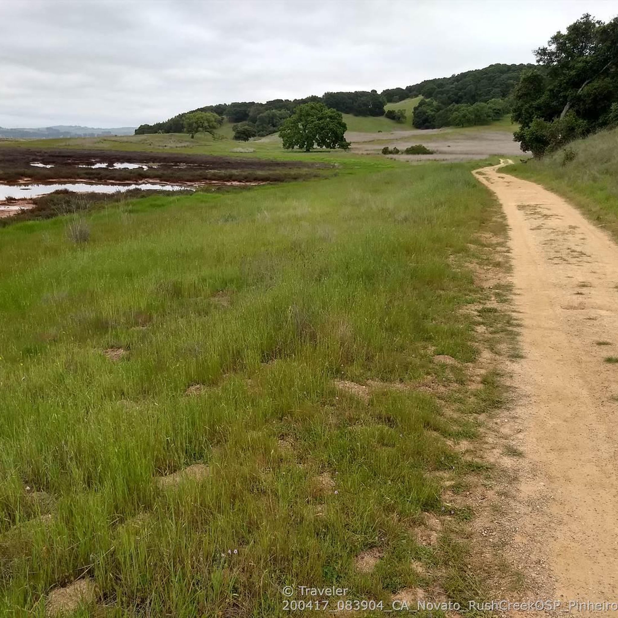
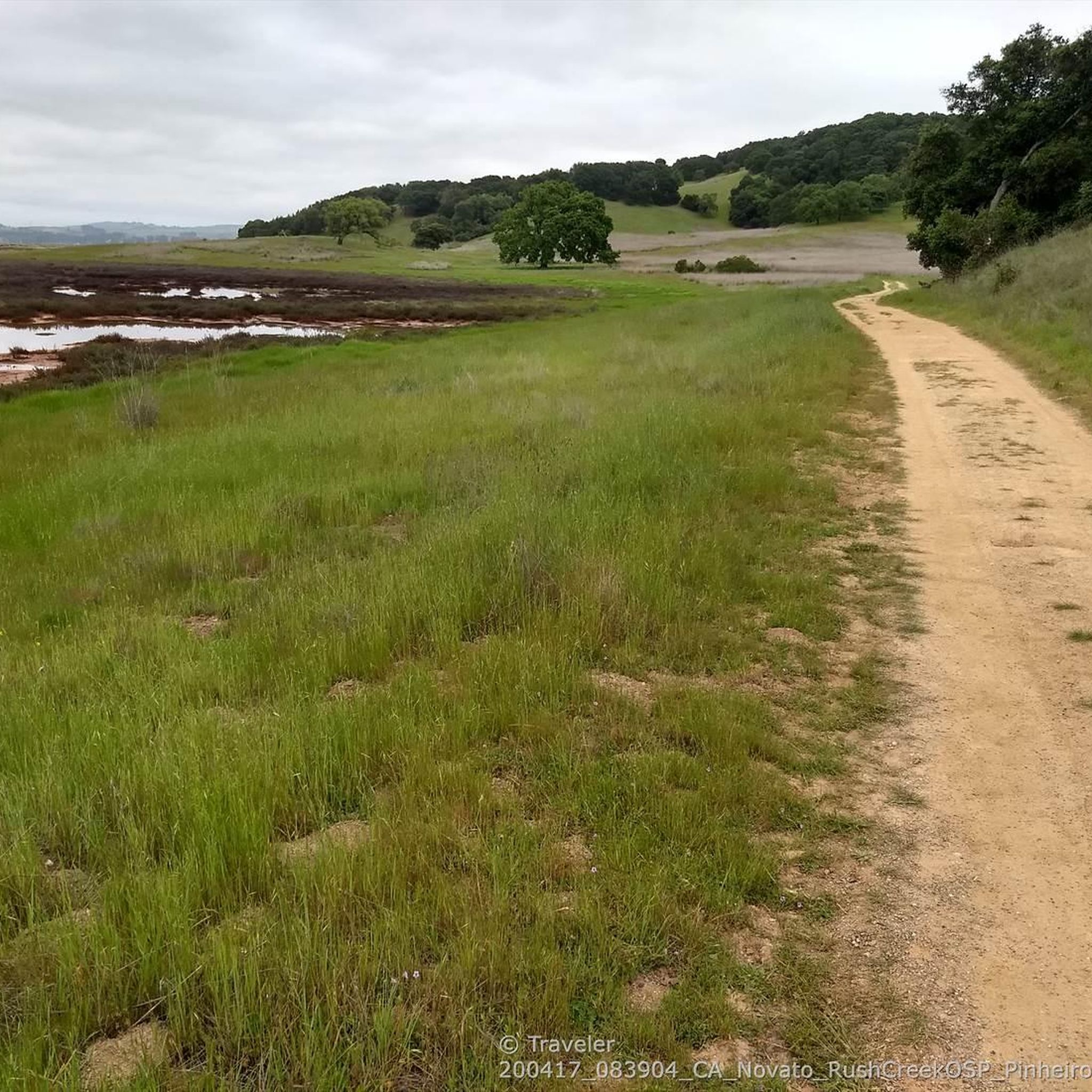
This trail runs along the edge of the Petaluma River wetlands and is a popular multi-use trail, so keep an eye out for others on the trail. The wetlands are an important area for wildlife, and are currently undergoing habitat restoration to improve conditions for native plants & animals.
0
0
This trail runs along the edge of the Petaluma River wetlands and is a popular multi-use trail, so keep an eye out for others on the trail. The wetlands are an important area for wildlife, and are currently undergoing habitat restoration to improve conditions for native plants & animals.
0
0

The position of this vintage 1960s station wagon at the remote and roadless northern side of the Bahia is a fascinating mystery that can motivate creative story telling. The most plausible explanation might be that it was driven to the top of Bahia ridge when the preserve was still a mostly grass-covered ranchland, and somehow rolled down the hill and crashed. The trees that grew around it after grazing ended seem to be lifting the wreck up as they grow and grab the metal in various places with their bark.
1
0
Frequently Asked Questions
What kind of terrain can I expect on running routes in Mount Burdell Open Space Preserve?
Mount Burdell Open Space Preserve offers a diverse landscape for runners. You'll find a mix of open grasslands, dense woodlands with classic California oaklands, and areas with serpentine soils. Many routes utilize wide fire roads, which are generally good for jogging, though they can become muddy during the rainy season. The preserve features both relatively gentle grades and more challenging ascents.
Are there easy running trails suitable for beginners in Mount Burdell Open Space Preserve?
Yes, the preserve offers several easy loops and paths perfect for beginners or those looking for a less strenuous run. While specific easy routes aren't highlighted in the top picks, the extensive network includes options with gentler grades. Overall, there are 3 easy routes available for jogging.
Which running routes offer the best panoramic views of the Bay Area?
For sweeping panoramic views, consider routes that ascend towards the summit of Mount Burdell. The Bay Area Ridge Trail to Burdell Mountain loop is a popular choice, offering grassland views and a climb to higher elevations where you can see the San Francisco Bay Area, Mount Tamalpais, and Mount Diablo.
What natural features or landmarks can I see while running in Mount Burdell Open Space Preserve?
As you run, you might encounter diverse habitats, seasonal streams, and Hidden Lake during the rainy season. Spring brings vibrant wildflower displays. At the summit, you can see an impressive four-foot stone wall built by Chinese laborers in the 1870s. The preserve also holds remnants of quarries that supplied cobblestones for San Francisco streets. For a shady retreat, look for the Pierre Joske Grove.
When is the best time of year for jogging in Mount Burdell Open Space Preserve?
Spring is particularly beautiful, with abundant wildflowers coloring the meadows. During the rainy season, seasonal streams and Hidden Lake become active. While fire roads are generally good, they can get muddy in winter. Warmer days might make the shady Pierre Joske Grove a welcome stop. Overall, spring and fall offer pleasant conditions.
Are there challenging running routes for experienced runners?
Absolutely. Mount Burdell Open Space Preserve has several routes with significant elevation gain for a more rigorous workout. The Bay Area Ridge Trail to Burdell Mountain loop and the Miwok to Upper Mount Burdell Trail are both rated as difficult and feature substantial climbs, passing through varied forest sections and offering rewarding views.
Are dogs allowed on the running trails in Mount Burdell Open Space Preserve?
Mount Burdell Open Space Preserve is generally dog-friendly, but specific rules regarding leashes and trail access can vary. It's always best to check the latest regulations from Marin County Parks before heading out, especially since grazing dairy cows are often present in the preserve.
Are there any loop running trails in Mount Burdell Open Space Preserve?
Yes, many of the routes in the preserve are loops, allowing you to experience diverse scenery without retracing your steps. Popular loop options include the Bay Area Ridge Trail to Burdell Mountain loop and the Bahia Ridge, Bahia Trail, and Pinheiro Fire Road Loop.
What do other runners enjoy the most about jogging in Mount Burdell Open Space Preserve?
Runners frequently praise the preserve's varied terrain, from open grasslands to dense woodlands, and the stunning panoramic views from higher elevations. The extensive network of wide fire roads and trails offers options for all fitness levels, making it a rewarding experience for many. Over 100 runners have explored these routes using komoot.
How many running routes are available in Mount Burdell Open Space Preserve?
There are over 20 running routes available in Mount Burdell Open Space Preserve, catering to various fitness levels and preferences. This includes a mix of easy, moderate, and difficult trails.
Can I connect to other parks or trails from Mount Burdell Open Space Preserve?
Yes, the preserve's trail system connects to neighboring Olompali Historic State Park, providing opportunities for even longer and more diverse running routes if you wish to extend your exploration beyond Mount Burdell itself.
Are there any specific routes that pass through varied forest sections?
The Miwok to Upper Mount Burdell Trail is a great option for runners who enjoy varied forest sections. This route features significant elevation gain and takes you through different types of woodlands, offering a diverse natural experience.
Most popular routes in Mount Burdell Open Space Preserve

Get inspired with the komoot mobile app


Explore more
Browse the best Running Trails & Routes in other regions.
