The best walks and hikes in Berryessa Snow Mountain National Monument
5.0
(9)
228
hikers
32
hikes
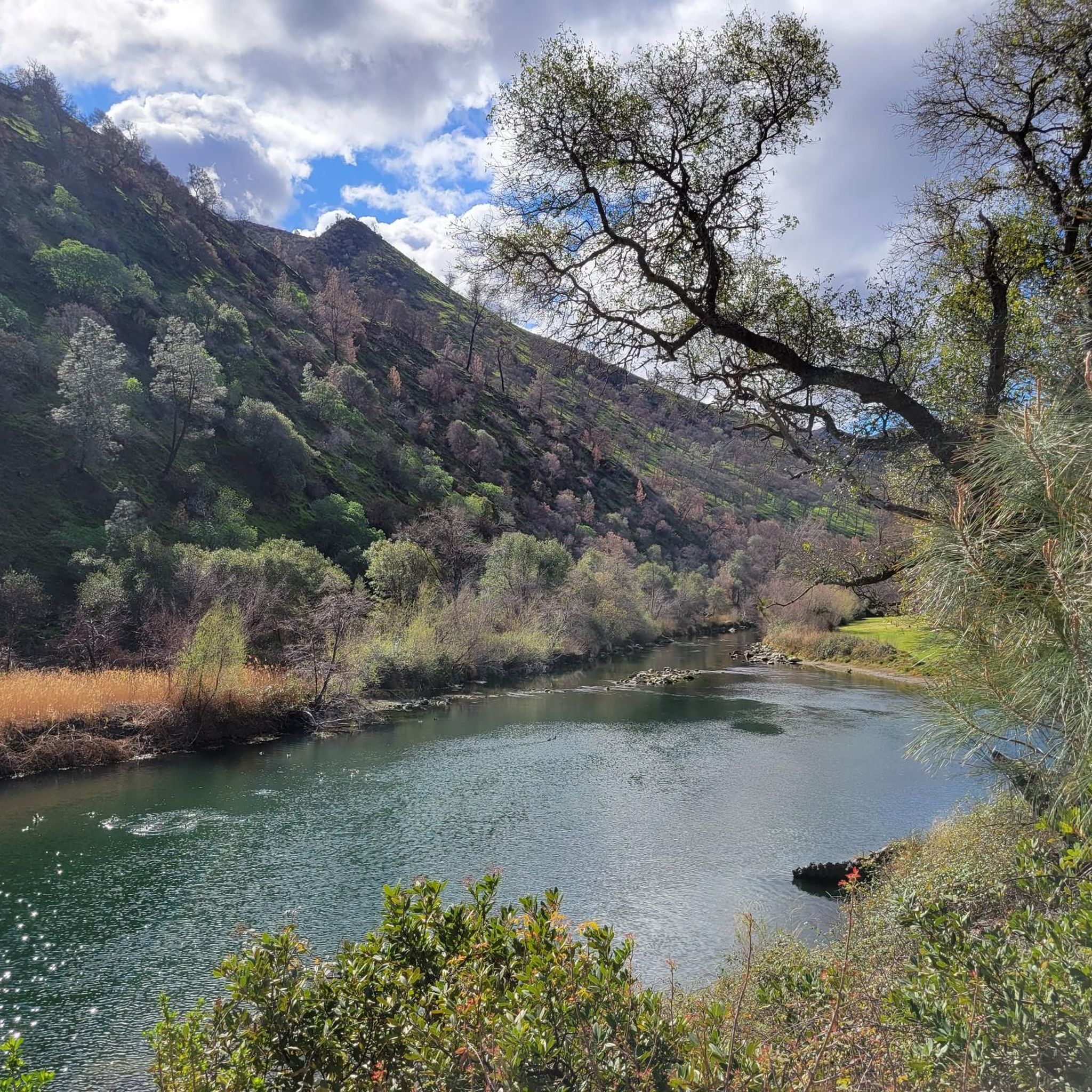
Hikes in Berryessa Snow Mountain National Monument cover a large and diverse landscape in northern California. The region is characterized by rugged terrain that ranges from oak-studded hills and steep canyons at lower elevations to mixed conifer forests higher up. The monument's trails traverse expansive ridgelines and areas with unique serpentine soils, offering a variety of hiking experiences across its significant elevation changes.
Best hiking trails in Berryessa Snow Mountain National Monument
- The most popular hiking route is Snow Mountain East & West Peaks via Summit Trail — Snow Mountain Wilderness, a 9.2 mile (14.9 km) trail that takes around 4 hours 45 minutes to complete. This route ascends to the twin peaks of Snow Mountain within the Snow Mountain Wilderness.
- Another top favourite among local hiking enthusiasts is Blue Ridge Trail loop — Stebbins Cold Canyon Reserve, a moderate 4.9 mile (7.9 km) path. The trail involves a significant climb up the Blue Ridge, following a well-defined path through the canyon reserve.
- Local hiking enthusiasts also love the Cache Creek Wilderness loop via the Redbud Trail, a 4.0 mile (6.4 km) trail leading through the Cache Creek Wilderness area, often completed in about 1 hour 50 minutes.
- Hiking in Berryessa Snow Mountain National Monument is defined by high-elevation wilderness routes, rolling oak woodlands, and steep creek canyons. The trail network provides options for different ability levels, from easier loops to challenging mountain ascents.
- The routes in Berryessa Snow Mountain National Monument are highly rated by the komoot community with an average score of 4.9 stars from 8 reviews. More than 200 hikers have used komoot to explore Berryessa Snow Mountain National Monument's varied terrain.
Last updated: July 7, 2026
2.36km
00:44
130m
10m
The Redbud Trail in California's Cache Creek Wilderness is a fantastic option for a relatively short but incredibly scenic hike. This easy 1.5-mile (2.4 km) route takes you through beautiful blue oak woodlands, offering a diverse landscape with undulating terrain. As you climb 435 feet (133 metres) over approximately 44 minutes, you'll be treated to panoramic views of Cache Creek and Brushy Sky High Mountain from the ridge, making it a high-reward trail for its length. It's a great choice for most hikers looking for stunning viewpoints and a good workout without a huge time commitment.
Planning your visit to the Redbud Trail is straightforward, as it's generally accessible year-round. Spring is an especially good time to go if you want to see abundant wildflowers. Parking is usually available at the trailhead, but arriving early is a good idea on popular days. Remember to bring plenty of water, especially during warmer seasons, as parts of the trail can be exposed.
This trail is nestled within the rich biodiversity of the Cache Creek Wilderness, known for its varied plant life and potential for wildlife sightings, including Tule Elk in more secluded areas. The trail's location within this wilderness area, combined with its diverse flora and the impressive views from the ridge, makes it a notable and rewarding experience. It's a perfect way to experience the natural beauty of the region.
6.75km
02:44
560m
220m
Hike the moderate 4.2-mile Homestead and Blue Ridge Loop in Stebbins Cold Canyon Reserve, offering panoramic views of Lake Berryessa.

Sign up for free
5.0
(1)
93
hikers
7.90km
03:13
370m
370m
Hike the moderate Blue Ridge and Homestead Loop Trail for 4.9 miles with 1214 feet of gain, offering panoramic views of Lake Berryessa.
1
hikers
27.4km
09:08
1,350m
1,350m
Embark on the Snow Mountain Loop via Deafy Glade Trail for a truly demanding hiking experience. This difficult route stretches 17.1 miles (27.4 km) and challenges you with a significant 4416 feet (1346 metres) of elevation gain, typically taking around 9 hours and 8 minutes to complete. You will traverse diverse terrain, from pleasant black oak forests to steep ascents through areas of scorched manzanita and conifer stands. The highlight is reaching the East Peak of Snow Mountain, where you can enjoy magnificent panoramic views across the Sacramento Valley, the Sierra Nevada, and even Mount Shasta on a clear day.
Before you set out, be aware that this difficult trail demands a high level of fitness, especially with its significant elevation gain in the initial miles. Recent reports indicate that some sections, particularly from Stony Creek to Deafy Glade, are overgrown and can be difficult to navigate due to dense vegetation and fallen trees. Strong navigation skills are essential for this route, and you should plan carefully for water, as it can be scarce during the summer months. Always check current trail conditions before your visit.
This challenging loop takes you through the rugged beauty of the Snow Mountain Wilderness, an ecologically rich landscape. As you hike, keep an eye out for local wildlife, including deer and various bird species like eagles. The journey offers a unique perspective on the area's natural history, passing through areas that show remnants of past wildfires, adding to the diverse character of the terrain.
1
hikers
14.9km
04:45
650m
650m
Embark on a moderate hike along the Snow Mountain East & West Peaks via Summit Trail, a route that covers 9.2 miles (14.9 km) with an elevation gain of 2122 feet (647 metres). You can expect to complete this journey in about 4 hours and 45 minutes. As you ascend, the trail takes you through diverse ecological zones, from manzanita slopes to subalpine forests of white fir and Jeffrey pine. You will notice areas impacted by past wildfires, where burned trees create a unique atmosphere, but wildflowers often thrive here at the right time of year. From the twin summits of Snow Mountain East and West, you are rewarded with expansive views across the Sacramento Valley, the Sierra Nevada, and even Mount Shasta on clear days.
Parking is available at the Summit Springs Trailhead, which serves as your starting point for this adventure. Be ready for strenuous conditions; some parts of the trail might be hard to follow, and you may encounter fallen trees. If you plan to hike in summer, remember that shade is limited and water sources can be scarce. Always carry enough water, and consider bringing a map or GPS device to help with navigation.
This trail offers a unique opportunity to experience the recovery of a landscape after wildfires, showcasing nature's resilience. The varied ecological zones you pass through highlight the rich biodiversity of the Snow Mountain Wilderness. It is a rewarding experience for those who appreciate expansive vistas and the quiet beauty of a recovering forest ecosystem.
Get access to more routes and recommendations from other explorers.
Sign up for free
Already have an account?
Our route recommendations are based on thousands of hikes, rides, and runs completed by other people on komoot.
Start today with a free account
Your next adventure awaits.
Login or Signup
Popular around Berryessa Snow Mountain National Monument

Tips from the Community

Stebbins Cold Canyon Reserve is beautiful. Nestled in a steep, north-facing canyon of the northern Coast Range, it showcases a range of undisturbed habitats with year-round springs providing crucial watering areas for a wide variety of wildlife, including deer, mountain lion and bear. Dogs are not allowed in the reserve, so you'll need to leave your pup home to enjoy exploring this stunning area.
0
0

This point on the trail marks the saddle of Snow Mountain East and Snow Mountain West. This rockier area provides excellent views of the surrounding landscape and also offers a variety of route options for trail users.
0
0
Snow Mountain is a peak in the Snowy Mountain Wilderness that technically has three separate prominent points. Snow Mountain East is the highest of the three points while Snow Mountain, itself, is the lowest of the three summits at 6,542 feet.
0
0
Snow Mountain West sits at an elevation of 7,041 feet. This rockier peak has excellent 360 views of the surrounding mountains of Mendocino National Forest.
0
0

The east summit has an elevation of 7055 feet. It is the highest point in both Lake and Colusa counties. From this spot there's an amazing panoramic view.
0
0

This beautiful trail runs along the ridge giving amazing views over the lake and surrounding mountains.
0
0
Berryessa Lake is located in Napa County. The Reservoir contains the Glory Hole, a giant hole that draws in water when it exceeds a certain level. It is activated to prevent overflows.
0
0
Frequently Asked Questions
What is the best time of year to hike in Berryessa Snow Mountain?
Spring is a fantastic time to visit, as the monument comes alive with vibrant wildflower displays, especially on lower elevation trails. Autumn offers pleasant temperatures for hiking. Summers can be very hot, particularly in the exposed lower canyons, so early morning starts are recommended. Winter can bring snow to the higher elevations, like Snow Mountain, making some trails inaccessible without proper gear.
Are there any easy, family-friendly trails in the monument?
Yes, there are several easier options suitable for families. The monument has about 8 easy-rated trails. A good choice is the Bloody Rock Trail — Mendocino National Forest, which is a relatively short and flat walk. Always check the trail conditions before you go, as the terrain can be rugged even on simpler paths.
Can I bring my dog on the trails?
Dog regulations can vary depending on which part of the monument you are in, as it is managed by multiple agencies. In general, dogs are often required to be on a leash. However, they may be prohibited in certain sensitive areas like the Stebbins Cold Canyon Reserve to protect wildlife. It is essential to check the specific rules for the trail you plan to hike on the BLM or Forest Service websites before you go.
What kind of wildlife might I see while hiking?
The monument is a sanctuary for a diverse range of wildlife. Keep an eye out for black-tailed deer, tule elk, and various bird species. The area is notable for hosting a large population of wintering bald eagles. While less common to see, the region is also home to black bears and mountain lions, so it's important to be aware of your surroundings and know proper wildlife safety.
Are there any good trails for seeing wildflowers?
The monument is renowned for its spring wildflower blooms. Trails at lower elevations, such as the Redbud Trail within the Cache Creek area, are famous for spectacular displays of poppies, lupines, and other native flowers. The unique serpentine soils in parts of the monument also support rare and interesting plant life that you won't see elsewhere.
How difficult are the hikes to the peaks like Snow Mountain?
Hikes to the high peaks are typically challenging. For example, the Snow Mountain loop via Deafy Glade Trail is a strenuous 17-mile (27 km) trek with significant elevation gain, suited for experienced and well-prepared hikers. These routes reward the effort with subalpine scenery and panoramic views.
How many hiking trails are available in the monument?
There are over 25 designated hiking routes throughout Berryessa Snow Mountain National Monument. These trails cover a wide range of difficulties, from 8 easy walks in the oak woodlands to 4 difficult ascents in the high country, offering something for nearly every fitness level.
What do other hikers think of the trails in this region?
The trails in Berryessa Snow Mountain are highly regarded by the komoot community. Hikers often praise the sense of wildness and solitude, the stunning ridge-top views, and the diverse ecosystems you can experience in a single day, from oak-studded hills to conifer forests.
Are there options for backpacking or overnight camping?
Yes, backpacking is a popular activity, especially in the Snow Mountain Wilderness. Dispersed camping is generally allowed, but regulations are in place to protect the environment. You must follow Leave No Trace principles. For specific rules on camping and campfires, it's best to consult the official Bureau of Land Management (BLM) or Forest Service guidelines for the area.
How do I get to the trailheads and is there parking?
Access to most trailheads within the vast monument requires a car, as public transportation options are very limited. Many trailheads are located along remote forest roads which can be unpaved and rough. A high-clearance vehicle is recommended for accessing some of the more remote areas, especially in the Mendocino National Forest portion. Parking is usually available at designated trailheads, but can be limited.
Where can I find a reliable trail map?
You can explore all the trails on komoot, which provides detailed route information and topographic maps. For official park information and printable maps, the Bureau of Land Management website is an excellent resource. You can download their official brochure and map here: BSMNM Brochure. It's always wise to download maps for offline use as cell service is unreliable in the monument.
Are there other activities besides hiking?
Absolutely. The monument's rugged terrain is great for mountain biking and horseback riding on designated trails. The rivers and lakes, including Lake Berryessa and Cache Creek, offer opportunities for kayaking, fishing, and swimming. It's a true multi-sport destination.
Most popular routes in Berryessa Snow Mountain National Monument

Get inspired with the komoot mobile app


Explore more
Browse the best Hikes in other regions.
