Routes

Planner

Features

Updates

App

Login or Signup

Get the App

Login or Signup

Login or Signup

Routes
Running Trails
Canada
British Columbia

Hillkeep Regional Park

The best running trails in Hillkeep Regional Park

4.9

(33)

243

runners

16

runs

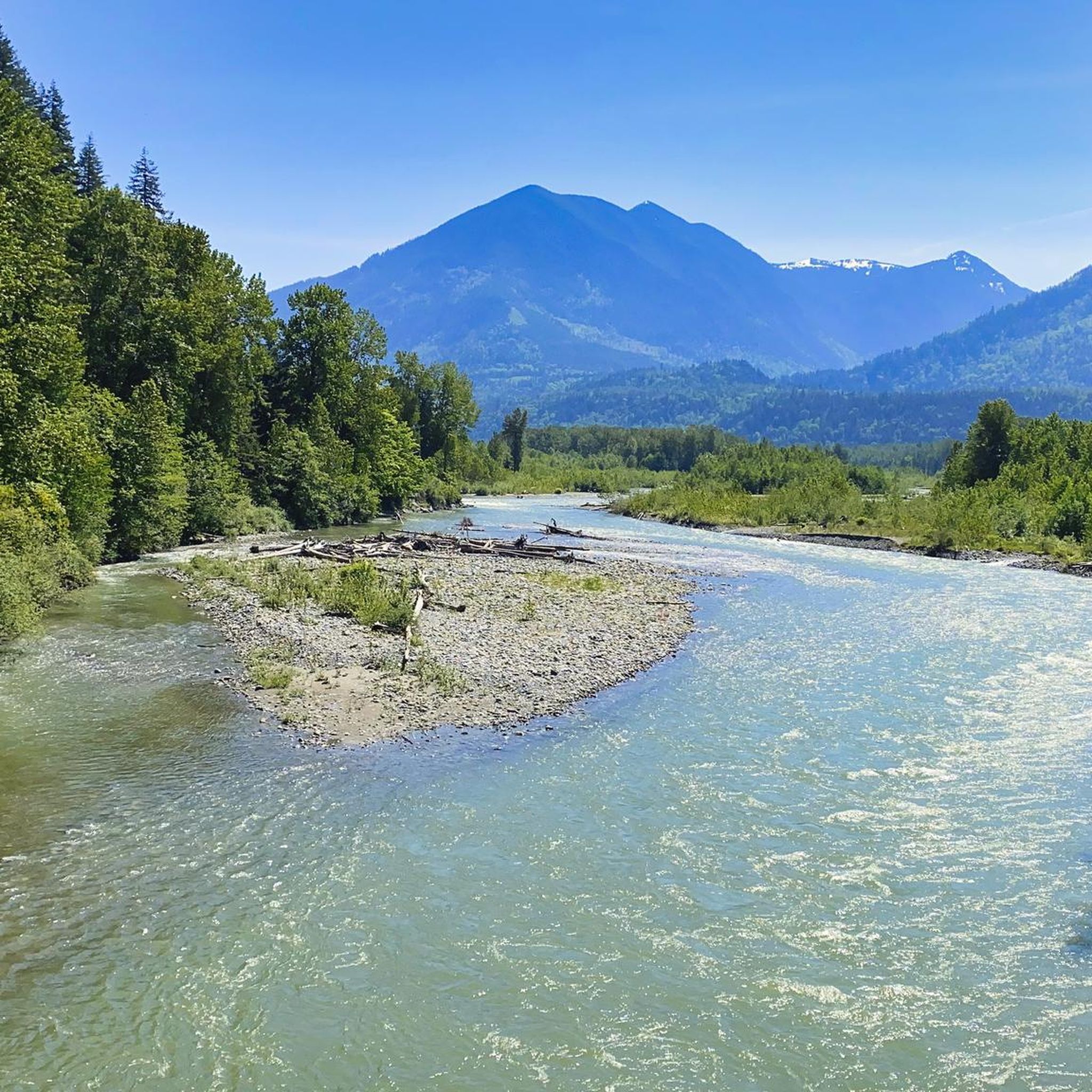
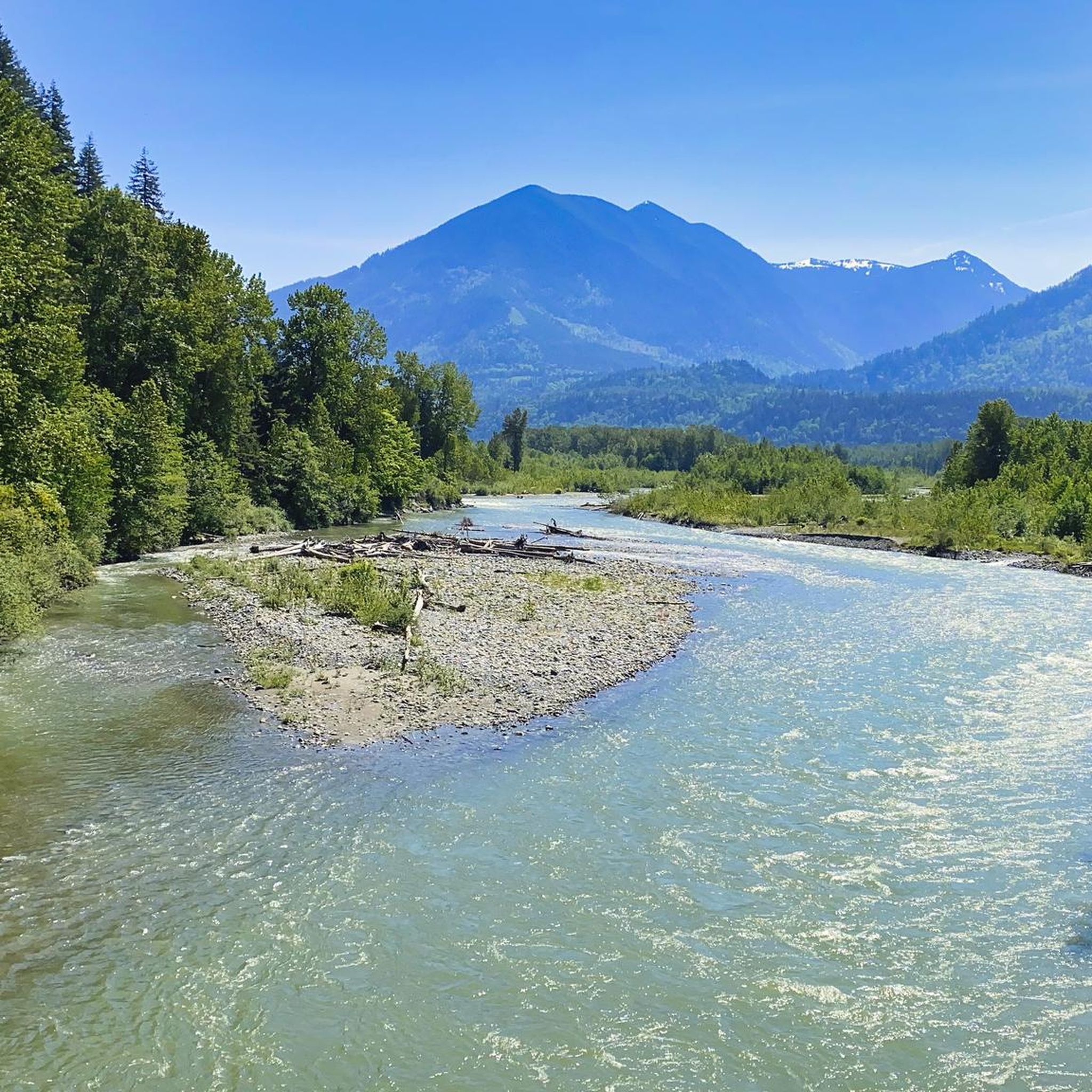
Jogging in Hillkeep Regional Park offers a network of trails primarily characterized by low elevation changes and proximity to water features. The routes often follow creek-side paths and loop around natural reserves, providing a generally flat and accessible running experience. The terrain is suitable for various fitness levels, with paths winding through areas like the Peach Creek Spawning Channels and Blue Heron Reserve.

Best jogging routes in Hillkeep Regional Park

  • The most popular jogging route is Running loop from Peach…

Last updated: May 24, 2026

5.0

(2)

7

runners

#1.

Peach Creek Spawning Channels loop from Peach Creek Spawning Channels

10.3km

01:04

10m

10m

Moderate run. Good fitness required. Mostly paved surfaces. Suitable for all skill levels.

Navigate with device

Send to Phone

Save

Moderate

Moderate run. Good fitness required. Mostly paved surfaces. Suitable for all skill levels.

Moderate
guide_signup
Let us show you the way with the komoot mobile app
With a free komoot account, you can easily find, customize, and navigate endless outdoor adventures.

Sign up for free

Moderate run. Good fitness required. Mostly paved surfaces. Suitable for all skill levels.

Moderate

Moderate run. Good fitness required. Mostly paved surfaces. Suitable for all skill levels.

Moderate

Hard run. Very good fitness required. Mostly paved surfaces. Suitable for all skill levels.

Hard
Sign up for free to see 12 more runs in Hillkeep Regional Park.

Get access to more routes and recommendations from other explorers.

Sign up for free

Already have an account?

Our route recommendations are based on thousands of hikes, rides, and runs completed by other people on komoot.

Start today with a free account

Your next adventure awaits.
Login or Signup

Popular around Hillkeep Regional Park

Hiking in Hillkeep Regional Park

Road Cycling Routes in Hillkeep Regional Park

Cycling in Hillkeep Regional Park

MTB Trails in Hillkeep Regional Park

Gravel biking in Hillkeep Regional Park

Tips from the Community

Alex
February 27, 2026, Great Blue Heron Nature Reserve

The Great Blue Heron Nature Reserve spans 325 acres across a protected wetland habitat for one of the area’s largest colonies of great blue herons. Visitors can explore the reserve on flat gravel trails and raised boardwalks. This beautiful marshland and wooded area are open year-round, with educational programs and volunteer stewardship.

0

0

Alex
February 27, 2026, Vedder River

The Vedder River flows along the southern edge of Chilliwack, beginning at Cultus Lake and running northwest until it joins the Fraser River. The river is famous for salmon fishing during fall salmon runs. Besides fishing, visitors like to swim, tube, kayak, and raft.

0

0

Frequently Asked Questions

Are there easy running routes suitable for beginners in Hillkeep Regional Park?

Yes, Hillkeep Regional Park offers routes suitable for various fitness levels, including easy options. The terrain is generally flat with low elevation changes, making it accessible for beginners. While most routes are moderate, you can find paths that provide a gentle introduction to running in the park.

What are the typical distances for running trails in Hillkeep Regional Park?

The running trails in Hillkeep Regional Park vary in length. For example, the Running loop from Peach Creek Spawning Channels is 5.3 miles (8.5 km), while the Blue Heron Reserve loop from Peach Creek Spawning Channels extends to 6.4 miles (10.3 km). You'll find a range of distances to suit different training goals.

Are there any challenging running trails for experienced runners in Hillkeep Regional Park?

While Hillkeep Regional Park is known for its generally flat and accessible terrain, there are routes classified as 'difficult' within the park's network. These trails might offer slightly longer distances or more varied surfaces, providing a good challenge for experienced runners looking to push their limits. Overall, there are 7 routes rated as difficult.

Can I bring my dog on the running trails in Hillkeep Regional Park?

Hillkeep Regional Park is generally dog-friendly, but it's always best to check specific park regulations or signage on individual trails regarding leash requirements and restricted areas. Many of the creek-side paths are popular with dog owners, offering a great environment for you and your canine companion to enjoy a run together.

Are the running routes in Hillkeep Regional Park suitable for families?

Yes, the low elevation changes and accessible nature of many paths make Hillkeep Regional Park suitable for family runs. Routes that follow creek-side paths and loop around natural reserves, such as those near the Peach Creek Spawning Channels, are often enjoyed by families looking for a pleasant outdoor activity.

Are there circular running routes available in Hillkeep Regional Park?

Many of the running routes in Hillkeep Regional Park are designed as loops, offering convenient circular paths. For instance, the McFadden Pond – Peach Creek Spawning Channels loop is a popular circular option that takes you through diverse scenery without needing to retrace your steps.

What kind of scenery can I expect along the running routes in Hillkeep Regional Park?

Runners in Hillkeep Regional Park can expect scenic creek-side paths, views of ponds like McFadden Pond, and natural reserves such as the Blue Heron Reserve. The routes often wind through areas rich in local flora and fauna, providing a refreshing natural backdrop for your run.

Is there public transport access to the running trails in Hillkeep Regional Park?

While specific public transport stops vary, Hillkeep Regional Park is generally accessible. Many routes, like the Peach Creek Spawning Channels loop from Keith Wilson at Carter (WB), have starting points near main roads, which may be served by local bus routes. It's advisable to check local transit schedules for the most convenient access points.

Where can I park when visiting Hillkeep Regional Park for a run?

Parking is typically available at various access points around Hillkeep Regional Park. Many routes, such as the Running loop from Keith Wilson Rd at Lindys Dr (WB), start from locations that offer designated parking areas, often near main roads or residential access points. Look for signs indicating public parking.

What do other runners say about the trails in Hillkeep Regional Park?

The running trails in Hillkeep Regional Park are highly regarded by the komoot community, holding an average rating of 4.9 stars from over 30 reviews. Runners frequently praise the park's accessible, generally flat terrain, and the pleasant creek-side and natural reserve scenery, making it a popular choice for a refreshing run.

Are there any less crowded running routes in Hillkeep Regional Park?

While some routes, like the Peach Creek Spawning Channels loop, are popular, Hillkeep Regional Park offers a network of trails. To find less crowded options, consider exploring routes slightly further from main access points or visiting during off-peak hours. The park's extensive network allows for varied experiences.

What is the best time of year to go running in Hillkeep Regional Park?

Hillkeep Regional Park's trails are generally enjoyable year-round due to the low elevation changes. Spring and fall offer pleasant temperatures and vibrant natural scenery. Even in winter, the relatively flat paths can be suitable for running, though conditions may vary, so checking local weather is always recommended.

Most popular routes in Hillkeep Regional Park

Hiking in Hillkeep Regional Park

Store rating

Get inspired with the komoot mobile app

With a free komoot account, you can easily find, customize, and navigate endless outdoor adventures.

or

Join komoot Now

Store rating

Explore more

Browse the best Running Trails & Routes in other regions.

Coast MountainsVancouverStanley Park National Historic SiteSelkirk MountainsElectoral Area AVictoriaVictoria Harbour Migratory Bird SanctuaryArea C (Pemberton Valley/Mount Currie/D'Arcy)Metro Vancouver Regional ParksLower Seymour Conservation ReserveRocky MountainsVancouver IslandAlberni-ClayoquotBlackcomb Glacier Provincial ParkEast Central Okanagan Electoral AreaArea D (Elaho/Garibaldi)BurnabySaanichMonashee MountainsOkanagan LakeCentral Okanagan JCypress Provincial ParkPacific Spirit Regional ParkTantalus Provincial ParkMount Seymour Provincial ParkStawamus Chief Provincial ParkNanaimoGaribaldi Provincial ParkBurnaby Lake Regional ParkPacific Rim National Park Reserve - Long Beach UnitThwaytes Landing Regional ParkCapilano WatershedLynn Headwaters Regional ParkBuntzen Lake Recreation AreaArea C (Arrowsmith-Benson)RichmondArea A (Kicking Horse/Kinbasket Lake)Area E (Chilliwack River Valley)Brackendale Eagles Provincial ParkDawley Passage Provincial ParkCoquitlam WatershedLangleyPinecone Burke Provincial ParkOak Bay Islands Ecological ReserveIona Beach Regional ParkArea B (Shelter Bay/Mica Creek)Alaksen National Wildlife AreaArea P (Rivers and the Peaks)Capilano River Regional ParkSurreyVargas Island Provincial ParkArea B (South Fraser Canyon/Sunshine Valley)Brandywine Falls Provincial ParkEagle Mountain Recreation SiteGeorge C. Reifel Migratory Bird SanctuaryGrouse Mountain Regional ParkColony Farm Regional ParkFraser River Delta -- RamsarNorth Okanagan BWhistler Interpretive ForestCentral SaanichComox Valley B (Lazo North)Yoho National ParkArea L (Grasslands)Vedder Mountain Interpretative ForestSooke Hills Wilderness Regional ParkKanaka Creek Regional ParkBrohm Lake Interpretive Forest TrailsTəmtəmíxʷtən/Belcarra Regional ParkSurrey Bend Regional ParkK'Ómoks Royston LandsBrohm Lake Day Use Recreation SitePitt LakeNorth CowichanMaple RidgeCariboo MountainsBear Creek Provincial ParkAlice Lake Provincial ParkCultus Lake Provincial ParkDeas Island Regional ParkAlouette LakeBlue Mountain Recreation SiteNorth SaanichBowen Island Ecological ReserveCrippen Regional ParkPurcell MountainsArea B (Shawnigan Lake)Goldstream Provincial ParkAbbotsfordAyum Creek Regional Park ReserveOkanagan-Similkameen DSea To Sea Regional ParkStave West Forest & Recreation AreaShowh Lakes-Ancient Cedars Trail Recreation SiteArea F (McConnell Creek/Hatzic Prairie)Sooke Mountain Provincial ParkArea J (Copper Desert Country)Fraser Islands Regional Park ReserveȽáu,Welṉew̱/John Dean Provincial ParkUbc Malcolm Knapp Research ForestNanaimo EBlaney Bog Regional Park ReserveSatellite Channel Ecological ReserveArea C (Puntledge/Black Creek)North Cowichan Municipal Forest ReserveArea G (Deroche/Dewdney/Sumas Mountain)Cougar Canyon Ecological ReserveMinnekhada Regional ParkDeltaGolden Ears Provincial ParkArea F (Alberni Highway)Burnaby Mountain Conservation AreaMt. Macpherson Cross-Country Trails Recreation SiteMount Tuam Ecological ReserveArea H (Manning Park/Tulameen/Siwash)E.C. Manning Provincial ParkArea C (Chilako River/Nechako)Epper Passage Provincial ParkMount Revelstoke National ParkCapital GNairn Falls Provincial ParkLiumchen Ecological ReserveBurns Bog Ecological Conservancy AreaSumas Mountain Regional ParkGowlland Tod Provincial ParkStebbings Road Community ForestBurgoyne Bay Provincial ParkPitt MeadowsArea C (Moyie/Bull River)Okanagan Mountain Provincial ParkSalt Spring Island Electoral AreaMt Begbie Area Recreation SiteArea E (Balfour/Cottonwood Lake)Area D (Trinity/West Creighton)Mount Gardner Recreation SiteMill Farm Regional Park ReserveArea G (Salmo Valley)Area A (Upper Flathead/Elk Valley)Nanaimo GOwl Lake Recreation ReserveWest Arm Provincial ParkCampbell Valley Regional ParkArea H (Lighthouse Country)Glen Valley Regional ParkMount Begbie Recreation SiteArea A (Baynes Sound)Tynehead Regional ParkRobert'S Lake Regional ParkSunshine Coast Regional DistrictMount Fernie Provincial ParkArea D (Tabor Lake/Stone Creek)Mount Maxwell Ecological ReserveMount Maxwell Provincial ParkArea D (Oyster Bay/Buttle Lake)Area F (Trout Creek Valley)Kalamalka Lake Provincial ParkUpper Puntledge River WoodlandsRace Rocks Ecological ReserveStephens Coyote Ridge Regional ParkWells Gray Provincial ParkArea A (Wells Gray Country)Crown Land ReserveUpper Trent River WoodlandsArea E (Naramata/Greyback)Area F (Willow River/Upper Fraser)Widgeon Marsh Regional Park ReserveCodd Wetland Ecological Conservancy AreaSpallumcheenUpper Qualicum River WoodlandsCowichan Valley FArea B (Lake Koocanusa)Seymour WatershedKootenay National ParkMyra-Bellevue Provincial ParkSeal Bay Regional Nature ParkCowichan Valley GArea A (Salmon River/Lakes)Fraser River Ecological ReserveRuckle Provincial ParkArea G (Forster Creek/Mount Assiniboine)Williams Beach ForestSkaha Bluffs Provincial ParkEllison Provincial ParkArea C (Inkaneep/Willowbrook)Area A (Osoyoos Lake)Elk Falls Provincial ParkArea H (Canim Lake/Forest Grove)Fraser Valley DArea A (North Skeena)Woodworth Lake ConservancyArea B (Discovery Islands/Mainland Inlets)Beaufort East WoodlandsStrathcona Provincial ParkTsable Lakes WoodlandsBeaver Lodge Forest LandsBoundary Bay Regional ParkArea B (Lower Columbia/Old Glory)Trinity Ricardo Trail Recreation SiteSilver Star Provincial ParkBodega Ridge Provincial ParkRathtrevor Beach Provincial ParkMount Richardson Provincial ParkBoyle Point Provincial ParkHelliwell Provincial ParkArea E (Saint Mary/Skookumchuck)Cowichan River Provincial ParkArea F (Columbia Lake/Windermere Lake)Telemark Cross-Country Ski Trails Recreation SiteArea A (Kyuquot/Nootka/Sayward)Area C (Sasquatch Country)Mount Geoffrey Escarpment Provincial ParkSpipiyus Provincial Park

Nearby adventure guides

Things to Do in Fraser River Ecological Reserve

background

Get ready to conquer new peaks

Sign up for Free

Explore
RoutesRoute plannerFeaturesHikesMTB TrailsRoad cycling routesBikepackingSitemap
Download the app
Follow Us on Socials

© komoot GmbH

Privacy Policy