The best cycling routes in Boundary Bay Regional Park
4.6
(50)
259
riders
13
rides
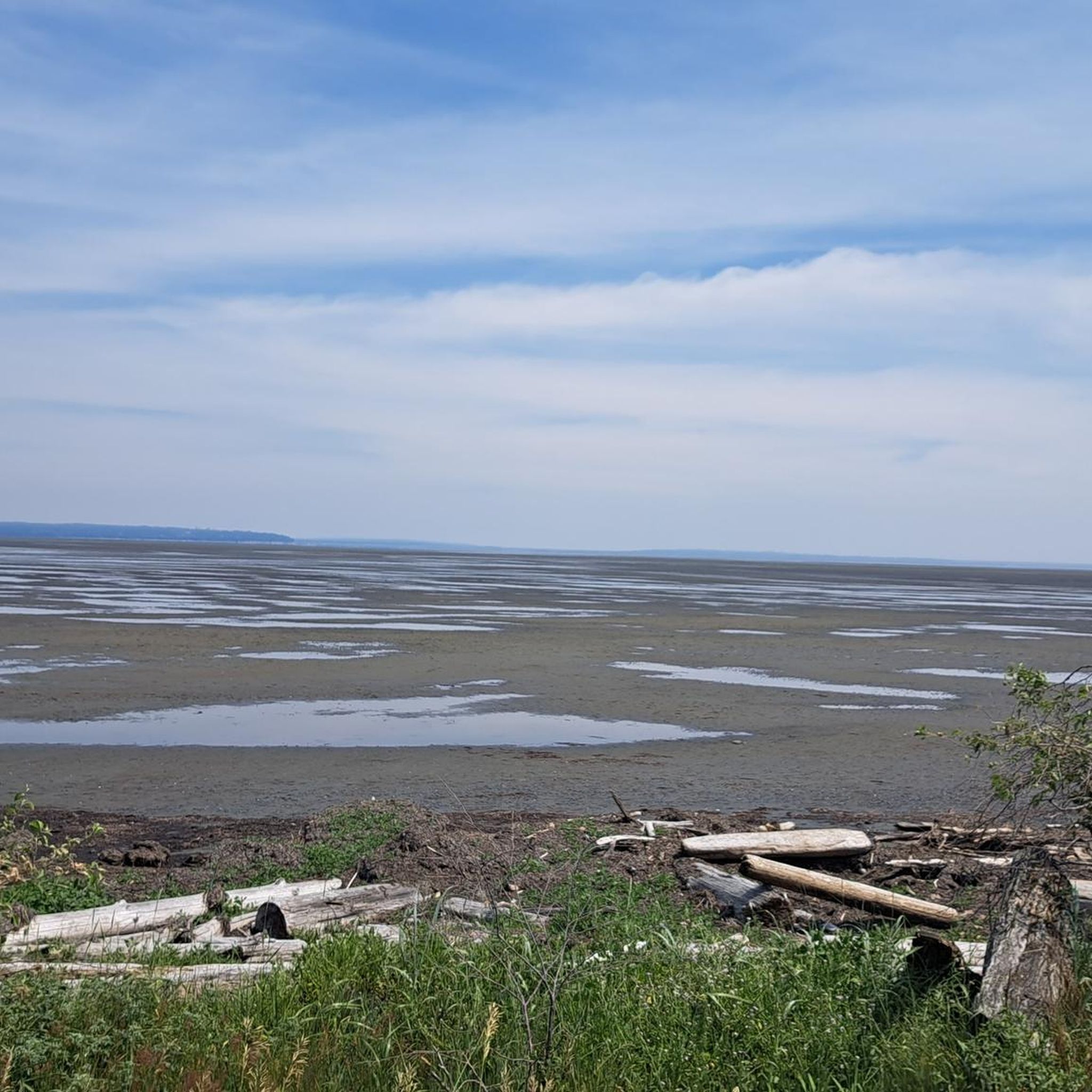
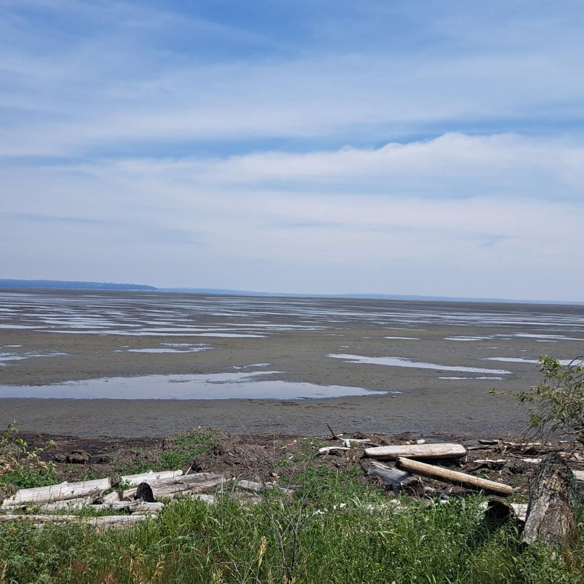
Touring cycling routes in Boundary Bay Regional Park offer extensive, flat, and well-maintained paths, primarily along the coastline. The terrain is characterized by dyke trails, expansive sandy beaches, and tidal flats, providing a traffic-free cycling experience. The park encompasses diverse ecosystems, including salt and freshwater swamps, mudflats, and meadows, with minimal elevation changes. Cyclists can enjoy panoramic views of the North Shore mountains and the bay.
Best touring cycling routes in Boundary Bay Regional Park
- The most popular touring cycling route is Bike loop from Maple Beach, an 8.7 miles (13.9 km) trail that takes 1 hour 6 minutes to complete. This easy route offers views of the bay and surrounding natural areas.
- Another top favourite among local touring cyclists is Mud Bay Park – Boundary Bay Gravel Path loop from Tsawwassen, a moderate 27.5 miles (44.3 km) path. This route follows the Boundary Bay Dyke Trail, providing flat gravel surfaces and coastal scenery.
- Local touring cyclists also love the Massey Tunnel Bike Underpass – Highway 99 Underpass, Delta loop from Tsawwassen, a 24.3 miles (39.2 km) trail leading through coastal areas and near the Fraser River, often completed in about 2 hours 19 minutes.
- Touring cycling in Boundary Bay Regional Park is defined by flat dyke trails, coastal paths, and views of salt marshes and mud flats. The network offers options for various ability levels, from easy loops to moderate rides.
- The routes in Boundary Bay Regional Park are highly rated by the komoot community with an average score of 4.6 stars from over 50 reviews. More than 250 touring cyclists have used komoot to explore Boundary Bay Regional Park's varied terrain.
Last updated: September 2, 2026
5.0
(2)
12
riders
13.9km
01:06
20m
20m
Easy bike ride. Great for any fitness level. Mostly paved surfaces. Suitable for all skill levels.
4.5
(13)
99
riders
44.3km
03:44
50m
50m
Moderate bike ride. Good fitness required. Mostly paved surfaces. Suitable for all skill levels.

Sign up for free
4.0
(1)
19
riders
Moderate bike ride. Good fitness required. Mostly paved surfaces. Suitable for all skill levels.
4.7
(3)
24
riders
61.2km
04:32
160m
160m
Moderate bike ride. Good fitness required. Mostly paved surfaces. Suitable for all skill levels.
4.3
(3)
23
riders
23.1km
01:51
30m
30m
Easy bike ride. Great for any fitness level. Mostly paved surfaces. Suitable for all skill levels.
Get access to more routes and recommendations from other explorers.
Sign up for free
Already have an account?
Our route recommendations are based on thousands of hikes, rides, and runs completed by other people on komoot.
Start today with a free account
Your next adventure awaits.
Login or Signup
Popular around Boundary Bay Regional Park

Tips from the Community

So need to use a gravel bike ? Would it be too challenge with road bike?
0
0

Boundary Bay Dyke Trail is a long, flat route along the shoreline, with uninterrupted views across mudflats and the open water. Its wide gravel surface is ideal for walking and cycling, with plenty of benches and access points along the way. Set along a major migratory route, the trail is especially known for birdlife and beautiful, expansive coastal scenery.
1
0
Beach Grove Park is a lovely mix of open lawns with pockets of mature trees, with flat, well-kept paths that wind through the park, connecting playgrounds, sports courts, picnic areas, and off-leash spaces. Its laid-back, neighbourhood feel makes it a convenient spot for a quick stroll or casual time outdoors.
0
0

Smooth gravel. Beautiful views of Boundary Bay and Mount Baker.
0
0

Deas Island Regional Park is a tranquil 300-acre green space situated along the Fraser River in Delta, BC. Located at 6090 Deas Island Road, the park is easily accessible from Vancouver via Highway 99 and the George Massey Tunnel. It offers approximately 7.6 km (4.7 miles) of easy, flat trails suitable for walking, cycling, and horseback riding. Popular trails include the Tinmaker’s Walk, Riverside Walk, and Island Tip Trail, which provide scenic views of the river and surrounding nature. The park is open daily from 7 a.m. to 10 p.m. during the summer months, with varying closing times in winter. Dogs are welcome on-leash. Vancouver Trails +2
1
0
The Highway 99 underpass in Delta, BC, is a crucial part of the region's cycling infrastructure, offering a safe and convenient route for cyclists and pedestrians to cross beneath the highway. This underpass is especially significant during the construction phase of the new Fraser River Tunnel, as it helps maintain connectivity for active transportation users in the area.
0
0
Early Industry: Oyster harvesting and shucking have been part of BC's coastal history since the late 19th century, initially focusing on the native Olympia oyster. Pacific Oyster Introduction: The introduction of the larger Pacific oyster in the early 20th century spurred the growth of the industry, leading to the establishment of dedicated shucking plants. Delta Example: One early significant plant was the BC Packers Limited shucking plant in Delta, operating from 1941 until its closure due to pollution in 1963. This plant processed both local and oysters from other BC farms. Hand Shucking: Traditionally, oyster shucking in BC was done entirely by hand, a labor-intensive process under strict sanitary regulations.
0
0

Frequently Asked Questions
What kind of terrain can I expect on touring cycling routes in Boundary Bay Regional Park?
The routes primarily follow extensive, well-maintained dyke trails, offering a mostly flat and traffic-free cycling experience. You'll encounter hard-packed gravel paths, some paved sections, and coastal scenery along salt marshes, mud flats, and expansive sandy beaches. Elevation changes are minimal, making it suitable for relaxed touring.
Are there any family-friendly touring cycling routes in Boundary Bay Regional Park?
Yes, Boundary Bay Regional Park is excellent for families. Many routes are wide, flat, and traffic-free, making them safe and enjoyable for all ages. An easy option is the Bike loop from Maple Beach, which is 8.7 miles (13.9 km) long and offers pleasant views of the bay.
Can I bring my dog on the cycling trails in Boundary Bay Regional Park?
While the park is generally dog-friendly, specific regulations may apply to trails and protected areas, especially due to the significant bird populations. It's always best to keep dogs on a leash and check local signage for any restrictions on specific paths to ensure the safety of wildlife and other visitors.
What are the best times of year to go touring cycling in Boundary Bay Regional Park?
The park is enjoyable year-round, but spring and fall offer pleasant temperatures and excellent opportunities for birdwatching as thousands of migratory birds pass through. Summer provides warm weather for cycling and exploring the beaches, while winter can offer unique views, including the chance to spot snowy owls, though some paths might be wet.
Are there any circular touring cycling routes in Boundary Bay Regional Park?
Yes, many routes in the park are designed as loops, allowing you to start and end at the same point. For example, the Mud Bay Park – Boundary Bay Gravel Path loop from Tsawwassen is a moderate 27.5-mile (44.3 km) route that follows the Boundary Bay Dyke Trail, offering continuous coastal scenery.
What natural features or viewpoints can I see along the cycling routes?
Cyclists can enjoy panoramic views of the North Shore mountains, salt marshes, and mud flats along the bay. On clear days, you might even spot Mount Baker. The park also features expansive sandy beaches, tidal flats, and diverse ecosystems, including rare coastal sand dunes. Observation points are available for enhanced birdwatching.
Are there any amenities like cafes or picnic areas near the cycling routes?
Boundary Bay Regional Park offers practical amenities to enhance your visit. You'll find spacious picnic areas, some with BBQ grills, and well-maintained washrooms. While specific cafes might be a short distance away in nearby communities, the park itself provides excellent spots for a break and a packed lunch.
How many touring cycling routes are available in Boundary Bay Regional Park?
There are over 10 touring cycling routes available in Boundary Bay Regional Park, ranging from easy loops to moderate rides. This variety ensures options for different fitness levels and preferences, all offering scenic views of the bay and its natural surroundings.
What do other touring cyclists enjoy most about cycling in Boundary Bay Regional Park?
The area is highly rated by the komoot community, with an average score of 4.6 stars. Reviewers often praise the flat, well-maintained dyke trails, the stunning coastal scenery, and the peaceful, traffic-free environment. The opportunities for wildlife spotting, especially birds, are also frequently highlighted.
Are there any routes suitable for beginner touring cyclists?
Absolutely. Boundary Bay Regional Park is ideal for beginners due to its predominantly flat and well-maintained trails. The Centennial Beach – Eagle View Farms Ltd loop from Maple Beach is an easy 14.3-mile (23.1 km) route that offers a gentle introduction to the park's beautiful landscapes.
How accessible is Boundary Bay Regional Park by public transport for cyclists?
While direct public transport access to all trailheads might be limited, TransLink serves the broader Delta area. Cyclists can plan routes that connect from bus stops in nearby communities to the park's trail entrances. It's advisable to check TransLink's website for the most current routes and bike-on-bus policies.
Where can I park my car when visiting Boundary Bay Regional Park for cycling?
The park offers several designated parking areas, including at Centennial Beach and near various trail access points along the dyke. These facilities are generally well-maintained and provide convenient access to the cycling routes.
Are there any challenging or advanced touring cycling routes in the park?
The touring cycling routes in Boundary Bay Regional Park are generally easy to moderate, characterized by minimal elevation gain and flat dyke trails. There are no routes classified as 'difficult' in this guide, making it more suited for relaxed touring and scenic rides rather than strenuous challenges. Longer moderate routes, like the Massey Tunnel Bike Underpass – Mud Bay Park loop from Wildlife Reserve, offer extended distances for those seeking a longer ride.
Most popular routes in Boundary Bay Regional Park

Get inspired with the komoot mobile app


Explore more
Browse the best Cycling routes in other regions.
