The best cycling routes in Maudslay State Park
4.3
(32)
279
riders
48
rides
Touring cycling in Maudslay State Park offers routes through 500 acres of diverse landscapes along the Merrimack River in Newburyport, Massachusetts. The park features woodlands, meadows, and riverfront scenery. Cyclists can utilize wide dirt paths and old carriage roads within the park, with some routes extending to mostly paved surfaces outside the park. The terrain includes gentle gradients and some moderate climbs, providing varied experiences for touring cyclists.
Best touring cycling routes in Maudslay State Park
- The most popular touring…
Last updated: May 27, 2026
5.0
(1)
3
riders
44.6km
02:37
260m
260m
Moderate bike ride. Good fitness required. Mostly paved surfaces. Suitable for all skill levels.
3.0
(1)
23
riders
Moderate bike ride. Good fitness required. Mostly paved surfaces. Suitable for all skill levels.

Sign up for free
9
riders
20.5km
01:14
150m
150m
Moderate bike ride. Good fitness required. Mostly paved surfaces. Suitable for all skill levels.
12
riders
32.1km
02:00
120m
110m
Moderate bike ride. Good fitness required. Mostly paved surfaces. Suitable for all skill levels.
2
riders
35.2km
02:13
310m
310m
Moderate bike ride. Good fitness required. Mostly paved surfaces. Suitable for all skill levels.
Get access to more routes and recommendations from other explorers.
Sign up for free
Already have an account?
Our route recommendations are based on thousands of hikes, rides, and runs completed by other people on komoot.
Start today with a free account
Your next adventure awaits.
Login or Signup

Tips from the Community

For Hans - I know you're writing at a distance so it's hard to be accurate. The trail has various sections but right now only Portsmouth to Hampton New Hampshire are open for 8 miles (not that long). Eventually this is planned to go as far as Newburyport Massachusetts by linking to other trails. Repair stations are completely normal on rail trails here but I have yet to actually see someone make use of them.
0
0
I did about half this rail trail from Breakfast hill road to the end in Hampton. All stone dust. Through nice areas but unusual for other trails it often doesn't link to roads it passes by. Will be a great asset when completed. https://nhseacoastgreenway.org/
0
0

The Newburyport Harbor Rear Range Light was built in 1873 and stands at 53 ft tall. Along with the Front Range Light, it was used to help guide ships into Newburyport Harbor.
0
0

Plum Island Airport is a historic, public-use airfield owned by Historic New England and operated by the nonprofit Plum Island Aerodrome, Inc., This airport is a general aviation facility and a museum of early American aviation.
0
0

Joppa is a nice little park along the water and connected to the Clipper City Rail Trail. There's a few benches, inforation boards, and great views across the Merrimack River.
0
0

A place to see birds
1
0

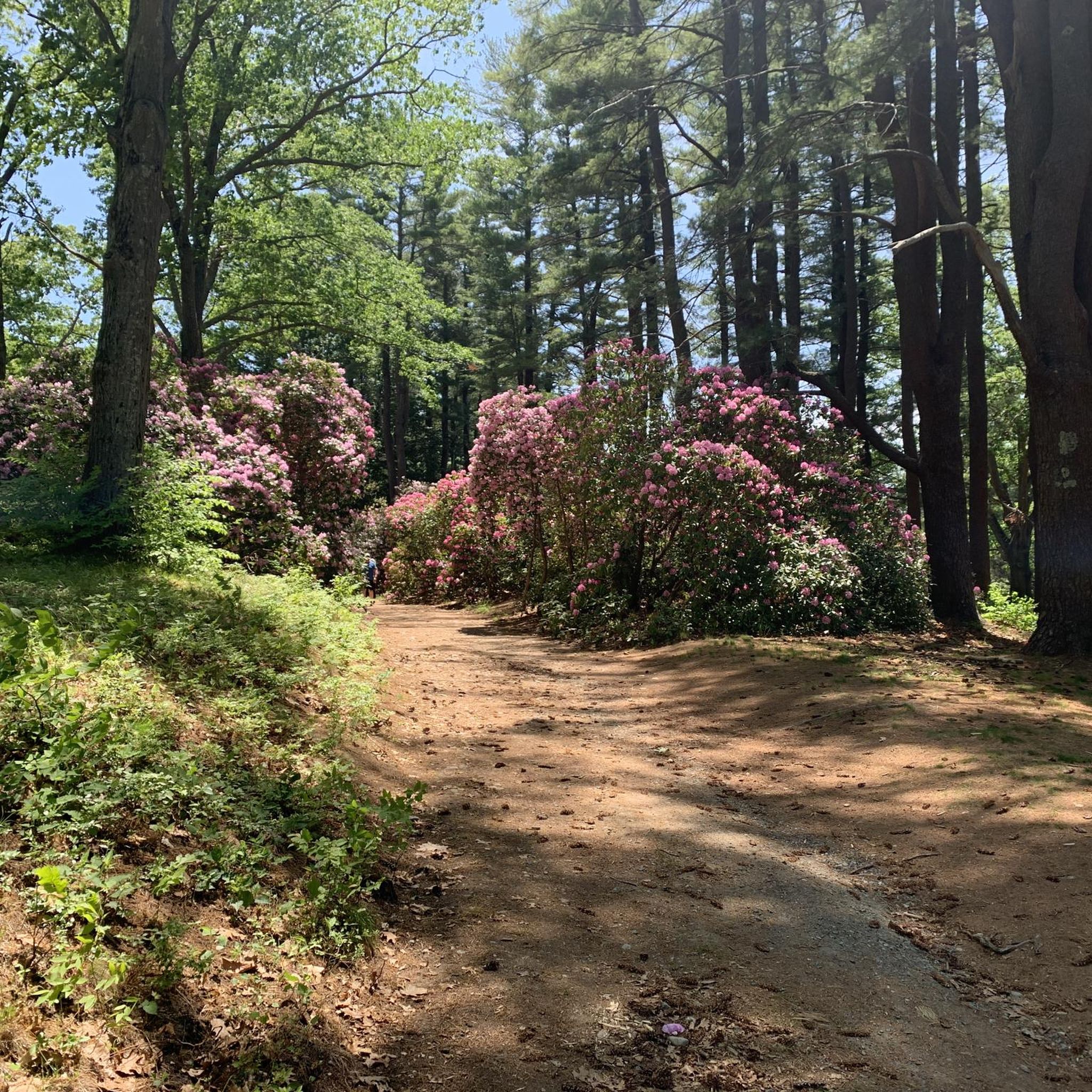
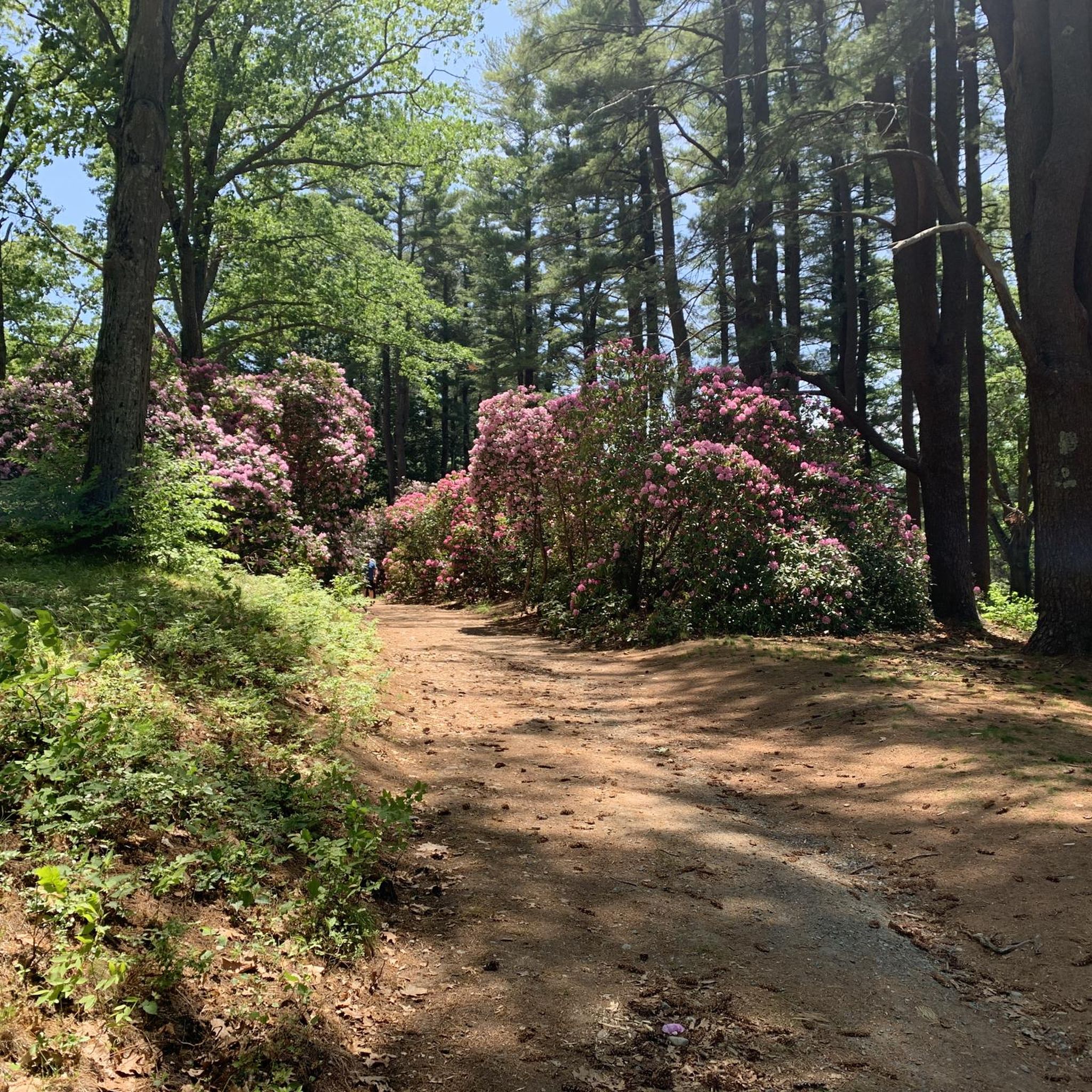
Maudslay State Park features 19th-century gardens, rolling meadows, towering pines, and one of the largest naturally occurring stands of mountain laurel in the state. It’s an ideal spot for walking, biking, or picnicking - the trails, however, within the park are mostly for hiking. The park also features educational programs during the summer months. It is open from sunrise to sunset, with daily year-round.
0
0

Here you just have to decide whether it is the old railway bridge or the sculpture in front of it. There is something about it - a new sculpture in front of a crumbling building
0
0
Frequently Asked Questions
How many touring cycling routes are available in Maudslay State Park?
Maudslay State Park offers a wide selection of touring cycling routes, with over 45 options to explore. These routes cater to various skill levels, including 20 easy, 27 moderate, and 1 difficult route.
What kind of terrain will I encounter while touring cycling in Maudslay State Park?
You can expect diverse terrain, including wide dirt paths and old carriage roads within the park. Some routes extend outside the park onto mostly paved surfaces. The landscape features woodlands, meadows, and riverfront scenery along the Merrimack River, with gentle gradients and some moderate climbs.
What are some of the natural features and landmarks I can see along the cycling routes?
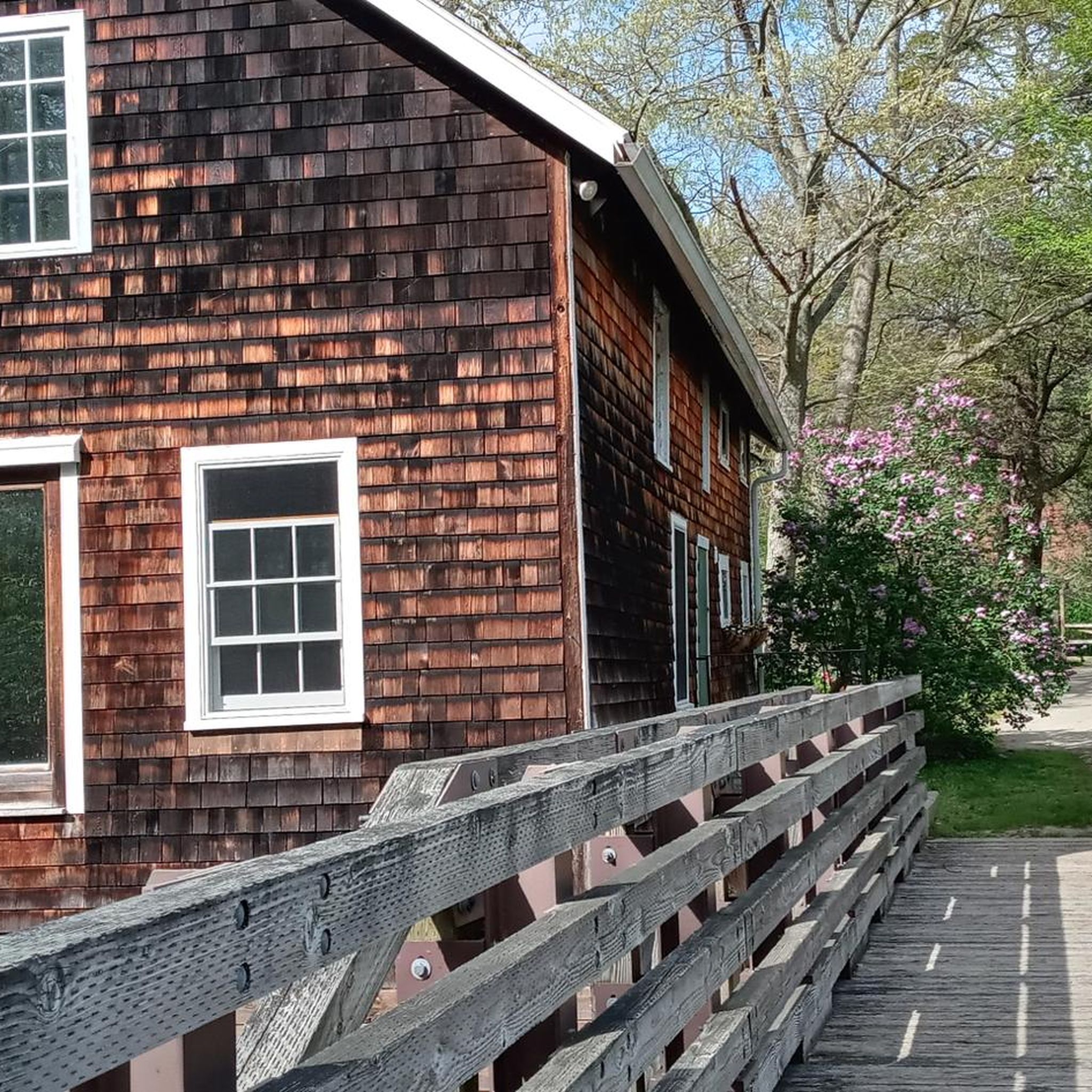
Maudslay State Park is rich in natural beauty and historical elements. Cyclists can enjoy views of the Merrimack River, 19th-century gardens, stone arch bridges, and a flowering reflection pond. The park also features towering pines and one of Massachusetts' largest naturally occurring stands of mountain laurel. You might also pass by the Flowering Pond or the historic Curzon Mill / Emery House Lane.
Are there any circular touring cycling routes in the area?
Yes, many of the touring cycling routes in and around Maudslay State Park are designed as loops. For example, you could try the Upper Artichoke Reservoir – Plum Island Airport loop from Maudslay State Park, which offers varied scenery over 22.9 miles. Another option is the Amesbury Town Center loop from Amesbury, a 12.7-mile route through town and natural environments.
Is Maudslay State Park suitable for family cycling trips?
Absolutely. Maudslay State Park is considered very family-friendly. Its well-maintained trails, which are often filled with bark mulch, are generally appropriate for all ages. The park's natural beauty and varied landscapes make it an enjoyable destination for family outings.
Can I bring my dog on the cycling trails?
Yes, Maudslay State Park is dog-friendly. You are welcome to bring your dog along on the trails, provided they are kept on a leash. This makes it a great option for cyclists who want to enjoy the outdoors with their canine companions.
What is the best time of year to go touring cycling in Maudslay State Park?
Maudslay State Park offers beautiful cycling experiences throughout the year. Spring brings vibrant wildflower displays, while autumn is spectacular with its foliage. During winter, a portion of the park is closed to protect roosting bald eagles, but other areas remain accessible. Consider checking local conditions before your visit, especially after heavy rain, as some dirt paths might be muddy.
Are there routes suitable for beginner touring cyclists?
Yes, Maudslay State Park has 20 routes classified as easy, making it a great place for beginner touring cyclists. The park's wide dirt paths and old carriage roads, combined with gentle gradients, provide an accessible and enjoyable experience for those new to touring cycling.
What do other touring cyclists enjoy most about Maudslay State Park?
The area is highly rated by the komoot community, with an average score of 4.4 stars from over 25 reviews. Reviewers often praise the park's diverse landscapes, the historic carriage roads, and the scenic views of the Merrimack River. Many appreciate the blend of natural beauty and accessible trails.
Where can I park when visiting Maudslay State Park for cycling?
Maudslay State Park offers designated parking areas for visitors. Specific parking access points can vary depending on which part of the park or which trail you plan to start from. It's advisable to check the park's official website or a detailed map for the most convenient parking locations for your chosen route.
Are there any longer touring cycling routes that extend beyond the park?
Yes, several routes connect Maudslay State Park to broader cycling opportunities. A popular choice is the Groveland Community Trail to Newburyport Front Range Light loop, a 27.7-mile route that includes paved sections and takes approximately 2 hours and 37 minutes to complete.
What kind of wildlife might I see while cycling in the park?
Maudslay State Park is a thriving habitat for diverse wildlife. Cyclists might spot various raptors, including eagles, owls, and hawks. The park is particularly known for its bald eagle population, especially during winter when a portion of the park is closed to protect their roosting sites.
Most popular routes in Maudslay State Park
Most popular attractions in Maudslay State Park

Get inspired with the komoot mobile app


Explore more
Browse the best Cycling routes in other regions.
