The best road cycling routes in Palmer Wildlife Refuge
160
riders
79
rides
Road cycling in Palmer Wildlife Refuge offers opportunities primarily on access roads and surrounding highways, as dedicated paved routes within the refuge's core recreational areas are limited. The region encompasses 28,800 acres of coastal and freshwater wetlands, tidal sloughs, mudflats, lakes, streams, and birch forests. Cyclists can experience panoramic views of the Chugach and Talkeetna Mountains, Hatcher Pass, and Pioneer Peak. While internal trails are mostly for hiking, the broader Palmer area provides scenic cycling with views of snow-capped peaks…
Last updated: October 2, 2026
4
riders
63.6km
02:45
570m
570m
Moderate road ride. Good fitness required. Mostly well-paved surfaces and easy to ride.
4
riders
57.1km
02:55
930m
930m
Hard road ride. Very good fitness required. Mostly well-paved surfaces and easy to ride.

5
riders
35.0km
01:31
280m
280m
Easy road ride. Great for any fitness level. Mostly well-paved surfaces and easy to ride.
3
riders
Moderate road ride. Good fitness required. Mostly well-paved surfaces and easy to ride.
3
riders
Moderate road ride. Good fitness required. Mostly well-paved surfaces and easy to ride.
Get access to more routes and recommendations from other explorers.
Already have an account?
Our route recommendations are based on thousands of hikes, rides, and runs completed by other people on komoot.
Start today with a free account
Your next adventure awaits.




Tips from the Community

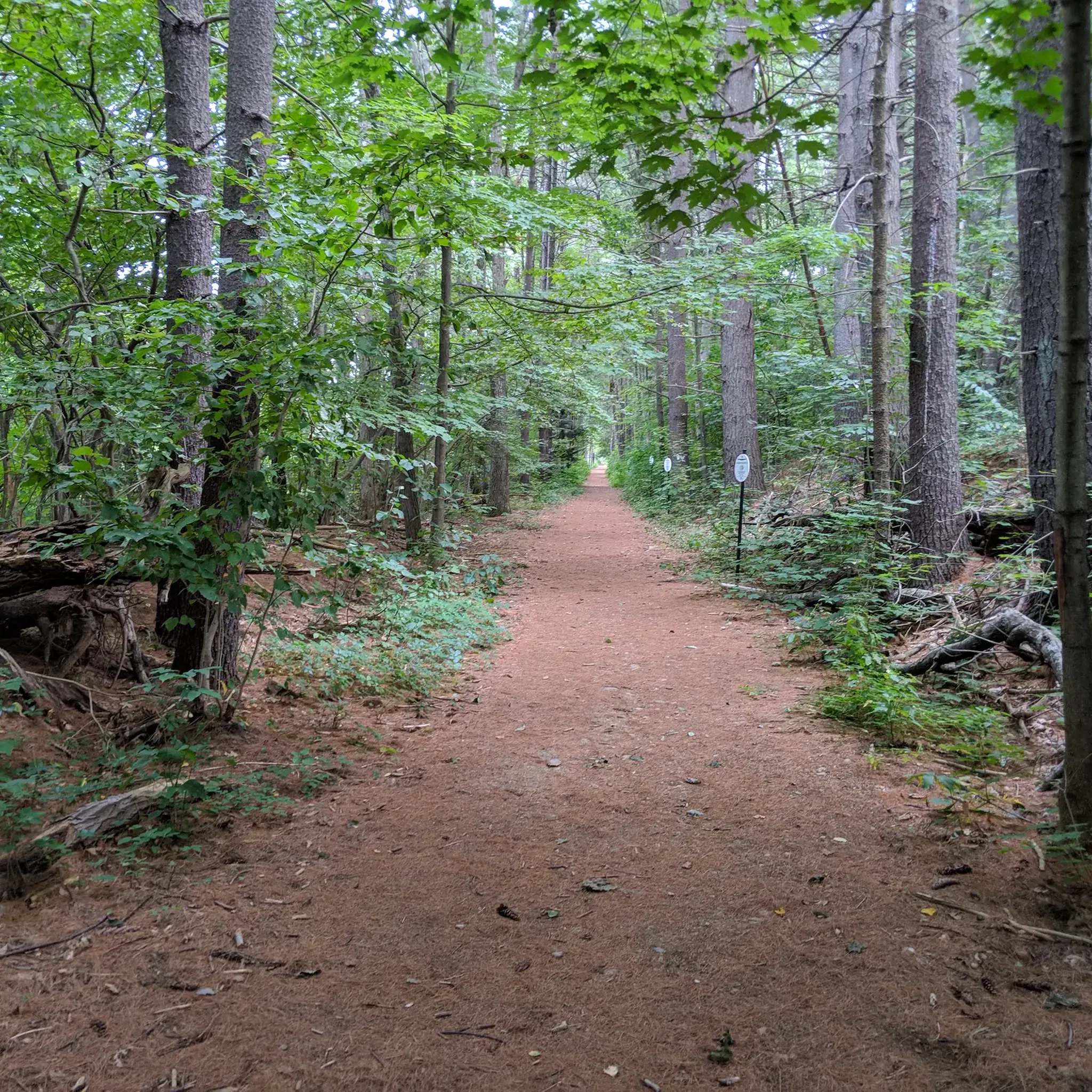
This is the northern terminus of the Nashua River Trail. It runs from this point all the way to Ayer, Massachusetts. The trail passes through J. Harry State Forest and is tree lined for a majority of its trajectory.
0
0

Wonderful panoramic views from the summit, well worth the hike up!
0
0

This flat road runs along the lake on one side, with tall pines lining the other. It is a beautiful stretch to cycle on, with plenty of wildlife to see.
0
0

From here all the way south to Ayer, this 12.5 miles trail follows the course of the Nashua River through J. Harry State Forest. Calm and tree-dimmed light make the way a real treat.
0
0
As we cruise through the NH-111 road, we find our tires rolling over the wide Nashua river, formed in Massachusetts to irrigate the Merrimack river in Hudson.
0
0
Pack Monadnock Mountain is the highest peak of the Wapack Mountain Range at 2,290 feet. From the top, there is a great view of the valleys around and the other nearby peaks. There is a road that leads to the peak, so there is parking, restrooms and water.
0
0
Tucker Brook Falls is a great small waterfall tucked in the woods. It is not visible from the road, but if you walk your bike a couple of feet down a path, you will be able to get a view of the falls.
0
0
Silver Lake Beach is a great place for a break during a long ride. The beach has picnic tables, bathrooms and water. It is a great area to relax and enjoy the beautiful lake and wooded area around the water.
0
0
Frequently Asked Questions
How many road cycling routes are available in the Palmer Wildlife Refuge area?
There are over 90 road cycling routes available in the broader Palmer Wildlife Refuge area, offering a variety of experiences for different skill levels. These routes are primarily found on access roads and surrounding highways, as dedicated paved paths within the refuge's core recreational areas are limited.
What are the difficulty levels of road cycling routes in the Palmer Wildlife Refuge region?
The road cycling routes in the Palmer Wildlife Refuge region cater to various skill levels. You'll find approximately 15 easy routes, 70 moderate routes, and 5 difficult routes, ensuring options for both casual riders and those seeking a challenge.
Are there any family-friendly road cycling options in the Palmer Wildlife Refuge area?
While many internal trails within the refuge are primarily for hiking and may not be suitable for road bikes, the broader Palmer area offers more accessible options. Look for routes on paved multi-use trails or frontage roads, such as sections of the Glenn Highway Trail or Knik-Goose Bay Bike Path, which provide smoother surfaces suitable for families.
What kind of scenic views can I expect while road cycling near Palmer Wildlife Refuge?
Road cycling in this region offers stunning panoramic views. You can expect to see the majestic Chugach and Talkeetna Mountains, Hatcher Pass, and Pioneer Peak. The landscape features vast wetlands, birch forests, and distant mountain ranges, with opportunities to cycle alongside snow-capped peaks and glaciers.
Is it possible to spot wildlife while cycling in the Palmer Wildlife Refuge area?
Yes, the Palmer Hay Flats State Game Refuge is a prime location for wildlife observation. While cycling on surrounding roads, you might spot moose, muskrat, foxes, coyotes, and eagles. During migration seasons, tens of thousands of waterfowl, including ducks, geese, swans, and shorebirds, are common, especially in spring and summer.
Are there any circular road cycling routes in the Palmer Wildlife Refuge region?
Yes, there are several circular road cycling routes available. For example, the Milford to Pack Monadnock Mountain loop is a challenging 35.5-mile route with significant elevation gain. Another popular option is the Nashua River Trailhead – Pepperell Covered Bridge loop from Brookline, a moderate 31.3-mile path exploring riverside scenery.
What is the best time of year for road cycling in Palmer Wildlife Refuge?
The best time for traditional road cycling is typically during the warmer months, from late spring through early fall, when roads are clear of snow and ice. This period allows for comfortable riding conditions and optimal wildlife viewing opportunities, especially for migrating birds.
Can I road cycle in the Palmer Wildlife Refuge area during winter?
Traditional road cycling is generally not recommended within the refuge's interior trails during winter due to snow, ice, and potential flooding. However, specialized winter cycling, such as 'ice biking' or fat biking, is popular on frozen waterways like Rabbit Slough within the refuge, offering a unique experience for those with appropriate equipment.
Where can I park my car when visiting for road cycling near Palmer Wildlife Refuge?
Access to the refuge is primarily via major routes like the Glenn Highway and Knik-Goose Bay Road. Parking is typically available at designated access points along these highways or at trailheads for multi-use paths in the broader Palmer area. Always check local signage for specific parking regulations.
What are some longer road cycling routes for experienced riders?
Experienced riders seeking longer routes can explore options like the Nashua River Trailhead – Silver Lake Beach loop from Big Dickerman Town Forest, which covers over 39 miles. Another option is the Silver Lake Beach – Quiet country road loop from Big Dickerman Town Forest, a moderate 29-mile ride.
What makes road cycling in the Palmer Wildlife Refuge region unique?
Road cycling in this region is unique due to its dramatic Alaskan landscape, characterized by vast wetlands, birch forests, and stunning views of the Chugach and Talkeetna Mountains. The area's history, shaped by the 1964 earthquake, has created a dynamic environment, offering a blend of natural beauty and wildlife observation opportunities not found elsewhere.
Are there any specific attractions or landmarks along the cycling routes?
While dedicated attractions directly on road cycling routes within the refuge are limited, the area itself is a landmark. The refuge offers an observation tower at Reflection Lake with 270-degree views of the mountains and wetlands. The historic Iditarod Trail also passes through the refuge, adding a layer of historical significance to the landscape.
How accessible are the road cycling routes within the Palmer Wildlife Refuge itself?
Dedicated paved road cycling paths within the refuge's core recreational areas are limited. Most road cycling opportunities are found on access roads and surrounding highways like the Glenn Highway and Knik-Goose Bay Road. Internal trails within the refuge are generally flat but are primarily designed for hiking and can be muddy or subject to tidal flooding, making them unsuitable for road bikes.
Most popular routes in Palmer Wildlife Refuge

Get inspired with the komoot mobile app


Explore more
Browse the best Road cycling routes in other regions.
