The best road cycling routes in Clarksburg State Park
4.8
(9)
351
riders
8
rides
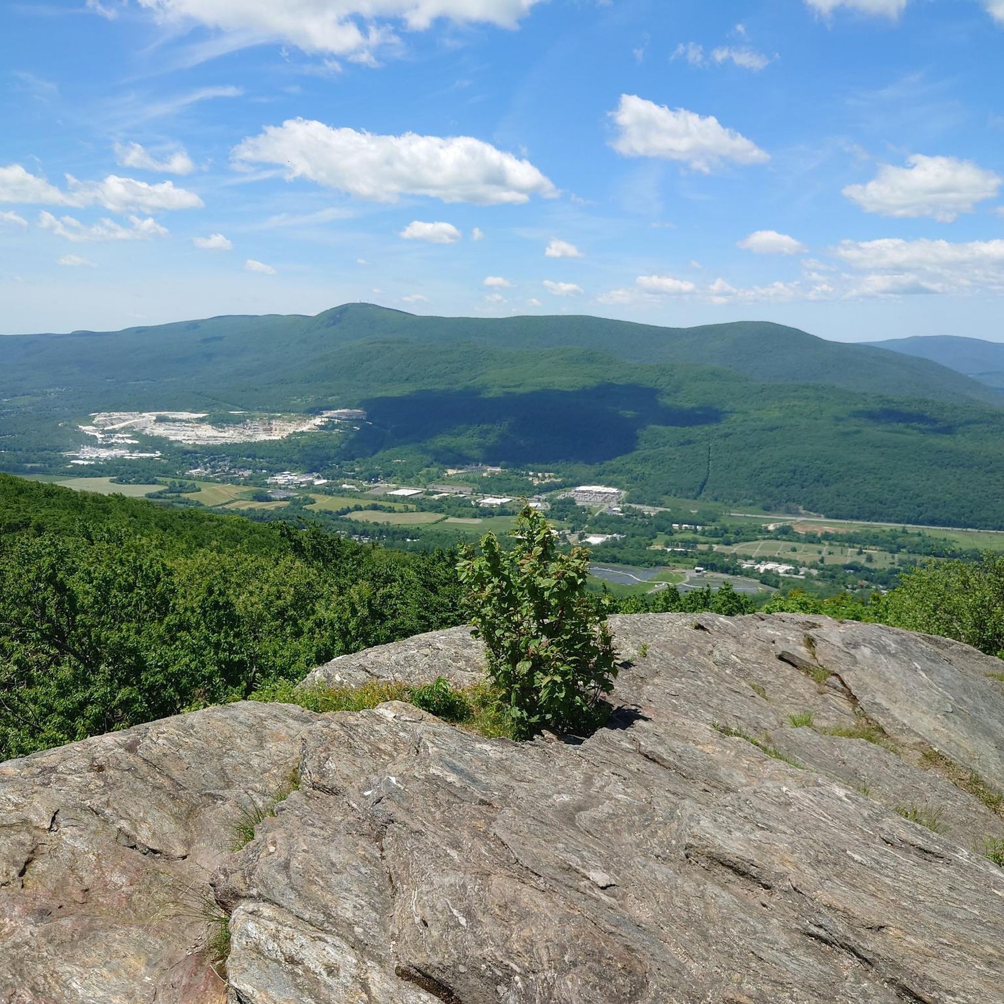
Road cycling routes in Clarksburg State Park traverse a landscape characterized by northern hardwood forests and views of the Hoosac Range, Mount Greylock, and the Green Mountains. The area features varied terrain, including roads that wind through forested areas and offer elevation changes. While the park itself is known for Mauserts Pond, the surrounding Berkshire County provides a network of scenic roads suitable for road cycling.
Best road cycling routes in Clarksburg State Park
- The most popular road cycling route…
Last updated: October 1, 2026
16
riders
53.6km
03:10
1,150m
1,150m
Hard road ride. Very good fitness required. Mostly well-paved surfaces and easy to ride.
6
riders
63.0km
03:10
1,020m
1,020m
Hard road ride. Very good fitness required. Mostly well-paved surfaces and easy to ride.

5.0
(7)
125
riders
Moderate road ride. Good fitness required. Mostly well-paved surfaces and easy to ride.
33
riders
21.3km
01:23
640m
640m
Moderate road ride. Good fitness required. Mostly well-paved surfaces and easy to ride.
20
riders
28.5km
01:14
250m
250m
Easy road ride. Great for any fitness level. Mostly well-paved surfaces and easy to ride.
Get access to more routes and recommendations from other explorers.
Already have an account?
Our route recommendations are based on thousands of hikes, rides, and runs completed by other people on komoot.
Start today with a free account
Your next adventure awaits.
Popular around Clarksburg State Park


Tips from the Community

Probably more impressive to ride/drive up through McCauley Road. You can also access it from Natural Bridge or Hudson Brook Lane Road on foot or on a bike (which is what we did). White marble natural bridges/quarries are apparently not very common in the North America. Worth the detour if you are in North Adams.
0
0

Located just north of Adams, the Ashuwillticook Rail Trail Head sets a lovely tone for the rest of your ride along the trail, perfectly smooth and easy to use for families.
0
0


The 1753 House stands as a faithful reproduction of a settler's home from 1753 in The Berkshires. Situated in Field Park at Williamstown's west end, it was built by volunteers in 1953 to commemorate the town's Bicentennial. Early settlers in the Hoosac Valley, including Williamstown and North Adams, were obligated by contract to construct a house of specific dimensions and clear a designated amount of land to secure their lot. You can see the house from the roadside.
0
0

Here's the Trail Head of the Ashuwillticook Rail Trail. The trail is perfectly smooth and easy to use for families.
0
0

The Hoosac Tunnel is a working 4.75-mile (7.64 km) active freight railroad tunnel in western Massachusetts. The East Portal of the tunnel can be found in the town of Florida. It is on the big bend of the Deerfield River and not far from the roadside, so it is easy to go and visit.
1
0
The U.S. Bicycle Route 7 (USBR 7) is a super good, north-south bike trail that follows the Western New England Greenway through Connecticut, Massachusetts, and Vermont. This section in Massachusetts goes past the Cheshire Reservoir and then on past the Hoosic River. It has particularly good views.
0
1
Frequently Asked Questions
How many road cycling routes are available in and around Clarksburg State Park?
There are over 5 dedicated road cycling routes in the Clarksburg State Park area, catering to various skill levels. These routes are highly rated by the komoot community, with an average score of 4.8 stars.
What kind of terrain can I expect on road cycling routes near Clarksburg State Park?
The road cycling routes in this region traverse a diverse landscape. You'll encounter roads winding through northern hardwood forests, offering scenic views of the Hoosac Range, Mount Greylock, and the Green Mountains. The terrain includes both paved surfaces and some routes with significant elevation changes, providing options from easy rides to challenging mountain ascents.
Are there any family-friendly road cycling routes in the area?
Yes, there are easy road cycling routes suitable for families. For instance, the Hoosic River – 1753 House loop from North Adams is an easy 23 km route that takes about 1 hour 3 minutes to complete, offering a pleasant ride through river valleys.
What are some challenging road cycling routes for experienced cyclists?
For experienced cyclists seeking a challenge, the Mount Greylock loop from Clarksburg State Park is a difficult 53.6 km route with significant elevation gain as it ascends Mount Greylock. Another option is the Mount Greylock loop from Mount Williams, a moderate yet challenging 21.3 km route with over 640 meters of elevation gain.
Are there any loop trails for road cycling in Clarksburg State Park?
Yes, many of the road cycling routes in the area are designed as loops. For example, the popular Ashuwillticool Trail – Ashuwillticook Rail Trail Head loop from North Adams offers a moderate 53.8 km loop with a mix of paved surfaces and scenic views.
What kind of views can I expect along the road cycling routes?
Road cycling routes in the Clarksburg State Park area offer impressive panoramic views. You can expect to see the Hoosac Range, Mount Greylock, and the Green Mountains of Vermont. Many routes also wind through dense northern hardwood forests and along river valleys, providing a varied and picturesque backdrop.
Is parking available for road cyclists near the routes?
While specific parking details for each route vary, Clarksburg State Park itself offers parking facilities. Given the park's popularity for outdoor activities, you can generally find parking options at trailheads or designated areas, especially when starting routes that originate near the park.
What is the best time of year for road biking in Clarksburg State Park?
The best time for road biking in Clarksburg State Park is typically during the spring, summer, and fall months. Spring offers lush greenery, summer provides warm weather, and fall showcases stunning foliage. Always check local weather conditions before heading out, especially for routes with significant elevation.
Can I spot wildlife while road cycling in the area?
The natural settings and forested areas around Clarksburg State Park provide opportunities for wildlife viewing. While road cycling, you might encounter various birds and smaller mammals. There's even a chance to spot larger wildlife, such as a moose, particularly in the quieter, more remote sections of the routes.
Are there any easy, shorter road cycling routes for beginners?
Absolutely. The Cold Spring Preserve – Hoosic River loop from Harriman-and-West Airport is an easy 28.5 km route that takes about 1 hour 14 minutes to complete. It leads through river valleys and natural preserves, making it a great option for beginners or those looking for a relaxed ride.
What do other road cyclists enjoy most about road cycling in Clarksburg State Park?
The area is highly rated by the komoot community, with an average score of 4.8 stars from more than 5 reviews. Reviewers often praise the diverse terrain, from challenging mountain ascents to scenic rides through northern hardwood forests, and the impressive views of the surrounding mountain ranges.
Most popular routes in Clarksburg State Park

Get inspired with the komoot mobile app


Explore more
Browse the best Road cycling routes in other regions.
