The best road cycling routes in Mcconnells Mill State Park
36
riders
7
rides
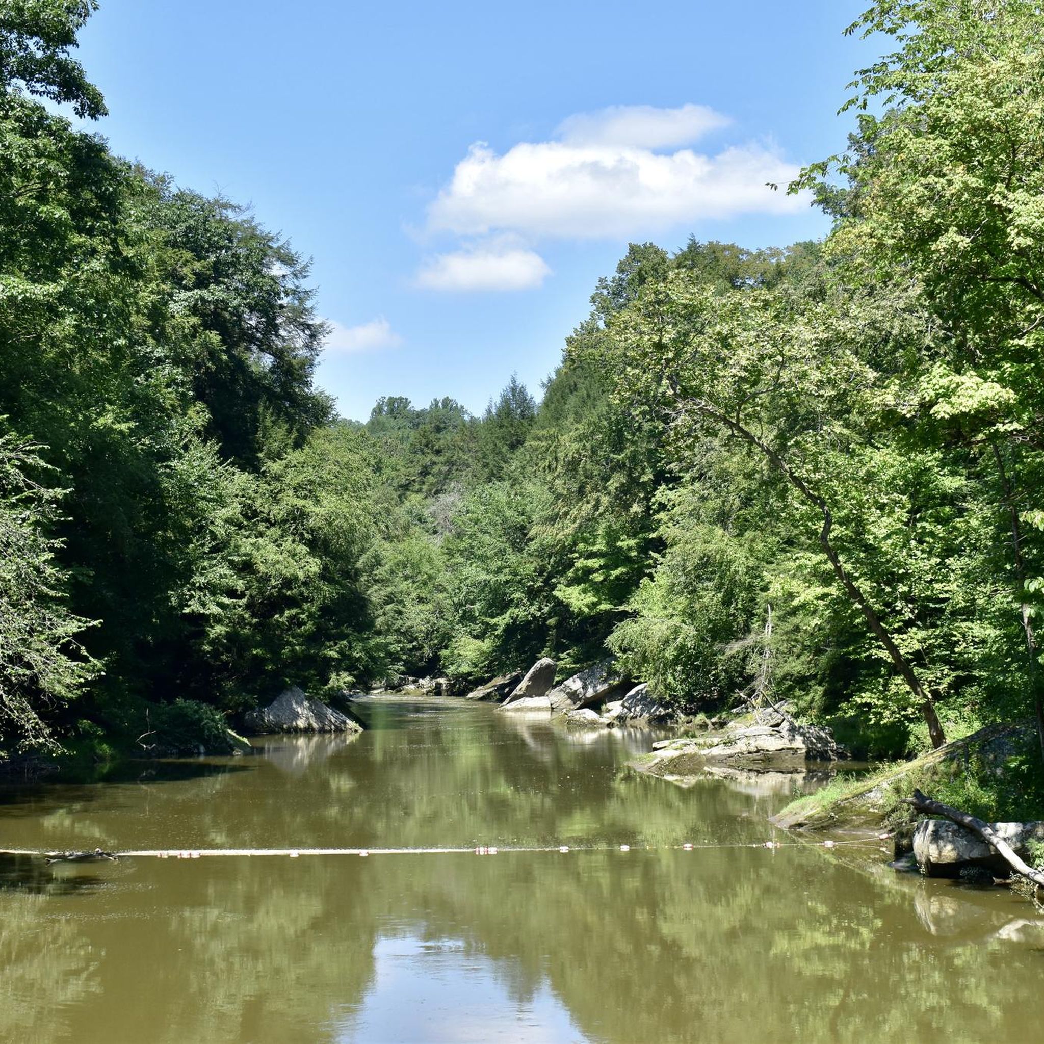
Road cycling routes in Mcconnells Mill State Park navigate a landscape characterized by the deep gorge of Slippery Rock Creek, dense woodlands, and rolling hills. The region features varied topography, with routes often following waterways and traversing areas with notable elevation changes. Road cyclists can expect to encounter a mix of open countryside and forested sections throughout the park and surrounding areas.
Best road cycling routes in Mcconnells Mill State Park
- The most popular road cycling route is Connoquenessing Creek…
Last updated: September 1, 2026
10
riders
77.4km
03:40
650m
650m
Moderate road ride. Good fitness required. Mostly well-paved surfaces and easy to ride.
2
riders
81.8km
03:42
670m
670m
Moderate road ride. Good fitness required. Mostly well-paved surfaces and easy to ride.

Sign up for free
16
riders
14.9km
00:38
80m
80m
Easy road ride. Great for any fitness level. Mostly well-paved surfaces and easy to ride.
1
riders
42.6km
02:15
530m
530m
Moderate road ride. Good fitness required. Mostly well-paved surfaces and easy to ride.
3
riders
60.3km
03:03
680m
680m
Moderate road ride. Good fitness required. Mostly well-paved surfaces and easy to ride.
Get access to more routes and recommendations from other explorers.
Sign up for free
Already have an account?
Our route recommendations are based on thousands of hikes, rides, and runs completed by other people on komoot.
Start today with a free account
Your next adventure awaits.
Login or Signup
Popular around Mcconnells Mill State Park
Tips from the Community

I actually rode here and won’t copy paste a tip from some website, who are these people? Park at the far western end of the trail and use the tire pump at the bike rental place to pump your MTB tires up nice and hard. Lock out your suspension and have a blast carving the corners all the way to the marina and up the hill to the Parking lot on Glacier Ridge. You‘re all warmed up! Bleed out some air and ride the trails back down.
0
0
This is great, maybe one of the best paved multi use trails I’ve been on. I rode a bike and really enjoyed all the corners and short climbs as the path twisted along Lake Arthur. Road bike friendly, as many trees as there were I was suprised the asphalt wasn’t pushed up by roots at all and the surface was fast. Numerous pavilions, picnic tables, benches, bathrooms and green lawns for breaks.
0
0

Rapp's Seat, located on a steep hillside in Harmony, is a stone-carved chair created by George Rapp, founder of the Harmony Society. Rapp would climb the hill to meditate and look over the town. The site is accessible via wooden steps constructed in 1999 as an Eagle Scout project. The trail leads to a rock outcrop where the seat provides a view of the town and surrounding landscape. Although trees now obstruct some of the view, visitors can still climb to the top often.
0
0
The Mennonite Meeting House and Cemetery, preserved by the Harmony Museum, is a beautiful 1825 building that was used as a church, school, and social center for the Mennonite community led by Abraham Ziegler. The building's acoustics make it ideal for small concerts and weddings. Visitors can view it from the street or visit its historic charm during museum hours, from Tuesday to Friday, 12:30 p.m. to 4:00 p.m. For more information, call (724) 452-7341.
0
0

Prospect is a lovely small town surrounded by the quintessential beauty of Pennsylvania's rolling hills, woodlands, and farmlands. It has great shops and restaurants and is only a short ride from the beautiful Moraine State Park. On Main Street, you'll find the Prospect Corner Store, an ideal spot if you need to stop for supplies for a nice picnic at the park.
0
0

The park's rolling hills and sparkling lakes are remnants of the Wisconsin glaciation, making it a living museum of Earth's dynamic past. Traverse gentle paths through woodlands, conquer challenging climbs, or enjoy leisurely rides overlooking the water.
0
0
The paved multi-use trail is a delightful 7.1-mile route that winds along the picturesque north shore of Lake Arthur. The trees along the water create a stunning backdrop, especially in the fall when the leaves change into vibrant colors.
1
0
Lake Arthur is in Moraine State Park and is home to warm water fish, frogs, newts, turtles, and water snakes. The Moraine State Park Bike Trail borders its northern shores, making for a nice waterfront ride.
1
0
Frequently Asked Questions
What is the range of difficulty for road cycling routes in Mcconnells Mill State Park?
Mcconnells Mill State Park offers a variety of road cycling routes catering to different skill levels. You'll find easy routes, such as the Lake Arthur loop from E11, as well as moderate options like the Dight Hill loop from Portersville Park & Ride. For experienced cyclists seeking a challenge, there are difficult routes with significant elevation gain, such as the Connoquenessing Creek – McConnells Mill State Park loop from Route 528 (Evans City) Park & Ride.
Are there any family-friendly road cycling routes in Mcconnells Mill State Park?
For families or those looking for a less strenuous ride, the Lake Arthur loop from E11 is an excellent choice. This easy 9.2-mile (14.9 km) route around Lake Arthur is relatively flat and can be completed in under an hour, making it suitable for a relaxed outing.
What are the typical lengths and durations of road cycling routes in the park?
Route lengths vary significantly. You can find shorter rides like the Lake Arthur loop from E11, which is about 9.2 miles (14.9 km) and takes around 38 minutes. Longer, more challenging routes, such as the Connoquenessing Creek – McConnells Mill State Park loop from Route 528 (Evans City) Park & Ride, can extend to 59.2 miles (95.3 km) and require nearly 5 hours to complete.
Are there loop road bike trails available in Mcconnells Mill State Park?
Yes, many of the road cycling routes in and around Mcconnells Mill State Park are designed as loops, offering varied scenery without retracing your path. Examples include the Lake Arthur – Lake Arthur Bike Trail loop from Portersville Park & Ride and the Prospect – Rapp's Seat loop from Zelienople.
What is the best time of year for road biking in Mcconnells Mill State Park?
The spring and fall seasons generally offer the most pleasant conditions for road cycling in Mcconnells Mill State Park, with milder temperatures and beautiful foliage. Summer can also be enjoyable, though it's advisable to start early to avoid the midday heat. Winter conditions can bring snow and ice, making many roads unsuitable for cycling.
What kind of terrain can I expect on road cycling routes in Mcconnells Mill State Park?
Road cycling in Mcconnells Mill State Park is characterized by a mix of terrain. Routes often follow waterways like Slippery Rock Creek, traverse dense woodlands, and include rolling hills. You can expect varied topography with notable elevation changes, offering both open countryside views and forested sections.
Are there specific viewpoints or scenic spots along the road cycling routes?
While specific viewpoints are not always marked for road cyclists, many routes offer extensive views across the countryside, especially on higher elevations. The deep gorge of Slippery Rock Creek provides dramatic scenery, and routes around Lake Arthur offer picturesque lakeside vistas. Keep an eye out for natural beauty throughout your ride.
What should I bring for a road cycling trip in Mcconnells Mill State Park?
For road cycling in the park, it's essential to bring plenty of water, especially on longer routes, as amenities can be sparse. A helmet is mandatory for safety. Consider carrying snacks, a basic repair kit (spare tube, pump, tire levers), and appropriate clothing layers for changing weather conditions. A phone for navigation and emergencies is also recommended.
Are there any cafes or places to refuel near the road cycling trails?
While Mcconnells Mill State Park itself is primarily natural, nearby towns and communities like Portersville, Zelienople, or Evans City (depending on your starting point) offer options for cafes, restaurants, and convenience stores where you can refuel before or after your ride. It's advisable to plan your stops in advance, especially for longer routes.
What do other road cyclists enjoy most about road cycling in Mcconnells Mill State Park?
Road cyclists frequently praise the varied terrain and natural beauty of Mcconnells Mill State Park. The combination of challenging climbs, scenic descents, and routes along waterways and through woodlands provides a rewarding experience. The komoot community appreciates the diverse options for different fitness levels and the opportunity to explore the region's unique landscape.
How many road cycling routes are available in Mcconnells Mill State Park?
There are at least 5 distinct road cycling routes detailed for Mcconnells Mill State Park and its surrounding areas, ranging in difficulty from easy to difficult. These routes have been explored by over 30 road cyclists using komoot.

Get inspired with the komoot mobile app


