The best walks and hikes in Brown County State Park
4.8
(54)
722
hikers
41
hikes
Hiking in Brown County State Park offers routes through a landscape of rugged hills, narrow ridges, steep slopes, and deep ravines. This extensive natural area, often referred to as the "Little Smokies," features dense forests and prominent lakes such as Ogle Lake and Strahl Lake. The terrain was shaped by glacial meltwaters, providing varied conditions for outdoor activities.
Best hiking trails in Brown County State Park
- The most popular hiking route is West Overlook loop via Trail 8 — Brown County State Park, an easy 4.2 miles (6.8 km) trail that takes 1 hour 51 minutes to complete. This route provides views from the West Overlook.
- Another top favourite among local hikers is Ogle Lake loop — Brown County State Park, an easy 2.7 miles (4.4 km) path. This trail circles Ogle Lake, offering scenic views of the water and surrounding woodlands.
- Local hikers also love the Ogle Lake via Trails 9 and 11 — Brown County State Park, a 9.2 miles (14.8 km) trail leading through varied forest terrain, often completed in about 4 hours 13 minutes.
- Hiking in Brown County State Park is defined by rugged hills, dense forests, and serene lakes. The network offers options for different ability levels, from easy loops around lakes to more challenging paths through ravines.
- The routes in Brown County State Park are highly rated by the komoot community with an average score of 4.8 stars from around 30 reviews. More than 400 hikers have used komoot to explore Brown County State Park's varied terrain.
Last updated: September 26, 2026
4.3
(6)
36
hikers
4.80km
01:21
100m
100m
The Strahl Lake Trail offers a peaceful journey through the forested landscape of Brown County State Park, winding past mossy ground and distinctive sycamore trees. The highlight is undoubtedly Strahl Lake itself, with its clear, cool waters reflecting the surrounding foliage, creating a serene atmosphere. Depending on recent rainfall, you might even discover a small waterfall along the way, adding to the trail's charm.
This easy 3.0-mile (4.8 km) hiking route, with a gentle 329 feet (100 metres) of elevation gain, typically takes about 1 hour and 21 minutes to complete. While the lake loop is quite flat and family-friendly, be aware that connecting to the Nature Center involves a significant descent and ascent via wooden stairs, increasing the overall Strahl Lake Trail hiking difficulty. The best time of year to hike Strahl Lake Trail is often in the fall for stunning colors.
Strahl Lake is a notable feature in the park because it's closed to boats, ensuring a tranquil environment perfect for swimming, fishing (with a permit), or simply relaxing by the water's edge. The lake is regularly stocked with various fish species, making it a popular spot for anglers. This blend of tranquil lakeside paths and forested sections makes it a favorite among visitors seeking a refreshing natural escape.
4.7
(3)
31
hikers
14.2km
04:08
340m
430m
Embark on the Ogle Lake and Taylor Ridge Trail Loop for a moderate hiking adventure that blends serene lakeside paths with more challenging ridge-top sections. This 8.8-mile (14.2 km) route will take you about 4 hours and 7 minutes to complete, with an elevation gain of 1128 feet (344 metres). You'll enjoy tranquil vistas of the 17-acre Ogle Lake, its surface often reflecting the sky and surrounding forest. The trail then leads you through lush hardwood forests, where oak, hickory, and maple trees create a vibrant canopy, especially beautiful in the fall. Keep an eye out for wildlife like white-tailed deer and various birds as you explore.
When planning your hike, note that there is no direct parking at the Taylor Ridge Trailhead. You can easily access this combined loop by connecting from the Ogle Lake area, often via Trail 11 (Vollmer Trail). The Ogle Lake area provides well-maintained paths and clean restroom facilities near the trailhead, making it a convenient starting point. Be aware that some sections of the trail can become muddy, particularly after rain, so it is wise to plan your visit accordingly and wear appropriate footwear.
This loop offers a diverse experience within Brown County State Park, showcasing Indiana's original Hoosier landscape. The Taylor Ridge section, which includes the Ten O'Clock Line Nature Preserve, provides a unique glimpse into the region's natural heritage. This trail is an excellent choice if you are looking for a varied hike that combines peaceful waterside views with the rugged beauty of a forest ridge.

13
hikers
4.65km
01:20
110m
110m
The Taylor Ridge Trail in Brown County State Park offers a delightful journey through pristine hardwood forests, perfect for a tranquil escape. This 2.9-mile (4.7 km) lollipop trail, rated easy, guides you along a ridgeline before descending into a drainage area and then climbing back up, showcasing beautiful wildflowers in spring and vibrant fall foliage. With 361 feet (110 metres) of elevation gain, it's a rewarding hike that typically takes around 1 hour and 19 minutes, ideal for nature lovers seeking a peaceful experience.
Accessing the Taylor Ridge Trail requires a short detour, as there's no direct public parking at its trailhead. Hikers usually begin by taking Trail 11 (Vollmer Trail) from Ogle Lake to reach it. Dogs are welcome to join you on this adventure, provided they remain on a leash. For the most scenic experience, plan your visit during the spring to catch the wildflowers or in the autumn for the spectacular display of fall colors.
This trail is a highlight within the Ten O'Clock Line Nature Preserve, an area renowned for its rich biodiversity and significant hardwood forests that have been largely preserved since early settlement. You might spot wildlife such as red bats, bobcats, or eastern box turtles. It's a fantastic option for those looking for a family-friendly hike that offers a genuine connection with Indiana's natural heritage.
10
hikers
2.53km
00:42
50m
50m
The Saddle Barn Loop Trail offers a delightful escape into Brown County State Park's natural and historical landscape. This easy 1.6-mile (2.5 km) loop takes about 42 minutes to complete, guiding you through rolling hills and wooded sections where you'll spot hardwoods, wildflowers, and an abundance of ferns. You'll also encounter unique landmarks like the historic Saddle Barn and a stone tunnel built for horses, providing a blend of natural beauty and historical intrigue.
Accessing the trail is simple, with the trailhead situated conveniently behind the Abe Martin Lodge. Parking is typically available in the lodge area, making it an easy starting point for your adventure. There are no permits or fees required for this trail, and it's generally accessible throughout the year, offering a pleasant outing whenever you choose to visit.
What makes this trail particularly special is its rich history, with structures like the Saddle Barn and the stone tunnel dating back to the Civilian Conservation Corps era. Beyond the historical elements, the route is a haven for wildlife, with opportunities to spot various insects like water striders in the streams and diverse flora. It's a fantastic option for those seeking a short, engaging hike with a manageable 156 feet (48 metres) of elevation gain, perfect for families or a quick nature fix.
4
hikers
16.0km
04:25
270m
270m
Embark on the Hesitation, Aynes, Bobcat Loop for a moderate hiking adventure that covers 10.0 miles (16.0 km) with an elevation gain of 872 feet (266 metres). You can expect to complete this route in about 4 hours and 24 minutes, winding through dense forestland. The highlight of your journey will be the panoramic views from Hesitation Point Overlook, offering expansive vistas of Brown County's rolling hills and a true sense of immersion in nature.
This trail is located within Brown County State Park, so be prepared for park entrance fees if applicable. Parking is generally available at designated trailheads within the park, making access straightforward. Given the varied and sometimes technical terrain, ensure you are ready for a physically demanding experience. It's always a good idea to check park conditions before you head out, especially regarding trail status.
The Hesitation, Aynes, Bobcat Loop combines several paths, offering a diverse and challenging experience as you explore the park. During the fall, the forest transforms with vibrant colors, making it a particularly spectacular time to visit. You might also spot various wildflowers along the way, adding to the natural beauty and charm of the route.
Get access to more routes and recommendations from other explorers.
Already have an account?
Our route recommendations are based on thousands of hikes, rides, and runs completed by other people on komoot.
Start today with a free account
Your next adventure awaits.


Tips from the Community

Nice place for camping, cycling and hanging out with family and friends
1
0

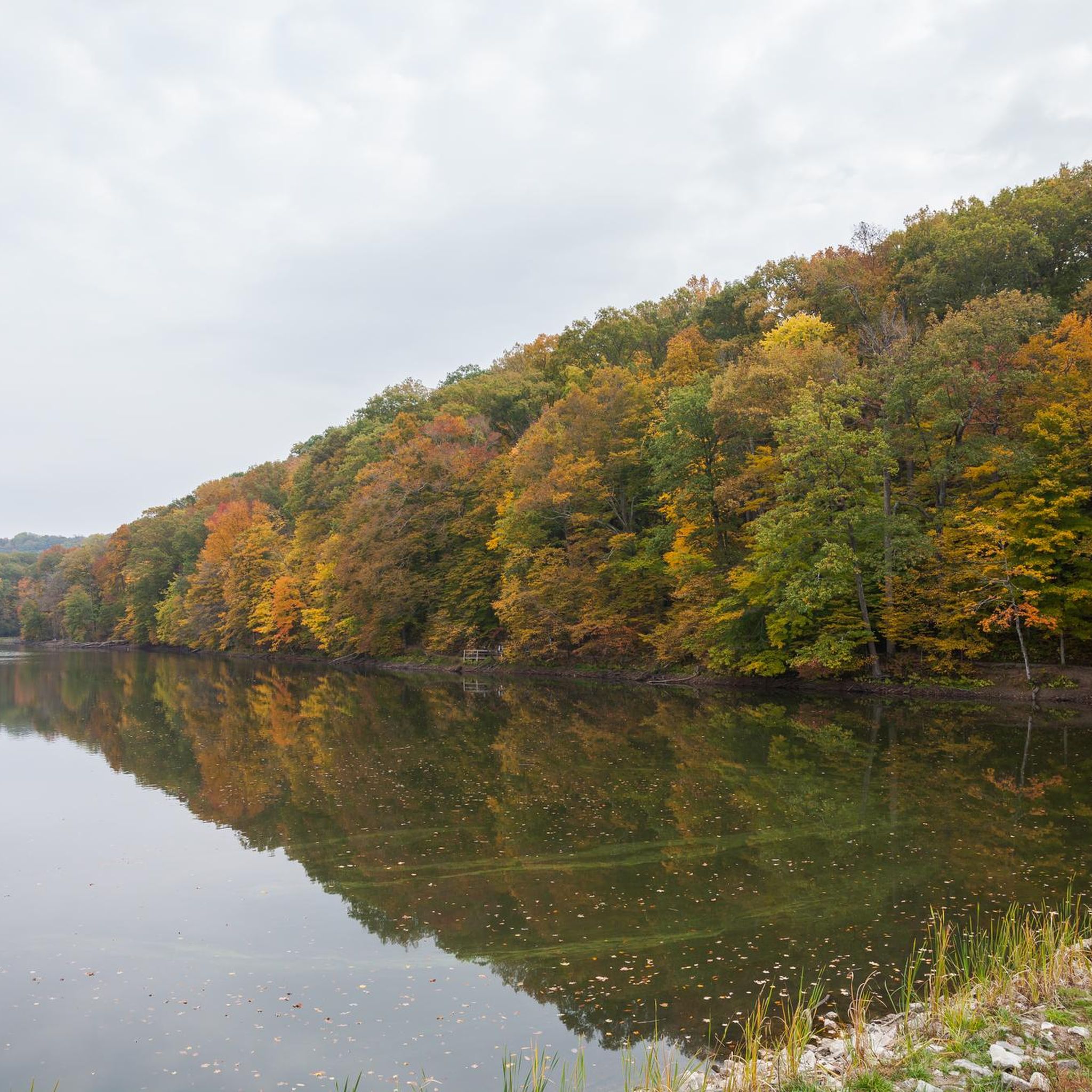
This 17-acre lake is crystal clear and is known as a good fishing spot. This is also a great area for viewing the changing colors in autumn.
0
0

A tower built with a stone base, and log cabin-style construction above that provides views in all directions over the park.
0
0
Hesitation Point is the name of both a peak and an official overlook pullout right off of West Gate Entrance Road. This point has an elevation of 1,003 feet and you can get additional views of the area from the trail that leaves from this parking area.
0
0
Interpretive trail within a 41 acre tract that presents the diversity of the forest in this part of Indiana. The trail is great for taking the family on a short educational hike.
0
0
A tower built with a stone base, and log cabin style construction above that that provides views in all directions over the park.
0
0
Strahl Lake is a small, but very scenic and has a trail that loops around it that is great for families to enjoy. It is espeically beautiful in the fall when the leaves change color and the trees reflect on the water.
0
0

This crystal clear 17-acre lake is located in Brown County State Park. It offers excellent fishing, as well as a hiking trail that snakes around the lake. During the fall season the colors around the lake are quite impressive.
0
0
Frequently Asked Questions
What types of hiking trails are available in Brown County State Park?
Brown County State Park offers a diverse range of hiking trails, from easy loops around lakes to more challenging paths through rugged hills and deep ravines. The park's terrain, shaped by glacial meltwaters, provides varied conditions suitable for different ability levels. There are over 25 hiking routes recorded in the park.
Are there any easy or family-friendly hiking options in Brown County State Park?
Yes, Brown County State Park has many easy and family-friendly trails. For instance, the Ogle Lake loop is an easy 2.7-mile path that circles Ogle Lake, offering scenic views. Another accessible option is the Strahl Lake loop via Trail 6, which is also considered easy.
Can I bring my dog on the hiking trails in Brown County State Park?
Yes, dogs are generally permitted on trails in Brown County State Park, but they must be kept on a leash no longer than six feet. Always ensure to clean up after your pet to maintain the park's natural beauty for all visitors.
Are there any circular hiking routes in Brown County State Park?
Many trails in Brown County State Park are designed as loops, allowing hikers to return to their starting point without retracing steps. Examples include the West Overlook loop via Trail 8 and the Ogle Lake loop, both offering scenic circular paths.
What are the best times to visit Brown County State Park for hiking?
Brown County State Park is particularly stunning in the fall when the dense forests transform into vibrant displays of autumn foliage, earning it the nickname 'Little Smokies.' Spring also offers beautiful scenery with blooming wildflowers, while summer provides lush greenery. Winter hiking can be serene, but trails may be icy or muddy.
Are there any waterfalls in Brown County State Park?
Yes, the Strahl Lake loop via Trail 6 features a notable waterfall, especially beautiful after rainfall. This trail loops around Strahl Lake and also passes through Civilian Conservation Corps-planted pine groves.
What kind of wildlife can I expect to see while hiking?
Brown County State Park is rich in wildlife. Hikers often spot white-tailed deer, raccoons, foxes, gray squirrels, and wild turkeys. The park's dense forests and varied habitats provide excellent opportunities for wildlife observation.
What are some notable landmarks or scenic overlooks in the park?
The park is known for its breathtaking scenic overlooks. Hesitation Point and West Overlook offer stunning panoramic views of the 'hills o' Brown' and the expansive forest canopy. The 90-foot Fire Tower also provides a 360-degree vista. Additionally, Ogle Lake and Strahl Lake are prominent and picturesque features.
Is there an entrance fee for Brown County State Park?
Yes, Brown County State Park charges an entrance fee. For current fee information and any permit requirements, it is best to check the official Indiana Department of Natural Resources website: in.gov/dnr.
What do other hikers enjoy most about hiking in Brown County State Park?
The area is highly rated by the komoot community, with an average score of 4.8 stars from nearly 30 reviews. Reviewers often praise the park's rugged hills, dense forests, and serene lakes, highlighting the variety of trails and the stunning fall foliage.
Are there any unique natural features or rare plants to look for?
Yes, Brown County State Park is home to diverse flora, including the rare and state-endangered Yellowwood tree. This tree can be particularly found along Trail 5 in the Ogle Hollow Nature Preserve, which is a rugged 0.75-mile self-guided trail winding through a mesic upland forest.
Where can I find parking and trailheads in Brown County State Park?
Brown County State Park has multiple parking areas and designated trailheads throughout the park. The Nature Center serves as a trailhead for Strahl Lake, and various campgrounds like Rally Campground also provide access to trails. Specific parking details are usually available on park maps provided at the entrance or visitor center.
Most popular routes in Brown County State Park
Most popular attractions in Brown County State Park

Get inspired with the komoot mobile app


Explore more
Browse the best Hikes in other regions.
