The best running trails in Occoquan Bay National Wildlife Refuge
4.4
(5)
135
runners
29
runs
Jogging in Occoquan Bay National Wildlife Refuge offers routes through diverse landscapes where the Occoquan River meets the Potomac. The refuge features a mix of wetlands, grasslands, and forests, providing varied scenery for runners. Trails are primarily composed of flat, gravel roads, making them accessible for various fitness levels with minimal elevation gain. This natural setting supports a wide array of plant and animal life, enhancing the running experience.
Best jogging routes in Occoquan Bay National Wildlife Refuge
- The most popular jogging route is Deep Hole Point Road & Charlie Road loop, a 3.1 miles (5.0 km) trail that takes around 35 minutes to complete. This easy route winds through diverse habitats, offering opportunities for wildlife observation.
- Another top favourite among local runners is Neabsco Creek Boardwalk – Neabsco Creek Boardwalk loop from Woodbridge, a difficult 13.7 miles (22.1 km) path. This longer route explores the wider area, including sections along the Neabsco Creek.
- Local runners also love the Neabsco Creek Boardwalk – Neabsco Creek Boardwalk loop from Featherstone National Wildlife Refuge, a 4.6 miles (7.3 km) trail leading through varied natural features, often completed in about 48 minutes.
- Jogging in Occoquan Bay National Wildlife Refuge is defined by flat gravel roads, wetlands, and forested sections. The network offers options for easy, moderate, and difficult ability levels.
- The routes in Occoquan Bay National Wildlife Refuge are highly rated by the komoot community with an average score of 4.5 stars from over 4 reviews. More than 100 runners have used komoot to explore Occoquan Bay National Wildlife Refuge's varied terrain.
Last updated: July 7, 2026
3
runners
4.97km
00:36
10m
10m
The Deep Hole Point Road & Charlie Road loop offers a delightful, easy jogging experience through the varied landscapes of the Occoquan Bay National Wildlife Refuge. This 3.1-mile (5.0 km) route, with a minimal 17 feet (5 metres) of elevation gain, takes about 35 minutes to complete on mostly flat, well-maintained gravel paths. You'll pass through wetlands, grasslands, and forests, enjoying the natural beauty where the Occoquan River meets the Potomac, making it a perfect Deep Hole Point Road Charlie Road loop jogging beginner route.
Access to the refuge is typically by car, with designated parking areas available. The park generally operates from 7 am until 5 pm in winter and 7 am until 7 pm during other seasons. Be aware that some sections of Deephole Point Road might have restrictions on jogging, so it's wise to check local signage or the refuge's official website for the latest rules before your visit. Dogs are permitted on Deephole Point Road but must be leashed.
This trail is a haven for wildlife enthusiasts, especially birdwatchers, as the Occoquan Bay National Wildlife Refuge supports over 200 species of birds and 650 plant species. The diverse habitats provide excellent opportunities for observing nature in a tranquil setting, offering a peaceful escape from urban life. It's a great option for a quick, accessible outdoor activity near Woodbridge, Virginia.
3
runners
4.61km
00:28
0m
0m
This easy jogging route at Occoquan Bay National Wildlife Refuge offers a refreshing escape into nature, winding through diverse habitats where the Occoquan River meets the Potomac. You'll traverse flat, wide gravel roads and some paved sections, enjoying views of wetlands, grasslands, and forests. Keep an eye out for abundant wildlife, from waterfowl to deer, and enjoy the serene water views along Occoquan Bay.
This accessible 2.9-mile (4.6 km) loop, with a minimal 15 feet (5 metres) of elevation gain, can be completed in about 28 minutes, making it a perfect quick outing. Parking is available at the refuge, and while the trails are generally uncrowded, consider an early start for maximum tranquility. Be prepared for potential biting insects during warmer, humid periods, especially near wetland areas.
The refuge is a prime location for wildlife observation, boasting over 200 species of birds, including nesting Osprey and Bald Eagles. The trail network utilizes former military roads, providing approximately 4 miles of dedicated foot traffic paths. It's an excellent choice for those seeking easy jogging routes near Woodbridge, VA, with a high chance of spotting local fauna.

Sign up for free
6
runners
22.1km
02:35
200m
200m
Hard run. Very good fitness required. Mostly paved surfaces. Suitable for all skill levels.
4.0
(1)
10
runners
3.36km
00:21
20m
20m
Easy run. Great for any fitness level. Mostly paved surfaces. Suitable for all skill levels.
10
runners
Moderate run. Good fitness required. Mostly paved surfaces. Suitable for all skill levels.
Get access to more routes and recommendations from other explorers.
Sign up for free
Already have an account?
Our route recommendations are based on thousands of hikes, rides, and runs completed by other people on komoot.
Start today with a free account
Your next adventure awaits.
Login or Signup
Popular around Occoquan Bay National Wildlife Refuge

Tips from the Community

Neabsco Regional Park spans 300 acres of beautiful wetlands, trails, and historic sites. Here, you can explore the Neabsco Creek Boardwalk, which winds through marshes rich with wildlife, or visit Rippon Lodge, one of the oldest homes in Prince William County. The park is part of the Potomac Heritage National Scenic Trail and is an excellent spot for a day hike, where you can enjoy scenic views and connect with regional history.
0
0

Situated in Occoquan Regional Park, Lorton, Virginia, the Turning Point Suffragist Memorial honors American suffragists. Positioned near the Occoquan Workhouse, where 168 suffragists were detained during the 1910s Silent Sentinels demonstrations, the memorial commemorates their resilience. Unveiled in May 2021, it serves as a testament to the fight for women's voting rights.
0
0
The views down from Lorton Road to the Occoquan River are fantastic from this position, with wide views of the river and impressive houses on the other side of it.
0
0

Leesylvania State Park encompasses over 500 acres right on the border of Virginia and the Potomac River. There are a couple different areas within the park that offer trail access. The northern area is more for sightseeing from the parking lot and visitors center, while this southern area is where the majority of the longer trails start.
0
0
Leesylvania State Park encompasses over 500 acres right on the border of Virginia and the Potomac River. There are a couple different areas within the park that offer trail access. The northern area is more for sightseeing from the parking lot and visitors center, while this southern area is where the majority of the longer trails start.
0
0

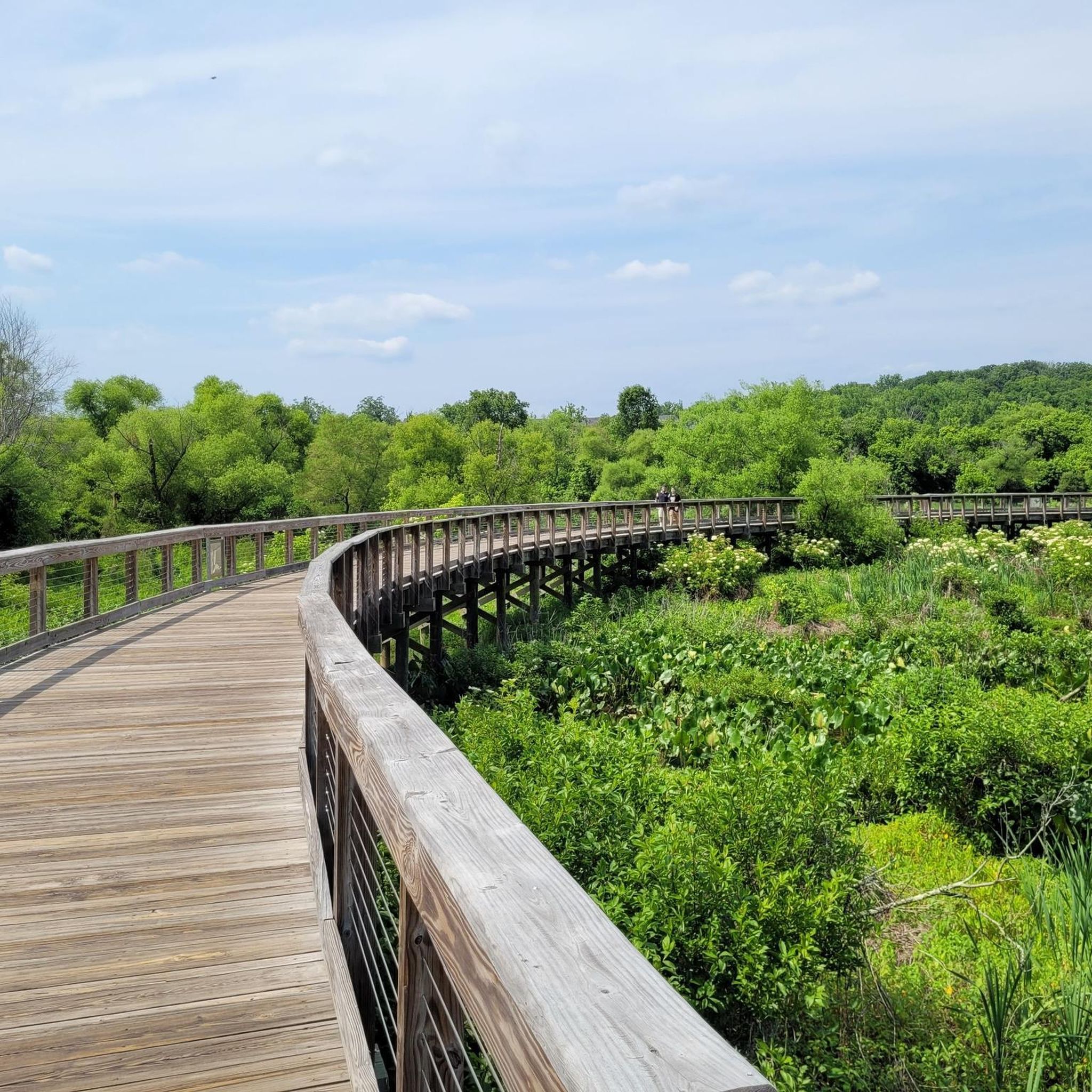
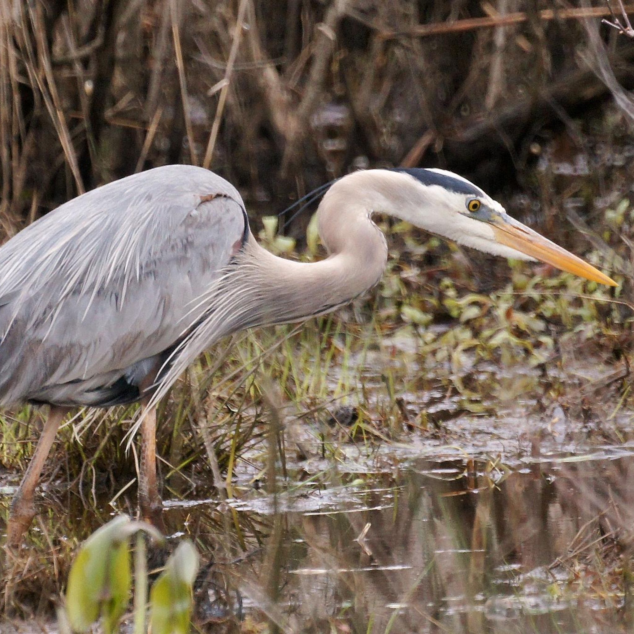
This 10-foot wide elevated boardwalk provides access to the wetlands along the Potomac. In addition to acting as a natural water filter, these wetlands provide important habitat for wildlife, especially bird populations of herons, mallards, wood ducks and more.
0
0

Located where the Potomac and Occoquan rivers meet, this wildlife refuge is a haven for migratory birds looking for a tranquil break away from DC. You'll find over 650 plant species and 200 species of bird here. The park is open from 7am until 5pm in winter and 7am until 7pm.
0
0
This 10-foot wide elevated boardwalk provides access to the wetlands along the Potomac. In addition to acting as a natural water filter, these wetlands provide important habitat for wildlife, especially bird populations of herons, mallards, wood ducks and more.
0
0
Frequently Asked Questions
What kind of terrain can I expect on the jogging routes in Occoquan Bay National Wildlife Refuge?
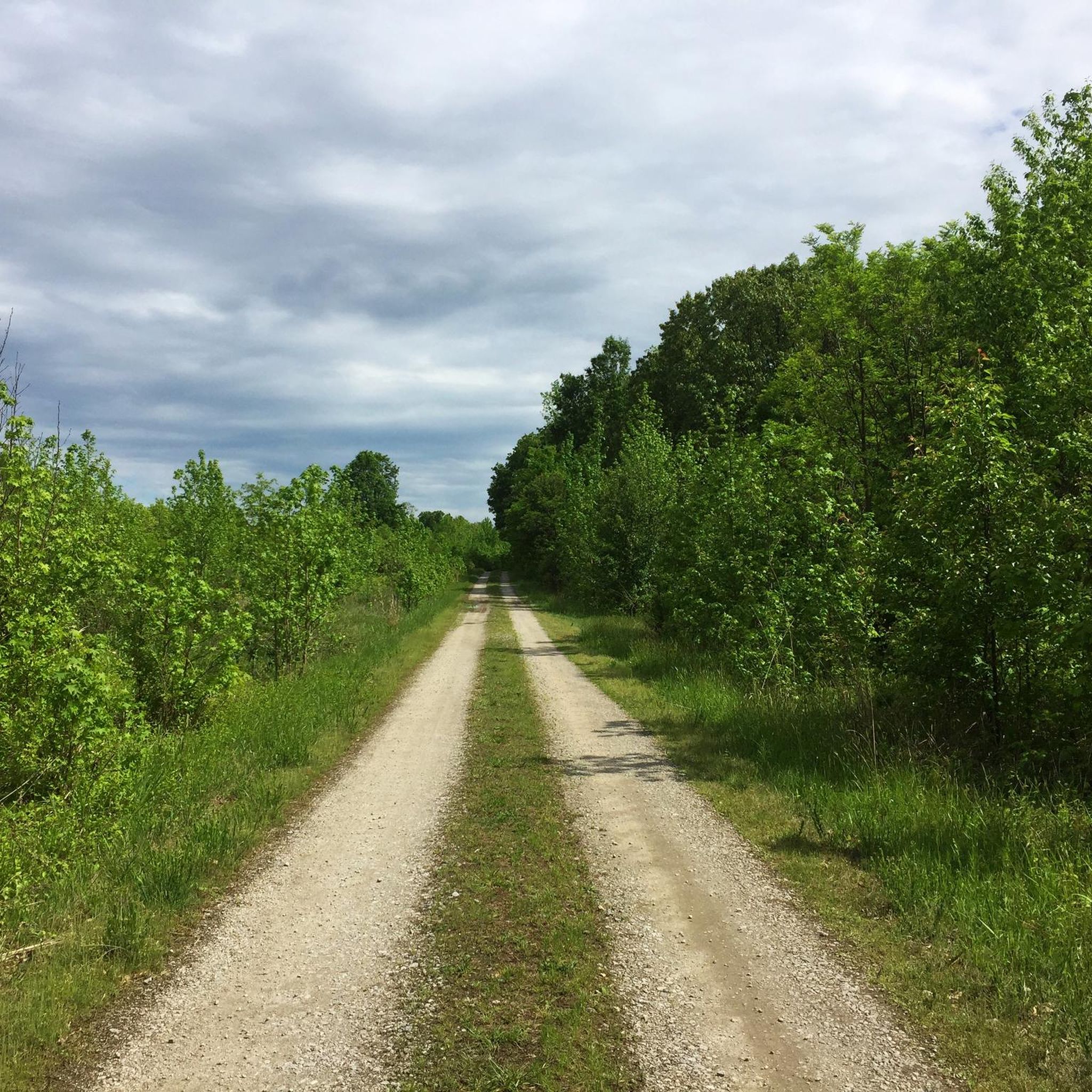
The jogging routes in Occoquan Bay National Wildlife Refuge primarily consist of flat, gravel roads. These paths were once military patrol roads, offering easy navigation through diverse habitats like grasslands, marshes, and forests. The minimal elevation gain makes them suitable for various fitness levels.
Are there any family-friendly running trails in the refuge?
Yes, many of the trails are suitable for families due to their flat, easy terrain. The refuge's approximately four miles of trails, like the Deep Hole Point Road & Charlie Road loop, are generally wide and offer a peaceful environment for all ages to enjoy. The minimal elevation gain ensures a comfortable experience for younger runners or those pushing strollers.
What natural features or wildlife can I observe while jogging in Occoquan Bay National Wildlife Refuge?
While running, you can immerse yourself in the refuge's diverse natural beauty. The area spans 644 acres, featuring wetlands, grasslands, forests, and tidally influenced marshes. It's a significant sanctuary for migratory birds, with over 220 species documented, including Bald Eagles. You might also spot waterfowl, deer, red fox, and raptors, especially in the open grasslands.
Is there an entrance fee to access the jogging trails?
The Region Research does not explicitly state an entrance fee for Occoquan Bay National Wildlife Refuge. However, for the most current information regarding fees or permits, it is always best to check the official U.S. Fish & Wildlife Service website for the refuge: fws.gov/refuge/occoquan-bay/visit-us.
What is the policy regarding dogs on the running trails?
The Region Research and Fan-Out Queries indicate that dog policies are a common concern. While the refuge is a wildlife sanctuary, specific details on dog policies for the running trails are not provided in the available data. It is recommended to check the official refuge website or contact them directly for current regulations regarding pets to ensure a pleasant visit for everyone and to protect the wildlife.
Are there any longer or more challenging running routes available?
Yes, while many trails are easy, there are options for longer runs. For instance, the Neabsco Creek Boardwalk – Neabsco Creek Boardwalk loop from Woodbridge is a more difficult 13.7-mile (22.1 km) path that explores the wider area, including sections along Neabsco Creek. This route offers a greater challenge for experienced runners.
How many jogging routes are available in Occoquan Bay National Wildlife Refuge?
There are over 20 jogging routes available in Occoquan Bay National Wildlife Refuge, catering to various difficulty levels. The komoot community has mapped 24 tours, including 5 easy, 14 moderate, and 5 difficult options.
What do other runners enjoy most about jogging in Occoquan Bay National Wildlife Refuge?
The area is highly rated by the komoot community, with an average score of 4.5 stars from over 4 reviews. Runners often praise the tranquil environment, the diverse habitats, and the opportunities for wildlife observation. The flat, well-maintained gravel roads are also frequently highlighted for their accessibility and ease of navigation.
Are there any circular running routes in the refuge?
Yes, the refuge offers several circular routes. A popular option is the Deep Hole Point Road & Charlie Road loop, which is an easy 3.1-mile run. Another is the Neabsco Creek Boardwalk – Neabsco Creek Boardwalk loop from Featherstone National Wildlife Refuge, a 4.6-mile trail that also forms a loop.
Is parking available at Occoquan Bay National Wildlife Refuge?
Yes, parking is available at the refuge. The former military roads that form the trail network are generally wide and rarely crowded, suggesting ample space. The refuge also offers a two-mile Wildlife Drive, which guides visitors through various habitats and likely includes designated parking areas.
What is the best time of year to go jogging in Occoquan Bay National Wildlife Refuge?
The refuge is suitable for jogging year-round, but spring and fall are particularly rewarding. These seasons offer pleasant temperatures and are significant stopping points for migratory birds, enhancing wildlife viewing opportunities. The diverse landscapes provide unique scenery in every season.
Can I reach Occoquan Bay National Wildlife Refuge using public transportation?
While the Region Research highlights the refuge's location, specific public transportation options are not detailed. For up-to-date information on how to reach the refuge via public transport, it is advisable to consult local transit authorities or the official refuge website: fws.gov/refuge/occoquan-bay/visit-us.
Are there any specific landmarks or points of interest along the running paths?
While there are no specific 'landmarks' in the traditional sense, the refuge itself is a significant point of interest due to its ecological importance. Joggers can enjoy photography blinds and interpretive kiosks along the trails, offering insights into the diverse plant and animal life. The confluence of the Occoquan River and the Potomac also provides scenic views.
Most popular routes in Occoquan Bay National Wildlife Refuge

Get inspired with the komoot mobile app


Explore more
Browse the best Running Trails & Routes in other regions.
