The best walks and hikes in Patapsco Valley State Park Mckeldin Area
4.5
(42)
350
hikers
12
hikes
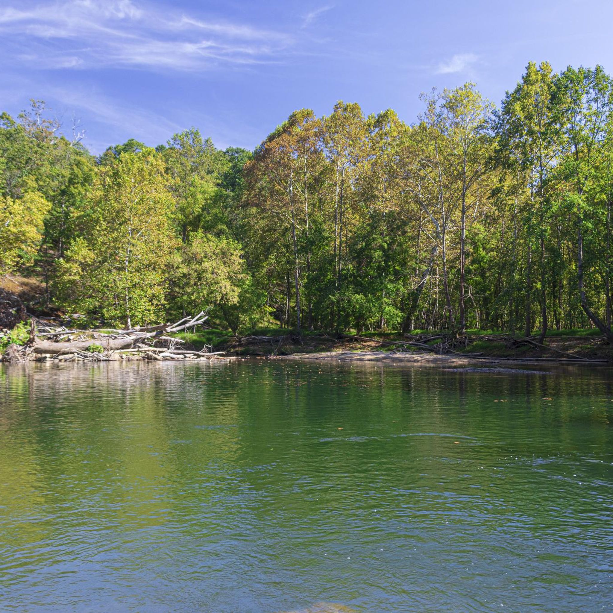
Hiking in Patapsco Valley State Park McKeldin Area offers a diverse network of trails along the Patapsco River, featuring the scenic McKeldin Rapids. The terrain includes varied landscapes such as thick pine groves, hardwood forests, and open fields. Elevations are generally moderate, with some routes incorporating steeper sections. This area provides a range of paths suitable for different hiking abilities.
Best hiking trails in Patapsco Valley State Park Mckeldin Area
- The most popular hiking route is Switchback Trail loop — Patapsco Valley State Park, a 4.3 miles (7.0 km) trail that takes 1 hour 53 minutes to complete. This multi-use path follows the riverside, with a northern section designated for foot-use only.
- Another top favourite among local hikers is McKeldin Rapids & Switchback Trail loop — Patapsco Valley State Park, an easy 1.8 miles (2.9 km) path. This route provides access to the McKeldin Rapids, a key natural attraction.
- Local hikers also love the Plantation Trail loop — Patapsco Valley State Park, a 1.7 miles (2.7 km) trail leading through pine groves and along one of the highest ridges, often completed in about 45 minutes.
- Hiking in Patapsco Valley State Park Mckeldin Area is defined by the Patapsco River, McKeldin Rapids, and diverse ecosystems including pine groves, hardwood forests, and open fields. The network offers options for different ability levels, from easy walks to moderately challenging routes.
- The routes in Patapsco Valley State Park Mckeldin Area are highly rated by the komoot community with an average score of 4.5 stars from over 40 reviews. More than 300 hikers have used komoot to explore Patapsco Valley State Park Mckeldin Area's varied terrain.
Last updated: July 8, 2026
10
hikers
13.4km
03:38
180m
190m
The McKeldin to Woodstock Area Loop offers a dynamic hiking experience within Patapsco Valley State Park, guiding you through a rich tapestry of landscapes. You will traverse riverside paths along the Patapsco River, wind through thick pine groves, and explore mature hardwood forests. Keep an eye out for the scenic McKeldin Rapids and the tranquil Old Quarry Lake, which adds a unique touch to the journey.
This moderate 8.4-mile (13.4 km) loop, with 591 feet (180 metres) of elevation gain, typically takes about 3 hours and 38 minutes. The terrain includes uneven ground, roots, and moderately steep slopes, so good fitness is recommended. While specific parking information is not detailed, arriving early at the trailhead is always a good idea, especially on busy days.
What makes this trail particularly notable is its comprehensive showcase of Patapsco Valley State Park's diverse ecosystems and varied challenge. It combines serene riverine landscapes with dramatic rapids and the tranquility of diverse forests. The broader park area also features historical structures built by the Civilian Conservation Corps (CCC) in the 1930s, adding a layer of historical context to your outdoor adventure.
3
hikers
14.6km
03:55
170m
170m
Embark on the Thru Trail and Switchback Trail Loop for a dynamic hiking experience through the scenic Patapsco Valley State Park. This moderate 9.1-mile (14.6 km) route, with 561 feet (171 metres) of elevation gain, guides you through varied forest terrain, incorporating switchbacks to ease the climbs and offering picturesque views of the Patapsco River. It's a great option for hikers seeking a rewarding journey that takes approximately 3 hours and 55 minutes to complete. You'll find sections of packed dirt, gravel, and some rooty areas underfoot, providing a diverse and engaging path. The trail's design makes it accessible for those looking for a good workout without extreme difficulty.
To make the most of your visit, plan to arrive early, especially on busy days, to secure parking at the trailhead within Patapsco Valley State Park. While the trail is enjoyable in most seasons, milder weather often provides the best conditions for hiking. Remember to bring plenty of water, particularly if you're tackling this nearly four-hour hike during warmer periods. There are no specific permits mentioned, but always check park regulations before you go.
This loop is notable for its clever use of switchbacks, which transform potentially steep ascents into more manageable sections, allowing you to appreciate the natural beauty of the Patapsco Valley. The trail offers a chance to immerse yourself in the forest environment and enjoy the tranquil presence of the Patapsco River, making it a popular route for those exploring the Woodstock Area of the park. It provides a balanced blend of physical activity and scenic reward, making it a solid choice for a half-day adventure.

Sign up for free
1.35km
00:21
10m
10m
Embark on an easy hike along the Liberty Dam Trail, a short and accessible route perfect for a quick escape into nature. You will follow the North Branch of the Patapsco River, enjoying serene landscapes as you make your way towards the impressive Liberty Dam and its tranquil reservoir. This pleasant path covers just 0.8 miles (1.3 km) with a gentle elevation gain of 32 feet (10 metres), making it an ideal choice for a leisurely 20-minute stroll.
When planning your visit, be aware that parking near the trailhead can be limited, so arriving early is a good idea to secure a spot. The trail is both dog-friendly and family-friendly, welcoming everyone to enjoy the outdoors. Remember to pack out everything you bring in, as there are no restrooms or trash cans available along the route. For the best experience, consider hiking between February and November to catch vibrant wildflowers or stunning autumn leaves.
This trail offers a peaceful journey through tree-covered hills, with opportunities to spot local wildlife like various birds and small animals. As you hike, keep an eye out for small "beach fronts" or sandbars that appear along the river. The views of the gently flowing waters leading to the Liberty Dam provide a calming backdrop, making it a notable spot for a refreshing outdoor break within Patapsco Valley State Park.
35
hikers
6.97km
01:53
90m
90m
The McKeldin Switchback Plantation Loop offers a delightful mix of scenery within Patapsco Valley State Park, making it a fantastic option for an easy hike. You'll wander through shaded woodlands, open fields, and even distinct pine groves, all while enjoying glimpses of the Patapsco River and the notable McKeldin Rapids. This 4.3-mile (7.0 km) route features a gentle 304 feet (93 metres) of elevation gain and typically takes around 1 hour and 52 minutes to complete, providing a rewarding experience without being overly strenuous.
When planning your visit, be aware that this is a multi-use trail, so you might encounter mountain bikers and equestrians on certain sections. The McKeldin Area itself provides amenities like picnic pavilions, making it easy to extend your day. It's wise to bring a navigation app or map, as some parts of the trail might not have clear signage, especially at junctions.
This loop is a great way to experience the diverse ecosystems of the Patapsco Valley, home to wildlife like white-tail deer and various bird species. It blends natural beauty with recreational opportunities, offering a peaceful escape that's accessible to most. During late fall and winter, you might even catch a scenic view at the Liberty Dam Overlook, adding another layer to your exploration.
5.0
(1)
2
hikers
2.94km
00:47
30m
30m
The McKeldin Rapids and Switchback Trail Loop offers a delightful journey through varied landscapes, from thick pine groves and hardwood forests to open fields, all while tracing the scenic Patapsco River. You'll encounter impressive rock outcrops and palisades, with the highlight being the cascading McKeldin Falls where the river flows into a deep pool. This route provides a constantly changing backdrop, making it feel like a true escape into nature.
This easy 1.8-mile (2.9 km) hiking route involves a gentle 88 feet (27 metres) of elevation gain and typically takes around 46 minutes to complete. While mostly well-maintained, be prepared for some uneven and rocky sections, particularly on the Rapids Trail, which includes a sheer rock face that needs careful navigation. It's a great option for beginners or families looking for a quick, rewarding outdoor experience without a strenuous climb.
Beyond its natural beauty, the McKeldin Area of Patapsco Valley State Park holds historical significance, with many structures built by the Civilian Conservation Corps in the 1930s. The Switchback Trail is also multi-use, shared with mountain bikers and horseback riders, adding to the dynamic feel of the park. Keep an eye out for wildlife like deer as you explore this diverse ecosystem.
Get access to more routes and recommendations from other explorers.
Sign up for free
Already have an account?
Our route recommendations are based on thousands of hikes, rides, and runs completed by other people on komoot.
Start today with a free account
Your next adventure awaits.
Login or Signup



Tips from the Community

The lake is small and fully encircled by the trail. The wall of the quarry stands high on the far side from the viewpoint. In the summer the vegetation crowding the water makes it feel like quite the lush watering hole.
0
0

As part of the Patapsco Valley State Park, the Woodstock Area is characterized by its scenic woodlands and riverbanks along the trails. While exploring the area you can enjoy a peaceful retreat.
0
0
As part of the Patapsco Valley State Park, the Woodstock Area is characterized by its scenic woodlands and riverbanks along the hiking trails. While hiking through the area, nature enthusiasts can enjoy a peaceful retreat.
0
0

The Patapsco River is a 39-mile river that flows into the Chesapeake Bay, notably running through the city of Baltimore.
0
0
The Patapsco River is a 39-mile river that flows into the Chesapeake Bay, notably running through the city of Baltimore.
0
0
The North Branch Patapsco River is a 20-mile tributary to the larger Patapsco River.
0
0

Embark on the riverside trail, starting from the park's hilltop near the entrance. Whether you're a hiker, mountain biker, or equestrian, this scenic route caters to all. In late fall and winter, savor the picturesque Liberty Dam Overlook.
0
0
This abandoned Chevrolet lying next to the trail in the middle of the forest is the namesake for this trail.
0
0
Frequently Asked Questions
How many hiking trails are available in Patapsco Valley State Park McKeldin Area?
The Patapsco Valley State Park McKeldin Area offers nearly 40 hiking routes. These trails vary in length and difficulty, providing options for different abilities, from easy walks to moderately challenging routes.
What kind of natural features can I expect to see while hiking in the McKeldin Area?
Hikers can enjoy diverse landscapes including thick pine groves, hardwood forests, and open fields. A major highlight is the McKeldin Falls, where cascading water flows into a deep pool. You'll also find the Patapsco River, including the picturesque confluence of its North and South Branches, and impressive tulip poplar trees along paths like the Tall Poplar Trail.
Are there any family-friendly hiking options in Patapsco Valley State Park McKeldin Area?
Yes, the McKeldin Area is well-suited for families. Many trails are considered easy, and the park offers amenities like picnic areas, barbecue stations, and playgrounds. An easy option is the McKeldin Rapids & Switchback Trail loop, which is about 2.9 km long and provides access to the scenic rapids.
Are dogs allowed on the trails in Patapsco Valley State Park McKeldin Area?
Yes, the McKeldin Area is generally dog-friendly. Many trails are multi-use, allowing dogs on leash. The Switchback Trail loop is a popular multi-use path that follows the riverside, perfect for walks with your canine companion.
What are the difficulty levels of the trails in this area?
The trails in Patapsco Valley State Park McKeldin Area cater to various skill levels. Out of nearly 40 routes, 24 are rated as easy, 14 as moderate, and 1 as difficult. This ensures there's a suitable path whether you're looking for a leisurely stroll or a more challenging hike.
Are there any circular routes available for hiking?
Yes, many trails in the McKeldin Area are designed as loops, offering convenient circular routes. Examples include the Plantation Trail loop, which takes you through pine groves and along a ridge, and the Spring Glen & Tall Poplar Trails loop.
What is the best time of year to go hiking in the McKeldin Area?
The McKeldin Area offers enjoyable hiking experiences throughout the year. Spring brings lush greenery, while autumn showcases vibrant fall foliage. Summer is popular for riverside activities, and even winter can be beautiful with snow-covered landscapes, though some trails might be slick. Always check local conditions before heading out.
What kind of wildlife might I encounter on the trails?
Visitors might spot various wildlife, including deer. The rocky areas near the McKeldin Rapids are also known basking spots for several snake species, such as the northern water snake and occasionally the venomous copperhead, so it's advisable to be observant.
Are there any viewpoints or overlooks in the Patapsco Valley State Park McKeldin Area?
Yes, hikers can access an overlook that provides scenic views of Liberty Dam, which forms the Liberty Reservoir. This reservoir is a crucial drinking water source for Baltimore and offers a picturesque vista.
What do other hikers enjoy most about hiking in Patapsco Valley State Park McKeldin Area?
The area is highly rated by the komoot community, with an average score of 4.5 stars from over 40 reviews. Reviewers often praise the diverse network of trails, the scenic beauty of the Patapsco River and McKeldin Rapids, and the varied landscapes including pine groves and hardwood forests.
Is there parking available at Patapsco Valley State Park McKeldin Area?
Yes, the McKeldin Area of Patapsco Valley State Park provides designated parking facilities for visitors. It is always recommended to arrive early during peak seasons or weekends to secure a spot.
Are there any short, easy trails for a quick walk?
For a quick and easy walk, the Medicine Tree Trail loop is an excellent choice. It's approximately 0.7 km long and provides quick access to the McKeldin Rapids, making it ideal for a short outing.
Most popular routes in Patapsco Valley State Park Mckeldin Area
Most popular attractions in Patapsco Valley State Park Mckeldin Area

Get inspired with the komoot mobile app


Explore more
Browse the best Hikes in other regions.
