The best road cycling routes in Dufresne Recreation Area
2.0
(2)
93
riders
27
rides
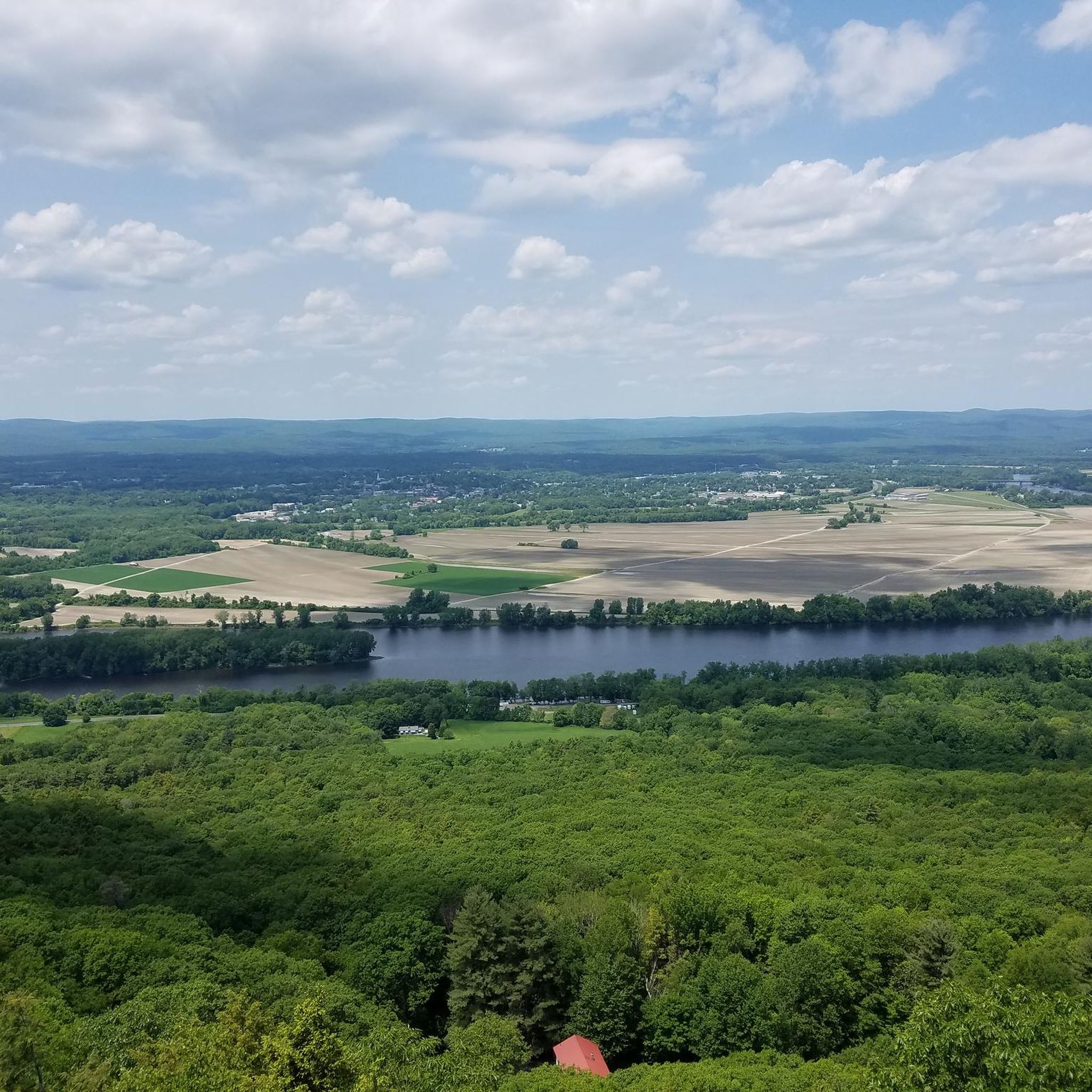
Road cycling routes in Dufresne Recreation Area are situated within the scenic Pioneer Valley, characterized by rolling hills, farmlands, and quiet country roads. The area features wooded paths and open fields, with Dufresne Pond and Ingraham Brook adding to the natural beauty. While the recreation area itself offers multi-use trails, the surrounding Granby region provides a network of roads and potential connections to paved rail trails suitable for road cycling. Routes often feature views of the Holyoke Range and picturesque…
Last updated: June 29, 2026
3
riders
47.5km
02:08
390m
390m
Moderate road ride. Good fitness required. Mostly well-paved surfaces and easy to ride.
4
riders
Easy road ride. Great for any fitness level. Mostly well-paved surfaces and easy to ride.

Sign up for free
5
riders
30.1km
01:23
300m
300m
Easy road ride. Great for any fitness level. Mostly well-paved surfaces and easy to ride.
6
riders
31.1km
01:27
260m
260m
Easy road ride. Great for any fitness level. Mostly well-paved surfaces and easy to ride.
3
riders
Easy road ride. Great for any fitness level. Mostly well-paved surfaces and easy to ride.
Get access to more routes and recommendations from other explorers.
Sign up for free
Already have an account?
Our route recommendations are based on thousands of hikes, rides, and runs completed by other people on komoot.
Start today with a free account
Your next adventure awaits.
Login or Signup
Popular around Dufresne Recreation Area



Tips from the Community

great paved foot/cycle path.
0
0


With forests, brooks, swamps, meadows, and wetlands, the Topping Farm Conservation Area really is a haven for the plants and animals that call the property their home. A few different paved roads wind around the area and offer views of the nature preserve from the roadside.
0
0

This section of the rail trail, from the top of the hill in Amherst to the end of the trail in Belchertown, includes this crossing of the fort river and goes through a lot of beautiful wetlands
0
0
This bridge along the Norwottuck Rail Trail crosses the Fort River and offers great views of the waterway.
0
0
With forests, brooks, swamps, meadows, and wetlands, the Topping Farm Conservation Area really is a haven for the plants and animals that call the property their home. A few different paved roads wind around the area and offer views of the nature preserve from the roadside.
0
0

The Norwottuck Rail Trail is a part of an extensive network of connecting multi-use paths connecting the towns of Amherst, Belchertown, Easthampton, Florence, Hadley, Southampton, and Williamsburg. This section of Norwottuck Rail Trail is the southernmost section in South Amherst where it ends at Warren Wright Road. This is a great section of trail where you pass through pine and oak forests, wetlands, and can glimpse some of the local mountains through the trees. You might also catch a glance at a train that runs on an adjacent railroad.
0
0

This 3,000-acre park showcases 7 miles of mountain ridge line and encompasses a diverse range of terrains. It provides an excellent experience for hikers, mountain bikers, snowmobilers, and cross-country skiers. Scattered throughout the park, there are several scenic viewpoints to take advantage of.
0
0
Frequently Asked Questions
How many road cycling routes are available in Dufresne Recreation Area?
There are over 25 road cycling routes available in and around the Dufresne Recreation Area on komoot, offering a variety of options for different skill levels. These routes explore the scenic Pioneer Valley, characterized by rolling hills and quiet country roads.
What kind of terrain can I expect on road cycling routes in Dufresne Recreation Area?
Road cycling routes in this area feature a mix of rolling hills, farmlands, and quiet country roads. While Dufresne Recreation Area itself has multi-use trails, the surrounding Granby region provides paved roads suitable for road cycling. You can expect scenic views, including glimpses of the Holyoke Range.
Are there easy road cycling routes suitable for beginners?
Yes, the area offers several easy road cycling routes. For example, the Fort River Bridge – Topping Farm Conservation Area loop from Batchelor Brook Area is an easy 25.5-mile path that winds through natural areas and highlights river crossings. Another easy option is the Mount Holyoke Range State Park loop from Batchelor Brook Area, which is 18.7 miles long.
Are there any challenging road cycling routes with significant elevation gains?
While the area is known for rolling hills, routes generally fall into easy to moderate difficulty. The Caffeine Coffee Shop loop from Granby is a moderate 29.5-mile route with an elevation gain of approximately 391 meters, offering a good workout while exploring the local road network.
What natural features or landmarks can I see along the road cycling routes?
Many routes offer views of the picturesque Holyoke Range. The region is known for its scenic beauty, including farmlands, quiet country roads, and potential glimpses of waterfalls and old mills. Within Dufresne Recreation Area itself, Dufresne Pond and Ingraham Brook are central to the natural landscape.
Are there any rail trails accessible for road cycling near Dufresne Recreation Area?
Yes, the broader Pioneer Valley region, where Granby is located, is strategically positioned to connect to a growing network of paved rail trails. There are initiatives to connect Granby to the Norwottuck Rail Trail network, which would provide car-free alternatives for road cyclists. Other regional paved rail trails like the Blackstone River Bikeway and the Ashuwillticook Rail Trail are also accessible within a short distance.
What is the best time of year for road biking in Dufresne Recreation Area?
The region is particularly stunning in the fall when the leaves change colors, offering beautiful scenery for road cycling. Spring and summer also provide pleasant conditions, though summer can be warm. Winter conditions may make some routes challenging due to snow and ice.
Are there cafes or places to stop for refreshments along the routes?
The Caffeine Coffee Shop loop from Granby specifically highlights local amenities, suggesting that cafes and other refreshment stops are available in Granby and surrounding towns. The Pioneer Valley region generally offers various small towns with local establishments.
Is parking available for road cyclists visiting Dufresne Recreation Area?
While specific parking for road cycling routes isn't detailed, Dufresne Recreation Area itself has parking facilities for visitors accessing its trails. For routes starting from specific towns like Granby or Batchelor Brook Area, public parking options are typically available within those communities.
What do other road cyclists enjoy most about road cycling in Dufresne Recreation Area?
The komoot community rates the road cycling experience in Dufresne Recreation Area with an average score of 2.0 stars. Cyclists often appreciate the varied terrain, which includes rolling hills and quiet country roads, and the scenic views of the Holyoke Range and surrounding farmlands.
Are there any long-distance road cycling routes in the area?
Yes, you can find routes that offer a good distance. For instance, the Caffeine Coffee Shop loop from Granby is nearly 30 miles (47.5 km) long, providing a substantial ride through the local road network.
Can I connect to other cycling networks from Dufresne Recreation Area?
The region is actively working on expanding its cycling infrastructure. There's a potential initiative to connect Granby to the Five College Bikeway and the wider Norwottuck Rail Trail network, which would significantly enhance connectivity to car-free paved trails for road cyclists.
Most popular routes in Dufresne Recreation Area

Get inspired with the komoot mobile app


Explore more
Browse the best Road cycling routes in other regions.
