The best running trails in Maxwell Mays Wildlife Refuge
1.0
(1)
13
runners
10
runs
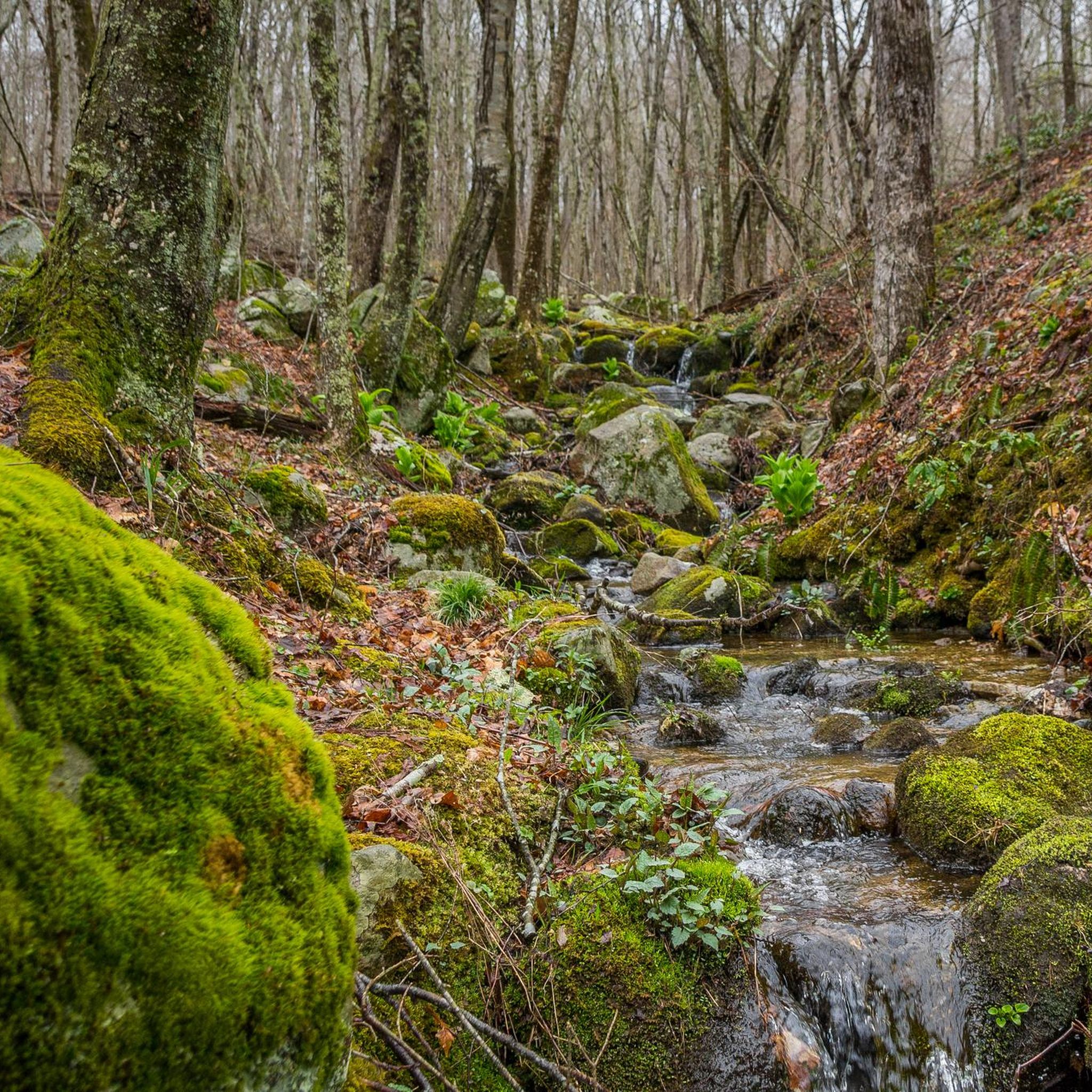
Jogging in Maxwell Mays Wildlife Refuge offers diverse landscapes across its 295 acres, featuring upland forests, serene wetlands, and open meadows. The terrain includes a rolling landscape with some varied elevations, providing engaging paths for runners. Carr Pond, an 11-acre body of water, serves as a central feature, with trails often leading along its edges. Mature, closed-canopy forests provide shaded routes and a sense of immersion in nature.
Best jogging routes in Maxwell Mays Wildlife Refuge
- The most popular jogging…
Last updated: May 17, 2026
4
runners
10.2km
01:06
160m
160m
Moderate run. Good fitness required. Mostly paved surfaces. Suitable for all skill levels.
1
runners
6.71km
00:49
60m
60m
Moderate run. Good fitness required. Mostly paved surfaces. Suitable for all skill levels.

Sign up for free
1
runners
31.0km
03:14
140m
140m
Hard run. Very good fitness required. Mostly accessible paths. Some sure footedness required.
6.17km
00:44
40m
40m
Moderate run. Good fitness required. Mostly paved surfaces. Suitable for all skill levels.
5.69km
00:40
40m
40m
Moderate run. Good fitness required. Mostly paved surfaces. Suitable for all skill levels.
Get access to more routes and recommendations from other explorers.
Sign up for free
Already have an account?
Our route recommendations are based on thousands of hikes, rides, and runs completed by other people on komoot.
Start today with a free account
Your next adventure awaits.
Login or Signup



Tips from the Community

The Washington Secondary Rail Trail totals over 19 miles in one direction and is paved the entire way (apart from some of the bridge crossings). The trail passes through neighborhoods, business districts, and parks on its way from town to town. This particular section encompasses the miles between Anthony and West Warwick. The pavement is smooth and well-kept the whole time, so this is a great spot for beginners.
0
0
This truss bridge carries you over the Pawtuxet River on the Washington Secondary Rail Trail. The bridge also offers views of the river off both sides.
0
0
Tillinghast Pond is a small reservoir that serves as the centerpiece of the Tillinghast Pond Management Area. There are multiple trails that leave from the southern end of the pond, and one path even circles around the banks of the water.
0
0
Tillinghast Pond is a small reservoir that serves as the centerpiece of the Tillinghast Pond Management Area. There are multiple trails that leave from the southern end of the pond, and one path even circles around the banks of the water.
0
0

Wickaboxet Management Area is a 678-acre patch of forest and wetlands that was founded in 1932.
0
0
The George B. Parker Woodland Wildlife Refuge is home to trails that pass through the forest on historic carriage roads that are now great double-track trails for trail runs. The paths are lined with rock formations and year round streams that make this refuge feel like a distant wilderness.
0
0
The Washington Secondary Rail Trail totals over 19 miles in one direction and is paved every step of the way (apart from some of the bridge crossings). The trail passes through neighborhoods, business districts, and parks on its way from town to town. This particular section encompasses the miles between Anthony and West Warwick.
0
0
This truss bridge carries you over the Pawtuxet River on the Washington Secondary Rail Trail. The bridge also offers views of the river off boths sides.
0
0
Frequently Asked Questions
How many running routes are available in Maxwell Mays Wildlife Refuge?
Maxwell Mays Wildlife Refuge offers a selection of over 10 dedicated running routes. These paths cater to various fitness levels, ranging from easy loops to more challenging long-distance trails, ensuring a diverse experience for every runner.
What kind of terrain can I expect on the jogging trails?
The refuge features a diverse and engaging terrain. You'll encounter upland forests, serene wetlands, and open meadows. The landscape is rolling with some varied elevations, providing a good workout and constantly changing scenery. Trails often lead along the picturesque Carr Pond and through mature, closed-canopy forests.
Are there any easy or beginner-friendly running routes?
Yes, Maxwell Mays Wildlife Refuge has several routes suitable for beginners or those looking for an easier run. Approximately 3 of the available routes are classified as easy, offering gentle paths through the refuge's beautiful natural settings. You can find options for shorter loops that take about 45 minutes to an hour to complete.
Can I bring my dog on the running trails?
While the refuge aims to protect its fragile ecology, pets are generally not permitted on the trails. However, service dogs are welcome. It's always a good idea to check the latest regulations before your visit.
What are some notable natural features or sights I might see while jogging?
While running, you can enjoy a variety of natural features. The 11-acre Carr Pond is a central highlight, offering tranquil water views. You'll also pass through mature forests, open meadows, and wetlands. Keep an eye out for wildlife such as deer, fox, coyote, and various bird species like Wild Turkey and Eastern Bluebird, which thrive in these diverse habitats. Hammitt Hill, the 22nd highest peak in Rhode Island, is also part of the trail system.
Is there parking available at Maxwell Mays Wildlife Refuge?
Yes, parking is available at the trailhead of Maxwell Mays Wildlife Refuge. Visitors can find trail maps and brochures there to help plan their run.
What do other runners enjoy most about the trails in Maxwell Mays Wildlife Refuge?
The running routes in Maxwell Mays Wildlife Refuge are highly rated by the komoot community, with an average score of 1.0 from 1 review. Runners often praise the peaceful natural environment, the well-maintained and clearly blazed trails, and the diverse landscapes that make for an engaging and refreshing run.
Are there any longer or more challenging running options?
Absolutely. For those seeking a longer or more challenging run, routes like the Washington Secondary Rail Trail offer a significant distance of 19.3 miles (31.0 km), typically taking over 3 hours to complete. Other moderate options include the George B. Parker Woodland Wildlife Refuge loop (6.4 miles) and the Wickaboxet Loop Trail (4.2 miles), which provide varied terrain and elevation changes.
Are there any circular running routes in the refuge?
Yes, many of the trails in Maxwell Mays Wildlife Refuge are designed as loops, offering convenient circular running experiences. For example, the Wickaboxet Loop Trail and the Tillinghast Pond and Coney Brook Loop are popular choices for runners who prefer to start and end at the same point without retracing their steps.
What are the operating hours for the refuge?
Maxwell Mays Wildlife Refuge is open from sunrise to sunset, allowing ample time for morning, afternoon, or evening runs. Please plan your visit accordingly to ensure you complete your run before closing.
Is public transportation available to reach Maxwell Mays Wildlife Refuge?
The region research does not indicate direct public transportation options to Maxwell Mays Wildlife Refuge. Visitors typically access the refuge by car, utilizing the available trailhead parking.
Are there any interpretive trails for learning about the local ecology?
Yes, the Maxwell Mays Interpretive Trail features seven investigative sites marked by numbered posts. This allows runners and walkers to learn about the local ecology and natural history of the refuge as they explore the paths.
Most popular routes in Maxwell Mays Wildlife Refuge

Get inspired with the komoot mobile app


Explore more
Browse the best Running Trails & Routes in other regions.
