The best walks and hikes in Refugio De Vida Silvestre Y Bosque De Proteccion Pasochoa
4.9
(11)
174
hikers
4
hikes
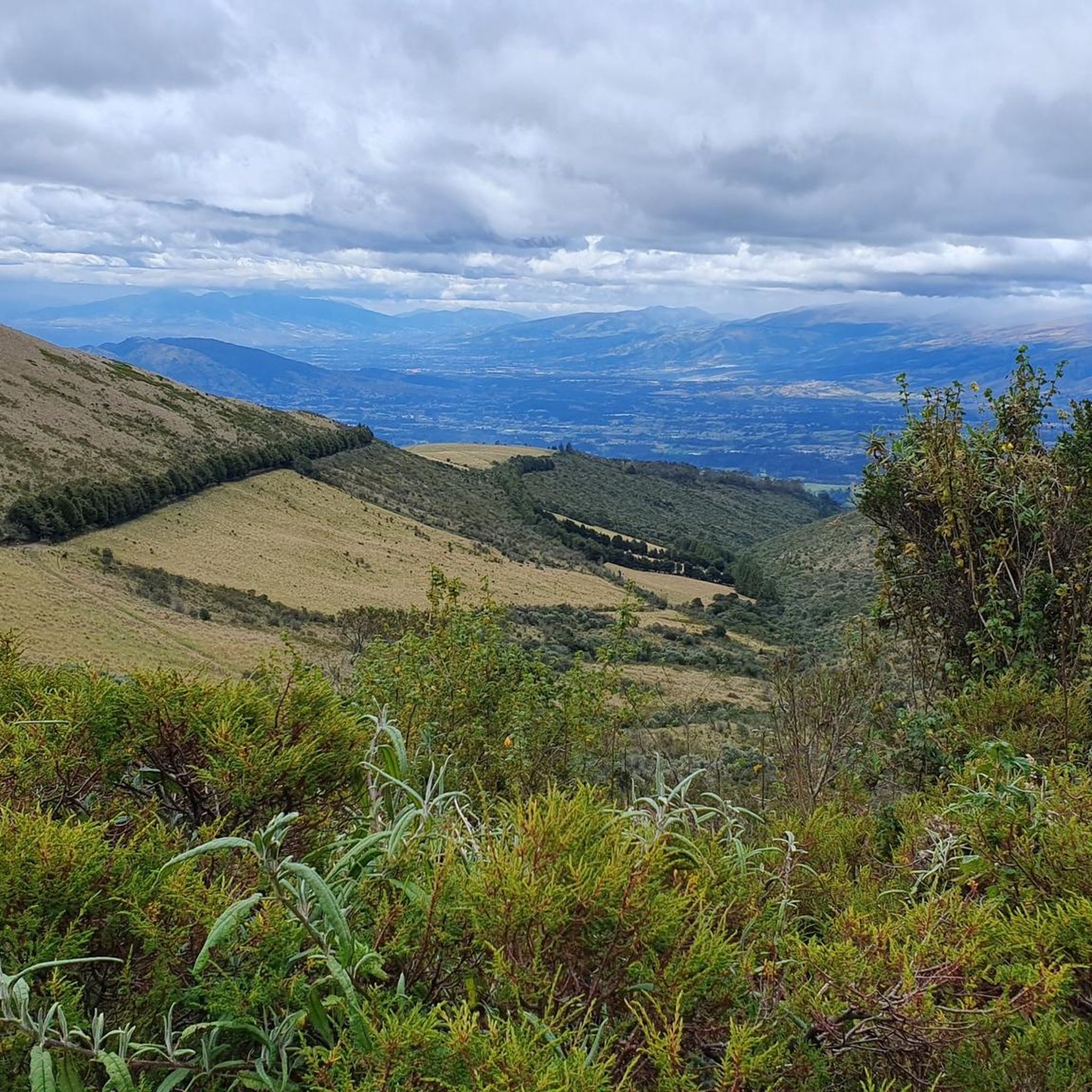
Hiking in Refugio De Vida Silvestre Y Bosque De Proteccion Pasochoa offers routes through a unique landscape within the caldera of an extinct volcano. The terrain features a preserved cloud forest that transitions into paramo at higher elevations, providing diverse natural features. Hikers can explore lush Andean forests, characterized by moss-draped trees and rich biodiversity, while ascending towards panoramic viewpoints of surrounding Andean peaks. The area's elevation ranges from cloud forest to shrub paramo, presenting varied conditions for different hiking…
Last updated: July 2, 2026
5.0
(4)
15
hikers
Moderate hike. Good fitness required. Easily-accessible paths. Suitable for all skill levels.
4.8
(4)
49
hikers
7.95km
02:57
530m
530m
Moderate hike. Good fitness required. Easily-accessible paths. Suitable for all skill levels.

Sign up for free
51
hikers
14.6km
05:03
810m
810m
Hard hike. Very good fitness required. Easily-accessible paths. Suitable for all skill levels.
5
hikers
3.96km
01:10
110m
110m
Easy hike. Great for any fitness level. Easily-accessible paths. Suitable for all skill levels.
5
hikers
4.36km
01:20
150m
150m
Easy hike. Great for any fitness level. Easily-accessible paths. Suitable for all skill levels.
Our route recommendations are based on thousands of hikes, rides, and runs completed by other people on komoot.
Start today with a free account
Your next adventure awaits.
Login or Signup
Popular around Refugio De Vida Silvestre Y Bosque De Proteccion Pasochoa
Frequently Asked Questions
What kind of hiking trails can I expect in Refugio De Vida Silvestre Y Bosque De Proteccion Pasochoa?
Refugio De Vida Silvestre Y Bosque De Proteccion Pasochoa offers a diverse range of trails, from easy, self-guided paths to challenging summit treks. You'll find routes that wind through pristine Andean cloud forests, characterized by moss-draped trees, and others that ascend to higher elevations, transitioning into shrub paramo and grasslands. The area provides options for various fitness levels, including 3 moderate and 1 difficult trail documented on komoot, alongside other marked paths within the refuge.
Are there any easy or family-friendly hiking options in Pasochoa?
Yes, Pasochoa offers several easy trails suitable for families. For instance, the Water System Trail – Columbo Swing loop from Hacienda Porvenir is an easy 4 km path, and the Water System Trail loop from Hacienda Porvenir is another easy 3.5 km option. The refuge also features a 900-meter Hummingbird trail, ideal for a gentle introduction to the cloud forest environment.
Can I hike to the summit of Pasochoa Volcano?
Yes, for experienced hikers, there are challenging routes that lead to the summit of Pasochoa Volcano, which reaches approximately 4,200 meters (13,800 feet). These treks offer expansive panoramic views of surrounding Andean peaks like Cotopaxi and Antisana on clear days. A notable route is the Pasochoa Volcano summit loop from Hacienda San Francisco de Pasochoa, a moderate 7.9 km path. Another option is the more difficult Paperbark Tree Forest – Summit of Pasochoa Volcano loop from Rumipamba, a 14.5 km trail.
What kind of wildlife can I expect to see while hiking in Pasochoa?
Pasochoa is a haven for biodiversity, especially for birdwatchers. Over 100 bird species have been recorded, including 14 types of hummingbirds, tanagers, falcons, and even some of Ecuador's last wild condors. While larger mammals are shy, you might spot white-tailed deer, Andean foxes, or skunks. The lush cloud forest also boasts approximately 232 plant species, including 23 varieties of orchids and 52 medicinal plants.
Are there any circular hiking routes available in the refuge?
Yes, several trails in Pasochoa are designed as loops, allowing you to start and end at the same point. Examples include the popular Pasochoa Trails – Palma de Cera Trail loop from Pasochoa Ecological Reserve - Entrance & Checkpoint, a moderate 7.5 km route through the cloud forest, and the Pasochoa Volcano summit loop from Hacienda San Francisco de Pasochoa.
Is Pasochoa a good place for altitude acclimatization?
Yes, hiking in Pasochoa is frequently recommended as an excellent way to acclimatize to the higher altitudes of the Andes. Its summit, at around 4,200 meters, offers a less technical and strenuous climb compared to other major volcanoes, making it an ideal preparatory hike for more challenging ascents in the region.
What are the notable natural features or viewpoints in Pasochoa?
The refuge itself is nestled within the caldera of an extinct volcano, preserving a vibrant cloud forest. Hiking to the summit provides expansive panoramic views of surrounding Andean peaks like Cotopaxi, Antisana, and Ilinizas. The pristine Andean forest, with its moss-draped trees, is a significant natural feature, often described as a 'living, breathing green cathedral.' As you ascend, the landscape transitions to paramo, offering another layer of ecological diversity.
What do other hikers enjoy most about hiking in Refugio De Vida Silvestre Y Bosque De Proteccion Pasochoa?
The area is highly rated by the komoot community, with an average score of 4.8 stars from over 14 reviews. Hikers often praise the immersive experience of the pristine Andean cloud forest, the rich biodiversity, and the rewarding panoramic views from the summit. Many appreciate the variety of trails catering to different skill levels and its suitability for altitude acclimatization.
Are there any facilities available for visitors at the refuge?
Yes, Refugio De Vida Silvestre Y Bosque De Proteccion Pasochoa provides essential facilities for visitors. These include an Environmental Education Centre, designated camping areas, picnic spots, and restrooms, ensuring a comfortable visit for hikers and nature enthusiasts.
Is there an entrance fee or permit required to hike in Pasochoa?
Yes, there is typically an entrance fee to access Refugio De Vida Silvestre Y Bosque De Proteccion Pasochoa, as it is a protected area. Specific permit requirements for certain trails or activities might also apply. It is advisable to check the official refuge website or contact them directly for the most current information on fees and any necessary permits before your visit.
Can I bring my dog on the hiking trails in Pasochoa?
The policy regarding dogs in Refugio De Vida Silvestre Y Bosque De Proteccion Pasochoa can vary as it is a protected wildlife refuge. While some protected areas allow dogs on leash, others restrict them to protect native wildlife. It is best to confirm the current regulations directly with the refuge administration before planning your visit with a pet.
How accessible is Refugio De Vida Silvestre Y Bosque De Proteccion Pasochoa by public transport?
Refugio De Vida Silvestre Y Bosque De Proteccion Pasochoa is situated about 22 kilometers southeast of Quito. While it is generally accessible, direct public transport options might be limited. Visitors often reach the refuge by private vehicle, taxi, or by arranging transport from nearby towns. It's recommended to research local bus routes to the closest towns and then consider a taxi for the final leg to the refuge entrance.
Most popular routes in Refugio De Vida Silvestre Y Bosque De Proteccion Pasochoa

Get inspired with the komoot mobile app


Explore more
Browse the best Hikes in other regions.
