The best road cycling routes in Ecoparque Cerro De Las Tres Cruces
5.0
(36)
685
riders
8
rides
Road cycling in Ecoparque Cerro De Las Tres Cruces offers routes with challenging ascents and panoramic views of Cali. This area, part of the Andes mountain range in Colombia, features significant elevation gains on its routes. The terrain includes both paved and unpaved sections, with some gradients reaching 8-10%. Efforts are underway to enhance forest cover, contributing to the natural environment.
Best road cycling routes in Ecoparque Cerro De Las Tres Cruces
- The most popular road cycling route is Puente…
Last updated: July 11, 2026
5.0
(5)
35
riders
52.2km
02:17
240m
240m
Moderate road ride. Good fitness required. Mostly well-paved surfaces and easy to ride.
5.0
(3)
123
riders
63.5km
03:56
1,630m
1,630m
Hard road ride. Very good fitness required. Mostly well-paved surfaces and easy to ride.

Sign up for free
5.0
(1)
5
riders
62.7km
02:34
170m
170m
Moderate road ride. Good fitness required. Mostly well-paved surfaces and easy to ride.
5.0
(5)
141
riders
91.7km
03:40
140m
140m
Moderate road ride. Good fitness required. Mostly well-paved surfaces and easy to ride.
4
riders
56.7km
03:48
1,400m
1,400m
Hard road ride. Very good fitness required. Some segments of this route may be unpaved and difficult to ride.
Get access to more routes and recommendations from other explorers.
Sign up for free
Already have an account?
Our route recommendations are based on thousands of hikes, rides, and runs completed by other people on komoot.
Start today with a free account
Your next adventure awaits.
Login or Signup
Popular around Ecoparque Cerro De Las Tres Cruces

Tips from the Community

It is a municipality of Colombia located in the department of Valle del Cauca. The Municipality is known culturally, touristically and economically because the Hacienda El Paraíso is located in its jurisdiction, the place where the events of the novel María, a masterpiece by Valle del Cauca writer Jorge Isaacs, took place. Part of its territory also belongs to the Las Hermosas National Natural Park. It is located to the east of Cali, the capital of the department, about 47 km away.
0
0

Frequently Asked Questions
What kind of terrain can I expect on road cycling routes in Ecoparque Cerro De Las Tres Cruces?
Road cycling routes in Ecoparque Cerro De Las Tres Cruces feature a mix of paved and unpaved sections. You'll encounter challenging ascents with gradients sometimes reaching 8-10%, characteristic of the Andes mountain range terrain.
Are there routes suitable for experienced road cyclists seeking a challenge?
Yes, the Ecoparque offers several challenging routes. For instance, the Buenaventura Km 18 loop from Cali is a difficult 39.5-mile (63.5 km) path with a significant elevation gain of over 5300 feet (1630 meters), making it a demanding ride for advanced cyclists. Another difficult option is the El Templete Church loop from Estadio Olímpico Pascual Guerrero, covering 35.2 miles (56.6 km) with over 4500 feet (1400 meters) of elevation gain.
What are the typical elevation gains on road cycling routes in this area?
Elevation gains vary significantly across routes. While some moderate routes like the Puente Rojo loop from Comuna 1 have around 790 feet (240 meters) of ascent, more difficult routes can feature over 5300 feet (1630 meters) of elevation gain, such as the Buenaventura Km 18 loop from Cali.
What natural features or views can I expect to see while cycling?
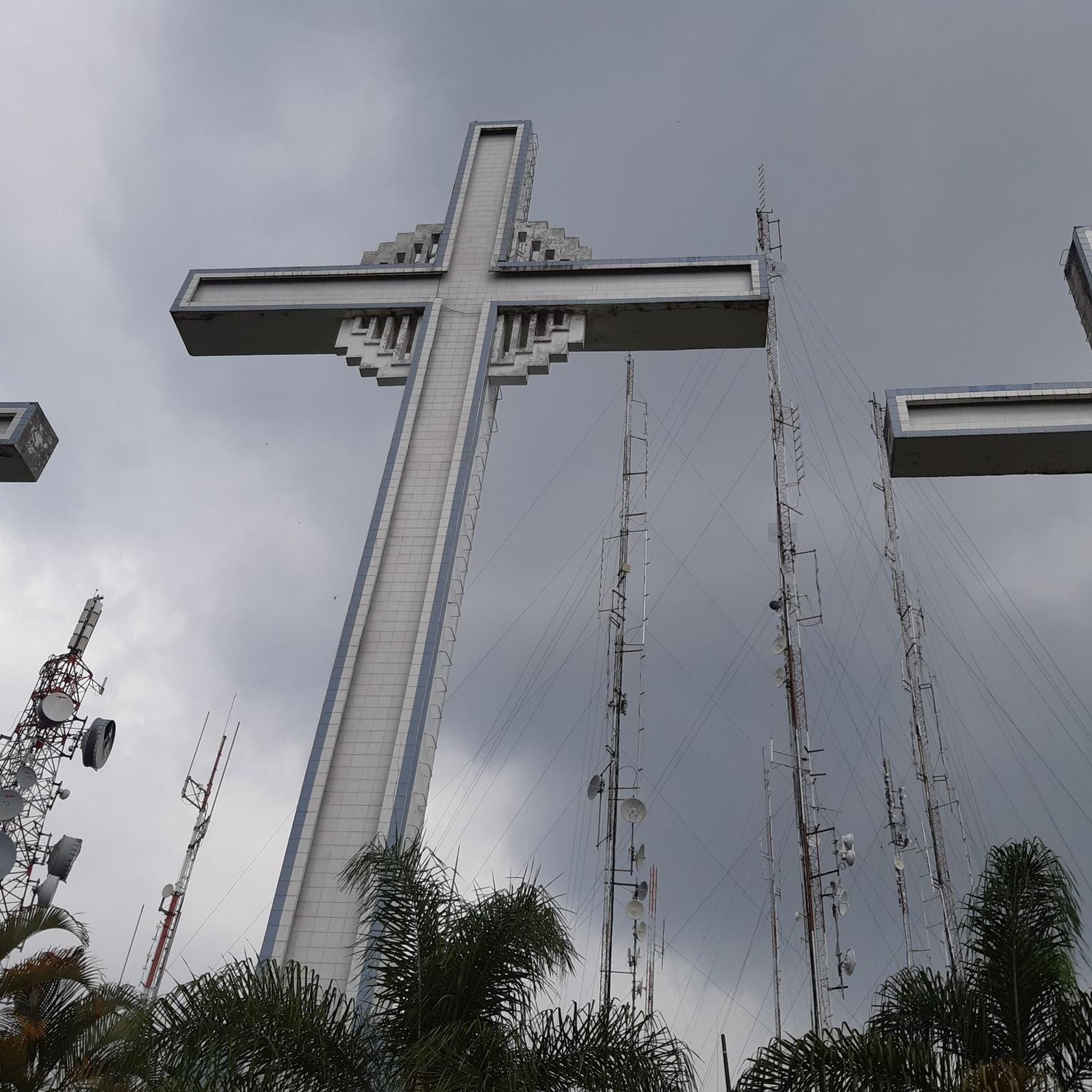
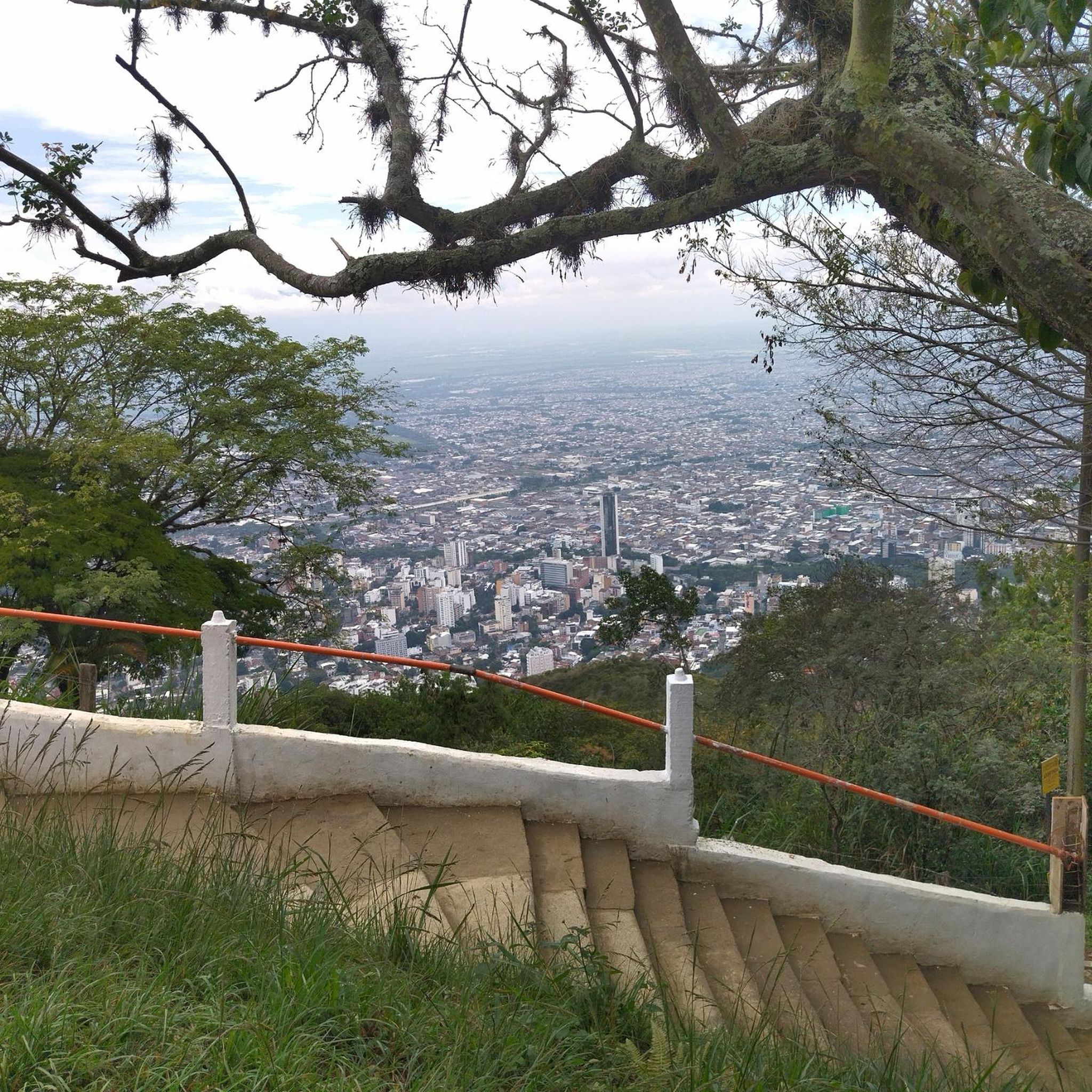
The primary natural feature is the Cerro de las Tres Cruces itself, offering spectacular panoramic views of Cali and the surrounding Andes mountains from the summit. Efforts are also underway to protect and recover the forest cover, enhancing the natural environment along the routes.
Are there any facilities or attractions at the summit of Cerro de las Tres Cruces?
Yes, at the summit of Cerro de las Tres Cruces, you'll find facilities for visitors. These often include outdoor gym equipment, vendors selling natural juices, benches, rest pergolas, and solid waste collection points. It's also a popular spot for photography, and there is a monument at the top of the hill.
What do other road cyclists say about their experience in Ecoparque Cerro De Las Tres Cruces?
The road cycling routes in Ecoparque Cerro De Las Tres Cruces are highly rated by the komoot community, with an average score of 4.9 stars from over 30 reviews. Cyclists often praise the challenging ascents, rewarding panoramic city views, and the natural beauty of the Andes mountain range.
Are there any family-friendly road cycling routes in Ecoparque Cerro De Las Tres Cruces?
While many routes feature significant climbs, there are moderate options that might be suitable for families with older children or those seeking less extreme challenges. We recommend checking the elevation profiles and distances of routes like the Marin Sport – Bridges loop from San Luis II, which is a moderate 56.9-mile (91.7 km) route with a more manageable 475 feet (145 meters) of elevation gain.
What is the best time of year to go road cycling in Ecoparque Cerro De Las Tres Cruces?
The Ecoparque is located in a tropical climate, so weather can be a factor. While specific best months aren't provided, it's generally advisable to consider the rainy season's impact, as unpaved sections might become more challenging. Checking local weather forecasts before your ride is always recommended.
Are dogs allowed on the cycling routes in Ecoparque Cerro De Las Tres Cruces?
The provided information does not specify rules regarding dogs on cycling routes within Ecoparque Cerro De Las Tres Cruces. It's best to check local regulations or park signage upon arrival to confirm any restrictions or requirements for pets.
Are there any specific rules or permits required for cycling in Ecoparque Cerro De Las Tres Cruces?
The available information does not indicate that specific permits are required for cycling in Ecoparque Cerro De Las Tres Cruces. However, as with any natural area, it's always good practice to respect local guidelines and environmental regulations. For more information on the park's environmental initiatives, you can refer to resources like medellin.gov.co or metropol.gov.co.
Where can I find parking or trailheads for road cycling routes?
While specific parking areas or trailheads are not detailed, many popular ascents to Cerro de las Tres Cruces start from areas near Cali, such as behind the Chipichape shopping center or by taking the highway to Aguacatal. These are common starting points for cyclists heading towards the Ecoparque.
How many road cycling routes are available in Ecoparque Cerro De Las Tres Cruces?
There are approximately 8 road cycling routes available in Ecoparque Cerro De Las Tres Cruces, offering a range of difficulties from moderate to difficult.
Most popular routes in Ecoparque Cerro De Las Tres Cruces

Get inspired with the komoot mobile app


Explore more
Browse the best Road cycling routes in other regions.
