The best cycling routes in Parque Natural Regional Pan De Azúcar El Consuelo
4.8
(22)
238
riders
29
rides
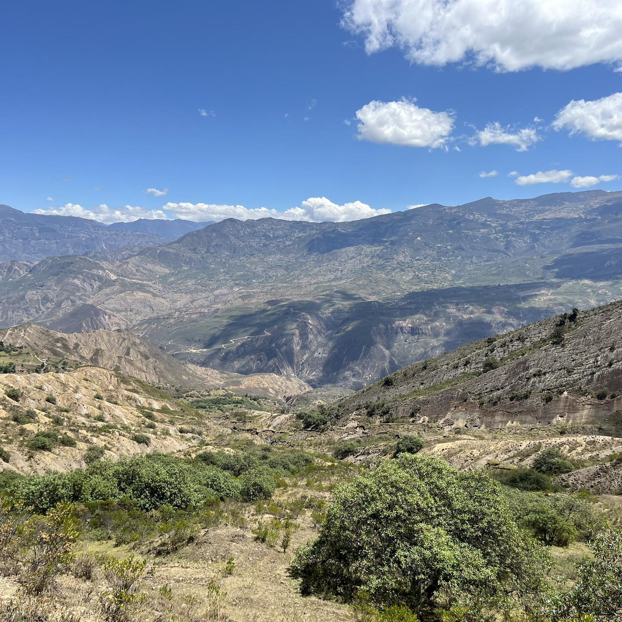
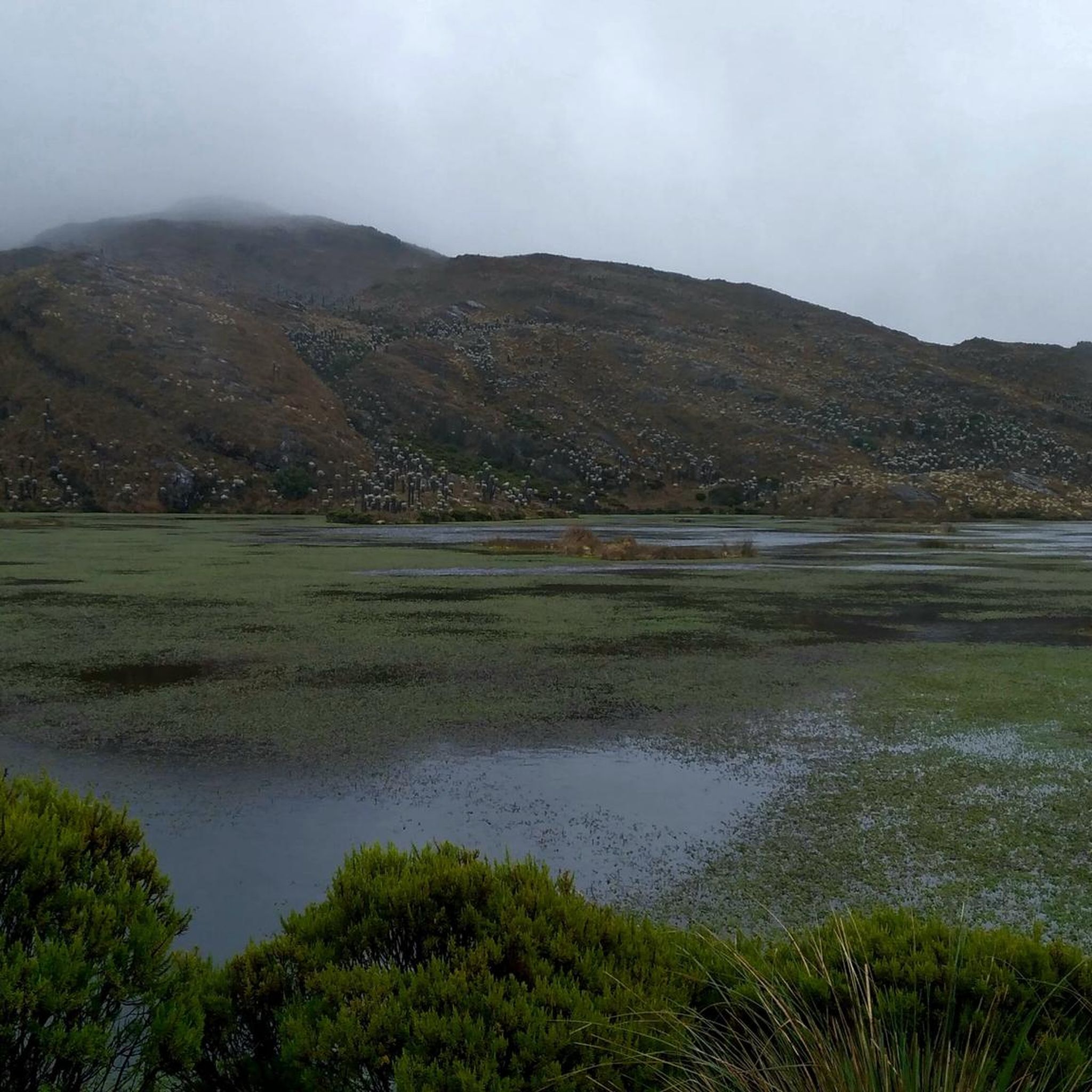
Touring cycling in Parque Natural Regional Pan De Azúcar El Consuelo offers challenging routes through high-altitude landscapes in the department of Boyacá, Colombia. The region is characterized by a significant biological corridor with altitudes ranging from 3200 to 4550 meters above sea level. Key ecosystems include páramo, wetlands, and extensive forests of oak and "coloraditos," providing varied terrain for cyclists. High-mountain lagoon systems, such as Laguna Grande and Laguna Negra, are also prominent natural features within the park.
Best touring…
Last updated: July 1, 2026
4
riders
26.2km
02:08
740m
740m
Hard bike ride. Very good fitness required. Mostly paved surfaces. Suitable for all skill levels.
4
riders
20.8km
01:41
490m
490m
Hard bike ride. Very good fitness required. Mostly paved surfaces. Suitable for all skill levels.

Sign up for free
8
riders
29.3km
02:15
790m
790m
Hard bike ride. Very good fitness required. Mostly paved surfaces. Suitable for all skill levels.
6
riders
41.0km
02:53
770m
770m
Hard bike ride. Very good fitness required. Mostly paved surfaces. Suitable for all skill levels.
5.0
(2)
5
riders
68.3km
06:24
1,590m
1,590m
Hard bike ride. Very good fitness required. Mostly paved surfaces. Suitable for all skill levels.
Get access to more routes and recommendations from other explorers.
Sign up for free
Already have an account?
Our route recommendations are based on thousands of hikes, rides, and runs completed by other people on komoot.
Start today with a free account
Your next adventure awaits.
Login or Signup
Popular around Parque Natural Regional Pan De Azúcar El Consuelo

Tips from the Community

Frequently Asked Questions
How challenging are the touring cycling routes in Parque Natural Regional Pan De Azúcar El Consuelo?
Touring cycling in this region is generally demanding due to its high-altitude landscapes, ranging from 3200 to 4550 meters above sea level. The terrain includes significant elevation changes, páramo, and dense forests. Most of the 29 available routes are classified as difficult, with 23 falling into this category, and 6 being moderate.
What kind of landscapes can I expect to see while cycling in the park?
Cyclists will experience diverse high-altitude ecosystems, including unique páramo landscapes, extensive forests of oak and 'coloraditos', and wetlands. The region is also home to several high-mountain lagoon systems, such as Laguna Grande and Laguna Negra, which offer breathtaking scenic views.
Are there any easier touring cycling options available in the park?
While the majority of routes are challenging, there are 6 moderate touring cycling routes available in Parque Natural Regional Pan De Azúcar El Consuelo. These still involve significant elevation but may be less strenuous than the difficult options.
What natural features or viewpoints are notable along the cycling routes?
The park is characterized by its high-mountain lagoon systems, which are crucial for regional water regulation and offer stunning vistas. These include Laguna Grande, Laguna Negra, Las Cruces, Careperro, Corralitos, and Lagunas Tapadas. Cycling through páramo ecosystems also provides unique, often misty, views.
What unique flora and fauna might I encounter while cycling?
As a vital biological corridor, the park boasts rich biodiversity. You might spot various mammals, amphibians, reptiles, and birds. Notably, the park is home to the endangered Chocontá frailejón (Espeletia chocontana), a unique high-altitude plant species.
What should I know about the weather and best time to visit for touring cycling?
Given the high altitudes (3200-4550m), weather conditions can be variable and often misty, especially in the páramo. It's essential to be prepared for rapid changes in temperature and potential rain. While specific seasonal recommendations aren't provided, generally, dry seasons are preferred for high-altitude cycling, but always check local forecasts.
Are there specific parking areas for cyclists accessing the routes?
The guide does not specify designated parking areas within the park itself. However, routes often start from nearby municipalities like Santa Rosa de Viterbo, Belén, Cerinza, and Tutazá. It is advisable to inquire locally in these towns for suitable parking options before heading out.
Do I need any special permits to cycle in Parque Natural Regional Pan De Azúcar El Consuelo?
The guide does not explicitly state permit requirements for cycling. However, as a Natural Regional Park, there may be regulations or entry fees. For official information regarding visitor access and any necessary permits, it is recommended to consult the regional environmental authority, Corpoboyacá, or the Boyacá government website: boyaca.gov.co.
Are there any circular touring cycling routes in the park?
Yes, many of the touring cycling routes in Parque Natural Regional Pan De Azúcar El Consuelo are designed as loops. Examples include the Viewpoint of Alto de Tobacia loop from Santa Rosa de Viterbo, the Bike loop from Santa Rosa de Viterbo, and the Canutos loop from Belén.
What do other touring cyclists say about their experience in Parque Natural Regional Pan De Azúcar El Consuelo?
The touring cycling routes in Parque Natural Regional Pan De Azúcar El Consuelo are highly rated by the komoot community, with an average score of 4.8 stars from over 20 reviews. Cyclists often praise the challenging Andean terrain, the unique high-altitude landscapes, and the immersive outdoor adventure.
Are the touring cycling routes in Parque Natural Regional Pan De Azúcar El Consuelo suitable for families?
Given the challenging nature of the terrain, with most routes classified as difficult and significant elevation changes, the touring cycling routes in Parque Natural Regional Pan De Azúcar El Consuelo are generally not recommended for young children or inexperienced family groups. The 6 moderate routes might be an option for families with strong, experienced teenage cyclists.
Can I bring my dog on the touring cycling trails in the park?
The guide does not provide specific information regarding dog policies on the cycling trails. As it is a Natural Regional Park with rich biodiversity and endangered species, there may be restrictions on pets to protect wildlife. It's best to check with local park authorities or Corpoboyacá before planning to bring a dog.
Where can I find accommodation or food services near the park?
The park is situated near several municipalities, including Santa Rosa de Viterbo, Cerinza, Belén, and Tutazá. These towns are likely to offer various services such as accommodation, restaurants, and cafes for visitors exploring the region.
Most popular routes in Parque Natural Regional Pan De Azúcar El Consuelo

Get inspired with the komoot mobile app


Explore more
Browse the best Cycling routes in other regions.
