The best running trails in Stebbings Road Community Forest
145
runners
2
runs
Jogging routes in Stebbings Road Community Forest traverse a 28.6-acre area characterized by lush greenery and scenic landscapes. The region features well-maintained trails that wind through natural settings, offering varied terrain for runners. Significant elevation changes are present on many routes, indicating a landscape with hills and undulating paths. The forest provides a tranquil environment for trail-based activities.
Best jogging routes in Stebbings Road Community Forest
- The most popular jogging route is View of Saanich Inlet – Jocelyn Hill loop…
Last updated: July 4, 2026
48
runners
Hard run. Very good fitness required. Mostly paved surfaces. Suitable for all skill levels.
3
runners
12.2km
01:29
370m
370m
Hard run. Very good fitness required. Mostly paved surfaces. Suitable for all skill levels.

Sign up for free
9
runners
13.4km
01:50
460m
460m
Hard run. Very good fitness required. Mostly accessible paths. Some sure footedness required.
10
runners
21.0km
02:41
680m
680m
Hard run. Very good fitness required. Mostly paved surfaces. Suitable for all skill levels.
6
runners
19.3km
02:40
730m
730m
Hard run. Very good fitness required. Mostly paved surfaces. Suitable for all skill levels.
Our route recommendations are based on thousands of hikes, rides, and runs completed by other people on komoot.
Start today with a free account
Your next adventure awaits.
Login or Signup
Popular around Stebbings Road Community Forest
Tips from the Community

The Saanich Inlet Viewpoint is an early viewpoint on the Timberman Trail. Though not a sweeping view, it's a clear break in the trees, and an exciting teaser for more viewpoints to follow.
0
0
Squally Reach Viewpoint is one of the most scenic lookouts along the Timberman Trail, with views stretching over the Saanich Inlet and Squally Reach. The Timberman Trail climbs through the coastal forest of old Douglas firs, cedars, and vine maple trees to the Squally Reach Viewpoint Trail spur. This short spur trail is a short climb, only about 100 meters to this impressive viewpoint.
0
0

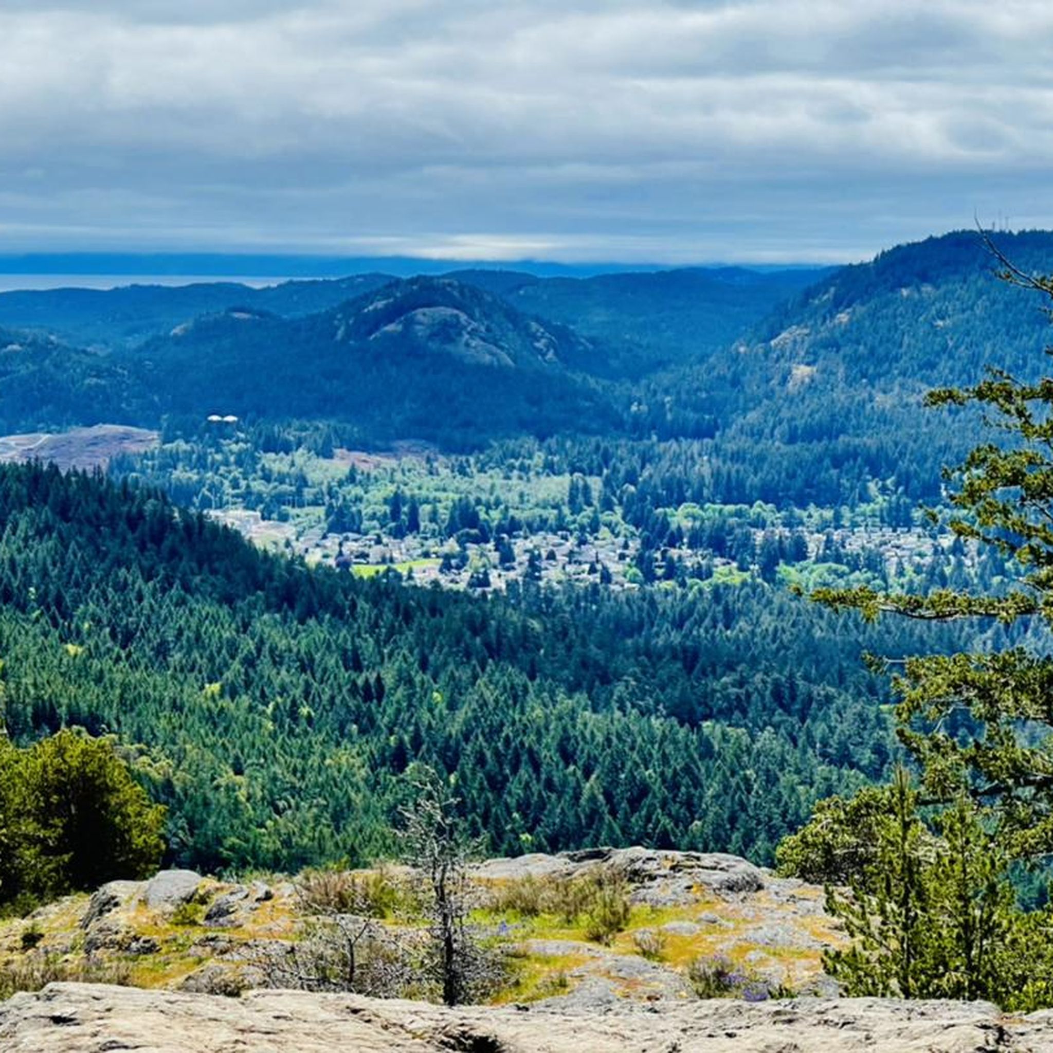
The summit of Jocelyn Hill is not obvious because the trail wraps around it. However, the best views are found where the trail levels out and opens onto a rocky clearing that overlooks Saanich Arm below.
0
0
The break in the trees makes for a great viewing area as you look down at the Saanich Inlet.
0
0
Holmes Lookout is the viewing area on Holmes Peak. As you summit Holmes Peak, you will notice an opening off to the left; follow it out for incredible views of Saanich Arm and the Malahat.
0
0
The Timberman Trail is a 5-kilometer single-track trail that is pretty well marked and offers fantastic views of the Saanich Inlet.
0
0
Frequently Asked Questions
What is the typical terrain and difficulty of running trails in Stebbings Road Community Forest?
The running trails in Stebbings Road Community Forest are characterized by varied terrain, often featuring lush greenery and natural settings. Based on the available routes, many trails are considered difficult, indicating challenging sections that may include rooty or rocky paths, and potentially narrow bridging over wet areas. Runners should expect a mix of woodland paths and potentially wider field trails.
Do the running routes in Stebbings Road Community Forest involve significant elevation changes?
Yes, the running routes in Stebbings Road Community Forest are known for significant elevation changes. For example, the View of Saanich Inlet – Jocelyn Hill loop from Sawluctus Island includes challenging uphill sections, with an elevation gain of over 360 meters. Similarly, the Jocelyn Hill – Timberman Trail loop from Cal Revelle Nature Sanctuary features nearly 500 meters of ascent, offering a good workout for those seeking climbs.
Are there any viewpoints or scenic spots along the running trails?
Yes, several running routes offer scenic rewards. The View of Saanich Inlet – Jocelyn Hill loop from Sawluctus Island provides beautiful views of Saanich Inlet. Another excellent option is the Squally Reach Viewpoint – Jocelyn Hill loop from Kindwood Forest, which leads directly to a viewpoint offering expansive forest landscapes.
Are dogs allowed on the running trails in Stebbings Road Community Forest?
Community forests generally welcome dogs, often with specific rules to ensure the enjoyment and safety of all visitors and wildlife. While specific regulations for Stebbings Road Community Forest are not detailed, it's common practice to keep dogs on a leash and to clean up after them. Always check local signage upon arrival for any specific dog policies.
Is there parking available for runners at Stebbings Road Community Forest?
While specific parking facilities for Stebbings Road Community Forest are not extensively documented, community forests typically provide designated parking areas for public access. It is advisable to check local maps or community park information for the most accurate parking locations before your visit.
Can I reach Stebbings Road Community Forest by public transport?
Information regarding direct public transport access to Stebbings Road Community Forest is limited. Community forests are often situated in more natural, less urbanized areas, which may mean public transport options are not directly available. It is recommended to consult BC Transit schedules and routes for Shawnigan Lake to determine the closest possible stop, and plan for potential walking or alternative transport to the forest entrance.
Are there any circular running routes in Stebbings Road Community Forest?
Yes, the guide features several excellent circular running routes. For instance, the Durrance Lake – Mount Work loop from Cal Revelle Nature Sanctuary offers a challenging circular path. Another popular option is the Lone Tree Hill – Jocelyn Hill loop from Cal Revelle Nature Sanctuary, providing a longer circular experience through varied terrain.
What is the best time of year to go running in Stebbings Road Community Forest?
Community forests like Stebbings Road are generally enjoyable year-round, but the best time can depend on personal preference. Spring and fall offer pleasant temperatures and vibrant scenery. Summer provides shaded trails, while winter conditions might include wet or muddy sections, and potentially some icy patches, especially on higher elevations or less exposed trails. Always check local weather conditions before heading out.
What kind of natural features can I expect to see while running?
Stebbings Road Community Forest is a 28.6-acre area known for its lush greenery and natural settings. Runners can expect to experience wooded areas, diverse flora, and potentially some small creeks or water features, typical of well-preserved community forests. The trails are designed to connect people with nature, offering a tranquil environment away from urban bustle.
What do other runners enjoy most about jogging in Stebbings Road Community Forest?
Runners frequently praise the tranquil environment and the challenging nature of the trails in Stebbings Road Community Forest. The significant elevation changes and varied terrain provide a rewarding experience for those seeking a good workout amidst lush greenery and scenic landscapes. The opportunity to enjoy views, such as those of Saanich Inlet, is also a highlight for many.
Are there any shorter or easier running options for beginners or families?
Based on the routes available in this guide, most running trails in Stebbings Road Community Forest are rated as difficult, featuring significant elevation changes and longer distances. While community forests often include a mix of terrain, specific shorter or easier routes suitable for beginners or young families are not prominently featured in the current selection. It's advisable to check local park information for any designated accessible or easier loop trails if available.
Most popular routes in Stebbings Road Community Forest

Get inspired with the komoot mobile app


Explore more
Browse the best Running Trails & Routes in other regions.
