The best walks and hikes in Golden Ears Provincial Park
4.7
(59)
1,051
hikers
12
hikes
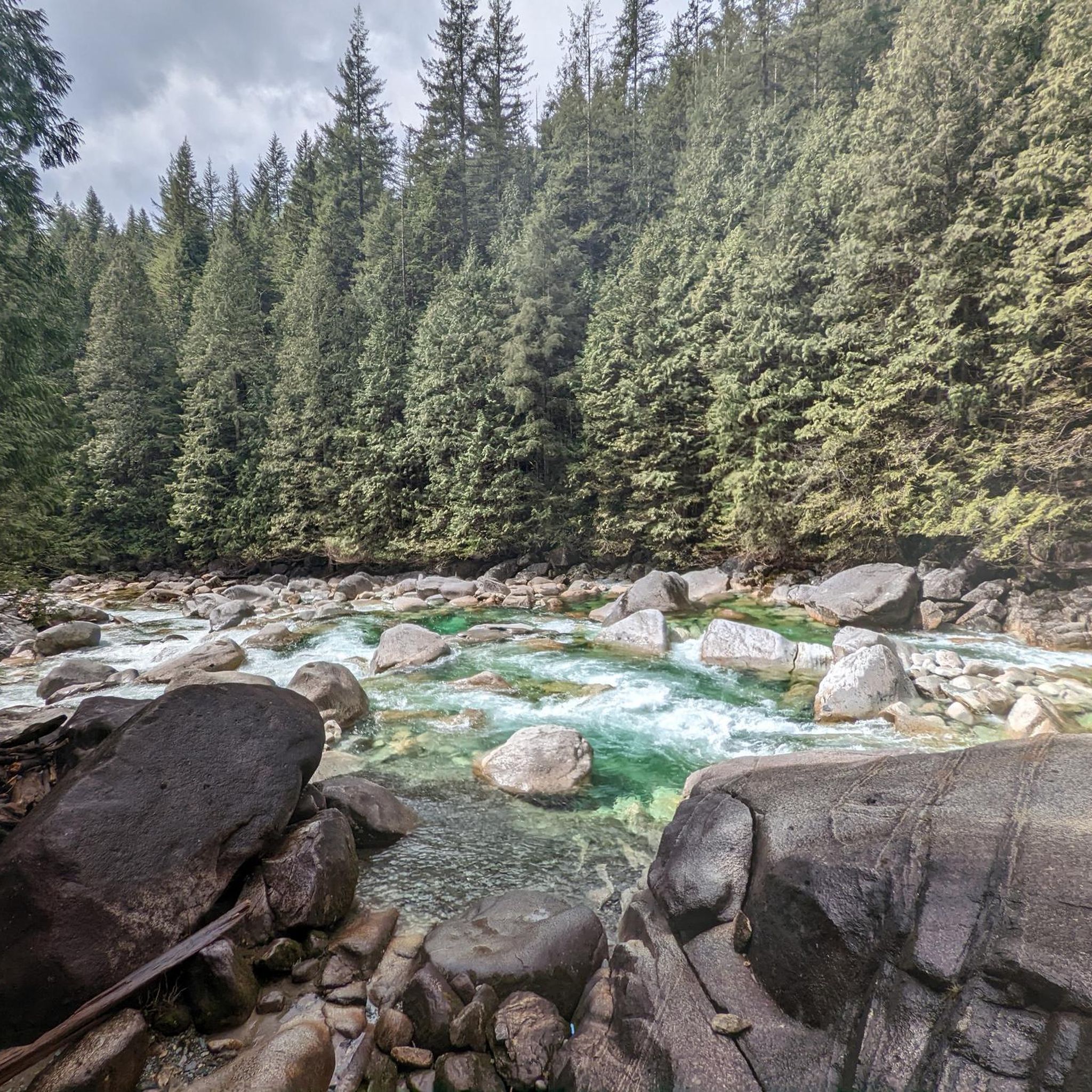
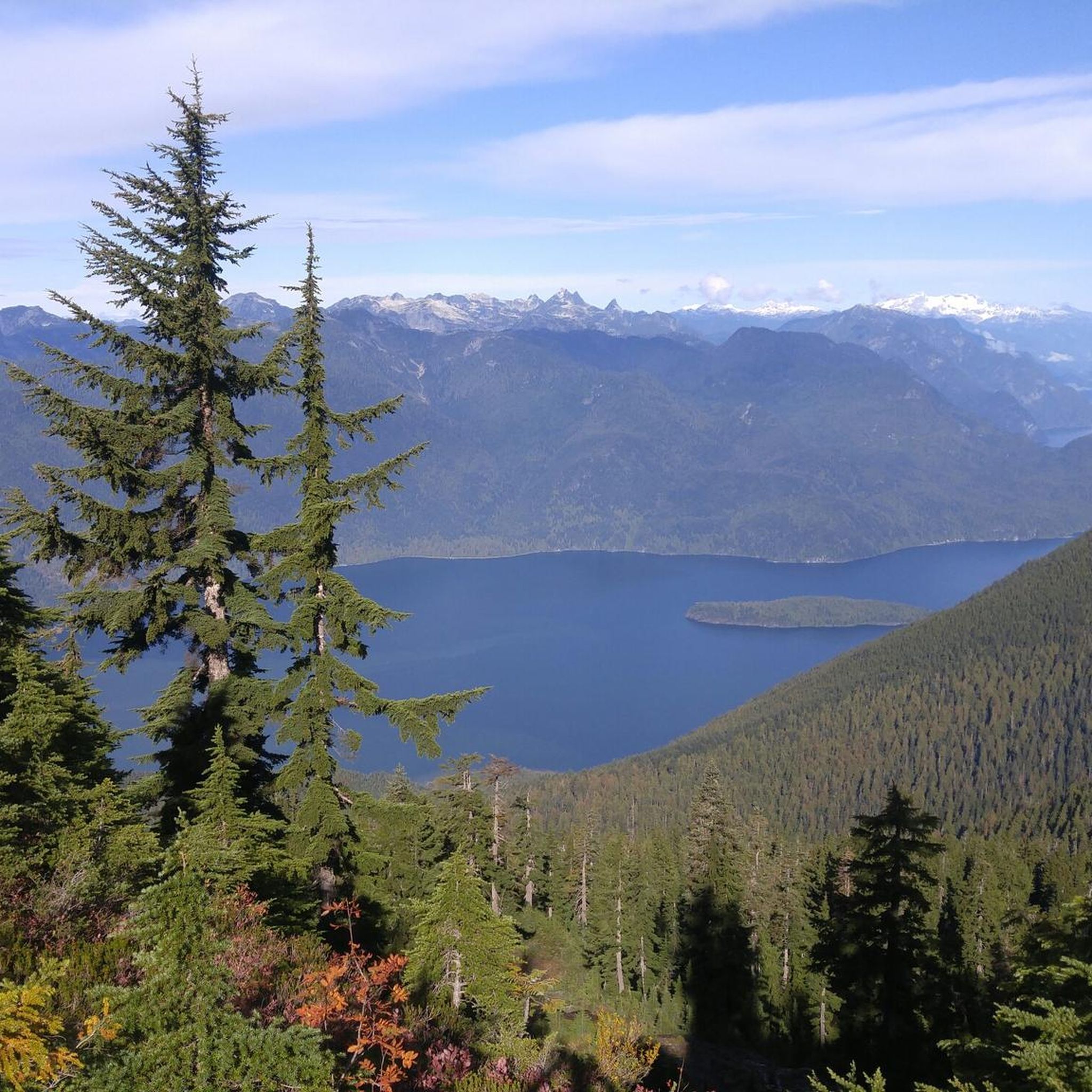
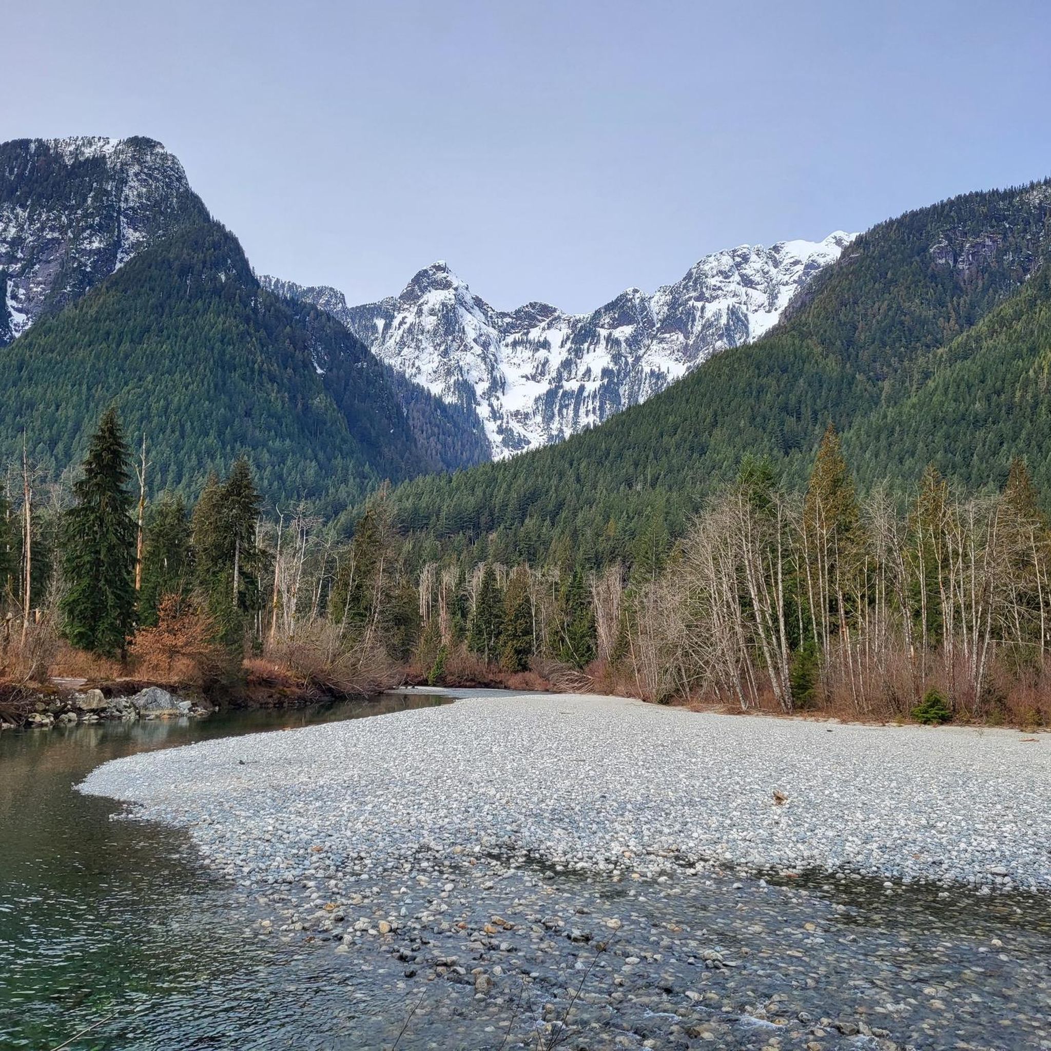
Hiking trails in Golden Ears Provincial Park traverse a diverse landscape within British Columbia's Coast Mountains. The park features majestic mountains, deep valleys, and extensive lush forests, including ancient Douglas firs and western red cedars. Cascading waterfalls, such as Gold Creek Falls, and clear lakes like Alouette Lake are prominent natural features. The terrain offers a range of elevations and environments suitable for various hiking experiences.
Best hiking trails in Golden Ears Provincial Park
- The most popular hiking route is West Canyon Trail Parking Lot loop from West Canyon parking lot, a 5.0 miles (8.1 km) trail that takes 2 hours 15 minutes to complete. This moderate route offers views of Gold Creek.
- Another top favourite among local hikers is Golden Ears Peak – West Canyon Trail Parking Lot loop from West Canyon parking lot, a difficult 14.3 miles (23.1 km) path. This challenging route features significant elevation gain towards Golden Ears Peak.
- Local hikers also love the Hiking loop from Gold Creek Parking, a 3.6 miles (5.8 km) trail leading through forested areas, often completed in about 1 hour 40 minutes.
- Hiking in Golden Ears Provincial Park is defined by mountainous terrain, dense forests, and scenic waterways. The network offers options for different ability levels, from easy strolls to strenuous ascents.
- The routes in Golden Ears Provincial Park are highly rated by the komoot community with an average score of 4.6 stars from over 50 reviews. Nearly 1000 hikers have used komoot to explore Golden Ears Provincial Park's varied terrain.
Last updated: July 9, 2026
1
hikers
5.23km
01:30
120m
130m
Easy hike. Great for any fitness level. Easily-accessible paths. Suitable for all skill levels.
881m
00:14
0m
0m
Easy hike. Great for any fitness level. Easily-accessible paths. Suitable for all skill levels.

Sign up for free
4.8
(8)
212
hikers
8.10km
02:15
140m
150m
Moderate hike. Good fitness required. Easily-accessible paths. Suitable for all skill levels.
4.8
(13)
122
hikers
11.4km
03:30
340m
350m
Hard hike. Good fitness required. Sure-footedness, sturdy shoes and alpine experience required.
4.8
(5)
73
hikers
5.85km
01:41
130m
130m
Moderate hike. Great for any fitness level. Mostly accessible paths. Sure-footedness required.
Get access to more routes and recommendations from other explorers.
Sign up for free
Already have an account?
Our route recommendations are based on thousands of hikes, rides, and runs completed by other people on komoot.
Start today with a free account
Your next adventure awaits.
Login or Signup
Popular around Golden Ears Provincial Park
Tips from the Community

The Loop Trail connects the Menzies and Alouette Trails, making a quick loop in Golden Ears Provincial Park. Though not particularly steep it should be noted that head in a clockwise direction will take you downhill, while counter-clockwise is uphill.
0
0
This beautiful waterfall is tucked away along a trail of the same name. You can do a short out and back hike if you only want to see the falls, or you can combine the Menzies Trail with others in the park for a longer loop hike.
0
0

The trail here is almost entirely a flat, with a wooden boardwalk designed to protect the sensitive peat bog beneath. The most unique feature here is the sphagnum moss bog. This rare ecosystem acts like a giant sponge, filtering rainwater and supporting plants that you won't see on the higher mountain ridges.
0
0
While most park trails are steep and rugged, this one is remarkably flat and wide because it follows an old 1920s railway grade once used for logging.
0
0


Pretty cool portion of the trail where it hugs the cliff side. Not too exposed, but may be difficult for people who are afraid of heights or small children.
0
0
Upper false is much less busy, and a great spot if you want to get away from the crowds. The trail is a bit technical, but short, so its a fun way to extend the lower falls hike and make it more challenging.
1
0
Its a great, easily accessible spot. Word of note, this is a very popular area. If you're not into people, check out upper false.
1
0
Frequently Asked Questions
How many hiking trails are available in Golden Ears Provincial Park?
Golden Ears Provincial Park offers a diverse network of over 10 hiking routes, ranging from easy strolls through lush forests to strenuous ascents with significant elevation gain. These trails cater to various skill levels, ensuring there's an option for every hiker.
Are there easy, family-friendly trails in Golden Ears Provincial Park?
Yes, the park features several easy and family-friendly options. The Lower Gold Creek Falls Trail is a popular choice, leading through old-growth forest to impressive waterfalls. Another accessible option is the Hiking loop from Burke Mountain, which is an easy 5.6 km route. The Spirea Nature Trail is also a short, wheelchair-accessible loop perfect for a relaxing walk.
What are some challenging multi-day hikes in the park?
For experienced hikers seeking a challenge, the Golden Ears Summit Trail is a demanding 26 km return trip with significant elevation gain, offering incredible panoramic views. This can be completed as an intense day hike or a more comfortable overnight trip. A challenging route that covers a portion of this area is the Golden Ears Peak – West Canyon Trail Parking Lot loop from West Canyon parking lot, which is 23.1 km long.
Can I find trails with waterfalls in Golden Ears Provincial Park?
Absolutely. The park is known for its beautiful cascading waterfalls. The most prominent is Gold Creek Falls, which can be reached via the popular Lower Gold Creek Falls Trail. This trail offers a rewarding experience through an old-growth forest leading to the falls.
Are there any loop trails for hiking in Golden Ears Provincial Park?
Yes, several loop trails are available. A popular moderate option is the West Canyon Trail Parking Lot loop from West Canyon parking lot, which is 8.1 km long and offers views of Gold Creek. Another well-liked route is the Hiking loop from Gold Creek Parking, a 5.8 km trail through forested areas.
What do other hikers enjoy most about hiking in Golden Ears Provincial Park?
The hiking routes in Golden Ears Provincial Park are highly rated by the komoot community, with an average score of 4.6 stars from over 50 reviews. Hikers frequently praise the diverse landscapes, from majestic mountains and deep valleys to lush ancient forests, as well as the scenic waterways like Gold Creek and Alouette Lake.
Are dogs allowed on the trails in Golden Ears Provincial Park?
Golden Ears Provincial Park generally allows dogs on trails, but they must be kept on a leash at all times. It's always a good idea to check the specific trail regulations or park notices before your visit, as some areas might have restrictions, especially during wildlife breeding seasons.
What are the best viewpoints in Golden Ears Provincial Park?
The park offers numerous scenic viewpoints. The summit of Golden Ears Peak provides incredible panoramic views of the surrounding Coast Mountains. For less strenuous options, trails like the North Beach Trail offer scenic viewpoints of Evans Creek and towering peaks, while the West Canyon Trail provides views of Gold Creek.
What is the best time of year to hike in Golden Ears Provincial Park?
The best time to hike largely depends on the trail and your preference. Spring and fall offer pleasant temperatures and vibrant scenery, with fewer crowds. Summer is ideal for accessing higher elevation trails and enjoying water-based activities at Alouette Lake. Some lower elevation trails may be accessible in winter, but conditions can be challenging due to snow and ice, especially at higher altitudes.
Is there public transport available to Golden Ears Provincial Park?
While Golden Ears Provincial Park is approximately an hour's drive from Vancouver, public transport options directly to the park entrance are limited. Most visitors access the park by car. It's advisable to check local transit authority websites for any potential bus routes that might connect to the Maple Ridge area, though a direct connection to the park itself is uncommon.
Where can I park my car when visiting Golden Ears Provincial Park?
The park offers several designated parking areas. Key trailheads like the West Canyon parking lot and Gold Creek Parking provide access to many popular routes. It's recommended to arrive early, especially on weekends and holidays, as parking lots can fill up quickly due to the park's popularity.
What other activities can I do in Golden Ears Provincial Park besides hiking?
Beyond hiking, Golden Ears Provincial Park offers a wide range of outdoor activities. Alouette Lake is a central attraction for swimming, paddleboarding, canoeing, boating, and fishing. The park also provides opportunities for frontcountry, backcountry, and marine camping, mountain biking on designated trails, horseback riding, and wildlife viewing, with animals like deer, beaver, and various bird species.
Most popular routes in Golden Ears Provincial Park

Get inspired with the komoot mobile app


Explore more
Browse the best Hikes in other regions.
