The best walks and hikes in Mkwal'Ts Conservancy
4.6
(24)
178
hikers
1
hike
Hiking in Mkwal'Ts Conservancy offers a wilderness experience within the Lil'wat Nation Traditional Territory, approximately 20 kilometers southeast of Pemberton. The conservancy protects the lower Ure Creek watershed and features old-growth forests, providing critical habitat for wildlife. Situated on the western shore of Lillooet Lake, the area is characterized by its undeveloped nature and rugged terrain, bordering the vast Garibaldi Park.
Best hiking trails in Mkwal'Ts Conservancy
- The most popular hiking route is Mount Currie — Pemberton, a difficult 12.0 miles (19.3 km) trail that takes 14 hours 5 minutes to complete, featuring significant elevation gain towards the summit.
- Another top favourite among local hikers is Nairn Falls – Nairn Falls Trailhead Parking loop from Nairn Falls Provincial Park, a moderate 6.1 miles (9.8 km) path. This route offers views of the falls and surrounding forest.
- Local hikers also love the One Mile Lake Park – One Mile Lake loop from Nairn Falls Provincial Park, a 1.1 miles (1.8 km) trail leading through forested areas around the lake, often completed in about 32 minutes.
- Hiking in Mkwal'Ts Conservancy is defined by its pristine wilderness, views of Lillooet Lake, and old-growth forests. The network offers options for different ability levels, from easy lake loops to challenging mountain ascents.
- The routes in Mkwal'Ts Conservancy are highly rated by the komoot community with an average score of 4.6 stars from over 20 reviews. More than 160 hikers have used komoot to explore Mkwal'Ts Conservancy's varied terrain.
Last updated: August 7, 2026
4
hikers
19.3km
14:05
2,130m
2,130m
Hard hike. Very good fitness required. Sure-footedness, sturdy shoes and alpine experience required.
4.8
(12)
83
hikers
Moderate hike. Good fitness required. Easily-accessible paths. Suitable for all skill levels.

Sign up for free
5.0
(1)
45
hikers
Easy hike. Great for any fitness level. Easily-accessible paths. Suitable for all skill levels.
5.0
(4)
21
hikers
Moderate hike. Good fitness required. Mostly accessible paths. Sure-footedness required.
3.8
(5)
19
hikers
Easy hike. Great for any fitness level. Easily-accessible paths. Suitable for all skill levels.
Our route recommendations are based on thousands of hikes, rides, and runs completed by other people on komoot.
Start today with a free account
Your next adventure awaits.
Login or Signup
Popular around Mkwal'Ts Conservancy
Tips from the Community

Above the treeline, you reach the main ridge. The final push to the summit is a challenging, sustained Class 3 scramble across a field of massive boulders and loose scree. Although the route is long, the panoramic views from the peak are incredible. Keep a constant lookout for cairns to maintain your direction. This last section is physically grueling, so please be prepared.
0
0
The Mount Currie trail begins with a steep climb via a series of switchbacks through forests and meadows.before opening into spectacular alpine terrain.
0
0
Mount Currie sits in the Garibaldi Range, forming the dominating backdrop of the Pemberton Valley. The hike is a very big day, as the over 20 km round trip requires third-class scrambling from the ridge to the summit.
0
0

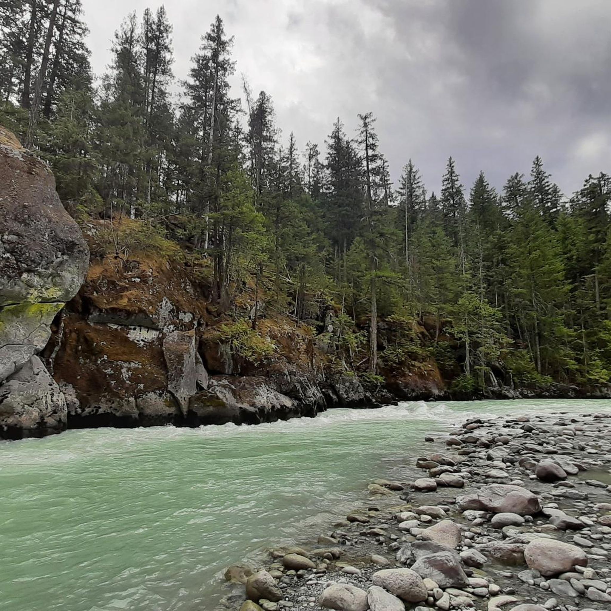
The Green River in the Nairn Falls area is known for its strong currents. Therefore, swimming is not permitted in the Green River in Nairn Falls Provincial Park. Visitors are advised to stay on the trails.
2
0
The Nairn Falls parking lot is located directly on Highway 99 / Sea-to-Sky, about 30 km from Whistler and 4 km before the town of Pemberton – near a cliff that drops 15 meters to the Green River.
2
0

Starting point of a short, fairly flat hike
0
0
The Tower of Power Trail is primarily used by mountain bikers, who plunge at breakneck speeds over the smooth granite cliffs into the depths. We're hiking high above the Green River down to One Mile Lake and climbing the partially steep rocky path to the electricity pylon, near which a metal helipad has been constructed. In the distance, the imposing Mount Currie rises above the wide valley of the Lillooet River near Pemberton. (Visit May 27, 2025) https://www.trailforks.com/trails/tower-of-power/
2
1
Lumpy's Epic is a loop trail south of Pemberton for mountain bikers and hikers. Part of the trail runs high on the rocky cliffs above the Green River - outside Nairn Falls Park, with views of Mount Currie in the distance. We ascended from Nairn Falls via the Tower of Power Trail, continued north for a section of Lumpy's Epic, and enjoyed the view of the mountains and the wide valley of the Lillooet River in bright sunshine. (Visit May 27, 2025) https://www.trailforks.com/trails/lumpy-s-epic-8691/
2
1
Frequently Asked Questions
What kind of hiking experience can I expect in Mkwal'Ts Conservancy?
Mkwal'Ts Conservancy offers a true wilderness experience within the Lil'wat Nation Traditional Territory. It is intentionally undeveloped, meaning you'll find a remote environment with no built infrastructure like campsites or public facilities. Hikers should be prepared for self-reliant backcountry activities, appreciating pristine nature, views of Lillooet Lake, and culturally significant landscapes.
Are there any easy hiking trails suitable for beginners or families?
Yes, while much of the conservancy offers a rugged experience, there are easier options nearby. For instance, the One Mile Lake Park – One Mile Lake loop from Nairn Falls Provincial Park is an easy 1.1-mile (1.8 km) trail that takes about 32 minutes to complete, leading through forested areas around the lake. Another easy option is the Nairn Falls Trailhead Parking – Lumpy’s Epic Trail loop from Nairn Falls Provincial Park.
What are some moderate hiking options in or near Mkwal'Ts Conservancy?
For a moderate challenge, consider the Nairn Falls – Nairn Falls Trailhead Parking loop from Nairn Falls Provincial Park. This 6.1-mile (9.8 km) path offers scenic views of the falls and surrounding forest. Another moderate route is the Nairn Falls Trailhead Parking – One Mile Lake Park loop from Nairn Falls Provincial Park, which is about 5.7 miles (9.2 km) long.
Are there any challenging hikes for experienced trekkers?
Absolutely. For experienced hikers seeking a significant challenge, the Mount Currie — Pemberton route is a difficult 12.0-mile (19.3 km) trail. It involves significant elevation gain towards the summit and typically takes around 14 hours to complete.
Can I bring my dog on the hiking trails in Mkwal'Ts Conservancy?
While the conservancy itself is a wilderness area, specific regulations regarding dogs on trails may vary. Generally, in undeveloped backcountry areas, dogs are often permitted but should be kept under control to protect wildlife. For trails in nearby provincial parks like Nairn Falls, dogs are typically allowed on leash. Always check the specific rules for the trail you plan to hike.
What natural features or wildlife can I expect to see?
Mkwal'Ts Conservancy is known for its pristine natural environment. You can expect to see the Ure Creek watershed, old-growth forests, and scenic views of Lillooet Lake. The area is also an important migration corridor and provides critical winter ranges for wildlife such as Mountain Goats and Black-tailed Deer. Old-growth forests offer habitat for species like the Northern Spotted Owl.
Are there any circular hiking routes available?
Yes, several routes offer a loop experience. The Nairn Falls – Nairn Falls Trailhead Parking loop from Nairn Falls Provincial Park and the One Mile Lake Park – One Mile Lake loop from Nairn Falls Provincial Park are both popular circular options, allowing you to start and end at the same point.
What is the best time of year to go hiking in Mkwal'Ts Conservancy?
The best time for hiking in Mkwal'Ts Conservancy, given its rugged and undeveloped nature, is typically during the warmer, drier months from late spring through early autumn (roughly June to September). During this period, snow has usually melted at lower elevations, and weather conditions are more stable, making trails more accessible and enjoyable. Always check local weather forecasts before heading out.
What do other hikers say about the trails in Mkwal'Ts Conservancy?
The hiking experiences in and around Mkwal'Ts Conservancy are highly rated by the komoot community, with an average score of 4.6 stars from over 20 reviews. Hikers often praise the pristine wilderness, the stunning views of Lillooet Lake, and the opportunity to connect with nature in a remote setting.
Is there public transport available to reach the hiking areas?
Mkwal'Ts Conservancy is a remote wilderness area, and direct public transport to its boundaries is generally not available. It is located approximately 20 kilometers southeast of Pemberton. Access typically requires personal vehicle transportation. For trails in nearby areas like Nairn Falls Provincial Park or One Mile Lake Park, you would still need to arrange transport to the trailheads.
Are there any waterfalls to see on the trails?
Yes, the Nairn Falls – Nairn Falls Trailhead Parking loop from Nairn Falls Provincial Park is an excellent choice if you're looking to see waterfalls. This moderate route offers impressive views of Nairn Falls, a significant natural attraction in the area.
What should I know about parking and trailheads?
Given the undeveloped nature of Mkwal'Ts Conservancy, official designated parking areas within its boundaries are limited or non-existent. Access points are often along forest service roads. For trails in nearby areas like Nairn Falls Provincial Park or One Mile Lake Park, there are established parking lots at the trailheads. Always ensure you park legally and do not block access roads.
Most popular routes in Mkwal'Ts Conservancy

Get inspired with the komoot mobile app


Explore more
Browse the best Hikes in other regions.
