The best walks and hikes in Whistler Interpretive Forest
4.6
(947)
8,760
hikers
132
hikes
Hiking in Whistler Interpretive Forest offers diverse landscapes across its 2800-hectare area, nestled between Garibaldi Park and Function Junction. The terrain features tranquil old-growth forests with western hemlock and red cedar, alongside the dramatic Cheakamus River canyon, known for its blue glacial meltwaters. Hikers can also explore unique geological features like Loggers Lake, situated within an extinct volcano, and the series of small alpine Jane Lakes.
Best hiking trails in Whistler Interpretive Forest
- The most popular hiking route is Riverside…
Last updated: May 20, 2026
4.5
(19)
148
hikers
5.22km
01:25
70m
70m
Easy hike. Great for any fitness level. Easily-accessible paths. Suitable for all skill levels.
5.0
(1)
3
hikers
15.9km
04:57
590m
590m
Moderate hike. Good fitness required. Easily-accessible paths. Suitable for all skill levels.

Sign up for free
4.6
(45)
538
hikers
2.83km
00:46
40m
40m
Easy hike. Great for any fitness level. Easily-accessible paths. Suitable for all skill levels.
4.6
(15)
146
hikers
14.7km
03:58
180m
180m
Moderate hike. Good fitness required. Easily-accessible paths. Suitable for all skill levels.
4.6
(20)
122
hikers
8.42km
02:22
170m
170m
Moderate hike. Good fitness required. Easily-accessible paths. Suitable for all skill levels.
Get access to more routes and recommendations from other explorers.
Sign up for free
Already have an account?
Our route recommendations are based on thousands of hikes, rides, and runs completed by other people on komoot.
Start today with a free account
Your next adventure awaits.
Login or Signup

Other adventures in Whistler Interpretive Forest

Tips from the Community

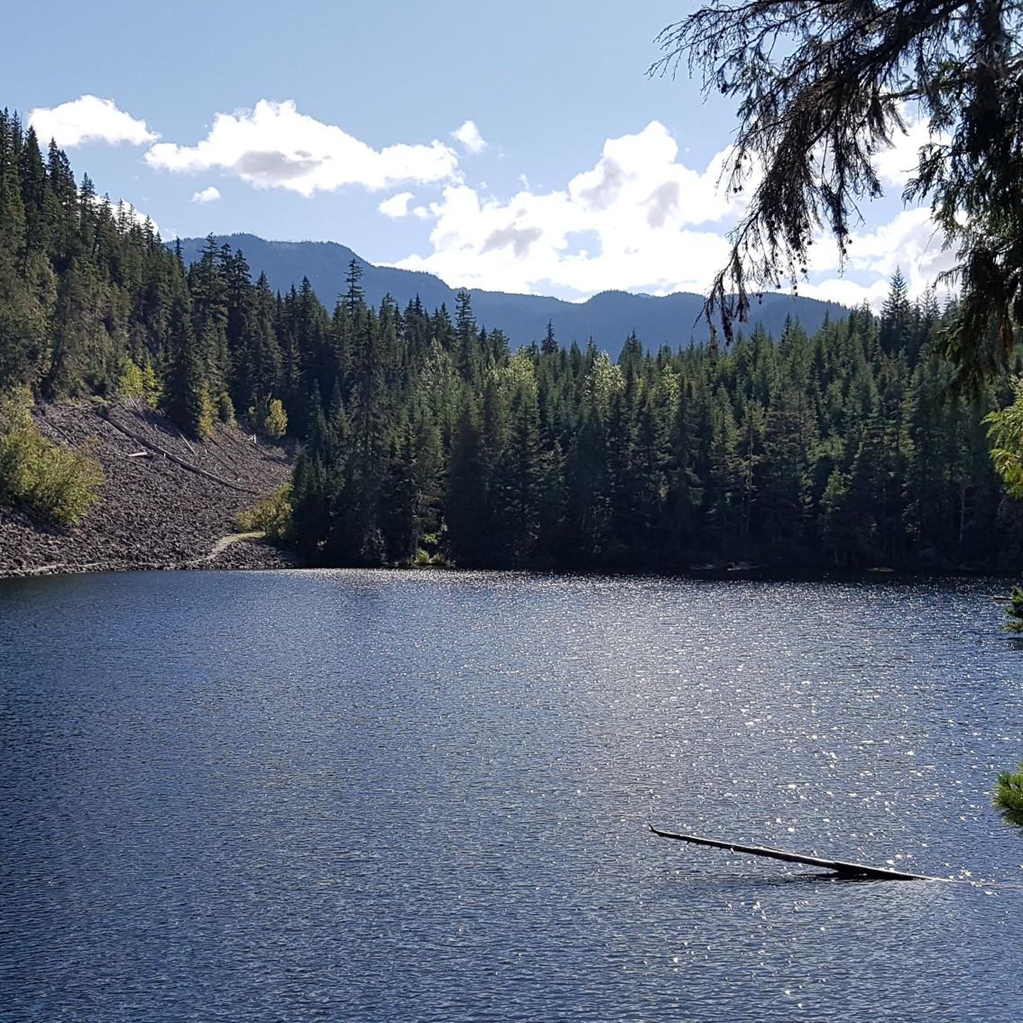
East June Lake is a small backcountry lake located near the Cheakamus Crossing area. The lake sits in a quiet forested setting and is part of a group of lakes connected by the Jane Lakes trail network. Surrounded by trees and low mountain terrain, it makes for a peaceful place to stop and enjoy the scenery.
0
0
The Jane Lakes Trail begins just off Black Tusk Microwave Tower Road and travels through forested terrain, leading to a series of small alpine lakes known as the Jane Lakes. The terrain is moderately challenging in places and consists of a mix of singletrack trail and old logging roads.
0
0
West Jane Lake is a small alpine lake located in the backcountry near Cheakamus Crossing, set in a quiet mountain landscape surrounded by forest, rocky terrain, and views of the surrounding peaks. Its clear water and remote setting make it a great spot to relax, take photos, or enjoy a peaceful break in nature.
0
0

Memorial Rock has become an informal place of remembrance. There are often flowers, handwritten notes, and painted stones left in memory of loved ones. Please enjoy this unofficial area peacefully and respectfully, as it is important to the community.
1
0
Don MacLaurin's Crossing, more widely known as the Cheakamus River Suspension Bridge, is a pedestrian bridge spanning the turquoise waters of the Cheakamus River. The bridge sways, but it is sturdy and safe. The river is especially amazing to watch from the bridge above during spring runoff when water levels are high.
1
0
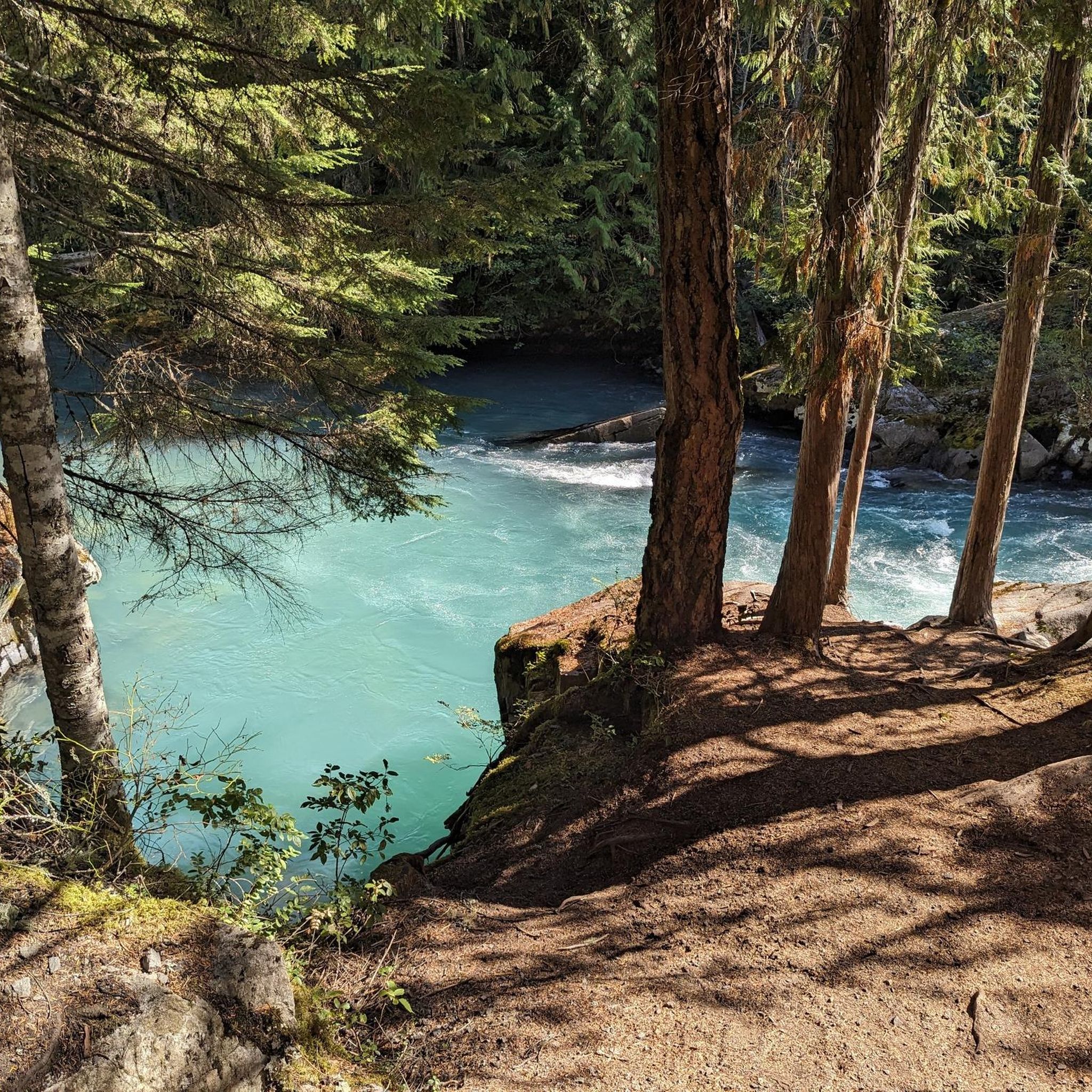
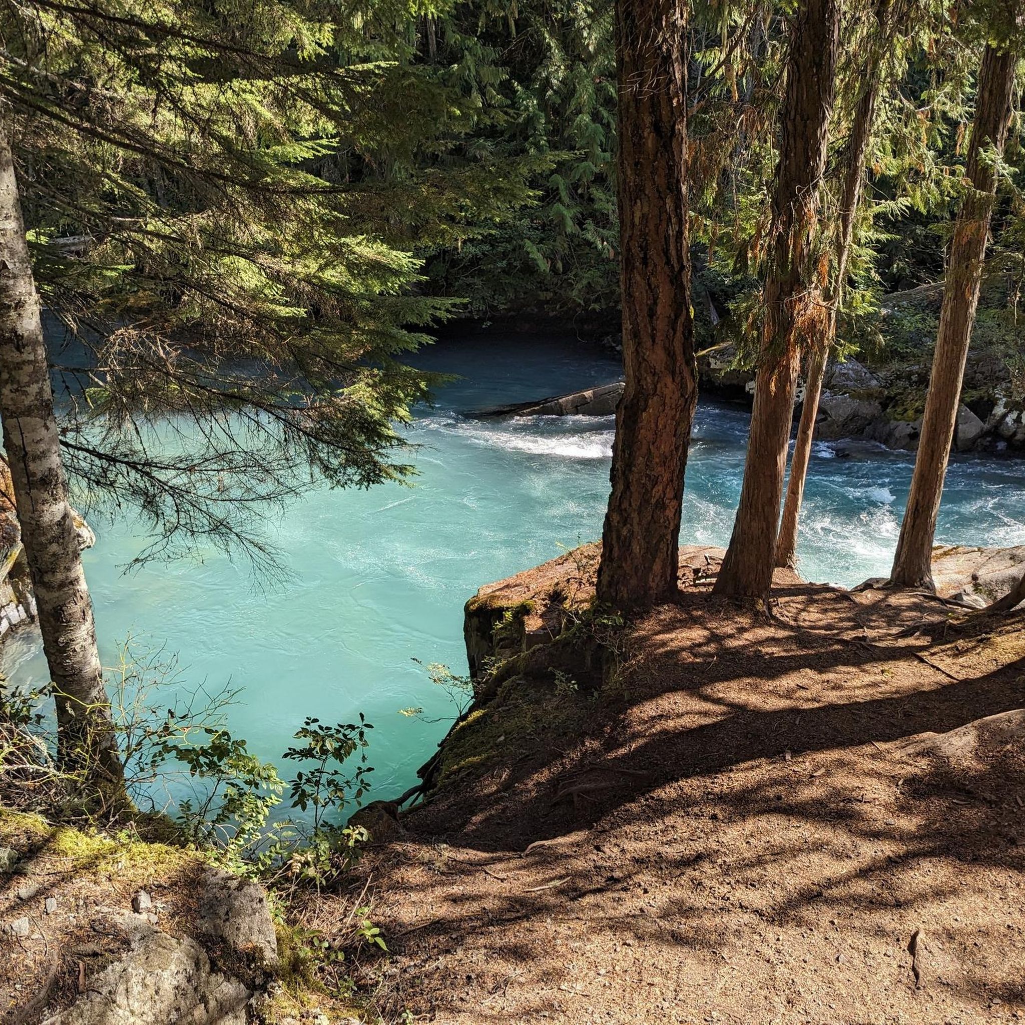
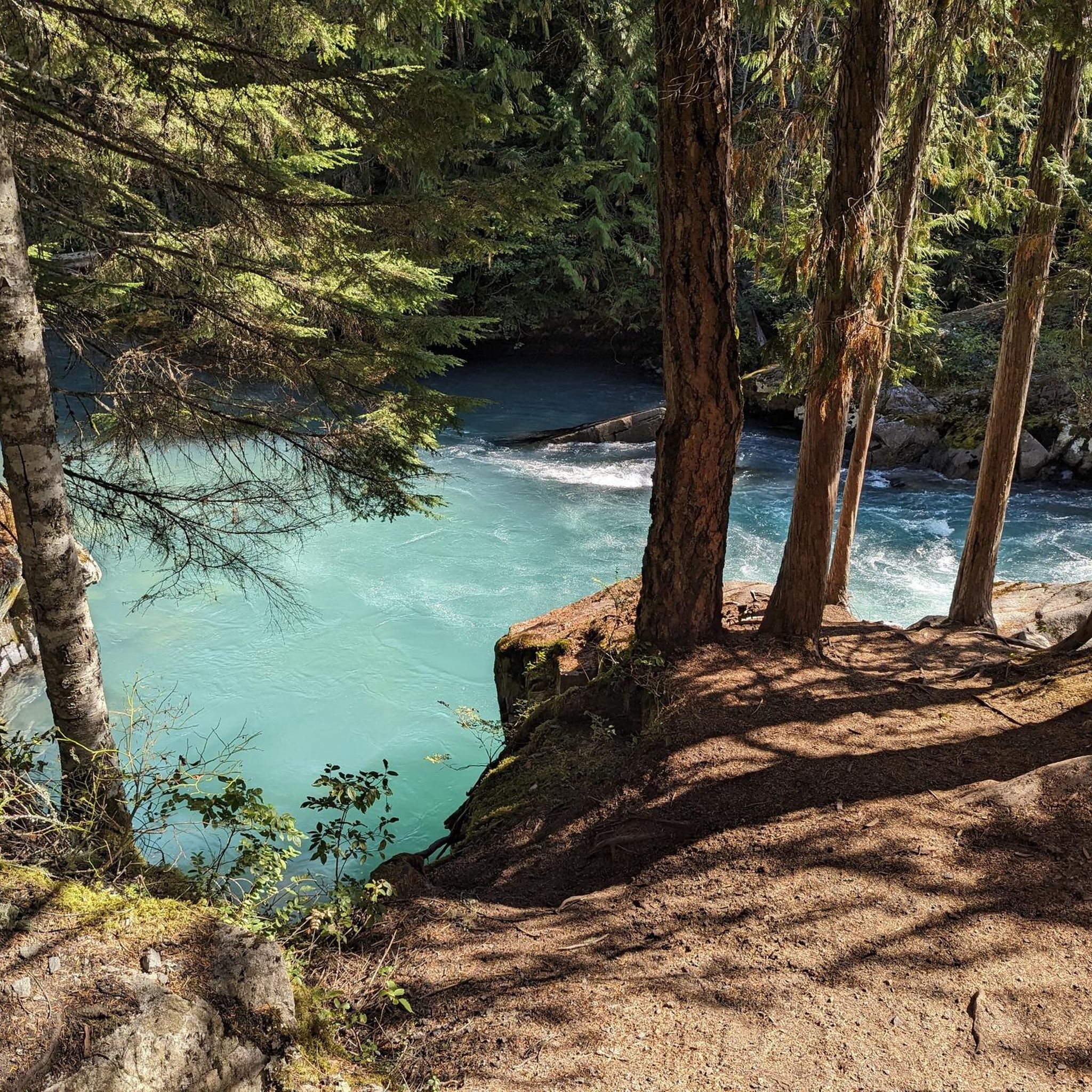
The Cheakamus River is known for its blue and turquoise water and the dramatic canyon it thunders through. The color comes from glacial melt from the nearby Coast Mountains. Hikers and bikers will pass rock cliffs and gorges carved by centuries of rushing water. The Cheakamus River is often dotted with fly fishers fishing for rainbow trout and bull trout. When the water is flowing strongly, whitewater paddlers brave the cold waters. In the fall, the surrounding trees turn amazing colors.
1
0

One of several very beautiful views along the way.
0
0
The hiking trail through the forest is really beautiful and quite flat, making it a relaxing walk.
0
0
Frequently Asked Questions
How many hiking trails are there in Whistler Interpretive Forest?
Whistler Interpretive Forest offers a wide selection of hiking opportunities, with over 130 trails available. These range from easy strolls to more challenging routes, ensuring options for various fitness levels.
What types of landscapes can I expect to see while hiking in Whistler Interpretive Forest?
You can expect diverse landscapes, including tranquil old-growth forests with western hemlock and red cedar trees, some dating back to the 1700s. The dramatic Cheakamus River canyon, known for its striking blue glacial meltwaters, is a prominent feature. You'll also find unique geological formations like Logger's Lake, situated within an extinct volcano, and the series of small alpine Jane Lakes.
Are there trails suitable for families with children or beginners?
Yes, Whistler Interpretive Forest is well-suited for families and beginners, with 63 easy routes available. An excellent option is the Riverside & Farside to Cheakamus River Suspension Bridge loop, which is 3.2 miles (5.2 km) long and leads to the impressive Cheakamus River Suspension Bridge.
Are there any circular hiking routes available?
Many trails in Whistler Interpretive Forest are designed as loops. For an easy circular hike, consider the Interpretive Forest Trail – Cheakamus River loop from Function Junction, which is 3.9 miles (6.3 km) and takes you through old-growth forest along the Cheakamus River.
What natural features or landmarks can I explore in Whistler Interpretive Forest?
Hikers can explore several notable features. The Cheakamus River Suspension Bridge offers impressive views of the turquoise river and canyon. You can also visit the unique Whistler Train Wreck site, accessible via various trails. Don't miss Logger's Lake, nestled in an extinct volcano, and the dramatic Cheakamus River itself.
Are dogs allowed on the trails in Whistler Interpretive Forest?
Yes, Whistler Interpretive Forest is generally dog-friendly, making it a great place to hike with your canine companion. Always ensure your dog is on a leash and that you clean up after them to preserve the natural environment for everyone.
What are some good trails for scenic views or photography?
For stunning views, trails around Logger's Lake and the Crater Rim Trail offer vistas from the ridge of the extinct volcano. The Cheakamus River Suspension Bridge also provides impressive photo opportunities of the canyon and glacial waters. You can also find viewpoints like the Old Viewpoint of the Coast Mountains and a View of the Tantalus Range.
How long do hikes typically take in Whistler Interpretive Forest?
Hike durations vary significantly depending on the trail and your pace. Easy routes like the Riverside & Farside to Cheakamus River Suspension Bridge loop can be completed in about 1 hour 24 minutes, while longer, more challenging trails such as West Jane Lake can take over 4 hours.
Is public transport available to reach the trailheads?
Yes, some trailheads in Whistler Interpretive Forest are accessible via public transport. For example, the Suspension Bridge – Whistler Train Wreck loop can be started from Cheakamus Crossing, which is served by local transit.
Where can I find parking for the hiking trails?
Parking is available at various access points for the Whistler Interpretive Forest trails, particularly near Function Junction and Cheakamus Crossing. These areas serve as convenient starting points for many popular routes.
What is the best time of year to hike in Whistler Interpretive Forest?
The best time to hike is generally from late spring through early autumn (May to October) when trails are clear of snow and the weather is mild. During these months, you can fully enjoy the diverse landscapes and attractions. Winter hiking is also possible, but conditions may require snowshoes or microspikes on some trails.
What do other hikers say about the trails here?
The trails in Whistler Interpretive Forest are highly rated by the komoot community, with an average score of 4.6 stars from over 1000 reviews. Hikers often praise the well-maintained and clearly marked trail network, the stunning views of the Cheakamus River, and the unique attractions like the Train Wreck and Logger's Lake.
Are there any trails that lead to a suspension bridge?
Absolutely! A popular and easy trail that leads to a suspension bridge is the Riverside & Farside to Cheakamus River Suspension Bridge loop. This route takes you directly to the impressive Cheakamus River Suspension Bridge, offering fantastic views of the canyon below.
Most popular routes in Whistler Interpretive Forest
Most popular attractions in Whistler Interpretive Forest

Get inspired with the komoot mobile app


Explore more
Browse the best Hikes in other regions.
