The best walks and hikes in Telemark Cross-Country Ski Trails Recreation Site
4.8
(39)
440
hikers
12
hikes
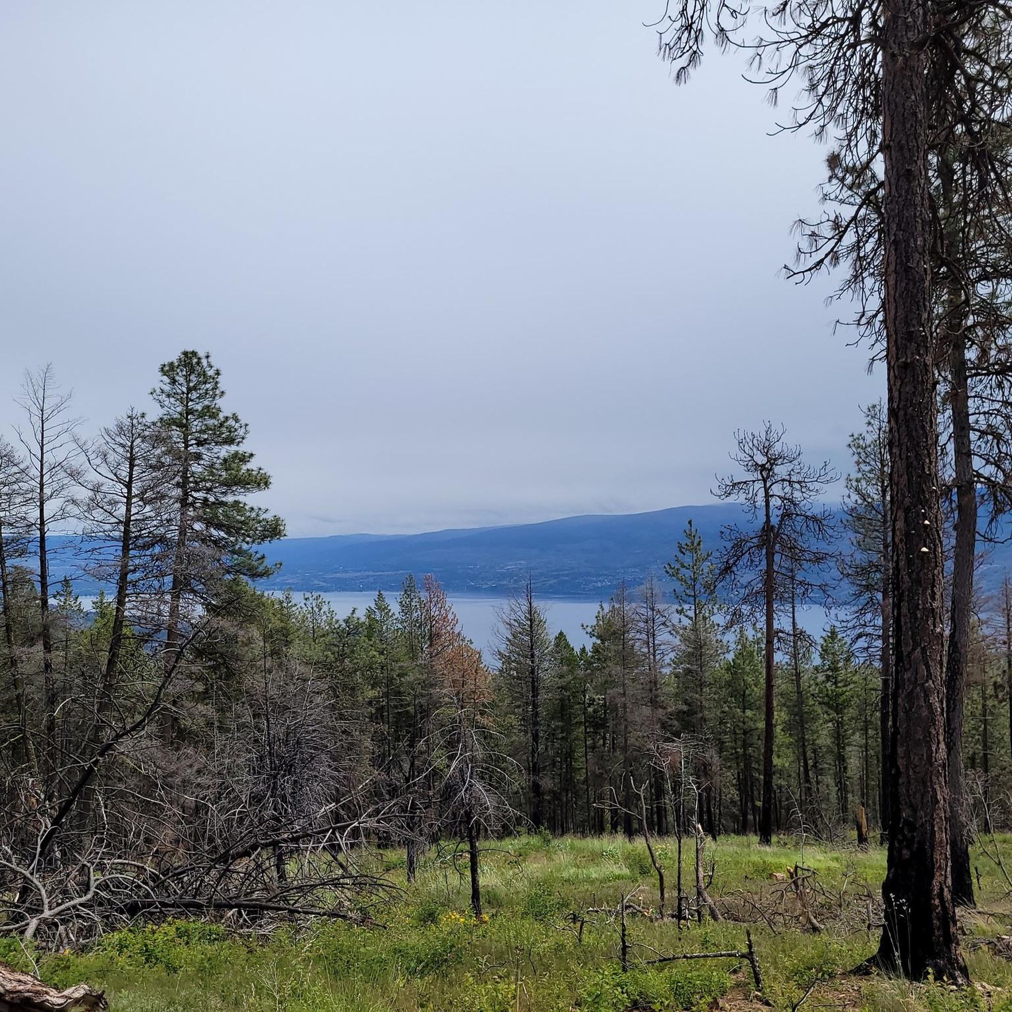
Hiking in Telemark Cross-Country Ski Trails Recreation Site offers access to a network of trails within a natural park in British Columbia. The area features varied topography, including gradual climbs and elevation changes, providing diverse hiking experiences. Trails often lead through forested areas and offer views of Okanagan Lake. The region is known for its extensive trail systems, catering to various outdoor activities.
Best hiking trails in Telemark Cross-Country Ski Trails Recreation Site
- The most popular hiking route is Lake…
Last updated: September 1, 2026
5.0
(1)
9
hikers
6.32km
01:43
90m
90m
Easy hike. Great for any fitness level. Easily-accessible paths. Suitable for all skill levels.
4.7
(10)
103
hikers
Easy hike. Great for any fitness level. Easily-accessible paths. Suitable for all skill levels.

Sign up for free
5.0
(1)
2
hikers
4.78km
01:30
180m
180m
Easy hike. Great for any fitness level. Easily-accessible paths. Suitable for all skill levels.
5.0
(2)
18
hikers
5.14km
01:43
260m
260m
Easy hike. Great for any fitness level. Easily-accessible paths. Suitable for all skill levels.
7
hikers
8.16km
02:04
20m
20m
Moderate hike. Good fitness required. Easily-accessible paths. Suitable for all skill levels.
Get access to more routes and recommendations from other explorers.
Sign up for free
Already have an account?
Our route recommendations are based on thousands of hikes, rides, and runs completed by other people on komoot.
Start today with a free account
Your next adventure awaits.
Login or Signup
Popular around Telemark Cross-Country Ski Trails Recreation Site
Tips from the Community

Okanagan Lake stretches through the heart of the valley, with communities including Vernon, Kelowna, Peachland and Penticton set along its shores. Around Peachland, you can stay close to the water for kilometres, with beaches, parks and the Centennial Way waterfront path lining the shore. It’s also a popular spot for swimming and paddling in summer, though beach water quality is monitored and occasional advisories can be issued.
0
0
Peachland Heritage Park sits on the Okanagan Lake waterfront at the south end of Centennial Way. It has open lawns, picnic tables, washrooms, a playground and splash park, plus direct access to the 120-metre Ray Kandola Heritage Pier. It’s also a handy place to pick up Centennial Way, the 13-block waterfront walkway that continues north along Beach Avenue.
0
0
Cove Beach is a small public beach on Okanagan Lake beside the former Davis Cove Resort (now called Peachland Beach Resort). It’s a simple spot, with sandy shoreline, a small swimming area and a picnic table rather than lots of facilities. There are no public washrooms or dedicated parking here, which also keeps it quieter than some of Peachland’s larger beaches.
0
0

You can park along Harrington Crescent to access the trail system north of Peachtree. There are a bunch of spur trails right when you start, so you'll want to download a GPS map to be certain of the main path - there are some that detour onto private land. Once you get further up into the Gladstone trail system the route becomes easier to follow.
0
0
Peachland was once a mining town, and the east side of the loop has a number of old mineshafts (now overgrown pits) from the 1890s. In its heyday, Gladstone Mine once exported gold, silver, copper, and other heavy metals.
0
0
The trail is well-maintained and there is a bench at the lookout to Okanagan Lake. It can be a bit rocky in places, but overall this trail is very new as it was constructed recently by the Peachland Outdoors Club.
0
0

The Trepanier Creek Trail follows a mostly flat, well-defined corridor along the creek. The terrain is mostly packed dirt and gravel, making it an accessible hike. Along the route, you’ll pass remnants of early hydro infrastructure, including segments of an old wooden stave pipeline that once operated here.
0
0
This is the entrance and parking area for Trepanier Regional Park, with ample parking, washrooms, and access to the Trepanier Creek Trail. The park is open during daylight hours, so its times change seasonally.
0
0
Frequently Asked Questions
How many hiking trails are available in Telemark Cross-Country Ski Trails Recreation Site?
Telemark Cross-Country Ski Trails Recreation Site offers several hiking trails, with a total of 7 routes documented on komoot. These trails cater to various skill levels, including 4 easy and 3 moderate options.
What kind of terrain can I expect on the hiking trails?
The trails in Telemark Cross-Country Ski Trails Recreation Site feature varied topography, including gradual climbs and significant elevation changes. You'll hike through forested areas, experiencing the beautiful Northwoods terrain, with many routes offering scenic views of Okanagan Lake.
Are there any easy hiking trails suitable for beginners or casual walkers?
Yes, there are several easy trails. For a pleasant walk with views, consider the Lake Okanagan viewpoint – Pincushion Mountain Summit loop from Pincushion Mountain, which is 2.2 miles long. Another easy option is the View of Okanagan Lake loop from Glenrosa, spanning 3.0 miles.
What do other hikers enjoy most about Telemark Cross-Country Ski Trails Recreation Site?
The area is highly rated by the komoot community, with an average score of 4.9 stars from over 20 reviews. Hikers often praise the varied terrain, the well-maintained paths, and the rewarding viewpoints overlooking Okanagan Lake.
Are there any trails with significant elevation gain for a more challenging hike?
For a more challenging experience with notable elevation gain, the Carrot Mountain Viewpoint loop from Davidson Creek is a moderate 3.1-mile route that includes over 550 meters of ascent, offering a good workout and panoramic views.
Are the hiking trails in Telemark Cross-Country Ski Trails Recreation Site suitable for families?
Yes, the area offers family-friendly options. Many trails, particularly the easy ones, are suitable for families. The varied terrain and scenic views provide an engaging experience for all ages. Always check the specific trail details for distance and elevation to match your family's capabilities.
Can I bring my dog on the hiking trails?
While the guide data does not explicitly state dog-friendly policies, many trails in natural recreation sites allow dogs on leash. It is always recommended to check local regulations or signage at the trailhead before heading out with your pet.
Are there any circular hiking routes available?
Yes, several routes are designed as loops. Examples include the Lake Okanagan viewpoint – Pincushion Mountain Summit loop from Pincushion Mountain and the View of Okanagan Lake loop from Glenrosa, both offering convenient circular paths.
What are the best trails for scenic views of Okanagan Lake?
Many trails offer beautiful vistas of Okanagan Lake. The Lake Okanagan viewpoint – Pincushion Mountain Summit loop from Pincushion Mountain is specifically noted for its views from Pincushion Mountain, and the View of Okanagan Lake loop from Glenrosa also provides excellent scenic overlooks.
Is there parking available at the trailheads?
While specific parking details for each trailhead are not provided in the guide, recreation sites like Telemark typically offer designated parking areas for visitors. It's advisable to look for signs or information boards upon arrival to confirm parking locations and any potential fees.
What is the typical duration for a hike in this area?
Hike durations vary depending on the trail's length and difficulty. Easy routes like the Lake Okanagan viewpoint – Pincushion Mountain Summit loop can take around 1 hour 20 minutes, while moderate trails such as the Big Sagebrush and Mountain Goat Trail might take about 2 hours 10 minutes.
Are there any trails that pass through unique natural features?
The Big Sagebrush and Mountain Goat Trail is known for leading through varied terrain, suggesting diverse flora and potentially wildlife, characteristic of the Northwoods landscape.
Most popular routes in Telemark Cross-Country Ski Trails Recreation Site

Get inspired with the komoot mobile app


Explore more
Browse the best Hikes in other regions.
