The best road cycling routes in Fish Creek Provincial Park
4.6
(83)
1,415
riders
45
rides
Road cycling in Fish Creek Provincial Park offers an expansive network of trails within south Calgary, spanning 19 km from east to west. The park features over 60 km of paved pathways, providing varied terrain for cyclists. It encompasses distinct natural regions, including grasslands, parkland, old-growth forests, open meadows, and wetlands, with Fish Creek meandering through its length before joining the Bow River.
Best road cycling routes in Fish Creek Provincial Park
- The most popular road cycling route is Weaselhead Natural Area – View of the Reservoir loop from Canyon Meadows, a 26.0 miles (41.9 km) trail that takes 1 hour 46 minutes to complete. This easy route offers views of the Weaselhead Natural Area and the reservoir.
- Another top favourite among local road cyclists is Annie's Café – MacKenzie Ridge loop from Fish Creek Provincial Park, an easy 25.0 miles (40.2 km) path. This route passes by Annie's Café, a popular refreshment stop, and explores the MacKenzie Ridge area.
- Local road cyclists also love the Stormwater Overflow Pond – Fish Creek Provincial Park loop from Sundance, a 15.2 miles (24.5 km) trail leading through the park's eastern sections, often completed in about 1 hour 12 minutes.
- Road cycling in Fish Creek Provincial Park is defined by paved pathways along Fish Creek and the Bow River, diverse landscapes including grasslands and forests, and connections to Calgary's larger pathway system. The network offers options for different ability levels, from easy rides to more demanding routes with elevation gains.
- The routes in Fish Creek Provincial Park are highly rated by the komoot community with an average score of 4.7 stars from over 70 reviews. More than 1,500 road cyclists have used komoot to explore Fish Creek Provincial Park's varied terrain.
Last updated: September 30, 2026
4.8
(4)
110
riders
42.0km
01:47
260m
260m
Easy road ride. Great for any fitness level. Mostly well-paved surfaces and easy to ride.
5.0
(1)
55
riders
40.2km
01:43
230m
230m
Easy road ride. Great for any fitness level. Mostly well-paved surfaces and easy to ride.

4.0
(2)
42
riders
34.6km
01:42
130m
130m
Moderate road ride. Great for any fitness level. Some segments of this route may be unpaved and difficult to ride.
5.0
(5)
33
riders
21.1km
00:55
90m
90m
Easy road ride. Great for any fitness level. Mostly well-paved surfaces and easy to ride.
27
riders
23.5km
01:03
110m
110m
Easy road ride. Great for any fitness level. Mostly well-paved surfaces and easy to ride.
Get access to more routes and recommendations from other explorers.
Already have an account?
Our route recommendations are based on thousands of hikes, rides, and runs completed by other people on komoot.
Start today with a free account
Your next adventure awaits.
Popular around Fish Creek Provincial Park
Tips from the Community

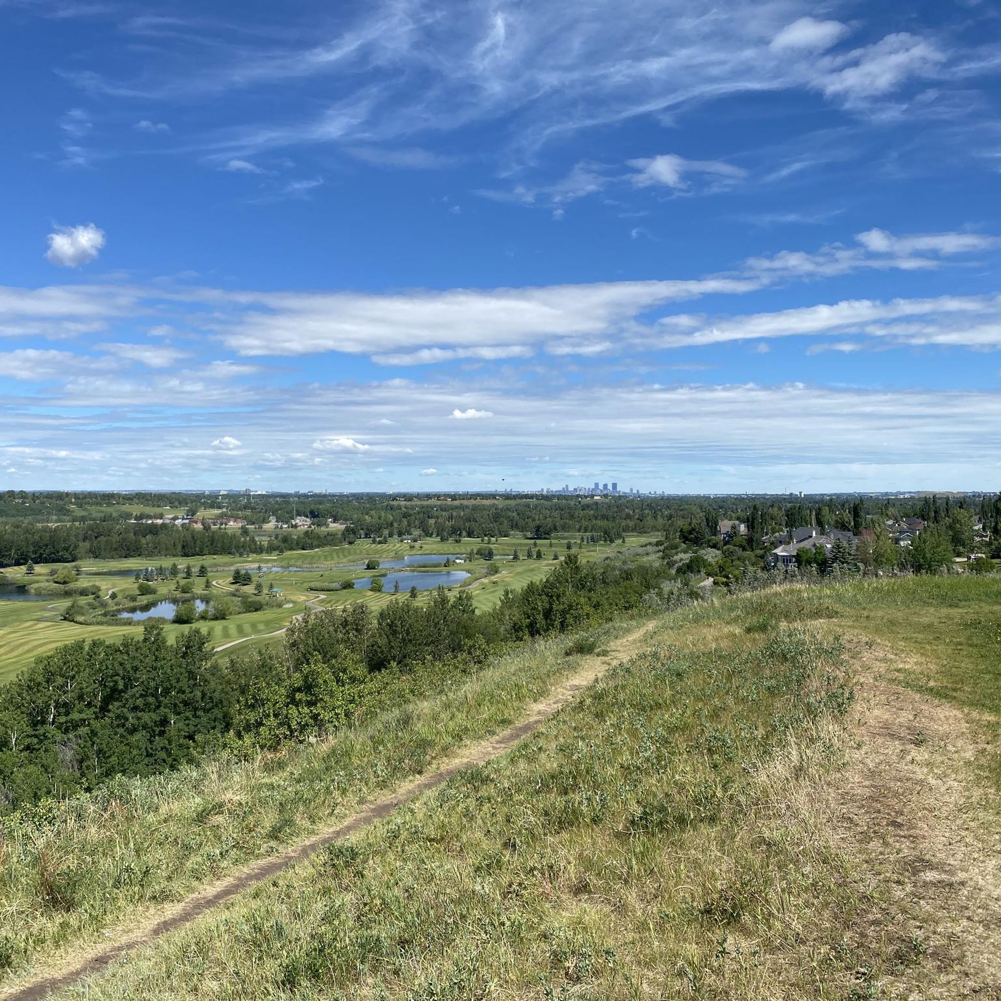
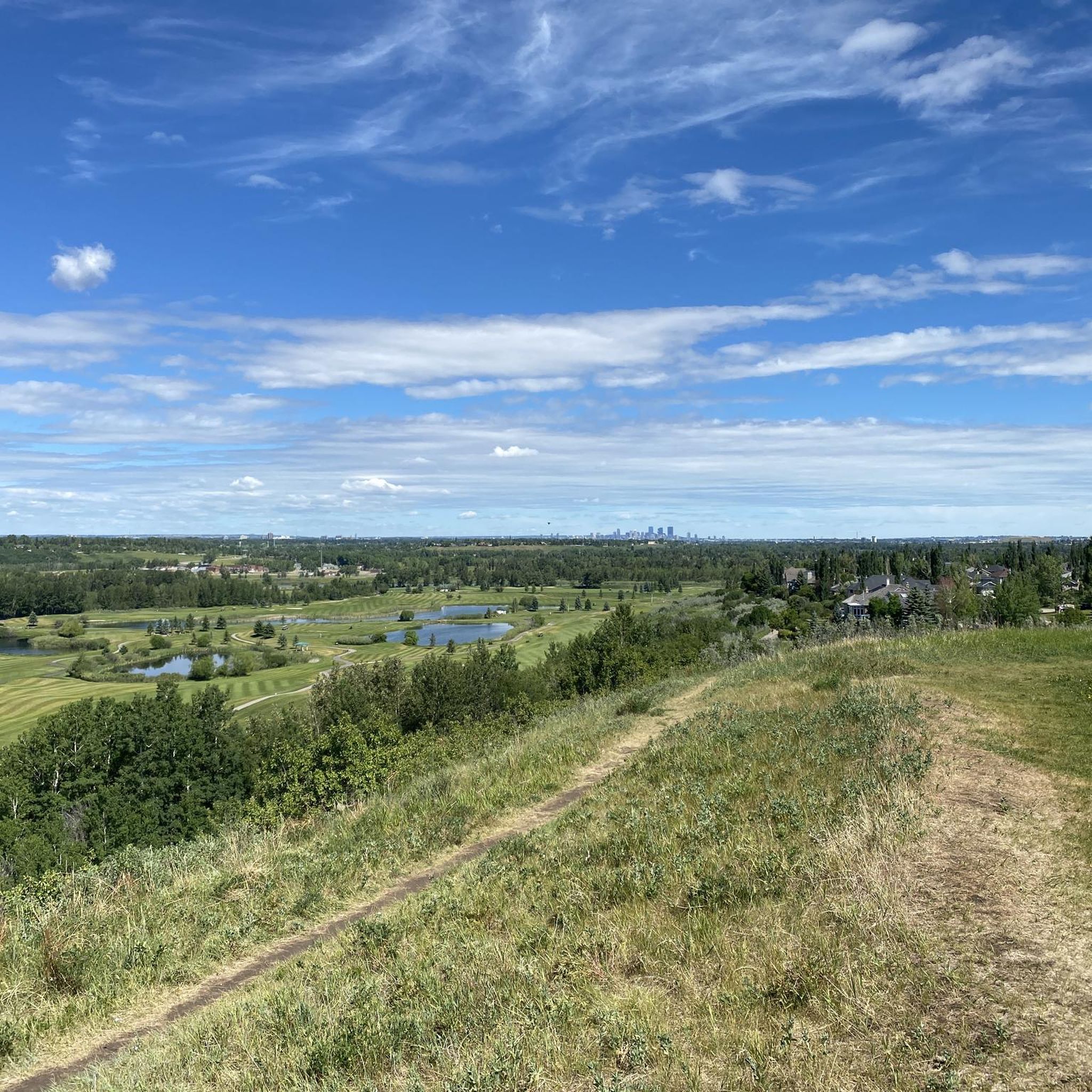
One of the most convenient access points for exploring Fish Creek Provincial Park, Glennfield West has a large parking area, modern washrooms, picnic sites, and direct access to both paved and natural-surface trails. From here, it's easy to reach Fish Creek, the Rotary Mattamy Greenway, and several forested sections of the park. Despite being within Calgary city limits, the surrounding cottonwood forest and creek valley create a surprisingly natural setting that's popular with walkers, cyclists, and wildlife enthusiasts.
0
0
Part of Calgary's 140-kilometre Rotary Mattamy Greenway, this paved multi-use pathway offers one of the easiest ways to explore Fish Creek Provincial Park. The route passes through a mix of forest, open grasslands, and creek-side scenery, with picnic areas and rest stops spread out along the way. Despite being within city limits, long stretches feel surprisingly removed from the surrounding neighbourhoods, making it a popular choice for walking, cycling, and wildlife spotting.
0
0


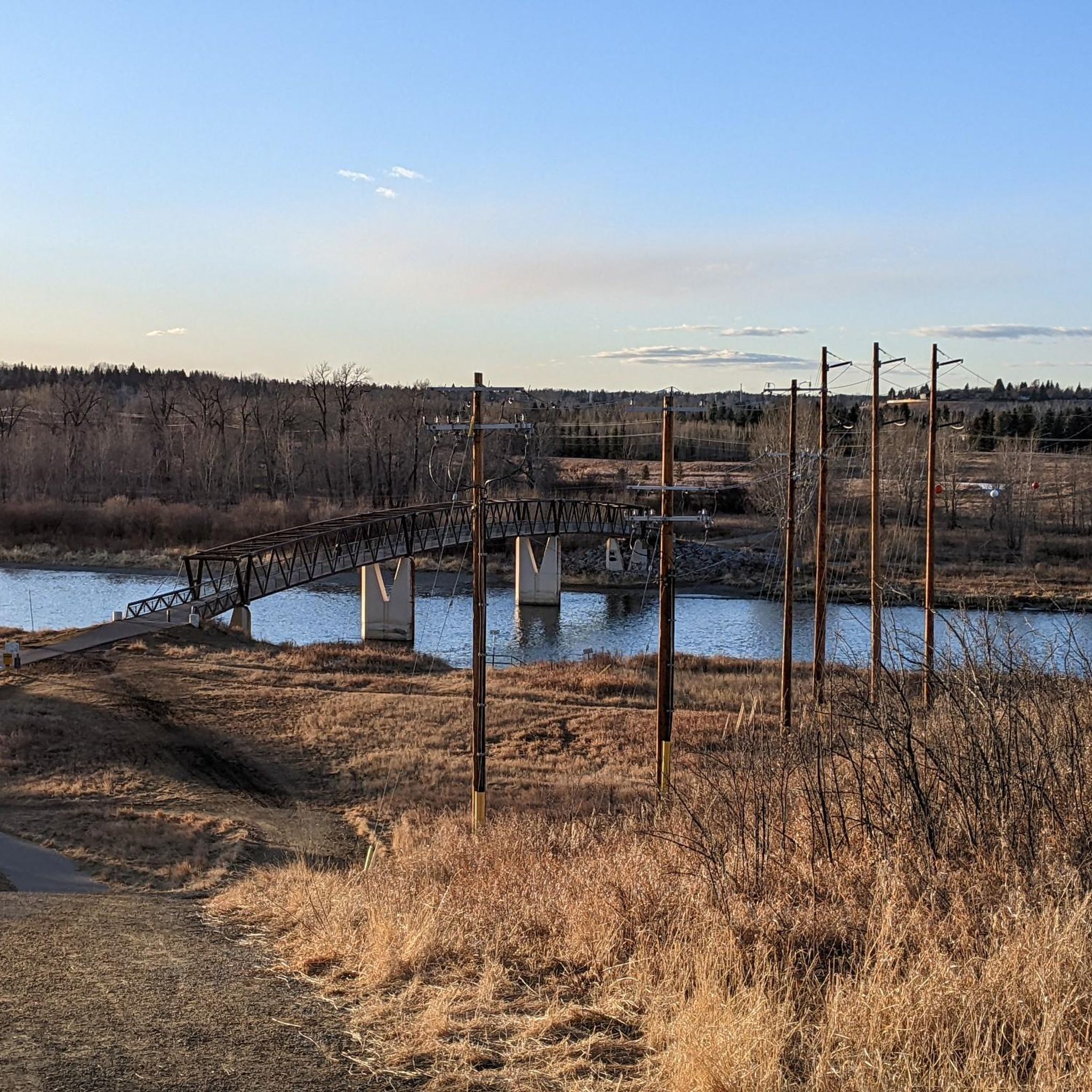
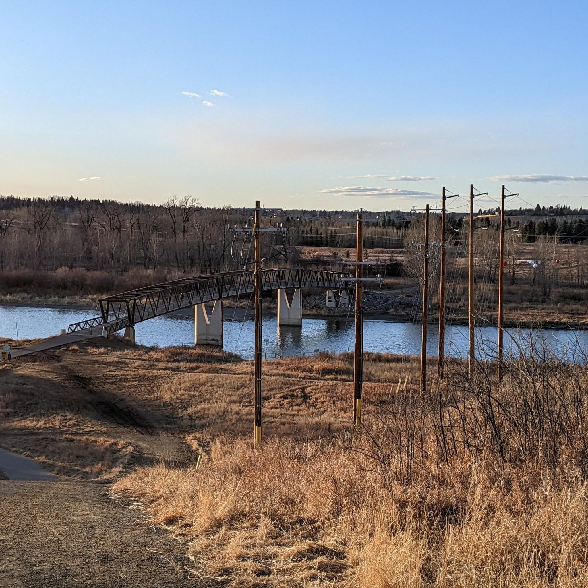
This section of the Trans-Canada Trail hugs the shores of the Bow River, with the McKenzie Meadows Golf Club to the east. The views from this section of trail have awesome views of the Bow River, with Fish Creek Provincial Park on the other side. The entire Trans-Canada Trail stretches over 27,000 kilometres, with this section passing through the heart of Calgary.
0
0
Gaze out over the Bow River to the west, with a neighbourhood to the east. This area of the Bow River Pathway is just elevated enough to get a view over the river, and on a clear day, the Banff Mountains in the far off distance. There's a lawn that can be rested on, and a trash can as well.
0
0

Fish Creek has maintained much of its natural state thanks to the large provincial park that surrounds it as it flows through southern Calgary. Providing vital habitat for a wide range of flora and fauna the creek is known for trout fishing and the over 200 bird species that have been spotted along its banks. The park that surrounds it as over 100 kilometres of trails ranging in difficulty and terrain type, so just about everyone is likely to find a stretch of trail that suits them.
0
0

There is a little bench by the trail where you can sit and enjoy the views over the mouth of the Elbow River as it meanders into the reservoir.
0
0

The Bow River flows east through Calgary and forms part of the eastern boundary of Fish Creek Provincial Park. In this area, paved pathways and multi-use trails follow its banks, offering scenic access to water views, wildlife, and connections to Calgary’s greater pathway system. The river and adjacent parklands are popular for walking, cycling, fishing and enjoying open-air river scenery within the city’s natural green corridor.
0
0
Frequently Asked Questions
What kind of terrain can I expect on road cycling routes in Fish Creek Provincial Park?
Fish Creek Provincial Park offers over 60 km of paved and generally well-maintained pathways, making it ideal for road cycling. The park features diverse landscapes, including grasslands to the east and parkland to the west, with old-growth forests, open meadows, and wetlands. You'll find routes along Fish Creek and the Bow River, often framed by thin poplar forests.
Are there road cycling routes suitable for beginners or families in Fish Creek Provincial Park?
Yes, the park's extensive network of paved pathways caters to a range of fitness levels, including easy, short rides perfect for beginners and families. Many routes are relatively flat, offering a pleasant experience. For example, the Weaselhead Natural Area – View of the Reservoir loop from Canyon Meadows is an easy route that offers scenic views.
How long are the typical road biking routes in Fish Creek Provincial Park?
Road biking routes in Fish Creek Provincial Park vary in length. You can find shorter rides, but many popular routes range from 20 km to over 40 km. For instance, the Annie's Café – MacKenzie Ridge loop from Fish Creek Provincial Park is about 40 km, while the Stormwater Overflow Pond – Fish Creek Provincial Park loop from Sundance is around 24.5 km.
Are there any circular road bike routes in the park?
Yes, many of the road cycling routes in Fish Creek Provincial Park are designed as loops, allowing you to start and end at the same point. Examples include the Weaselhead Natural Area – View of the Reservoir loop from Canyon Meadows and the Annie's Café – MacKenzie Ridge loop from Fish Creek Provincial Park.
What landmarks or natural features can I see along the road cycling routes?
As you cycle through Fish Creek Provincial Park, you can enjoy diverse natural features such as the Weaselhead Natural Area, the meandering Fish Creek, and the Bow River. Keep an eye out for the Stormwater Overflow Pond and the scenic MacKenzie Ridge. The park also features old-growth forests, open meadows, and wetlands.
Where can I find refreshments or amenities along the routes?
The park offers several convenient stops for refreshments. Annie's Cafe, a historic farmhouse, is a popular spot for coffee, baked goods, soups, and sandwiches. For a more refined dining experience, the historic Bow Valley Ranche Restaurant is also located within the park. Additionally, there are numerous picnic and day-use areas available.
What is the best time of year for road biking in Fish Creek Provincial Park?
Fish Creek Provincial Park is enjoyable for road cycling throughout much of the year. Spring, summer, and fall offer pleasant conditions for exploring the paved pathways. During summer, the Sikome Aquatic Facility provides a popular spot for swimming. While winter cycling is possible, conditions may vary, and pathways might be snow-covered or icy.
Can I spot wildlife while road cycling in Fish Creek Provincial Park?
Yes, Fish Creek Provincial Park is a biodiverse area, home to over 200 bird species, as well as mammals like deer, coyotes, owls, and beavers. Bald eagles can be seen nesting along the Bow River valley, and other raptors like red-tailed hawks are common. Remember to observe wildlife responsibly and maintain a safe distance.
How accessible is Fish Creek Provincial Park by public transport for cyclists?
Fish Creek Provincial Park is well-integrated into Calgary's larger pathway system, including connections to the Trans Canada Trail, making it accessible. While specific public transport routes for cyclists should be checked with local transit authorities, the park's urban location within south Calgary generally allows for good access.
What do other road cyclists enjoy most about road cycling in Fish Creek Provincial Park?
The area is highly rated by the komoot community, with an average score of 4.7 stars from over 70 reviews. Reviewers often praise the extensive network of paved pathways, the diverse natural landscapes, and the seamless connections to Calgary's broader cycling system, offering varied terrain for all ability levels.
Are there options for more challenging road bike routes with elevation gains?
While many routes are easy, Fish Creek Provincial Park does offer more demanding routes that can include elevation gains, providing a good workout for experienced cyclists. The park's varied terrain allows for options beyond just flat rides, catering to those looking for a greater challenge.
Most popular routes in Fish Creek Provincial Park
Most popular attractions in Fish Creek Provincial Park

Get inspired with the komoot mobile app


Explore more
Browse the best Road cycling routes in other regions.
