The best walks and hikes in Zec Du Lac-Au-Sable
4.6
(88)
2,356
hikers
16
hikes
Hiking in Zec Du Lac-Au-Sable offers a diverse network of trails within the rugged Charlevoix landscape of Québec. The region features elevations ranging from 150 meters to over 1000 meters, providing numerous viewpoints. Its expansive territory includes approximately one hundred lakes and a comprehensive network of rivers, such as the Malbaie, Petit Saguenay, and Jacob rivers. The distinct mountainous and forested areas create varied terrain for outdoor activities.
Best hiking trails in Zec Du Lac-Au-Sable
- The most popular hiking route…
Last updated: July 4, 2026
15
hikers
14.3km
06:08
610m
610m
Hard hike. Very good fitness required. Sure-footedness, sturdy shoes and alpine experience required.
4.9
(14)
360
hikers
Hard hike. Very good fitness required. Easily-accessible paths. Suitable for all skill levels.

Sign up for free
4.7
(3)
106
hikers
16.9km
04:26
140m
140m
Moderate hike. Good fitness required. Easily-accessible paths. Suitable for all skill levels.
4.5
(2)
119
hikers
Moderate hike. Good fitness required. Easily-accessible paths. Suitable for all skill levels.
4.3
(6)
78
hikers
Moderate hike. Good fitness required. Easily-accessible paths. Suitable for all skill levels.
Get access to more routes and recommendations from other explorers.
Sign up for free
Already have an account?
Our route recommendations are based on thousands of hikes, rides, and runs completed by other people on komoot.
Start today with a free account
Your next adventure awaits.
Login or Signup
Popular around Zec Du Lac-Au-Sable
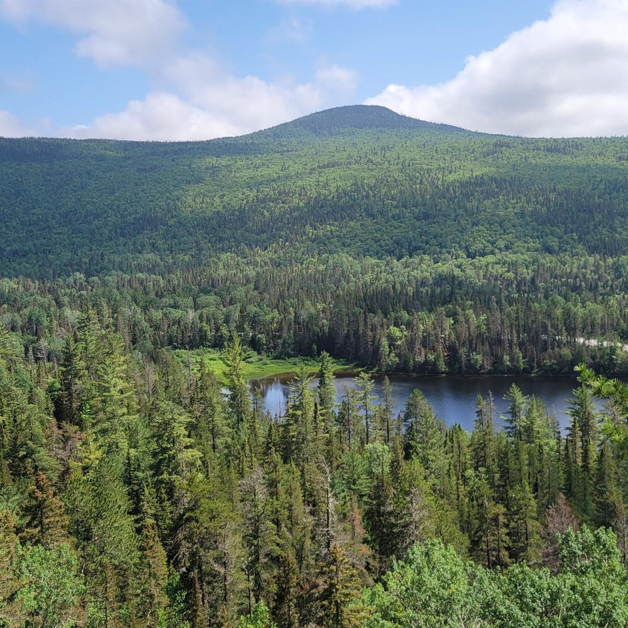
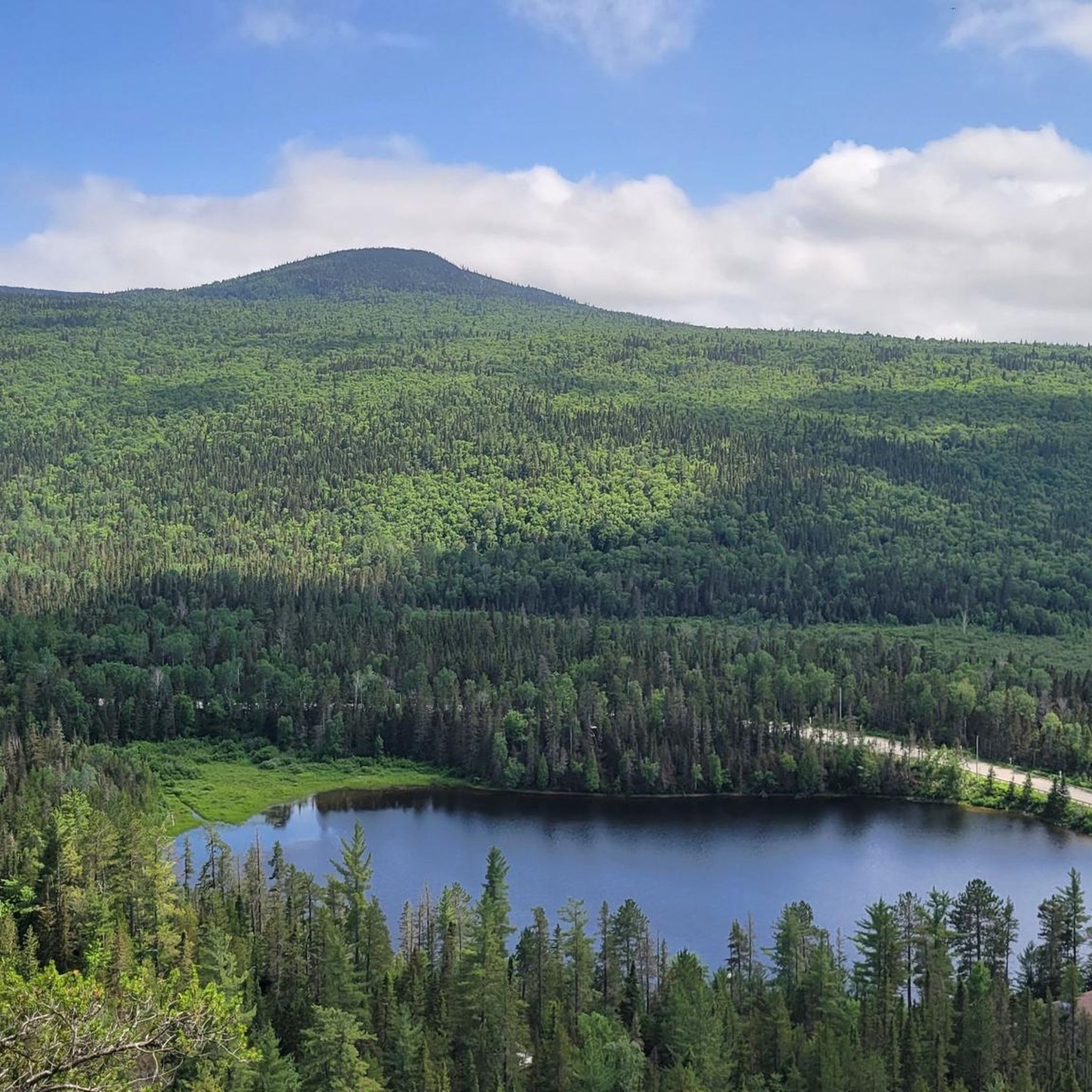
Tips from the Community

very beautiful trail, and perfect for relaxing near the lake
0
0

Together with Lac Larouche and Lac du Foulon, Lac Sans Oreille is nestled between some rolling hills covered with scented pine trees. What a great place to be! Enjoy the pristine nature and keep your eyes peeled for wildlife.
1
0

Bus runs every 15 min. Back to the parking lot at the beginning of the park
1
0
Frequently Asked Questions
How many hiking trails are available in Zec Du Lac-Au-Sable?
Zec Du Lac-Au-Sable offers a network of over 15 hiking trails, catering to various skill levels from easy to difficult. The region's diverse terrain, with elevations ranging from 150 to over 1000 meters, ensures a variety of experiences.
Are there any easy or beginner-friendly hiking routes in Zec Du Lac-Au-Sable?
Yes, Zec Du Lac-Au-Sable has options for beginners. The Gamelle Trail is an easily accessible and shorter option, less than 2 km round trip, following a river to a beautiful waterfall. Another good choice is the Mont à Peine Trail, located 10 km from the Zec's reception, which is classified as easy to intermediate and covers 3 km one way.
What kind of natural features and viewpoints can I expect to see while hiking?
The Zec is renowned for its rugged Charlevoix beauty. Hikers can expect stunning panoramic views from higher elevations, especially from summits like Mont Élie. The landscape is dotted with approximately one hundred lakes, including the magnificent sandy beach of Lac au Sable, and crisscrossed by rivers such as the Malbaie, Petit Saguenay, and Jacob rivers. Dense forests and mountainous terrain define the scenic beauty.
Are there any trails with waterfalls in Zec Du Lac-Au-Sable?
Yes, the Gamelle Trail is a short and accessible route that follows a river and culminates in a view of the beautiful Gamelle waterfall, making it a popular spot for those seeking a scenic natural feature.
Are there any family-friendly hiking options in the Zec?
For families, trails like the Gamelle Trail offer an easy and rewarding experience due to its short distance and the scenic waterfall at its end. The Mont à Peine Trail is also classified as easy to intermediate, providing a manageable distance for active families.
Can I bring my dog on the hiking trails in Zec Du Lac-Au-Sable?
While the region is generally welcoming to outdoor enthusiasts, specific regulations regarding dogs on trails can vary. It's always best to check directly with the Zec Du Lac-Au-Sable reception or their official website for the most current pet policy before planning your visit.
Are there any circular hiking routes in Zec Du Lac-Au-Sable?
Yes, several trails offer loop options. For example, the Mont Élie loop from Lac à l'Est is a challenging 14.3 km route. Another popular loop is the View of the Malbaie River – Le Draveur Service Center loop from Centre de découverte et de services Félix-Antoine-Savard, which covers 19.7 km.
Do I need a permit or pay an access fee to hike in Zec Du Lac-Au-Sable?
Yes, ZECs (Zones d'exploitation contrôlée) typically require visitors to pay an access fee for various activities, including hiking. It is advisable to check the official Zec Du Lac-Au-Sable website or contact their reception for current permit requirements and fee structures before your visit. You can find more information on their official tourism page: Tourisme Charlevoix.
What is the best time of year to go hiking in Zec Du Lac-Au-Sable?
The best time for hiking is generally from late spring to early autumn (May to October) when trails are clear of snow and the weather is mild. Fall offers spectacular foliage. While winter activities like snowshoeing are popular, specific hiking trails may be less accessible or require different gear due to snow and ice conditions.
Is there parking available at the trailheads?
Parking is generally available at key access points and service centers within Zec Du Lac-Au-Sable. For specific trailheads like the Mont à Peine Trail, parking is typically located near the Zec's reception or designated starting points. It's recommended to confirm parking availability and any associated fees when planning your hike.
What do other hikers enjoy most about hiking in Zec Du Lac-Au-Sable?
The area is highly rated by the komoot community, with an average score of 4.6 stars from over 80 reviews. Hikers often praise the stunning panoramic views, the diverse natural features including lakes and rivers, and the variety of trails that cater to different skill levels. The rugged beauty of the Charlevoix region is a consistent highlight.
Are there any challenging hikes for experienced trekkers?
Absolutely. For experienced hikers, the Mont Élie loop from Lac à l'Est is a difficult 14.3 km trail with significant elevation gain, offering magnificent panoramic views from the summit. Another challenging option is the View of the Malbaie River – Le Draveur Service Center loop from Centre de découverte et de services Félix-Antoine-Savard, a difficult 19.7 km path with rewarding river views.
Most popular routes in Zec Du Lac-Au-Sable

Get inspired with the komoot mobile app


Explore more
Browse the best Hikes in other regions.
