The best walks and hikes in Els Bassars - Clot De Galvany
4.4
(485)
4,148
hikers
169
hikes
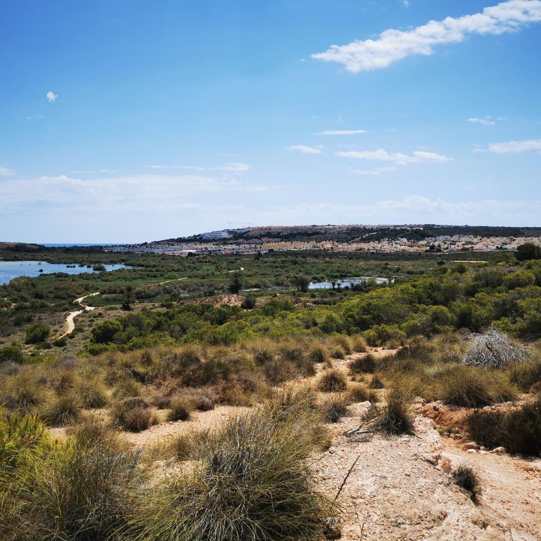
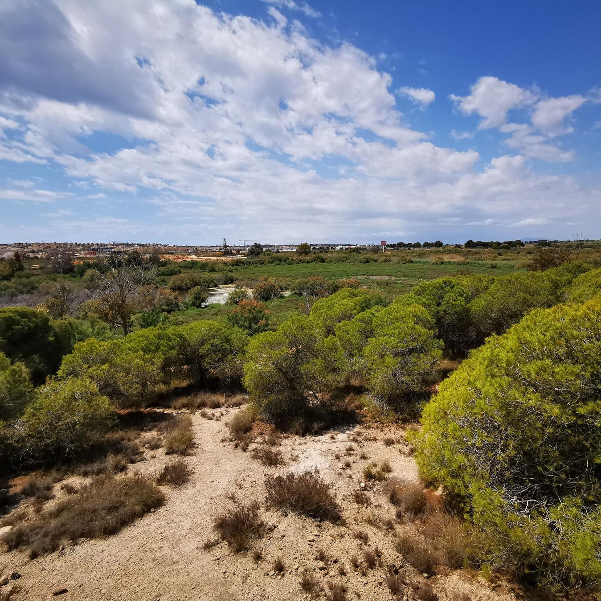
Hiking in Els Bassars - Clot De Galvany offers diverse landscapes within a 366-hectare nature reserve. The area features a blend of coastal environments, wetlands, and hills. Notable physical features include natural and artificial ponds, dune formations, and the hills of Cabeco-Carabassi with Mediterranean vegetation. This region provides varied terrain for outdoor activities.
Best hiking trails in Els Bassars - Clot De Galvany
- The most popular hiking route is Lagoon Viewpoint – Clot de Galvany Viewpoint loop from Clot de…
Last updated: July 5, 2026
5.0
(2)
41
hikers
9.42km
02:37
160m
160m
Moderate hike. Good fitness required. Easily-accessible paths. Suitable for all skill levels.
4.5
(2)
50
hikers
Moderate hike. Good fitness required. Easily-accessible paths. Suitable for all skill levels.

Sign up for free
4.0
(4)
37
hikers
Easy hike. Great for any fitness level. Easily-accessible paths. Suitable for all skill levels.
14
hikers
Easy hike. Great for any fitness level. Easily-accessible paths. Suitable for all skill levels.
3.0
(2)
24
hikers
Easy hike. Great for any fitness level. Easily-accessible paths. Suitable for all skill levels.
Get access to more routes and recommendations from other explorers.
Sign up for free
Already have an account?
Our route recommendations are based on thousands of hikes, rides, and runs completed by other people on komoot.
Start today with a free account
Your next adventure awaits.
Login or Signup

Tips from the Community

Don't do this route the other way around. We accidentally did, and we turned back because the descent was far too steep. It might be possible as a climb, but descending is far too dangerous!
0
0

Great view but the descent after the paraglider take-off point is very dangerous
0
2


Brilliant view at the lighthouse. The best time and best view is in the afternoon, as you then have the sun behind you with a view of the sea. Otherwise you're looking at the sun 🌞 and the photos don't turn out particularly well when backlit.
1
0

Coastal road from Santa Pola to Arenales del Sol. Very touristy area, especially with motorhomes.
1
0

Very interesting to remember our sad recent history. The explanatory signs are very good, but very deteriorated
2
0
Spectacular views of the coast and the island of Tabarca
2
0
Very nice location to experience the natural landscape. A little quieter than in the city. Driving is possible. 😉
1
0
Frequently Asked Questions
How many hiking trails are available in Els Bassars - Clot De Galvany?
There are over 170 hiking routes recorded in Els Bassars - Clot De Galvany. These trails cater to various preferences, ranging from easy strolls around the wetlands to more challenging ascents into the hills.
What are the typical difficulty levels for hiking in this region?
The hiking trails in Els Bassars - Clot De Galvany offer a good mix of difficulties. You'll find approximately 76 easy routes, 84 moderate routes, and 10 more challenging trails, ensuring options for all fitness levels.
Are there any family-friendly hiking routes in Els Bassars - Clot De Galvany?
Yes, the reserve is very suitable for families. Many of the easy, well-marked paths, especially those around the natural and artificial ponds, are perfect for all ages. The presence of wildlife observatories and a picnic area adds to the family-friendly experience.
Can I bring my dog on the hiking trails in Clot de Galvany?
The Clot de Galvany Municipal Natural Park is generally dog-friendly, but it's important to keep your dog on a leash to protect the diverse wildlife, especially birds and rabbits, and to respect other visitors. Always check local signage for any specific restrictions.
What kind of landscapes and natural features can I expect to see while hiking?
Els Bassars - Clot de Galvany offers incredibly diverse landscapes. You'll encounter coastal environments, significant dune formations, wetlands with natural and artificial ponds, and hills like Cabeco-Carabassi adorned with Mediterranean flora such as pine trees, thyme, and rosemary. It's a unique blend of ecosystems.
Are there any historical sites or landmarks to explore on the trails?
Yes, beyond its natural beauty, the region holds historical significance. As you hike, particularly on trails ascending the Cabeco-Carabassi hills, you can discover military trenches and bunkers dating back to the Spanish Civil War, which were part of Alicante's defense line.
What is the best time of year to go hiking in Els Bassars - Clot De Galvany?
Given its Mediterranean climate, the best times to hike in Els Bassars - Clot De Galvany are typically spring (March to May) and autumn (September to November). During these seasons, temperatures are milder, and the natural environment is vibrant. Winter can also be pleasant for hiking, while summer might be very hot, making early mornings or late afternoons preferable.
Are there any circular hiking routes available?
Yes, many of the trails in Els Bassars - Clot De Galvany are designed as circular routes, allowing you to start and end at the same point. An example is the Lagoon Viewpoint – Clot de Galvany Viewpoint loop from Clot de Galvany, which is an easy 7 km trail perfect for observing the ponds.
What kind of wildlife can I expect to see during a hike?
The reserve is a haven for wildlife, especially birds. You might spot marbled teals, squaccos, white-headed ducks, storks, and ferruginous ducks, particularly around the wetlands and ponds. Amphibians, reptiles, and a significant population of rabbits are also common. Birdwatching observatories are strategically placed for optimal viewing.
What do other hikers say about the trails in Els Bassars - Clot De Galvany?
The trails in Els Bassars - Clot De Galvany are highly regarded by the komoot community, with an average rating of 4.5 stars from over 400 reviews. Hikers often praise the diverse landscapes, the abundance of wildlife, and the well-maintained paths that offer a rewarding outdoor experience.
Are there any longer, more challenging routes for experienced hikers?
For those seeking a longer and more challenging experience, routes like the Monte Faro Viewpoint – Cape Santa Pola Lighthouse loop from Clot de Galvany offer a moderate 9.5 km path with an ascent of 183 meters, providing varied terrain and expansive views.
Is there parking available near the trailheads?
Yes, the Clot de Galvany Municipal Natural Park is well-equipped for visitors, and parking facilities are available, making it convenient to access the various hiking trailheads within the reserve.
Can I reach the hiking areas using public transport?
The reserve is located on the outskirts of Gran Alacant, near Carabassi beach. While specific public transport routes directly to the trailheads might vary, local bus services to Gran Alacant or nearby areas would likely provide the closest access, followed by a short walk or taxi ride.
Most popular routes in Els Bassars - Clot De Galvany

Get inspired with the komoot mobile app


Explore more
Browse the best Hikes in other regions.
