The best walks and hikes in Greenwood Conservation Area
4.4
(23)
286
hikers
19
hikes
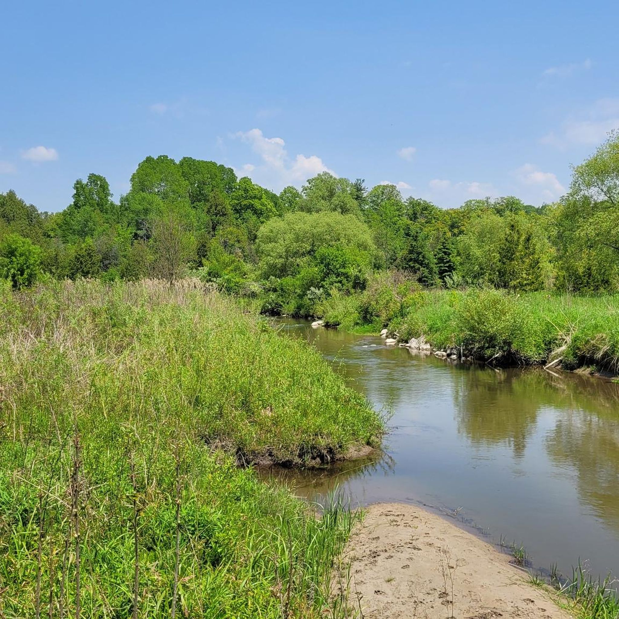
Hiking in Greenwood Conservation Area offers diverse landscapes, including flat sandy plains, rolling hills, and steep-sided river valleys. The area features expansive marshy and forested sections, with towering pine, cedar, oak, and elm trees. Duffins Creek winds through the conservation area, supporting a vibrant ecosystem and contributing to the varied terrain.
Best hiking trails in Greenwood Conservation Area
- The most popular hiking route is Duffins Creek – Greenwood Conservation Area loop from Greenwood Conservation Area, a 4.3 miles (6.8 km) trail that takes 1 hour 49 minutes to complete. This easy route features varied forest paths alongside Duffins Creek.
- Another top favourite among local hikers is Duffins Creek loop from Greenwood Conservation Area, an easy 3.0 miles (4.8 km) path. This trail offers scenic views of the creek and surrounding woodlands.
- Local hikers also love the West Duffins Creek Pine Ridge Trail loop, a 3.5 miles (5.6 km) trail leading through forested areas, often completed in about 1 hour 27 minutes.
- Hiking in Greenwood Conservation Area is defined by forested paths, river valleys, and open meadows. The network offers options for various ability levels, from easy walks to more challenging routes.
- The routes in Greenwood Conservation Area are highly rated by the komoot community with an average score of 4.4 stars from more than 20 reviews. More than 250 hikers have used komoot to explore Greenwood Conservation Area's varied terrain.
Last updated: August 26, 2026
4.7
(3)
15
hikers
Easy hike. Great for any fitness level. Easily-accessible paths. Suitable for all skill levels.
3
hikers
3.56km
00:57
30m
30m
Easy hike. Great for any fitness level. Easily-accessible paths. Suitable for all skill levels.

Sign up for free
24
hikers
9.99km
02:44
150m
150m
Moderate hike. Good fitness required. Easily-accessible paths. Suitable for all skill levels.
3
hikers
5.57km
01:27
40m
40m
Hike the easy 3.5-mile West Duffins Creek Pine Ridge Trail loop through Valley Farm Ravine in Pickering, taking about 1 hour and 27 minutes.
3
hikers
10.3km
02:38
30m
30m
Moderate hike. Good fitness required. Easily-accessible paths. Suitable for all skill levels.
Get access to more routes and recommendations from other explorers.
Sign up for free
Already have an account?
Our route recommendations are based on thousands of hikes, rides, and runs completed by other people on komoot.
Start today with a free account
Your next adventure awaits.
Login or Signup
Popular around Greenwood Conservation Area


Tips from the Community

The West Duffins Creek Pine Ridge Trail runs along the creek, partly as a loop trail. Parking is available to the south on Valley Farm Road next to the bridge over the creek. At low water, West Duffins Creek can be crossed near the railway bridge, leading to the Seaton Trail. (Visit on June 11, 2026)
0
0
The "Riveted" Railway Bridge on West Duffins Creek north of Pickering was likely built as part of the former Canadian Northern Railway Line between 1910-1911. Several high steel trestle bridges were erected across the river valleys. The Riveted Bridge over West Duffins Creek is the longest, measuring 259 meters. https://www.trha.ca/history/railways/canadian-northern-railway/ (Visited on June 11, 2026) https://www.youtube.com/watch?v=CRNNDUUYFs8
0
0
The Seaton Trail was created as a hiking trail in the 1970s. The trail follows the West Duffins Creek for about 13 kilometers from Concession Road 3 in the south to Highway 7 in the north. There are parking facilities at both trailheads. Since 2009, the hiking trail has been maintained by the Friends of Seaton Trail. http://www.seatontrail.org/ (Visited on June 11, 2026)
0
0
The name "Valley Farm" comes from a mid-19th century homestead built in the valley of West Duffins Creek by settler, farmer, and lumber producer James L. Palmer. Today's Valley Farm Road was originally the access route to this building near the creek. Today, remnants of the former farm can still be found in the Valley Farm Ravine area. (Visit on June 11, 2026)
0
0

Millers Creek winds through a narrow green corridor of forest, wetlands and parkland before eventually flowing toward Lake Ontario. Slower moving sections of the creek attract ducks, red winged blackbirds and other wetland birdlife, especially in the calmer marshy areas beside the trail.
0
0
Millers Creek Trail follows a fully paved multi use pathway through forested green space, neighbourhood corridors and naturalized creek areas, creating one of the longer connected urban trail routes in the area. The trail meanders alongside Millers Creek through sections of woodland, small bridges and open parkland, with relatively flat terrain making it popular for walking, cycling and running year round. Despite passing through suburban areas, parts of the route feel surprisingly sheltered beneath the tree canopy and along the creek corridor.
0
0
Millers Creek Park combines sports fields, playgrounds and paved multi use pathways with a natural creek corridor running through the centre of the park. Sections of the trail follow Millers Creek beneath pockets of mature trees and small pedestrian bridges, creating a greener and more sheltered atmosphere than the surrounding suburban neighbourhoods. Facilities within the park include playgrounds, sports courts, washrooms and picnic areas, making it a popular community recreation space year round.
0
0
The Seaton Trail near Concession Road follows the wooded valley of West Duffins Creek in Pickering. The trail quickly descends into the forested ravine and begins winding beside the creek. This section features rolling terrain with several hills, occasional viewpoints over the river valley, and stretches of natural trail that can become muddy after rain. The scenic creekside setting makes this one of the most popular starting points for exploring the Seaton Trail.
0
0
Frequently Asked Questions
How many hiking trails are available in Greenwood Conservation Area?
Greenwood Conservation Area offers a diverse network of over 15 hiking trails. These routes cater to various skill levels, from easy strolls to more challenging paths, ensuring there's something for every hiker.
What kind of terrain can I expect on the trails?
The trails in Greenwood Conservation Area feature a varied and engaging mix of terrain. You'll encounter flat sandy plains, rolling hills, and steep-sided river valleys. Paths navigate through dense forests, marshlands, and open meadows, with natural surfaces that can include soft dry ground, streams, and even stairs or fallen trees.
Are there any easy trails suitable for beginners or casual walkers?
Yes, Greenwood Conservation Area has numerous easy trails perfect for beginners or those seeking a relaxed walk. For instance, the Duffins Creek loop from Greenwood Conservation Area is an easy 4.8 km path offering scenic views. The Recreational Trail and Meadow Trail are also known for being easy options.
Are dogs allowed on the hiking trails?
While not explicitly detailed in the provided information, most conservation areas in the region permit dogs on trails, typically requiring them to be kept on a leash. It's always best to check local signage upon arrival for specific rules regarding pets.
Are there any family-friendly amenities or attractions?
Yes, Greenwood Conservation Area is well-suited for family outings. The area provides amenities such as picnic tables, seasonal washroom facilities, and a playground. Additionally, the nearby Pickering Museum Village, with some historic buildings within the woods, offers events and a glimpse into the region's past, adding to the family appeal.
What natural features or wildlife can I observe while hiking?
Hikers can enjoy a rich natural environment. Duffins Creek, a central feature, supports a vibrant ecosystem and is home to migratory rainbow trout and brook trout, with sightings of trout jumping in spring. The diverse landscapes include towering pine, cedar, oak, and elm trees. Large meadows offer excellent opportunities for bird watching, where vultures, chickadees, and robins are often spotted. Morel mushrooms can also be found in the area.
Are there any circular hiking routes?
Yes, Greenwood Conservation Area features several excellent circular routes. A popular option is the Duffins Creek – Greenwood Conservation Area loop from Greenwood Conservation Area, an easy 6.8 km trail. Another great choice is the West Duffins Creek Pine Ridge Trail loop, which is 5.6 km through forested areas.
What is the best time of year to visit Greenwood Conservation Area for hiking?
Greenwood Conservation Area can be enjoyed year-round. The fall is particularly remarkable when the foliage transforms into vivid shades of orange and red, making for stunning scenic hikes. Spring offers opportunities to see trout jumping in Duffins Creek. The trails are also utilized for snowshoeing and cross-country skiing in winter.
What do other hikers enjoy most about Greenwood Conservation Area?
The area is highly rated by the komoot community, with an average score of 4.4 stars from over 20 reviews. Hikers frequently praise the diverse landscapes, including forested paths, river valleys, and open meadows, as well as the variety of trails suitable for all skill levels.
Is there parking available at Greenwood Conservation Area?
Yes, parking facilities are available at Greenwood Conservation Area, making it convenient for visitors to access the trailheads. Specific details on parking locations or fees are best confirmed on-site or through official park information.
Can I reach Greenwood Conservation Area using public transport?
While the provided information does not detail specific public transport routes, it is generally advisable to check local transit authority websites for bus routes or other options that may serve the area. Access by car is typically the most straightforward method for conservation areas.
Are there any longer or more challenging routes for experienced hikers?
Yes, for experienced hikers seeking a greater challenge, routes like the Valley Farm Ravine loop from Dellbrook WB @ Major Oaks offer a difficult 21.7 km journey with significant elevation changes. The Concession Road to Clarkes Hollow via Seaton Trail is another moderate option at nearly 10 km.
Most popular routes in Greenwood Conservation Area

Get inspired with the komoot mobile app


Explore more
Browse the best Hikes in other regions.
