The best road cycling routes in Forks Of The Credit Provincial Park
4.0
(3)
34
riders
5
rides
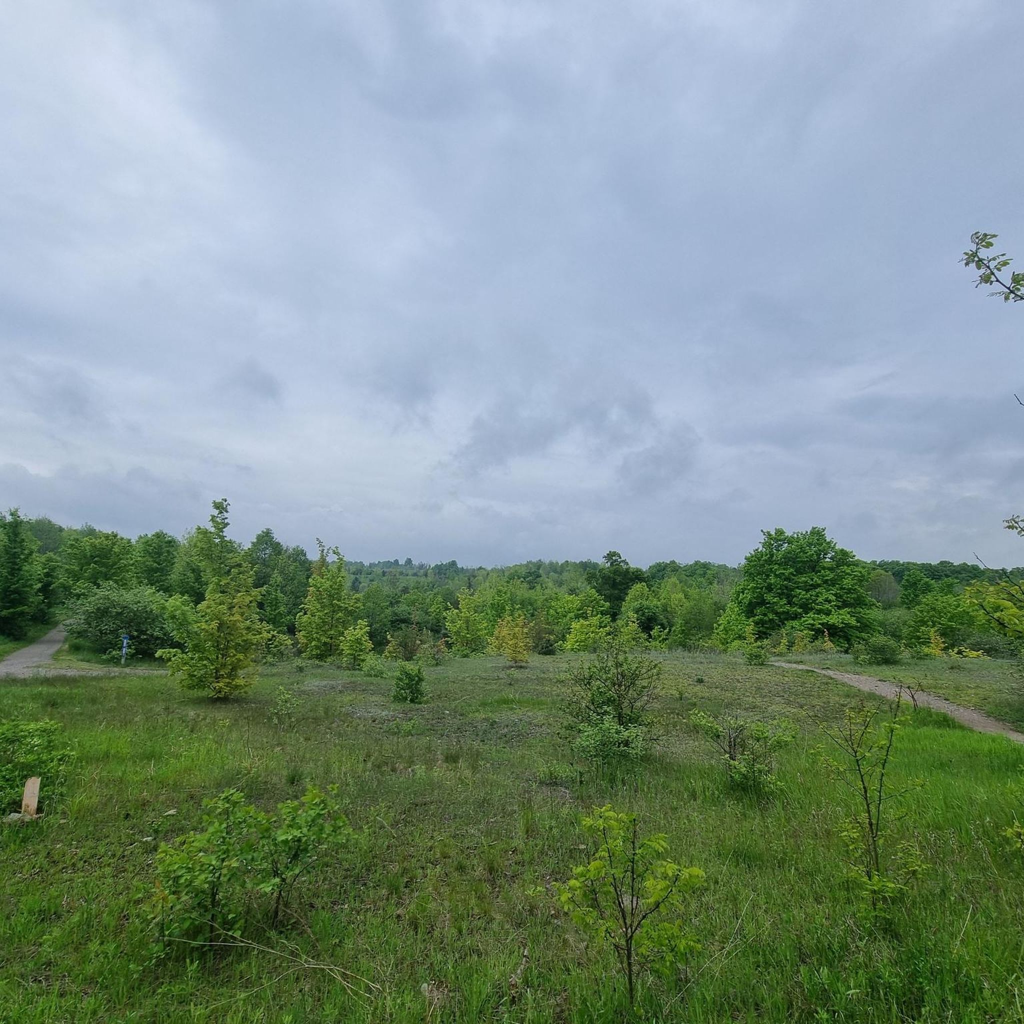
Road cycling in Forks Of The Credit Provincial Park and its surrounding area is characterized by a diverse landscape within the Niagara Escarpment biosphere. The region features the Credit River flowing through a deep gorge, alongside glacial formations like kettle lakes and kame hills. Cyclists will encounter varied terrain, including upland and lowland forests, and rolling pasture land, offering scenic routes with significant elevation changes on the surrounding roads.
Best road cycling routes in Forks Of The Credit Provincial Park
- The most popular road cycling route is Higher Ground Cafe loop from Inglewood, a 12.8 miles (20.6 km) trail that takes 1 hour 18 minutes to complete. This moderate route offers rolling terrain through the local countryside.
- Another top favourite among local road cyclists is Higher Ground Cafe – Sligo Hill loop from Scotsdale Farm, a moderate 33.4 miles (53.7 km) path. This route features varied landscapes and some notable climbs.
- Local road cyclists also love the Higher Ground Cafe – The Great Trail Forest View loop from Mount Pleasant, a 50.8 miles (81.8 km) trail leading through diverse forests and open areas, often completed in about 3 hours 30 minutes.
- Road cycling in Forks Of The Credit Provincial Park is defined by the Niagara Escarpment's varied terrain, the Credit River gorge, and extensive forests. The network offers options for different ability levels, from moderate loops to longer, more challenging rides.
- The routes in Forks Of The Credit Provincial Park are highly rated by the komoot community with an average score of 4.0 stars from over 2 reviews. More than 32 road cyclists have used komoot to explore Forks Of The Credit Provincial Park's varied terrain.
Last updated: July 2, 2026
6
riders
20.6km
01:18
250m
250m
Moderate road ride. Great for any fitness level. Some segments of this route may be unpaved and difficult to ride.
5.0
(2)
3
riders
36.5km
02:26
350m
350m
Moderate road ride. Good fitness required. Some segments of this route may be unpaved and difficult to ride.

Sign up for free
23
riders
Moderate road ride. Good fitness required. Some segments of this route may be unpaved and difficult to ride.
3.0
(1)
6
riders
53.7km
02:29
330m
330m
Moderate road ride. Good fitness required. Mostly well-paved surfaces and easy to ride.
2
riders
81.8km
03:30
440m
440m
Moderate road ride. Good fitness required. Some segments of this route may be unpaved and difficult to ride.
Our route recommendations are based on thousands of hikes, rides, and runs completed by other people on komoot.
Start today with a free account
Your next adventure awaits.
Login or Signup
Popular around Forks Of The Credit Provincial Park
Tips from the Community

Following a railway corridor first built in 1877, the Caledon Trailway winds through rolling farmland, woodlots, wetlands, and small rural communities across the Caledon countryside. This section between Caledon East and Palgrave is part of both The Great Trail and the Greenbelt Route, with a wide crushed-limestone surface that makes for easy walking. Along the way, you'll pass open views of the Oak Ridges Moraine, quiet forests, beaver ponds, and reminders of the region's railway heritage.
0
0

Coffee stop for Caledon ride. Lots of outdoor seats with lots of customers
0
0

The Great Trail in the Caledon region is beautiful in the fall.
0
0

There are multiple bridges throughout the Trailway, and this is one of the early ones.
0
0
Frequently Asked Questions
What kind of terrain can I expect when road cycling around Forks Of The Credit Provincial Park?
The region, part of the Niagara Escarpment biosphere, offers a diverse landscape. You'll encounter rolling pasture land, upland and lowland forests, and significant elevation changes on the surrounding roads. While the provincial park itself has unpaved trails, the roads in the vicinity, particularly Forks of the Credit Road, are known for challenging terrain and scenic beauty.
Are there any challenging road cycling routes for experienced riders?
Yes, the area provides routes with notable climbs and varied landscapes suitable for experienced cyclists. For example, the Higher Ground Cafe – The Great Trail Forest View loop from Mount Pleasant is an 81.8 km route with over 430 meters of elevation gain, offering a substantial challenge.
What are some scenic viewpoints or landmarks to look out for on road cycling routes?
While cycling the roads surrounding the park, you'll experience varied scenery including diverse forests and open areas. The Credit River flows through a deep gorge within the park, and the area features unique glacial formations like kettle lakes and kame hills. Forks of the Credit Road itself is renowned for its scenic beauty.
Is there parking available for road cyclists near Forks Of The Credit Provincial Park?
Parking is generally available at access points to the provincial park and in nearby towns, which serve as starting points for many road cycling routes. It's advisable to check specific starting locations for parking availability when planning your ride.
What is the best time of year to go road cycling in the Forks Of The Credit Provincial Park area?
The region offers varied scenery throughout the seasons. Fall is particularly scenic for its changing leaf colors, making it a popular time for road cycling. Spring and summer also provide excellent conditions, though cyclists should be aware of potential traffic on popular roads like Forks of the Credit Road.
Are there any family-friendly road cycling options in the area?
While many routes in the immediate vicinity of Forks of the Credit Provincial Park can be challenging due to elevation and traffic, there are options for varying fitness levels. The Higher Ground Cafe loop from Inglewood is a moderate 20.6 km route with rolling terrain, which could be suitable for families with some cycling experience.
Can I find cafes or places to stop for refreshments along the road cycling routes?
Yes, several routes are named after or pass by local establishments. For instance, the Higher Ground Cafe loop from Inglewood and the Higher Ground Cafe – Sligo Hill loop from Scotsdale Farm suggest that cafes are accessible, providing convenient stops for cyclists.
What do other road cyclists say about their experience in Forks Of The Credit Provincial Park?
The road cycling routes in the Forks Of The Credit Provincial Park area are highly rated by the komoot community, with an average score of 4.0 stars from over 2 reviews. Cyclists often praise the varied terrain and scenic beauty of the Niagara Escarpment.
Are there any circular road cycling routes available?
Yes, many of the road cycling routes in the area are designed as loops, allowing you to start and finish at the same point. Examples include the Higher Ground Cafe loop from Inglewood and the Higher Ground Cafe – Sligo Hill loop from Scotsdale Farm.
How many road cycling routes are available in the Forks Of The Credit Provincial Park area?
There are 5 road cycling routes currently available in the Forks Of The Credit Provincial Park area, offering a range of distances and challenges for different skill levels.
What is the typical duration for a road cycling route in this region?
Route durations vary depending on length and difficulty. For example, a moderate route like the Higher Ground Cafe loop from Inglewood (20.6 km) typically takes about 1 hour 18 minutes, while longer routes such as the Higher Ground Cafe – The Great Trail Forest View loop from Mount Pleasant (81.8 km) can take around 3 hours 30 minutes.
Most popular routes in Forks Of The Credit Provincial Park

Get inspired with the komoot mobile app


Explore more
Browse the best Road cycling routes in other regions.
