The best cycling routes in Claireville Conservation Area
4.9
(13)
99
riders
9
rides
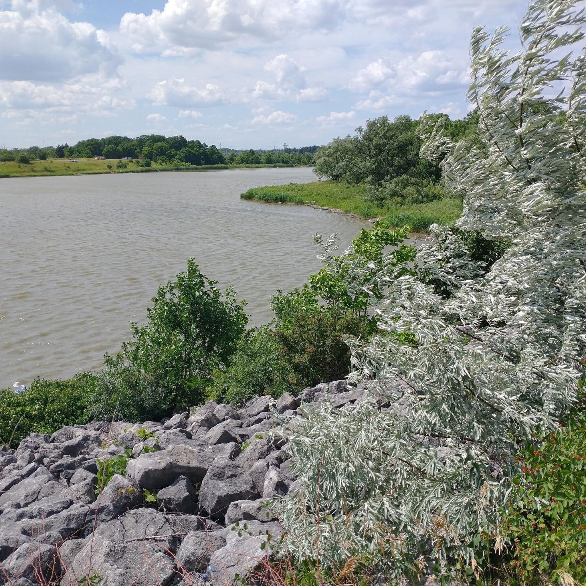
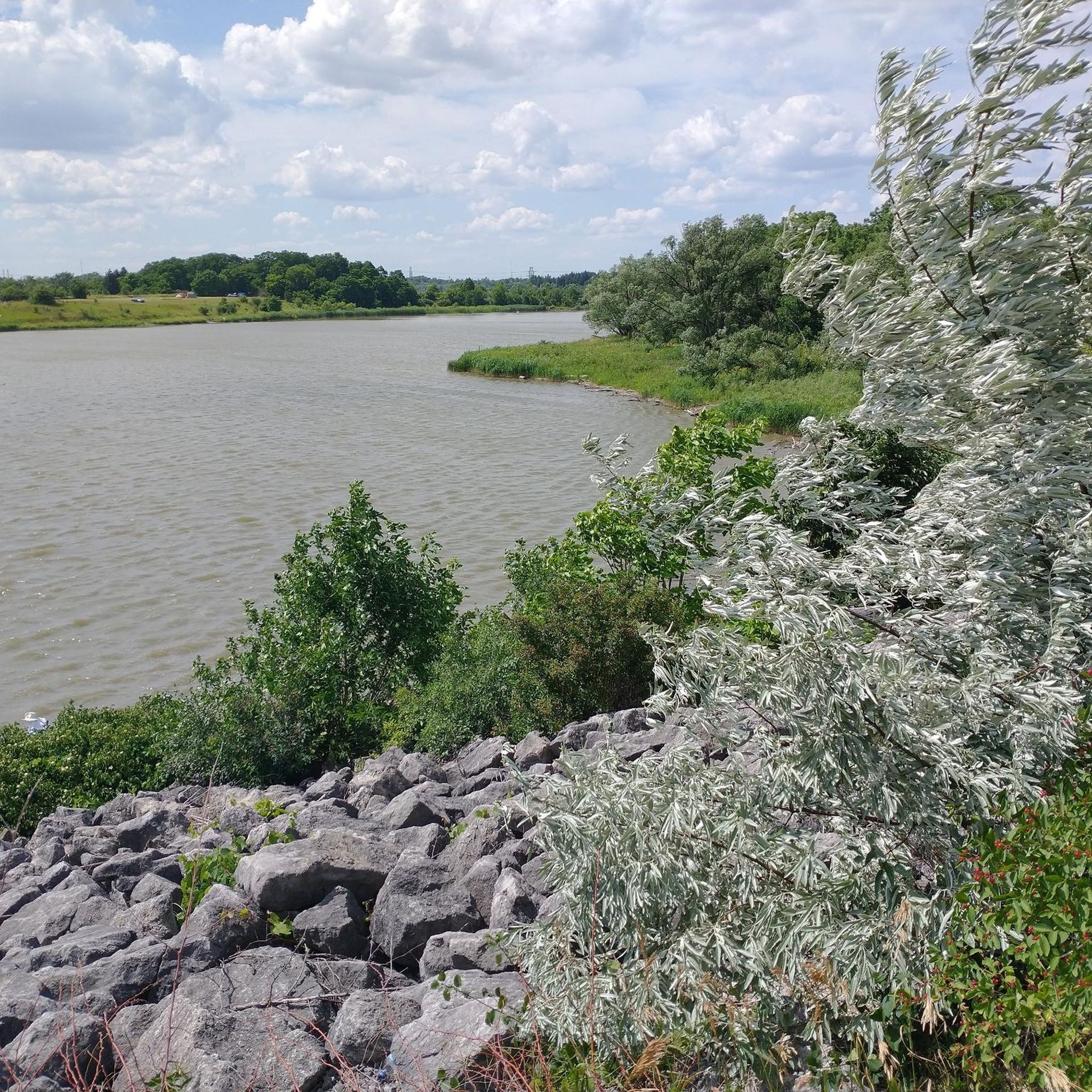
Touring cycling in Claireville Conservation Area offers diverse routes through 540 hectares of natural and forested land. The area features varied ecosystems including wetlands, valleys, forests, and grasslands, with the west branch of the Humber River winding through. Cyclists can navigate multi-use paths, gravel roads, and singletrack trails, encountering creeks, ravines, and rolling hills. The landscape provides a mix of paved and unpaved segments, suitable for different skill levels.
Best touring cycling routes in Claireville Conservation Area
- The most popular touring cycling route is Humber Arboretum – Humber River Trail loop from Casino Woodbine, a 6.4 miles (10.4 km) trail that takes about 35 minutes to complete. This easy route follows the Humber River, offering a smooth cycling experience.
- Another top favourite among local touring cyclists is Viewpoint – Humber River Trail loop from Casino Woodbine, an easy 15.3 miles (24.7 km) path. This route provides scenic views along the Humber River Trail.
- Local touring cyclists also love the Humber River Rail Bridge – Humber River Bridge loop from Humber Summit, a 22.3 miles (36.0 km) trail leading through the Humber River valley and over various bridges, often completed in about 2 hours 10 minutes.
- Touring cycling in Claireville Conservation Area is defined by multi-use paths along the Humber River, diverse ecosystems of wetlands and forests, and rolling hills. The network offers options for easy and moderate ability levels.
- The routes in Claireville Conservation Area are highly rated by the komoot community with an average score of 4.9 stars from over 25 reviews. More than 150 touring cyclists have used komoot to explore Claireville Conservation Area's varied terrain.
Last updated: May 23, 2026
8
riders
10.5km
00:37
40m
40m
Easy bike ride. Great for any fitness level. Mostly paved surfaces. Suitable for all skill levels.
16
riders
24.7km
01:27
110m
110m
Easy bike ride. Great for any fitness level. Mostly paved surfaces. Suitable for all skill levels.

Sign up for free
4.7
(11)
33
riders
32.2km
01:56
170m
170m
Moderate bike ride. Good fitness required. Mostly paved surfaces. Suitable for all skill levels.
7
riders
16.0km
01:04
110m
110m
Easy bike ride. Great for any fitness level. Mostly paved surfaces. Suitable for all skill levels.
5.0
(1)
6
riders
Easy bike ride. Great for any fitness level. Mostly paved surfaces. Suitable for all skill levels.
Get access to more routes and recommendations from other explorers.
Sign up for free
Already have an account?
Our route recommendations are based on thousands of hikes, rides, and runs completed by other people on komoot.
Start today with a free account
Your next adventure awaits.
Login or Signup
Popular around Claireville Conservation Area

Tips from the Community

This bridge offers a nice view over the Humber River. There are several benches here where you can stop for a rest and enjoy the surroundings.
0
0

The West Humber River is paralleled for much of its run by the paved, multi-use West Humber River Recreational Trail. The river also passes along the edge of the beautiful Humber Arboretum, which is a great place to spend a warm afternoon.
0
0

The Humber River spans 126 kilometres and flows from the Niagara Escarpment and Oak Ridges Moraine to Lake Ontario. Its watershed spans over 900 square kilometres and includes forests, meadows, wetlands, and urban areas, making it one of Toronto’s most ecologically and historically significant rivers. Designated a Canadian Heritage River in 1999, the Humber served as a vital travel corridor for Indigenous peoples and early European settlers, including along the Toronto Carrying-Place Trail.
0
0
Boyd Conservation Area is a beautiful 401-hectare park with several trails that wind through forest and open meadows. There are multiple picnic sites and open green spaces, making this a perfect spot for a leisurely walk, birdwatching, or enjoying a lovely picnic under the trees.
0
0
The Humber River Trail is a fantastic paved multi-use path that follows the Humber River, offering a scenic route for walking, running, and cycling. It stretches over 20 kilometres through parks, ravines, and historic sites, including the Toronto Carrying-Place Trail, a former Indigenous trade route that once followed the same path. The Humber River itself is designated a Canadian Heritage River, and this trail is an excellent way to explore its ecological and cultural significance on foot or by bike.
0
0

This historic rail bridge spans the Humber River with high steel arches and a classic railway design. It adds a striking feature to the landscape and is a great photo stop along the river trails. From the viewpoint below, you can see trains crossing above while the river flows quietly underneath, creating a nice contrast between nature and engineering. The viewpoint has wooden benches from where you can stop for a moment and observe.
1
0
The East Humber River flows through farms and parks in northern Toronto before joining the main branch of the Humber River in Woodbridge. There's a good trails system along its banks that allow hikers to visit various parks and nature preserves with ease.
0
0
The William Granger Greenway is a scenic trail running between Bindertwine Park and Boyd Conservation Area. Along the way it passes through a mix of natural landscapes and parks. A short side trail leads into Kleinburg, where you can visit the McMichael Canadian Art Collection or explore the village’s historic main street and shops. Parking is available at Bindertwine Park, Boyd Conservation Area, and the Rutherford Road trailhead. You can also use the trail to reach nearby facilities such as the Kleinburg Library, Al Palladini Community Centre, Pierre Berton Library, and the Kortright Centre.
0
0
Frequently Asked Questions
How many touring cycling routes are available in Claireville Conservation Area?
There are 10 touring cycling routes available in Claireville Conservation Area, catering to various preferences. Most of these routes are rated as easy, with a couple of moderate options for those seeking a bit more challenge.
What kind of terrain can I expect on the touring cycling routes?
The routes in Claireville Conservation Area feature a mix of paved and gravel surfaces, winding through natural forests, wetlands, and grasslands. You'll encounter multi-use paths along the Humber River, as well as some gentle rolling hills and ravines.
Are there any family-friendly touring cycling routes?
Yes, many routes are suitable for families. The area offers numerous easy paths, such as the Humber Arboretum – Humber River Trail loop from Casino Woodbine, which is 10.4 km long and follows the Humber River, providing a smooth and enjoyable experience for all ages.
What are the best routes for beginners or those looking for an easy ride?
For an easy and scenic ride, consider the Viewpoint – Humber River Trail loop from Casino Woodbine. This 24.7 km path offers pleasant views along the Humber River Trail without significant elevation changes. Another great option is the Humber River Trail – Scenic Gravel Trail loop from Vaughan—Woodbridge, which is 16 km and also rated easy.
Are there any longer or more challenging touring cycling routes?
For a longer, moderate ride, the Humber River Rail Bridge – Humber River Bridge loop from Mount Olive covers 32.2 km and leads through the Humber River valley, crossing various bridges. This route offers a bit more distance and elevation gain compared to the easier options.
What natural features or wildlife can I see while cycling?
Claireville Conservation Area is rich in natural beauty. You can expect to see natural forests, wetlands, valleys, and grasslands, with the west branch of the Humber River meandering through. The diverse habitats support wildlife such as deer, muskrats, and a wide array of bird species, making it a great spot for nature observation.
What do other touring cyclists enjoy most about Claireville Conservation Area?
The area is highly rated by the komoot community, with an average score of 4.9 stars. Reviewers often praise the diverse ecosystems, the peaceful multi-use paths along the Humber River, and the variety of routes suitable for different skill levels.
Are there any circular touring cycling routes in the area?
Yes, many of the touring cycling routes in Claireville Conservation Area are loops. Examples include the Humber Arboretum – Humber River Trail loop from Casino Woodbine and the Trail section – Humber River Trail loop from Casino Woodbine, which is 28 km long.
Is Claireville Conservation Area accessible by public transport?
While the guide does not specify direct public transport access to trailheads, Claireville Conservation Area is situated near major Greater Toronto Area cities, making it generally accessible. It's advisable to check local transit options to specific entry points.
What is the best time of year to go touring cycling in Claireville Conservation Area?
Claireville Conservation Area is accessible year-round. However, for touring cycling, spring and fall offer pleasant temperatures and vibrant scenery. Summer is also popular, but be prepared for warmer weather. Winter cycling is possible, but trail conditions may vary due to snow and ice.
Are there any specific viewpoints or scenic spots along the routes?
The routes often wind through picturesque landscapes, including pine forests and across wooden bridges. The Viewpoint – Humber River Trail loop from Casino Woodbine is specifically named for its scenic views along the Humber River Trail, offering excellent opportunities to enjoy the natural surroundings.
Most popular routes in Claireville Conservation Area

Get inspired with the komoot mobile app


Explore more
Browse the best Cycling routes in other regions.
