The best road cycling routes in Short Hills Provincial Park
5.0
(6)
254
riders
25
rides
Road cycling routes in Short Hills Provincial Park are situated within the Niagara Escarpment, an area characterized by a diverse and rugged natural environment. The park itself features a landscape sculpted by glacial activity, resulting in small but steep hills, scenic valleys, and meandering creeks like Twelve Mile Creek. While the park's multi-use trails are primarily suited for mountain biking, the paved Palaeozoic Path offers a surface suitable for road cycling within the park. The broader Niagara Region surrounding the…
Last updated: July 12, 2026
4
riders
40.6km
01:58
220m
220m
Easy road ride. Great for any fitness level. Mostly well-paved surfaces and easy to ride.
21
riders
29.5km
01:35
90m
90m
Easy road ride. Great for any fitness level. Mostly well-paved surfaces and easy to ride.

Sign up for free
9
riders
47.4km
02:10
230m
230m
Moderate road ride. Good fitness required. Some segments of this route may be unpaved and difficult to ride.
6
riders
34.2km
01:27
120m
120m
Moderate road ride. Great for any fitness level. Some segments of this route may be unpaved and difficult to ride.
4
riders
47.4km
02:28
300m
300m
Moderate road ride. Good fitness required. Some segments of this route may be unpaved and difficult to ride.
Get access to more routes and recommendations from other explorers.
Sign up for free
Already have an account?
Our route recommendations are based on thousands of hikes, rides, and runs completed by other people on komoot.
Start today with a free account
Your next adventure awaits.
Login or Signup
Popular around Short Hills Provincial Park

Tips from the Community

Brock University sits on the Niagara Escarpment and is the only university in Canada that is set within a UNESCO Biosphere Reserve. The campus has broad pedestrian routes, green spaces, and clear signage, so it’s simple to navigate whether you’re crossing the grounds or stopping for a short break while passing by on the Bruce Trail.
0
0

This scenic pedestrian bridge provides a safe place for runners, bikers and hikers to cross Twelve Mile Creek, totally separated from the busy Glendale Avenue that parallels this bridge. The bridge has an arc shape, and has great views of the turquoise blue river flowing below.
0
0

Merritt Trail follows Twelve Mile Creek through a long green corridor of forest, wetlands and old industrial infrastructure linking several parks and neighbourhoods. Much of the route runs beside the water on paved and gravel paths, passing wooden bridges, historic remnants of the old Welland Canals and sections shaded by dense tree canopy. Despite running through an urban area, the creek corridor creates a surprisingly peaceful atmosphere, especially around the quieter marsh and riverside sections further from the roads.
0
0
Walker’s Creek Trail is a multi-use trail made up of gravel and pavement. This corridor runs from residential areas north to Lake Ontario. The path is open year-round and is mostly flat and provides occasional shaded pockets and benches along the way.
0
0
Twelve Mile Creek runs through a long, forested valley with steady water views, small rapids, and shaded sections that feel nicely removed from the surrounding city. Trails and pathways follow the creek in several places, giving you easy access to the water and a mix of ravine lookouts, bridges, and calmer stretches where the creek widens out. It’s a peaceful green corridor and a reliable scenic feature along routes in this part of St. Catharines.
0
0

Handy distance markers to Buffalo, Sault Ste. Marie, and Melbourne (?)
0
0

Another great solo adventure! 4:45am start @ broadview station and arrived 11:15am Train station niagara falls 4stop drop my airpods, snacks, meet old friends burlington and ask fellow soloist rider coz of confusing the route? i was chasing train return toronto back? i was build with a group and turn indv. rider and thanks for the GPS/Komoot for give me a confident! i think before season end i really do the back n forth 300klms this time 23cc wide.
0
0

3 km stretch of gravel off of the main paved Welland Canal trail and right next to the water. Doable with gravel bike and tires.
0
0
Frequently Asked Questions
What kind of terrain can I expect when road cycling in Short Hills Provincial Park and the surrounding region?
Short Hills Provincial Park itself is characterized by a rugged landscape with small but steep hills and scenic valleys, shaped by glacial activity. While many trails within the park are better suited for mountain biking, the broader Niagara Region offers extensive road cycling opportunities on mostly paved surfaces. You'll encounter a mix of these varied terrains, from the park's distinctive topography to the flatter, scenic routes along the Niagara River and Welland Canal.
Are there any paved routes suitable for road cycling directly within Short Hills Provincial Park?
Yes, within Short Hills Provincial Park, the Palaeozoic Path offers a paved surface with gravel, making it suitable for road cycling, particularly for beginners or those seeking an accessible ride. This path also connects to the Swayze Falls Trail and features barrier-free benches and scenic lookouts.
What are some popular road cycling routes near Short Hills Provincial Park?
Beyond the park, the Niagara Region offers several well-regarded road cycling routes. For an easy ride, consider the Roadbike loop from Brock University, which covers 39.1 km. Another popular easy option is the Roadbike loop from Pelham, spanning 29.5 km. For a longer, moderate challenge, the Niagara River – Pedal Bicycle Shop loop from St. Catharines is an 81.2 km route through the Niagara River area.
How many road cycling routes are available in the Short Hills Provincial Park area on komoot?
There are 26 road cycling routes available in the Short Hills Provincial Park area on komoot. These routes cater to various skill levels, with 17 classified as easy and 9 as moderate, ensuring options for most road cyclists.
What is the difficulty level of road cycling routes in this region?
The road cycling routes in the Short Hills Provincial Park area range from easy to moderate. Many routes, like the Welland Canal North loop from St. Catharines, are considered easy, while others, such as the Niagara River – Queen's Royal Park loop from St. Catharines, offer a moderate challenge with more elevation gain.
Are there any natural features or landmarks to look out for while cycling?
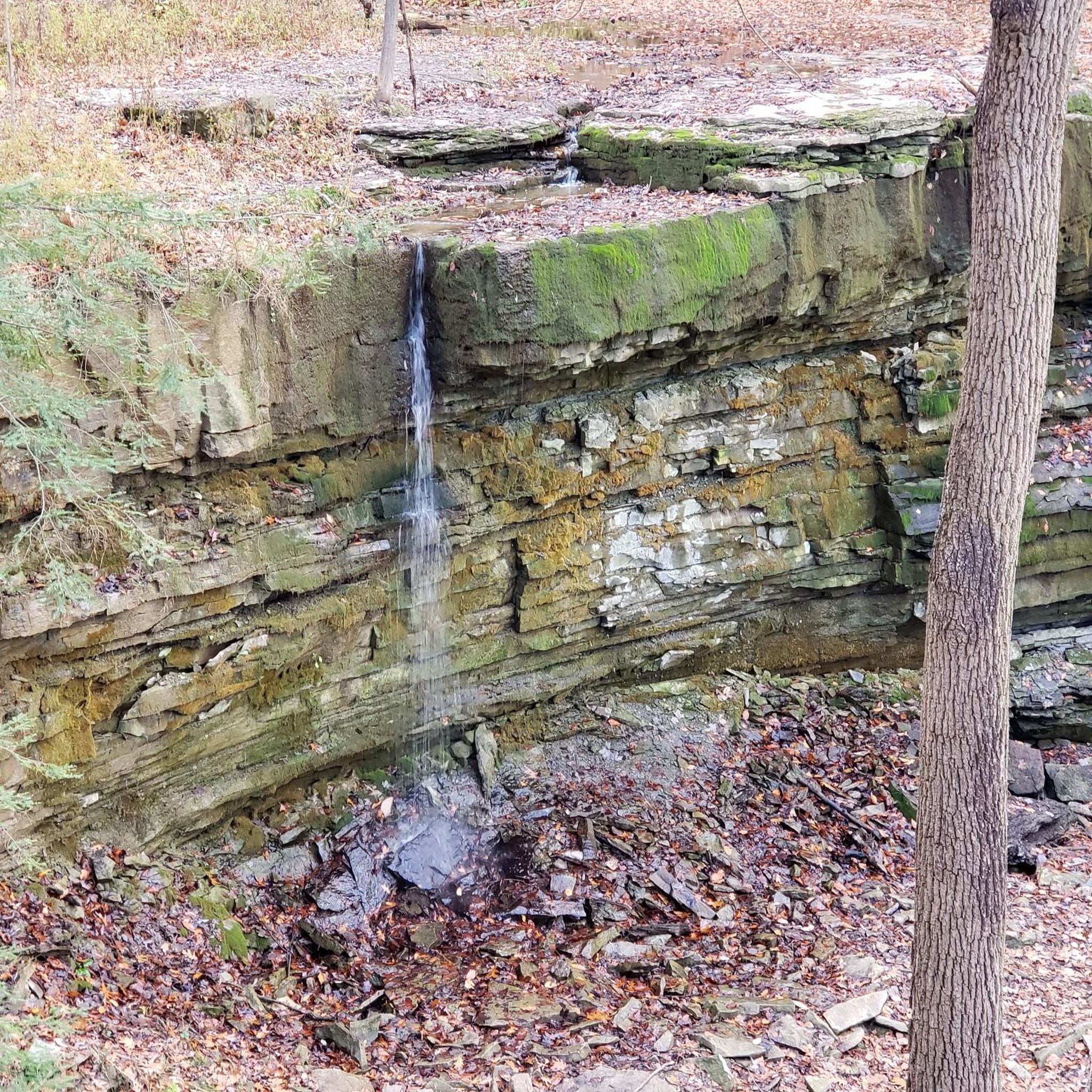
Yes, the region is rich in natural beauty. Within Short Hills Provincial Park, you can find Swayze Falls (though it can be dry in certain seasons) and the Twelve Mile Creek, Niagara's only cold-water creek. The park itself is known for its Carolinian forests and diverse plant species. Beyond the park, routes often feature views of the Niagara River and the Welland Canal.
What do other road cyclists say about their experience in Short Hills Provincial Park?
The road cycling routes in the Short Hills Provincial Park area are highly rated by the komoot community, with an average score of 5.0 stars from more than 7 reviews. Cyclists often praise the varied terrain, the scenic beauty of the Carolinian forests, and the proximity to the Niagara River, which offers diverse riding experiences.
Is Short Hills Provincial Park suitable for family-friendly road cycling?
While many of the park's multi-use trails are hilly and better for mountain bikes, the paved Palaeozoic Path within Short Hills Provincial Park is accessible and suitable for very beginner cyclists and families. For broader family-friendly road cycling, the surrounding Niagara Region offers numerous easy, mostly paved routes that are ideal for a leisurely family ride.
Can I bring my dog on road cycling routes in the area?
Short Hills Provincial Park is generally dog-friendly, allowing leashed dogs on its trails. When road cycling on regional routes outside the park, it's important to check local regulations for specific paths or trails regarding dogs. Always ensure your dog is leashed and well-behaved, and be mindful of other cyclists and pedestrians.
Are there any long-distance road cycling routes available?
Yes, the region offers longer routes for those seeking a more extensive ride. For example, the Niagara River – Pedal Bicycle Shop loop from St. Catharines is 81.2 km, and the Niagara River – Queen's Royal Park loop from St. Catharines extends to 85.2 km. These routes allow you to explore more of the Niagara River area and its diverse landscapes.
What is the best time of year for road cycling in Short Hills Provincial Park?
The Niagara Region, including Short Hills Provincial Park, generally offers pleasant road cycling conditions from spring through fall. Spring brings blooming Carolinian forests, while fall showcases vibrant foliage. Summer is also popular, but be prepared for warmer temperatures. Winter cycling is possible but requires appropriate gear and caution due to potential snow and ice.
Are there options for circular road cycling routes?
Yes, many of the road cycling routes in the Short Hills Provincial Park area are designed as loops, allowing you to start and end at the same point. Examples include the Roadbike loop from Brock University and the Roadbike loop from Pelham, providing convenient circular journeys through the region.
Most popular routes in Short Hills Provincial Park

Get inspired with the komoot mobile app


Explore more
Browse the best Road cycling routes in other regions.
