The best MTB trails in Roseville Swamp / Blair Creek Corridor
5.0
(1)
16
riders
1
ride
Mountain bike trails in Roseville Swamp / Blair Creek Corridor are situated within a significant wetland and wildlife corridor in Ontario, Canada. The area features extensive forest cover along the Cedar Creek stream corridor, with riparian areas maintaining natural vegetation. The broader region provides access to the Walter Bean Grand River Trail, which includes views from bluffs above the Grand River. While some sections of the swamp are very wet, the wider corridor offers opportunities for cycling through varied natural…
Last updated: May 24, 2026
5
riders
47.7km
02:46
230m
230m
Moderate mountain bike ride. Good fitness required. Suitable for all skill levels.
5
riders
23.9km
01:34
150m
140m
Easy mountain bike ride. Great for any fitness level. Suitable for all skill levels.

Sign up for free
4
riders
Easy mountain bike ride. Great for any fitness level. Suitable for all skill levels.
5.0
(1)
2
riders
17.0km
00:56
100m
100m
Easy mountain bike ride. Great for any fitness level. Suitable for all skill levels.
Our route recommendations are based on thousands of hikes, rides, and runs completed by other people on komoot.
Start today with a free account
Your next adventure awaits.
Login or Signup
Popular around Roseville Swamp / Blair Creek Corridor

Tips from the Community

As you walk, you will follow white blazes marked on the trees, which guide you through rolling hills and quiet, shaded pathways. The woods are filled with a mix of hardwoods like maple and oak, which create a beautiful canopy overhead. In the spring, you can see colorful wildflowers blooming on the forest floor, and in the autumn, the leaves turn into a sea of bright yellow and orange.
0
0
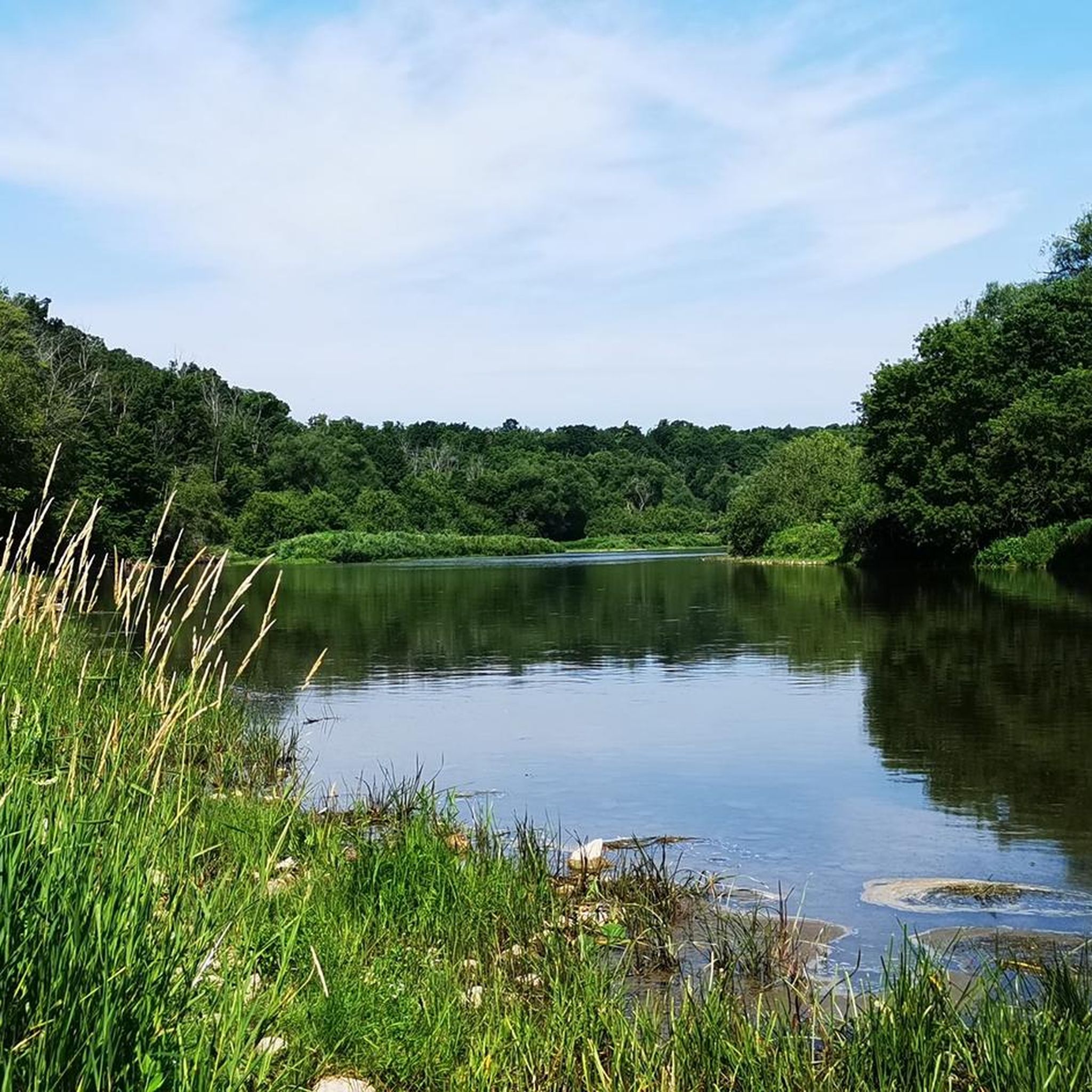
The river here is a great place for you to watch for local wildlife. If you stay quiet, you might spot a blue heron standing still in the shallow water or see a bald eagle soaring above the trees. For those who like being on the water, this section is popular for canoeing and kayaking because the current is usually gentle.
0
0

This is the north end of RIM Park and the end of the Walter Bean Grand River Trail section, but there’s no parking available here. If you’re planning to walk this route, you’ll need to park at the main RIM Park parking area that is located on Park Road. It’s a common point of confusion, so it’s worth planning ahead.
0
0
This section of the Walter Bean Grand River Trail follows a wide, easy path alongside the Grand River, making it more of a relaxed walk or run than a traditional hike. The trail is mostly flat, with a mix of paved and gravel surfaces, and stays close to the water for much of the route. You’ll move between open parkland and shaded sections through trees, with occasional views of the river. It’s part of a much longer trail system that runs through the region, but this stretch is especially accessible and easy to follow.
0
0

The Walter Bean Grand River Trail has its northern terminus here at Kiwanis Park and runs for over 25 kilometers to Doon Valley Golf Course in the south. It follows the river through many parks and neighbourhoods along the way and is a great link between opposite sides of the city.
0
0

The Walter Bean Grand River Trail is a scenic multi-use trail that follows the Grand River through much of the Waterloo Region. Stretching roughly 78 kilometers when complete, the trail connects communities such as Waterloo, Kitchener, and Cambridge. Much of the route winds through forested riverbanks, conservation areas, and quiet natural spaces, offering scenic views of the river. It’s a popular route for walking, running, and cycling.
0
0
The Grand River is a major waterway that stretches nearly 280 kilometers through the southern part of Ontario. It winds past farmland, forests, and historic towns before flowing into the Lake Erie. There are multiple ways to enjoy what the river has to offer such as hiking long-distance routes like the Grand Valley Trail, or paddling peaceful river stretches with access from several points. Wildlife is also abundant along its banks, making it a great pick for a nature-focused outing.
0
0
Idlewood Creek is a tributary of the Grand River, and an important habitat for many fish species that had dwindled in numbers thanks to two dams that were built across is, preventing them from reaching its upper sections. However, the city of Kitchener identified this problem and has since removed the barriers, allowing the fish to thrive once again in the full length of the creek.
0
0
Frequently Asked Questions
How many mountain bike trails are available in the Roseville Swamp / Blair Creek Corridor area?
The Roseville Swamp / Blair Creek Corridor area features several mountain bike routes. Komoot currently lists four distinct trails, offering a variety of experiences for riders.
What kind of terrain can I expect on mountain bike trails in Roseville Swamp / Blair Creek Corridor?
You can expect varied terrain, including sections through extensive forest cover, riparian areas along Cedar Creek, and paths offering views from bluffs above the Grand River. While the swamp itself can be very wet, the wider corridor provides drier routes suitable for cycling, often featuring natural vegetation and scenic river views.
Are there any easy mountain bike trails suitable for beginners or families?
Yes, there are easy routes available. For instance, the Grand Valley Trail – Grand River loop from Borden is an easy 24.0 km path that follows the Grand River, offering scenic views. Another easy option is the Grand River – Grand Valley Trail loop from Region of Waterloo International Airport, which is 19.0 km long and leads through forested areas.
What is the longest mountain bike trail in the Roseville Swamp / Blair Creek Corridor?
The longest mountain bike trail listed is the Heath Valley Trail – Waterloo Park loop from Borden. This moderate route spans 48.9 km and includes an elevation gain of over 230 meters.
Are there any mountain bike trails that offer scenic views of the Grand River?
Absolutely. Many routes in the Blair Creek Corridor connect to the Walter Bean Grand River Trail, providing excellent views. The Grand Valley Trail – Grand River loop from Borden and the Grand River – Grand Valley Trail loop from Region of Waterloo International Airport both follow the Grand River, offering picturesque scenery.
What natural features can I expect to see while mountain biking in this region?
The region is rich in natural beauty. You'll encounter extensive forest cover, especially along the Cedar Creek stream corridor, which is known as the largest cold-water trout creek in the Region of Waterloo. The area is also a Provincially Significant Wetland, so you might see diverse flora like ferns and spring ephemerals, and potentially wildlife in the largely uninterrupted wildlife corridor.
Is the Roseville Swamp / Blair Creek Corridor suitable for mountain biking with dogs?
While the guide doesn't specify dog-friendly rules for mountain biking, many trails in Ontario's natural areas permit dogs on leash. It's always best to check local signage or the specific trail's regulations before heading out with your dog to ensure a pleasant experience for everyone.
What do other mountain bikers say about the trails in Roseville Swamp / Blair Creek Corridor?
The routes in Roseville Swamp / Blair Creek Corridor are highly rated by the komoot community, with an average score of 5.0 stars. Over 10 mountain bikers have used komoot to explore the varied terrain, appreciating the natural environments and river views.
Are there any loop trails for mountain biking in the area?
Yes, all the listed mountain bike routes are loop trails, allowing you to start and end at the same point. Examples include the Heath Valley Trail – Waterloo Park loop from Borden and the Victoria Park Lake loop from Laurentian Hills.
What is the elevation gain like on these mountain bike trails?
The elevation gain varies by trail. For example, the moderate Heath Valley Trail – Waterloo Park loop from Borden has an elevation gain of over 230 meters. Easier routes like the Victoria Park Lake loop from Laurentian Hills have a more modest gain of around 94 meters.
When is the best time of year to go mountain biking in Roseville Swamp / Blair Creek Corridor?
Given the area's wetland characteristics, spring and fall generally offer pleasant conditions with cooler temperatures and vibrant foliage. Summer can be enjoyable, but be prepared for potentially warmer and more humid weather. Winter riding is possible, but trail conditions may vary significantly with snow and ice, so checking local reports is advisable.
Most popular routes in Roseville Swamp / Blair Creek Corridor

Get inspired with the komoot mobile app


Explore more
Browse the best MTB trails in other regions.
