The best walks and hikes in Στύλου - Κατωχωρίου Δήμου Αρμένων Και Κεραμειών
4.4
(1132)
5,791
hikers
74
hikes
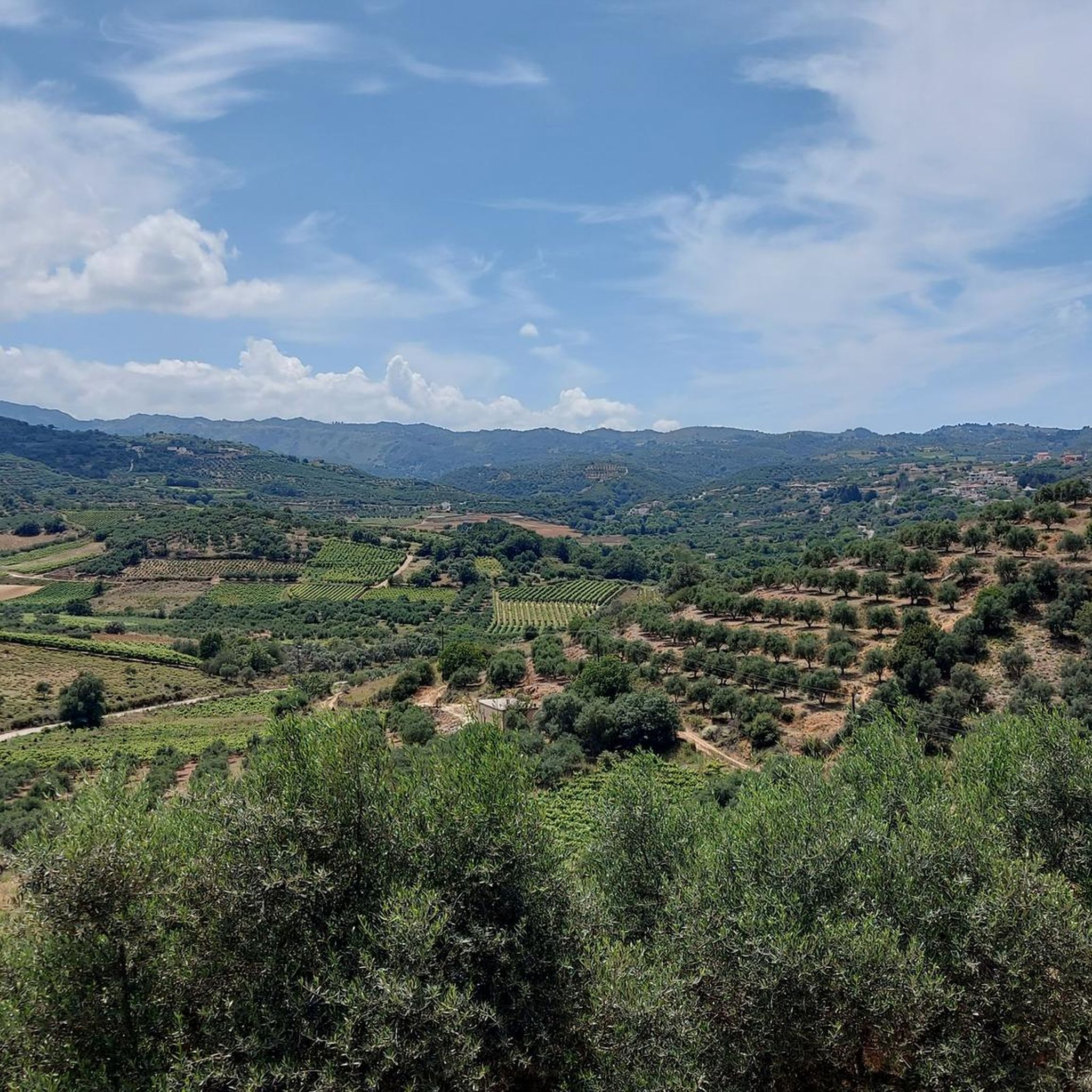
Hiking in Στύλου - Κατωχωρίου Δήμου Αρμένων Και Κεραμειών offers diverse landscapes within the Chania regional unit of Crete. The area is characterized by abundant springs feeding the Kiliaris River, which creates lush environments with shaded paths. Impressive gorges, such as Diktamos Gorge and Cyclamen Gorge, provide varied terrain for hikers. The region also features rolling hills, expansive olive groves, and vineyards, set against the backdrop of the White Mountains.
Best hiking trails in Στύλου - Κατωχωρίου Δήμου Αρμένων Και Κεραμειών
- The most popular hiking route is Diktamos Gorge – Oleander Gorge loop from Stylos, a 10.0 miles (16.1 km) trail that takes 4 hours 49 minutes to complete. This moderate route features lush, verdant vegetation within the gorge.
- Another top favourite among local hikers is Ancient City of Aptera – Roman Cistern at Aptera loop from Απτέρα, an easy 3.9 miles (6.3 km) path. This trail explores historical sites and offers views of the surrounding area.
- Local hikers also love the Diktamos Gorge – Chapel in the Olive Grove loop from Stylos, a 6.0 miles (9.7 km) trail leading through the Diktamos Gorge and olive groves, often completed in about 2 hours 37 minutes.
- Hiking in Στύλου - Κατωχωρίου Δήμου Αρμένων Και Κεραμειών is defined by river valleys, deep gorges, and agricultural landscapes. The network offers options for various ability levels, from easy walks to more challenging moderate trails.
- The routes in Στύλου - Κατωχωρίου Δήμου Αρμένων Και Κεραμειών are highly rated by the komoot community with an average score of 4.4 stars from nearly 1000 reviews. More than 5000 hikers have used komoot to explore Στύλου - Κατωχωρίου Δήμου Αρμένων Και Κεραμειών's varied terrain.
Last updated: August 27, 2026
4.4
(23)
49
hikers
16.1km
04:49
470m
470m
Moderate hike. Good fitness required. Easily-accessible paths. Suitable for all skill levels.
4.5
(6)
29
hikers
6.32km
01:46
130m
130m
Easy hike. Great for any fitness level. Easily-accessible paths. Suitable for all skill levels.

Sign up for free
3.9
(7)
16
hikers
8.61km
02:21
130m
130m
Moderate hike. Good fitness required. Easily-accessible paths. Suitable for all skill levels.
4.5
(4)
16
hikers
11.0km
03:31
440m
440m
Moderate hike. Good fitness required. Easily-accessible paths. Suitable for all skill levels.
4.4
(17)
41
hikers
5.78km
01:41
150m
150m
Easy hike. Great for any fitness level. Easily-accessible paths. Suitable for all skill levels.
Get access to more routes and recommendations from other explorers.
Sign up for free
Already have an account?
Our route recommendations are based on thousands of hikes, rides, and runs completed by other people on komoot.
Start today with a free account
Your next adventure awaits.
Login or Signup
Popular around Στύλου - Κατωχωρίου Δήμου Αρμένων Και Κεραμειών
Tips from the Community

Aptera, formerly known as Aptara, is located on the hill of Paliokastro, which dominates the southeast side of Souda Bay. The earliest reference to Aptera is the toponym a-pa-ta-wa, which we know from the Mycenaean Linear B tablets from Knossos (14th-13th century BC). The original site may have been located further south, on a low hill in the Azoires Stylou area of Apokoronas, where prehistoric remains have been discovered. In the Doric dialect, the name Aptara is found on coins, while in the Hellenistic period (4th-1st century BC) the spelling Aptera is also found in inscriptions and also in sources outside Crete. Source: https://ancientaptera.gr/de/geschichte/
2
0
The Koules fortress is located in the Paleokastro area, 12 km east of Chania, near the village of Kalami and near the ruins of ancient Aptera. The fortress was built by the Turks after the Cretan Revolution of 1866, as part of a program to control Crete from a network of towers. The fortress was built by Hussein Avni Pasha, the Turkish governor of Crete, and is a representative example of 19th-century architecture. The fortress was built to control the Vamos valley, which was in the middle of the passage to Chania. Together with the other towers built by the Turks in Vamos, it controlled the Souda Gulf and supported the nearby Intzedin fortress. Πηγή: ⭐ Tourist-Info für die Insel Kreta ⛵, Griechenland ⭐ - Aptera Koules cretanbeaches.com
2
0

Aptera is historically one of the most significant city-states of Crete. Here are a few facts that make this place so special: Strategic Location: The city sits enthroned on a plateau about 150-200 meters above the sea. From here, the Apterians controlled their two ports (Minoa near Marathi and Kissamos near Kalyves) and thus the trade in this part of the Mediterranean. The Myth of the Name: There are two beautiful legends about the origin of the name “Aptera” (Greek for “wingless”): One says that the Sirens lost a musical contest against the Muses here. Ashamed, the Sirens lost their wings, whereupon they plunged wingless (a-ptera) into the sea, forming the so-called “white islands” off the coast.
0
0
By the way, Saint Mamas is the patron saint of shepherds and their flocks – an absolutely fitting place for this hidden gem in the Cretan mountains.
1
0
Church of the Transfiguration of Christ - Agios Nikolaos Nestled in the dense greenery and wild flowers of the Apokoronas valley, this hidden little chapel is a wonderful, peaceful place for a stopover! It is a remarkable architectural monument, built around the year 1501.
1
0
Samonas was completely destroyed by the Germans in revenge, like so many other Cretan villages.
0
0
It is a two-nave church with a traditional tiled roof. The striking red doors with white cross-grilles and the small bell gable above the main entrance are typical of this historic building.
0
0
Frequently Asked Questions
How many hiking trails are available in Στύλου - Κατωχωρίου Δήμου Αρμένων Και Κεραμειών?
The region offers a wide selection of over 70 hiking trails. These routes cater to various fitness levels, with approximately 40 easy trails and 37 moderate options, ensuring there's something for everyone.
Are there family-friendly hiking options in the area?
Yes, many trails are suitable for families. The region's lush river valleys and olive groves provide pleasant, often shaded paths. An easy option is the Ancient City of Aptera – Roman Cistern at Aptera loop from Απτέρα, which is 6.3 km long and explores historical sites, making it engaging for all ages.
Can I bring my dog on the hiking trails?
Many trails in the region are dog-friendly, especially those through the open countryside, olive groves, and along riverbeds. Always ensure your dog is on a leash and that you clean up after them. It's advisable to check individual route details on komoot for specific restrictions or recommendations.
What kind of terrain can I expect on the hikes?
You can expect a diverse landscape. Trails often follow the Kiliaris River, providing lush, shaded environments. You'll also encounter impressive gorges like Diktamos Gorge and Cyclamen Gorge, rolling hills, expansive olive groves, and vineyards. The backdrop of the White Mountains adds dramatic views to many routes.
Are there any circular hiking routes?
Yes, many routes in the area are designed as loops, allowing you to start and end at the same point. For example, the Diktamos Gorge – Oleander Gorge loop from Stylos is a popular moderate circular trail, and the Hiking loop from Gerolakos offers an easier circular option.
What historical or cultural sites can I see while hiking?
The region is rich in history. Near Stylos, you can visit the 11th-12th century Monastery of Panagia Zerviotissa and the 13th-15th century Byzantine church of Saints John the Theologian and Nicholas. Stylos also features a complex of vaulted structures from the late Venetian period. The Ancient City of Aptera – Roman Cistern at Aptera loop from Απτέρα specifically takes you through significant historical ruins.
What is the best time of year to go hiking in this area?
The spring (April-May) and autumn (September-October) are generally the best times for hiking. During these seasons, the weather is mild, the landscapes are vibrant with wildflowers or autumn colors, and the temperatures are comfortable. Summer can be hot, but shaded gorge trails or early morning hikes are still enjoyable.
Are there trails with good views?
Absolutely. The diverse terrain, from river valleys to rolling hills and the backdrop of the White Mountains, offers numerous scenic viewpoints. Trails around Kerameia and Armeni provide expansive views over olive groves and vineyards, while routes through the gorges offer dramatic natural vistas.
How accessible is the region by public transport or car?
The region is easily accessible, being only about 18 kilometers from Chania. While public transport options might connect the main villages, having a car offers the most flexibility to reach various trailheads. Parking is generally available near village centers or designated starting points for popular trails.
What do other hikers enjoy most about hiking here?
The area is highly rated by the komoot community, with an average score of 4.4 stars from nearly 1000 reviews. Hikers frequently praise the diverse landscapes, from the lush river environments and impressive gorges to the peaceful olive groves. The combination of natural beauty and historical sites is also a significant draw.
Are there any easy trails for beginners or casual walkers?
Yes, there are plenty of easy trails. Approximately 40 of the 78 routes are classified as easy. An example is the Hiking loop from Gerolakos, which is 5.8 km long and can be completed in under two hours, offering a pleasant walk without significant elevation gain.
Can I find places to eat or drink near the trails?
The villages within the region, such as Stylos, Katochori, Armeni, and Kerameia, retain an authentic rural charm and often have local tavernas or cafes where you can enjoy traditional Cretan cuisine and refreshments after your hike. Stylos, known for its springs, is a particularly pleasant spot for a break.
Most popular routes in Στύλου - Κατωχωρίου Δήμου Αρμένων Και Κεραμειών

Get inspired with the komoot mobile app


Explore more
Browse the best Hikes in other regions.
