The best walks and hikes in Riserva Naturale Orientata Bosco Di Malabotta
4.3
(823)
2,771
hikers
66
hikes
Hiking in Riserva Naturale Orientata Bosco Di Malabotta features a landscape characterized by ancient woodlands, notable rock formations, and varied elevations. The region includes significant natural features such as Volturi Peak and the distinctive Eagle Rock (Adlerfelsen). Trails often traverse dense forest areas and offer views of the surrounding terrain. The natural reserve provides a diverse environment for outdoor activities.
Best hiking trails in Riserva Naturale Orientata Bosco Di Malabotta
- The most popular hiking route is Patriarchs' Trail – Volturi Peak loop from Contrada Fradaro, a 5.3 miles (8.5 km) trail that takes 2 hours 31 minutes to complete. This moderate route offers a circular path around Volturi Peak.
- Another top favourite among local hikers is Patriarchs' Trail – Eagle Rock (Adlerfelsen) loop from Monte Fontana Scavi, a moderate 8.9 miles (14.3 km) path. This trail explores the area around the prominent Eagle Rock formation.
- Local hikers also love the Eagle Rock (Adlerfelsen) – Rocche dell'Argimusco loop from Monte Fontana Scavi, a 1.1 miles (1.8 km) trail leading through unique rock formations, often completed in about 29 minutes.
- Hiking in Riserva Naturale Orientata Bosco Di Malabotta is defined by ancient forests, distinctive rock formations, and varied elevations. The network offers options for different ability levels, from easy hikes to more challenging routes.
- The routes in Riserva Naturale Orientata Bosco Di Malabotta are highly rated by the komoot community with an average score of 4.3 stars from over 670 reviews. More than 2,300 hikers have used komoot to explore Riserva Naturale Orientata Bosco Di Malabotta's varied terrain.
Last updated: September 1, 2026
4.7
(37)
120
hikers
8.48km
02:31
250m
250m
Moderate hike. Good fitness required. Easily-accessible paths. Suitable for all skill levels.
4.4
(10)
35
hikers
Moderate hike. Good fitness required. Easily-accessible paths. Suitable for all skill levels.

Sign up for free
5.0
(13)
27
hikers
21.4km
06:31
750m
750m
Hard hike. Very good fitness required. Easily-accessible paths. Suitable for all skill levels.
4.8
(11)
36
hikers
13.6km
03:59
370m
370m
Moderate hike. Good fitness required. Easily-accessible paths. Suitable for all skill levels.
5.0
(1)
5
hikers
Easy hike. Great for any fitness level. Easily-accessible paths. Suitable for all skill levels.
Get access to more routes and recommendations from other explorers.
Sign up for free
Already have an account?
Our route recommendations are based on thousands of hikes, rides, and runs completed by other people on komoot.
Start today with a free account
Your next adventure awaits.
Login or Signup
Popular around Riserva Naturale Orientata Bosco Di Malabotta
Tips from the Community

The enchanted forest, this is the impression while ascending the Licopedi Torrent within the Malabotta Woods
0
0

Beautiful foliage in the autumn period
0
0
This place is always open and is a stop on the famous Path of the Patriarchs. Basic trekking equipment is recommended.
0
0

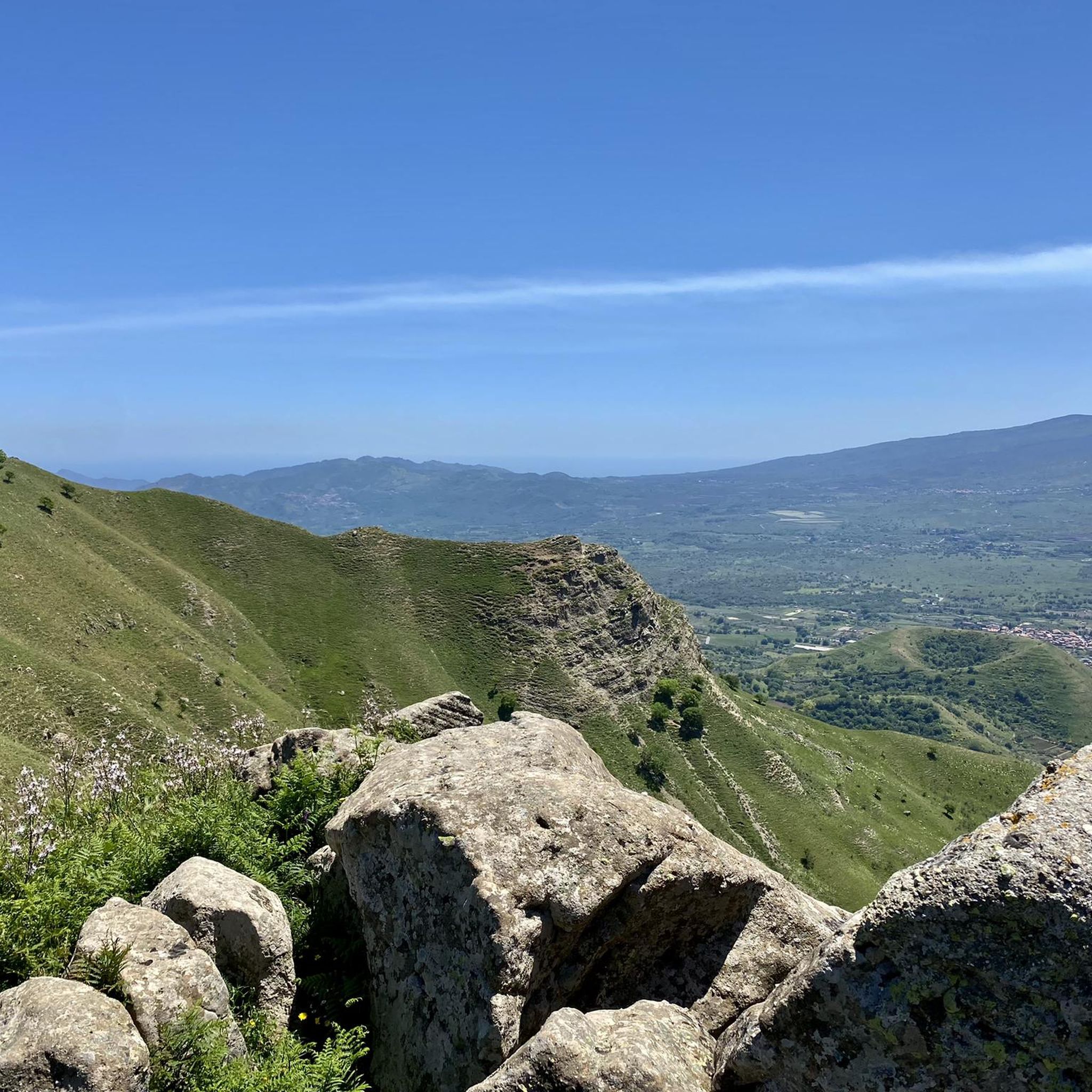
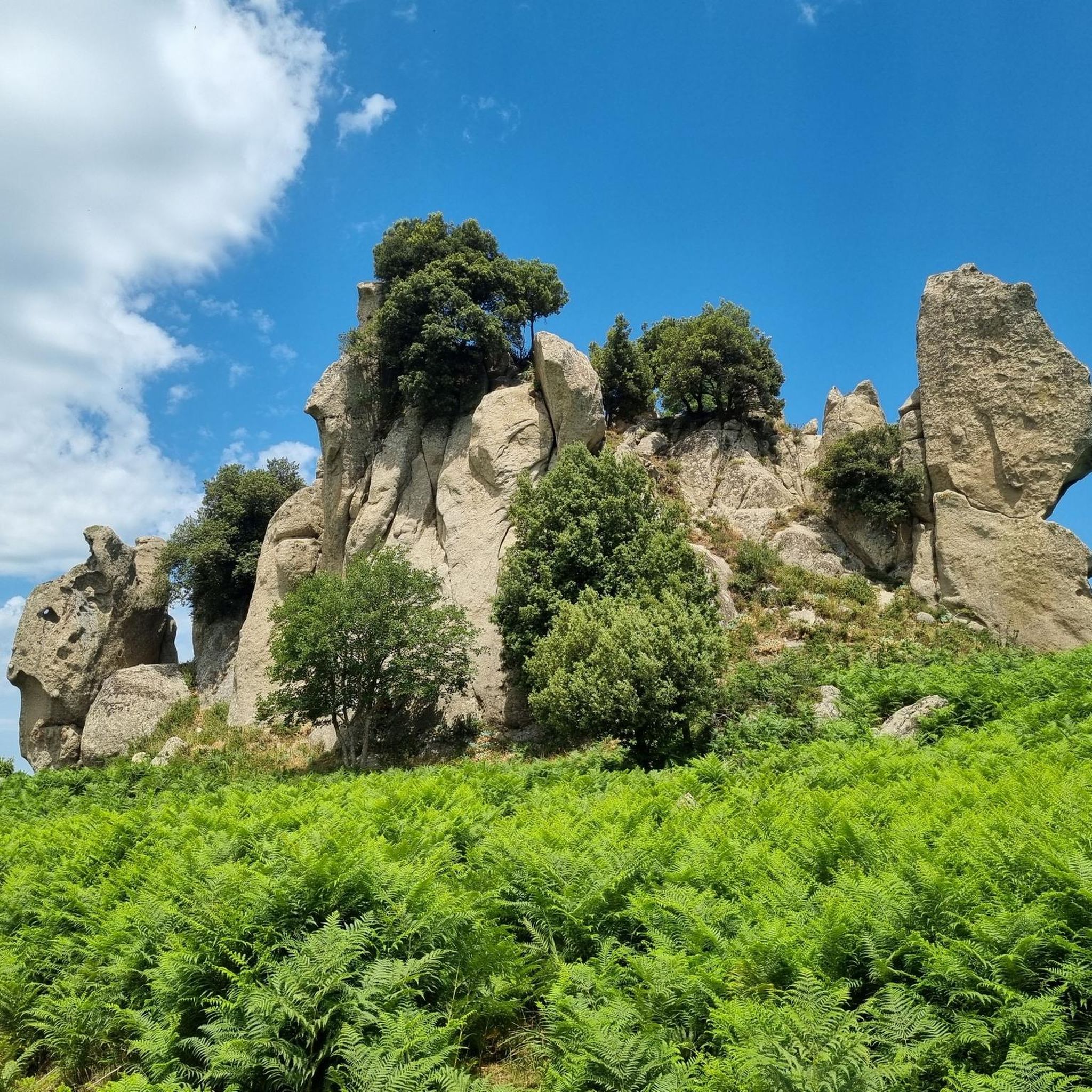
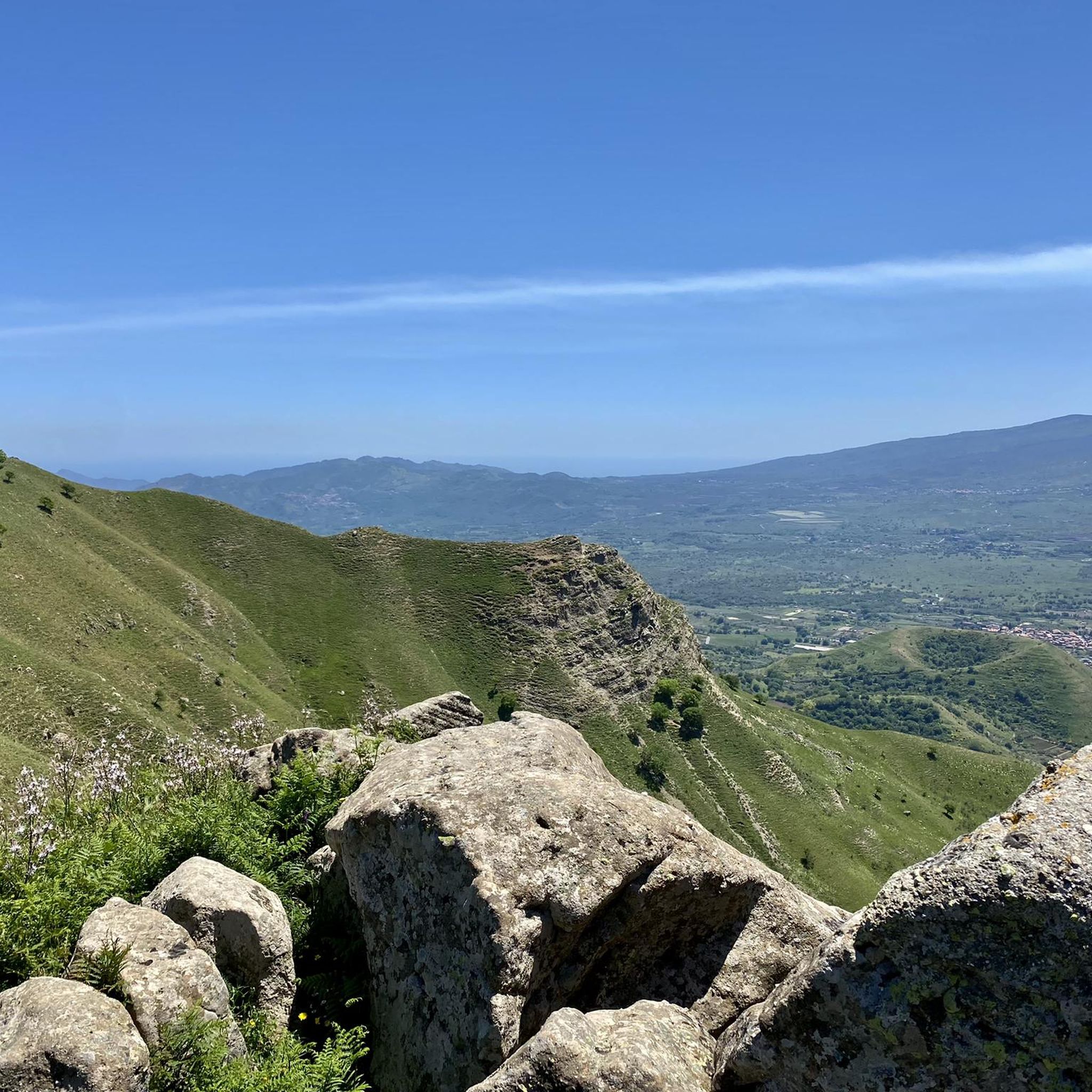
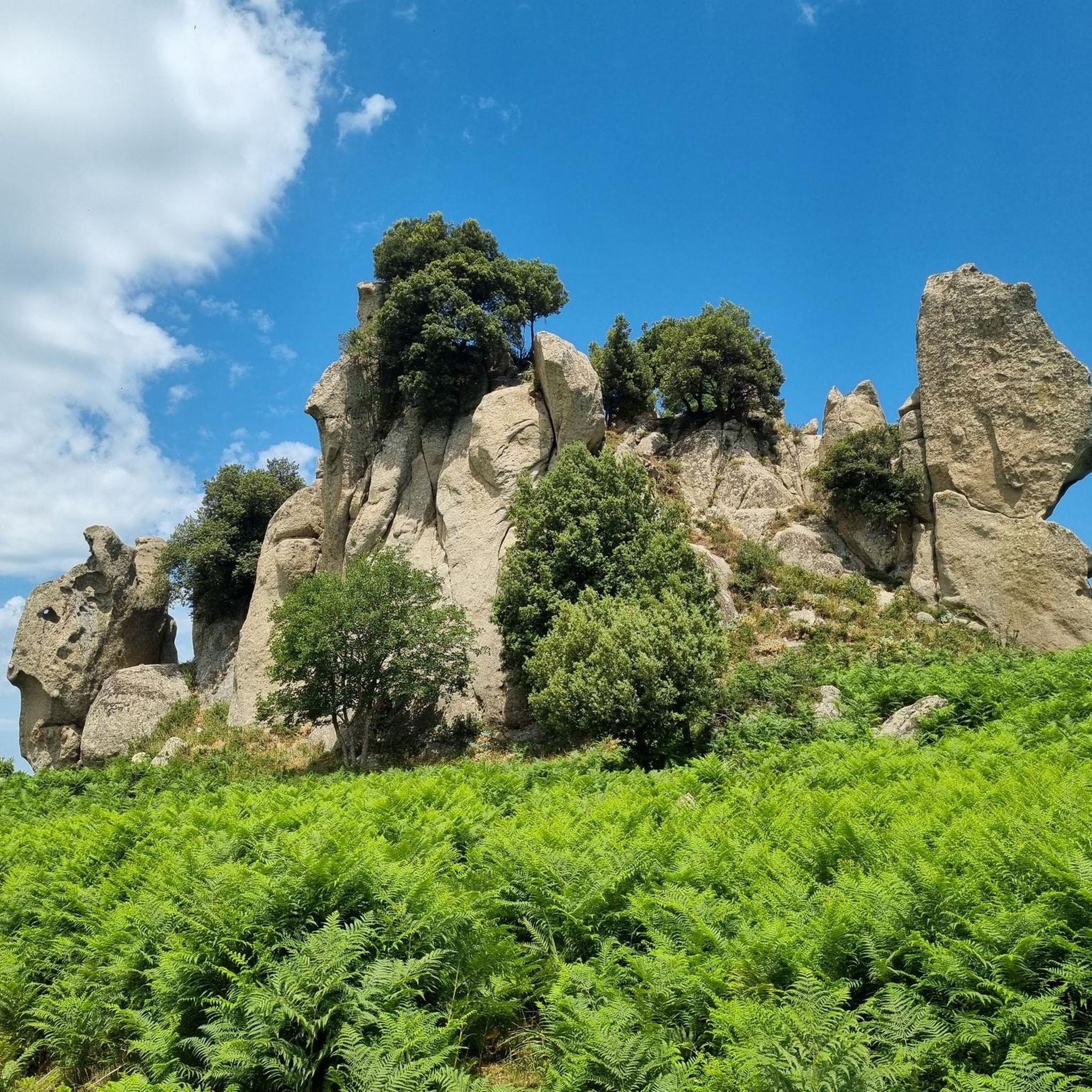
With a guide, you can interpret the possible roles of each rock in the ancestors' rites of passage. Spectacular views, including of Mount Etna, not only from the highest rock with its "pool," but also from walking through the fields of ferns (they were a beautiful green in August 2025).
0
0

Argimusco is a plateau located in Sicily, just north of Etna, approximately on the border between the Nebrodi and Peloritani mountains, and is administratively divided between the municipalities of Montalbano Elicona, Tripi (which stands on the site of ancient Abacaenum) and Roccella Valdemone. The plateau is very panoramic as you can admire Etna, the Aeolian Islands, the curious mountains Rocca Salvatesta and Montagna di Vernà, Capo Tindari, Capo Calavà and Capo Milazzo up close. It is part of the Bosco di Malabotta nature reserve.
2
0

This beautiful picnic area is located right next to the Croce Mancina gate, a pass at an altitude of 1,241 meters. Here, even in the height of summer, you can breathe the fresh air of the forest.
1
0

Nasty geological effect or star mirror? Everyone can decide for themselves and research or dream
1
0

Frequently Asked Questions
How many hiking trails are available in Riserva Naturale Orientata Bosco Di Malabotta?
There are over 65 hiking trails in Riserva Naturale Orientata Bosco Di Malabotta, offering a diverse range of options for different skill levels. This includes 22 easy routes, 34 moderate routes, and 9 difficult trails.
Are there easy hiking trails suitable for beginners or families?
Yes, the reserve offers 22 easy hiking trails. A great option for a shorter, family-friendly walk is the Eagle Rock (Adlerfelsen) – Rocche dell'Argimusco loop from Monte Fontana Scavi. This 1.1-mile (1.8 km) trail takes about 29 minutes and leads through unique rock formations.
What kind of natural attractions can I see along the hiking trails?
Hikers can explore ancient woodlands, distinctive rock formations, and varied elevations. Notable natural attractions include Volturi Peak, the prominent Eagle Rock (Adlerfelsen), and the unique Argimusco Rock Formations.
Are there any circular hiking routes in the reserve?
Yes, many trails in Riserva Naturale Orientata Bosco Di Malabotta are circular. For example, the Patriarchs' Trail – Volturi Peak loop from Contrada Fradaro is a moderate 5.3-mile (8.5 km) route that circles Volturi Peak.
What is the best time of year to go hiking in Riserva Naturale Orientata Bosco Di Malabotta?
The reserve is beautiful year-round, but spring and autumn offer pleasant temperatures and vibrant scenery. Spring brings blooming flora, while autumn showcases rich fall colors in the ancient woodlands. Summers can be warm, so early morning or late afternoon hikes are recommended.
Are dogs allowed on the hiking trails?
Generally, dogs are allowed on trails in Riserva Naturale Orientata Bosco Di Malabotta, but it's always best to keep them on a leash to protect local wildlife and ensure a pleasant experience for all hikers. Please respect any specific signage regarding pets.
Are there any trails that feature waterfalls?
Yes, you can find trails that lead to waterfalls. Consider the Roccella Ford – Palazzolo Angara Waterfalls loop from Roccella Valdemone, a moderate 8.7-mile (8.7 km) route that takes you to the Palazzolo Angara Waterfalls.
What do other hikers enjoy most about Riserva Naturale Orientata Bosco Di Malabotta?
The area is highly rated by the komoot community, with an average score of 4.3 stars from over 670 reviews. Reviewers often praise the quiet woodlands, the unique rock formations, and the diverse environment for outdoor activities.
Where can I find parking when visiting the reserve?
Parking is typically available near common trailheads and access points. For routes starting from Monte Fontana Scavi, such as the Patriarchs' Trail – Eagle Rock (Adlerfelsen) loop, you will usually find designated parking areas.
Are there any longer or more challenging hikes for experienced hikers?
Yes, for experienced hikers, there are 9 difficult trails. The Patriarchs' Trail – Volturi Peak loop from Roccella Valdemone is a challenging 12.8-mile (20.5 km) route with significant elevation gain, offering a more strenuous experience.
What kind of wildlife can be spotted in Riserva Naturale Orientata Bosco Di Malabotta?
The ancient woodlands and diverse habitats of the reserve are home to various wildlife. While specific sightings are never guaranteed, you might encounter local bird species, small mammals, and insects. The untouched nature provides a rich ecosystem for observation.
Are there any places to eat or get refreshments near the hiking trails?
While the reserve itself is primarily natural, small villages and towns bordering the area, such as Montalbano Elicona, often have local cafes or trattorias where you can find refreshments and traditional Sicilian food after your hike.
Most popular routes in Riserva Naturale Orientata Bosco Di Malabotta
Most popular attractions in Riserva Naturale Orientata Bosco Di Malabotta

Get inspired with the komoot mobile app


Explore more
Browse the best Hikes in other regions.
