The best walks and hikes in Sic Monti Di Castro
4.4
(57)
282
hikers
16
hikes
Hiking in Sic Monti Di Castro, located in the Viterbo province of Italy, features diverse landscapes suitable for various activity levels. The region is characterized by green, gently rolling hills, river valleys, and proximity to the Tyrrhenian coast. Trails often traverse areas with significant natural features like the Fiora River and nature reserves, alongside historical and archaeological sites. The terrain includes varied elevations, with some routes reaching over 400 meters of ascent.
Best hiking trails in Sic Monti Di Castro
…Last updated: July 5, 2026
4.6
(9)
46
hikers
8.40km
02:20
150m
150m
Moderate hike. Good fitness required. Easily-accessible paths. Suitable for all skill levels.
5.0
(4)
24
hikers
3.42km
00:55
50m
50m
Easy hike. Great for any fitness level. Easily-accessible paths. Suitable for all skill levels.

Sign up for free
5
hikers
10.6km
03:23
430m
430m
Moderate hike. Good fitness required. Easily-accessible paths. Suitable for all skill levels.
5.0
(1)
1
hikers
3.50km
00:58
60m
60m
Easy hike. Great for any fitness level. Easily-accessible paths. Suitable for all skill levels.
3.0
(1)
6
hikers
8.45km
02:32
280m
280m
Moderate hike. Good fitness required. Easily-accessible paths. Suitable for all skill levels.
Get access to more routes and recommendations from other explorers.
Sign up for free
Already have an account?
Our route recommendations are based on thousands of hikes, rides, and runs completed by other people on komoot.
Start today with a free account
Your next adventure awaits.
Login or Signup
Tips from the Community

It can be reached after a walk (also accessible by bike) along a path that runs alongside the Fiora River; the last stretch is accessible only on foot. Impressive.
0
0

The site is closed for maintenance. Paths are disturbed, unmaintained, and often unmarked. Walking the route often leads you to the back of closed buildings.
0
0

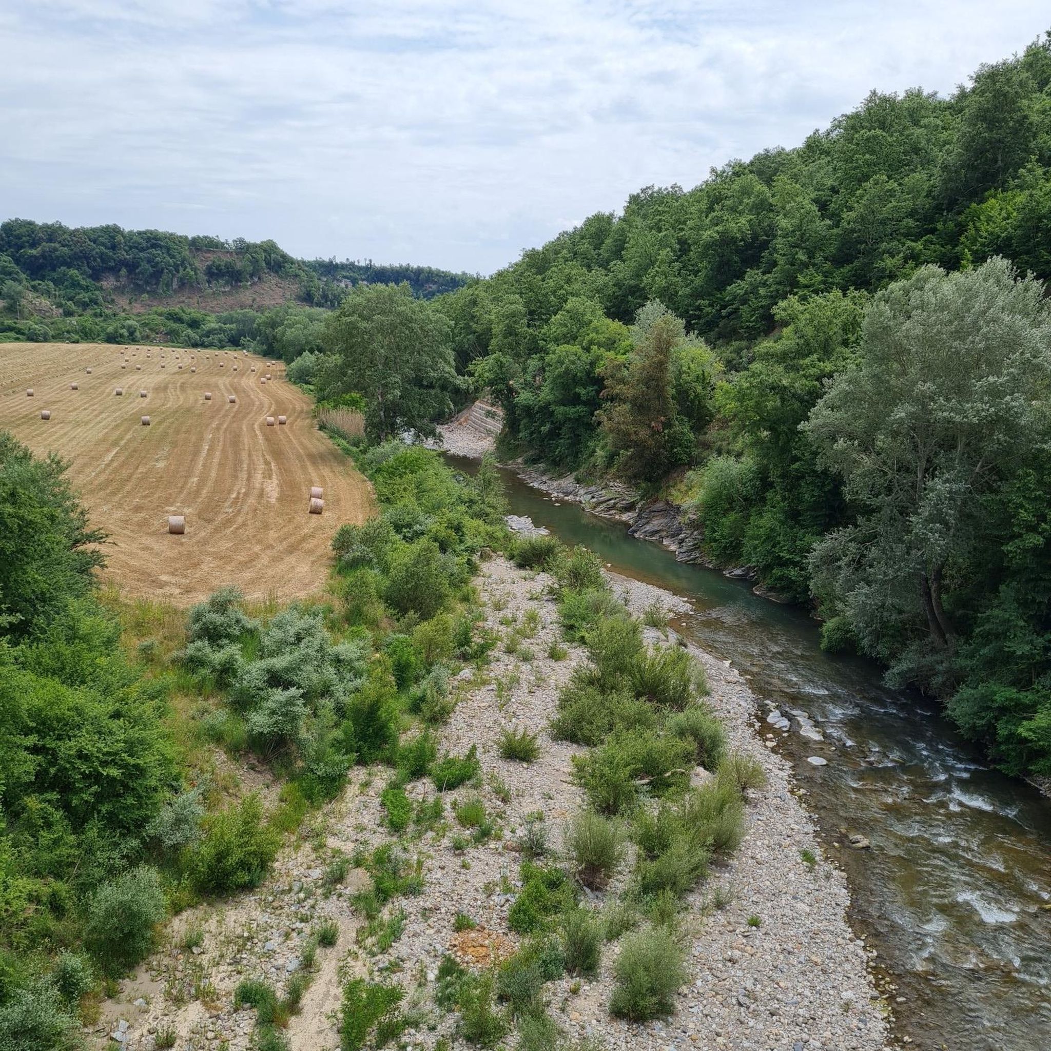
Section of the Fiora river near the monastery of Poggio Conte
1
0

This “via cava”, a multitude of narrow streets that lead like canyons through the tuff rock, is also dug into the rather soft tuff of the area. The Etruscans were the originators of this bizarre road system more than 2,500 years ago. Why the “vie cave” were created and for what purpose they were used remains a mystery to scientists to this day: Were the ravines merely connecting and supply routes between Etruscan settlements? Did you serve to drain the rainwater? Or were they mystical places of worship? The proximity of the Etruscan people to mysticism and astrology - and the numerous necropolises that one encounters when walking through the paths speak for the latter point of view. This one is already quite dilapidated at one end and you have to look for a path between fallen rocks.
3
0
The settlement was a small, poor and largely abandoned village at the time of the founding of the Duchy of Castro (1537) before becoming the capital. The Farnese decided to transform it to make it worthy of the rank of capital of the duchy and a symbol of their power and prestige. The reconstruction embraced the city in all its aspects, from defensive walls to public buildings, from noble palaces to houses and streets, turning the settlement into a perfect example of Renaissance art and architecture. Powerful families, Pope Paul III. Farnese as well as many nobles who competed in building noble palaces and made Castro a fashionable city. The heart was represented by Piazza Maggiore, in the center of which there was a fountain and along its perimeter the Palazzo della Zecca, the Hostaria, to welcome the Duke's illustrious guests, the residence of these and the palaces of the most important citizens. Castro also had brick streets and squares with sewers, which was very rare at the time. Sangallo's drawings remain in Florence as proof of this. In Castro there were 13 churches, the most important of which was certainly the Romanesque cathedral dedicated to San Savino, protector of the city, celebrated on May 3 in the main square with a carousel and a palace between the districts. There was also a hospital and hospice to help widows and orphans. To solve the problem of water shortages, a fountain called Santa Lucia was built, located near the church of the same name, with spiral staircases similar to those of San Patrizio in Orvieto. In 1649 the papal troops of Innocenzo X Pamphilj, whose family was an ally of the Barberinis and an enemy of the Farnese, besieged the city, sacked it, razed it to the ground and deported its inhabitants. Today the ruins are covered with forest. Over time, excavations have been carried out that have brought to light the remains of the main square with its pavement, the remains of the Cathedral, those of the Palazzo della Zecca, the Convent of San Francesco, the fortifications and Porta Lamberta. One can also see the remains of underground rooms, cellars, wells, cisterns and cellars
4
0
Über die Einsiedelei von Poggio Conte gibt es nur sehr wenige historische und archivarische Informationen. Im Bürgermuseum "Pietro e Turiddo Lotti" in Ischia di Castro würden sechs der dreizehn Tafeln mit den Aposteln aufbewahrt, die in den 1960er Jahren von den Wänden der Einsiedelei gestohlen wurden. Aus architektonischer Sicht zeigt die Einsiedelei von Poggio Conte eine bemerkenswerte künstlerische und skulpturale Fähigkeit und eine Beherrschung der Ausdrucksmittel, die deutlich an die französische Kultur des 13. Jahrhunderts erinnern. Davon zeugt das Blumenmotiv auf dem Gewölbe des ersten Raumes sowie der Grundriss. Letzteres beeinflusst von der Zisterzienserarchitektur mit der Pflanze, die einer strengen geometrischen Einstellung folgt, die in der Artikulation auf zwei Linien und zwei symmetrischen Kreisen stattfindet. Weitere interessant Details sind die kubischen Kapitelle, das Reliefblumenmuster auf dem Gewölbe des ersten Raumes und die Apsis des zweiten Raumes. Diese raffinierten künstlerischen Details werden dem 13. Jahrhundert zugeschreiben. Die Geschichte der Einsiedelei von Poggio Conte ist jedoch mindestens zweihundert Jahre älter, da die ersten Beweise für die Einsiedelei in einem Dokument aus dem Jahr 1027 enthalten sind. Höchstwahrscheinlich hingen sowohl die Einsiedelei von Poggio Conte als auch die nahe gelegene Einsiedelei von Ripatonna Cicognina von der nahe gelegenen Abtei San Colombano auf dem Gebiet von Ischia di Castro ab, deren Gründung mindestens bis ins 9. Jahrhundert zurückreicht. Die Wahl des Klosterlebens, die die Einsiedler von Poggio Conte veranlasste, sich an diesen Ort zurückzuziehen, nach dem Lebensmodell von San Colombano, einem kompromisslosen irischen Einsiedler, der nicht zu Kompromissen neigte und sich der Spiritualität widmete, stand im offenen Widerspruch zur Opulenz und Weltlichkeit des Klerus von Rom. … Sicher ist, dass die Einsiedelei von Poggio Conte das Ergebnis einer Überschneidung kultureller Schichten ist, die in der etruskischen Ära beginnen und bis heute andauern. Entlang des Zugangs zur Einsiedelei auf dem Tuffkamm befinden sich tatsächlich zwei kleine Kammergräber (etruskische Ära), deren Zugangsstufe noch erkennbar ist und die aller Wahrscheinlichkeit nach einmal Teil eines größeren Komplexes gewesen sein müssen.
10
0

Crossing the Olpeta River on wooden trunks and at the ancient destroyed bridge that led to the city of Castro. Leaving the hollow streets, following a wet path, you reach the enchanting Olpeta River. Recommend good shoes even better if waterproof.
2
0
Ancient capital of the rich duchy of Castro, the city destroyed in the 16th century. by order of the Pope, it maintains a mysterious and archaic charm due to the vegetation that has reconquered the urban spaces. One of those few places in Italy where you can still experience the fascination of exploration and archeology immersed in nature, good shoes and torches are recommended for entering the still well-preserved underground structures.
2
0
Frequently Asked Questions
How many hiking trails are there in Sic Monti Di Castro?
Sic Monti Di Castro offers a diverse network of over 18 hiking routes. These trails cater to various preferences, ranging from easy strolls to more challenging ascents, allowing you to explore the region's natural beauty and historical sites.
Are there any family-friendly hiking options in Sic Monti Di Castro?
Yes, Sic Monti Di Castro has several easy trails suitable for families. For instance, the Walk in the ancient city of Castro is a shorter, 2.2-mile (3.5 km) path that takes about an hour, perfect for a leisurely family outing to explore historical ruins.
Can I bring my dog on the trails in Sic Monti Di Castro?
While specific regulations for dogs on every trail can vary, many natural areas in Italy are generally dog-friendly, especially if dogs are kept on a leash. It's always recommended to check local signage or park rules for specific reserves like Lago di Burano or Selva del Lamone before heading out with your pet.
What kind of natural features or landmarks can I expect to see while hiking?
Hiking in Sic Monti Di Castro offers a rich blend of natural and historical sights. You can explore the Fiora River, discover the picturesque Ponte dell'Arcobaleno, or visit the Selva del Lamone Regional Nature Reserve, home to the spectacular Salabrone Waterfall. The region also features diverse landscapes from rolling green hills to coastal beauty near Montalto Marina.
Are there any trails that feature waterfalls?
Yes, the region is home to impressive waterfalls. The Strozzavolpe Waterfall – Poggio Conte Hermitage loop from Poggio Salone is a popular moderate route that explores riverine environments and natural features, including the Strozzavolpe Waterfall. Additionally, the Selva del Lamone Regional Nature Reserve boasts the spectacular Salabrone Waterfall.
Are there circular hiking routes available?
Many trails in Sic Monti Di Castro are designed as loops, offering a convenient way to explore without retracing your steps. Examples include the Strozzavolpe Waterfall – Poggio Conte Hermitage loop from Poggio Salone and the Poggio Conte Hermitage – Eremo Waterfall loop from Monte Calvo.
What is the best time of year to go hiking in Sic Monti Di Castro?
The Lazio Maremma region, including Sic Monti Di Castro, generally offers pleasant hiking conditions in spring (April-June) and autumn (September-October) when temperatures are milder. Summers can be hot, especially in July and August, while winters are typically mild but can be rainy.
What are the typical terrain and difficulty levels of hikes in the region?
The terrain in Sic Monti Di Castro is varied, featuring green, gently rolling hills, river valleys, and some coastal paths. Trails range from easy, accessible paths with minimal elevation gain, like the Poggio Conte Hermitage – Eremo Waterfall loop from Monte Calvo, to moderate routes with significant ascents, such as the Castle ruins loop from Monte Calvo, which has over 400 meters of elevation gain.
Is parking available at the trailheads?
While specific parking details for every trailhead are not always listed, many popular hiking areas and natural reserves in Italy typically offer designated parking facilities. For routes starting from towns or established attractions like Vulci Archaeological Site, parking is generally available nearby.
How can I reach the hiking areas using public transport?
Public transport options to reach specific trailheads in rural areas like Sic Monti Di Castro can be limited. Montalto di Castro is accessible by bus and train, but reaching the more remote hiking starting points often requires a car. It's advisable to check local bus schedules from Montalto di Castro to smaller villages if you plan to rely on public transport.
Are there places to eat or stay near the hiking trails?
Yes, the charming walled hill town of Montalto di Castro and the nearby Montalto Marina offer various amenities, including cafes, restaurants, and accommodation options. These towns serve as excellent bases for exploring the surrounding hiking trails and natural attractions.
What do other hikers say about the trails in Sic Monti Di Castro?
The trails in Sic Monti Di Castro are highly rated by the komoot community, with an average score of 4.4 stars from over 50 reviews. Hikers often praise the blend of natural beauty with historical sites, the variety of terrain, and the opportunity to discover hidden gems like waterfalls and ancient ruins.
Are there any historical or archaeological sites I can explore on a hike?
Absolutely. The region is rich in history. The Vulci Archaeological Site is a major highlight, offering a combination of nature and history with Etruscan ruins, necropolises, and the Castello della Badia. You can also explore the ancient city of Castro or the Necropolis of Poggio Buco, which can be accessed via the Necropolis of Poggio Buco loop from La Capannella.
Most popular routes in Sic Monti Di Castro

Get inspired with the komoot mobile app


Explore more
Browse the best Hikes in other regions.
