The best walks and hikes in Riserva Naturale Delle Salse Di Nirano
4.4
(1164)
5,943
hikers
11
hikes
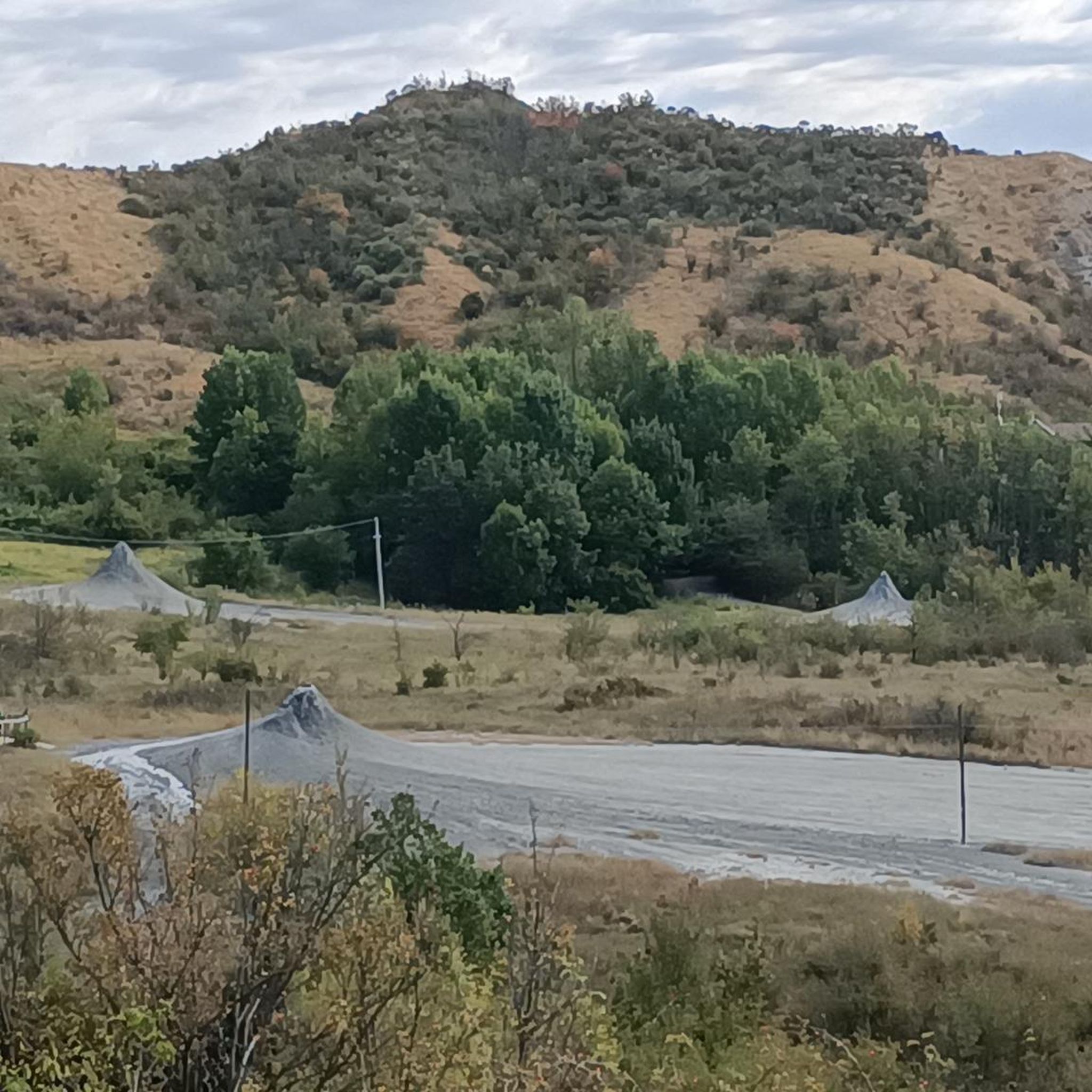
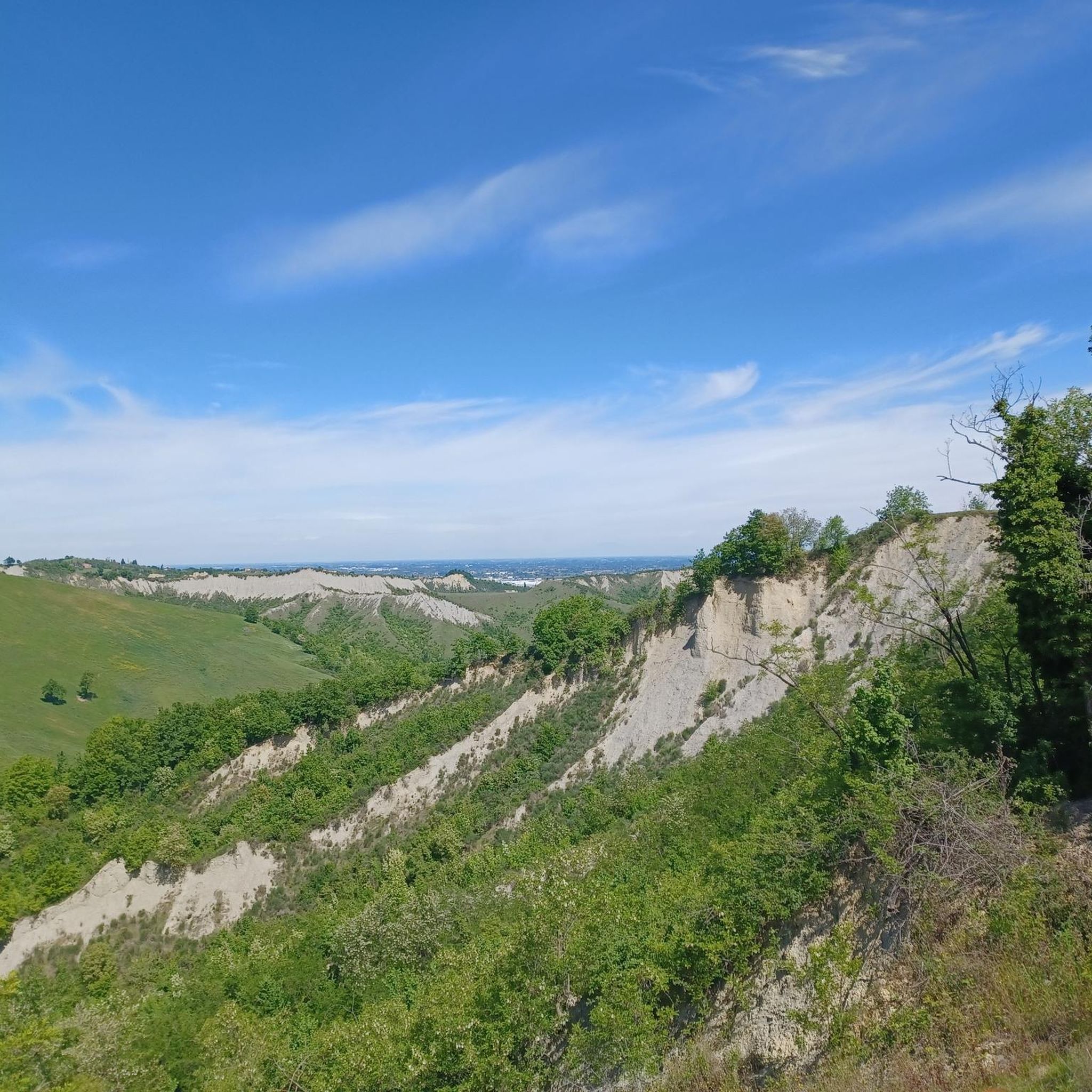
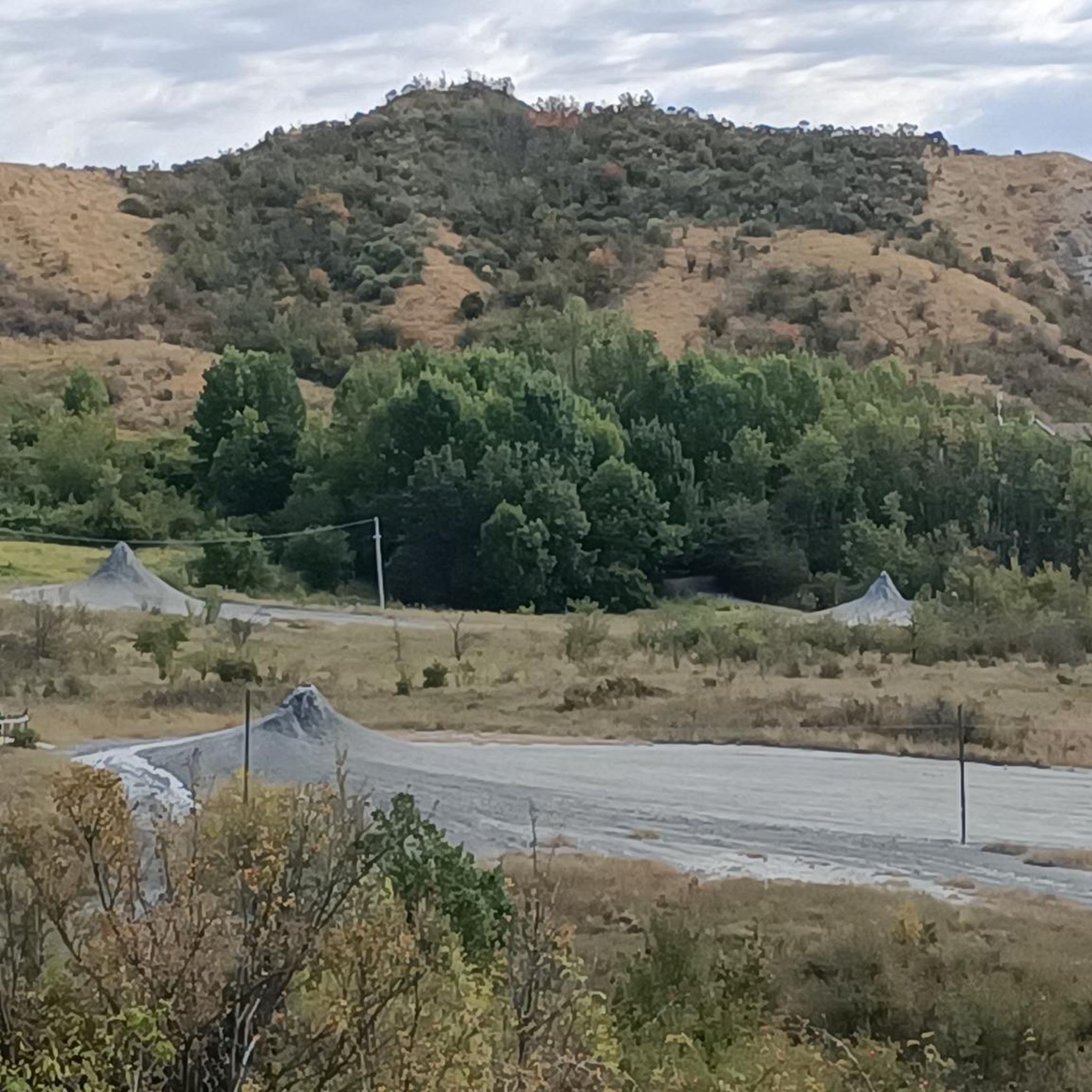
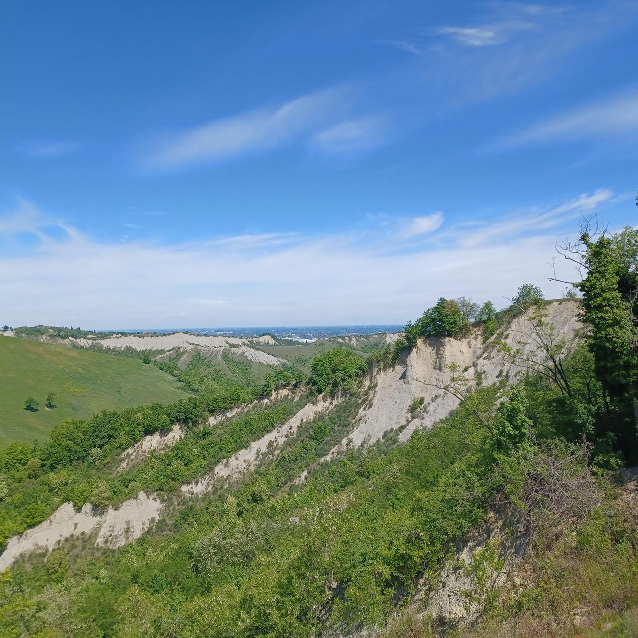
Hiking in Riserva Naturale Delle Salse Di Nirano offers a distinctive experience centered around its unique geological features. The reserve is characterized by "salse," or mud volcanoes, where cold, clay-rich mud and gas rise to the surface, creating an unusual landscape of conical mounds. Beyond these pseudovolcanic formations, the terrain includes hilly areas, badlands, and sparse woodland, with elevations ranging from 150 to 300 meters above sea level. This environment supports specific salt-tolerant plant life and provides varied hiking conditions.
Best hiking trails in Riserva Naturale Delle Salse Di Nirano
- The most popular hiking route is Giro delle Salse Loop, an easy 2.5 miles (4.0 km) trail that takes 1 hour 9 minutes to complete. This path offers a direct experience of the mud volcanoes and is suitable for families.
- Another top favourite among local hikers is Mud volcanoes – Roe Deer Trail loop from Castello di Spezzano, a moderate 5.3 miles (8.5 km) path. This route combines views of the mud volcanoes with scenic sections through the reserve's varied landscape, often completed in about 2 hours 26 minutes.
- Local hikers also love the Montegibbio Castle – View from Monte Mongigatto loop from Castello di Spezzano, a 10.4 miles (16.8 km) trail leading through hilly terrain and offering panoramic views towards Montegibbio Castle, often completed in about 4 hours 57 minutes.
- Hiking in Riserva Naturale Delle Salse Di Nirano is defined by its unique mud volcanoes, hilly terrain, and sparse woodland. The network offers options for different ability levels, from easy walks around the salse to more challenging treks through the surrounding hills.
- The routes in Riserva Naturale Delle Salse Di Nirano are highly rated by the komoot community with an average score of 4.4 stars from nearly 1000 reviews. More than 5000 hikers have used komoot to explore Riserva Naturale Delle Salse Di Nirano's varied terrain.
Last updated: July 7, 2026
5.0
(1)
9
hikers
4.02km
01:09
100m
90m
Easy hike. Great for any fitness level. Easily-accessible paths. Suitable for all skill levels.
4.3
(6)
32
hikers
Easy hike. Great for any fitness level. Easily-accessible paths. Suitable for all skill levels.

Sign up for free
5.0
(3)
18
hikers
Easy hike. Great for any fitness level. Easily-accessible paths. Suitable for all skill levels.
4.3
(4)
14
hikers
Easy hike. Great for any fitness level. Easily-accessible paths. Suitable for all skill levels.
5.0
(2)
14
hikers
Easy hike. Great for any fitness level. Easily-accessible paths. Suitable for all skill levels.
Get access to more routes and recommendations from other explorers.
Sign up for free
Already have an account?
Our route recommendations are based on thousands of hikes, rides, and runs completed by other people on komoot.
Start today with a free account
Your next adventure awaits.
Login or Signup
Popular around Riserva Naturale Delle Salse Di Nirano

Tips from the Community

The most evocative part of the tour is undoubtedly the stretch of path that from "Cà Rossa" crosses (partly on wooden walkways also suitable for the disabled) the mud volcano area, which can be admired at very close range, obviously without touching anything! Since you enter a marshy area, equip yourself with adequate shoes, even boots might be useful if it has rained recently! The "short" tour that starts from the car park, reaches Cà Rossa via the "dragonfly path" and returns to the car park via the "owl path" takes about an hour.
0
0

The Cà Tassi Visitor Center, located in a panoramic position, is the result of the renovation of an old rural complex, following the principles of green building. Activities aimed at protecting and enhancing the Reserve are carried out within the building. (Source and further information: https://www.fioranoturismo.it/it/natura/salse-di-nirano/ca-tassi-centro-visite )
0
0

start of the cycle path on the bridge to cross the stream, and it joins the asphalt road that leads to the parking lot at the beginning of the Salse
0
0
to see other craters of the reserve up close
0
0
The tunnel of sounds, to listen to the sounds of animals
0
0
The collapse and reconstruction of the bridge makes us deviate from the main asphalted route
0
0
tunnel to monitor the sounds of the surrounding fauna, a non-invasive method for the environment
2
0
Frequently Asked Questions
What kind of hiking trails can I expect in Riserva Naturale Delle Salse Di Nirano?
The reserve offers a diverse network of trails, from easy walks around the unique mud volcanoes to more challenging treks through hilly terrain and sparse woodland. You'll find paths suitable for various fitness levels, with elevations ranging from 150 to 300 meters above sea level. In total, there are over 300 hiking routes available.
Are there any easy, family-friendly hikes in the reserve?
Yes, the reserve is well-suited for families. An excellent option is the Salse di Nirano Mud Volcanoes – View of the Salse di Nirano loop from Riserva naturale delle Salse di Nirano. This easy 4.4 km path allows you to experience the mud volcanoes up close and is perfect for shorter excursions with children.
Can I bring my dog on the hiking trails?
The Riserva Naturale Delle Salse Di Nirano is generally dog-friendly, but it's always best to keep your dog on a leash to protect the delicate environment and local wildlife. Many trails, especially the wider paths, are suitable for walks with your canine companion.
What are the main natural features or landmarks to see while hiking?
The primary draw is the fascinating geological phenomenon of the "salse," or mud volcanoes, where cold, clay-rich mud and gas rise to the surface, creating an otherworldly landscape. You can explore these unique formations, such as the Mud Volcanoes of Salse di Nirano and the First Mud Volcano of the Salse di Nirano. The reserve also features badlands, sparse woodland, and panoramic viewpoints like the View of the Salse di Nirano.
Are there any circular hiking routes available?
Yes, many trails in the reserve are circular, allowing you to start and end at the same point. For a moderate circular hike that combines the mud volcanoes with scenic views, consider the Mud volcanoes – Roe Deer Trail loop from Castello di Spezzano, which is about 8.5 km long.
What is the best time of year to hike in Riserva Naturale Delle Salse Di Nirano?
The reserve can be visited year-round. Spring and autumn offer pleasant temperatures and vibrant colors, making them ideal for hiking. In spring, you might see specific salt-tolerant plants in bloom. Summer can be warm, so early morning or late afternoon hikes are recommended. Winter offers a different, quieter experience, though paths might be muddy after rain.
Where can I park when visiting the reserve?
The reserve is well-equipped for visitors, and parking is generally available near the main entrances and visitor centers, such as the Cà Tassi Visitors' Centre. Specific trailheads often have designated parking areas, making access convenient for hikers.
Are there any longer or more challenging hikes for experienced trekkers?
For those seeking a more challenging experience, the reserve offers longer routes through its hilly terrain. The Montegibbio Castle – View from Monte Mongigatto loop from Castello di Spezzano is a 16.8 km trail that leads through picturesque hills and offers panoramic views towards Montegibbio Castle, typically taking around 5 hours to complete.
What do other hikers say about the trails in Riserva Naturale Delle Salse Di Nirano?
The trails in Riserva Naturale Delle Salse Di Nirano are highly regarded by the komoot community, with an average rating of 4.4 stars from nearly 1000 reviews. Hikers often praise the unique geological formations, the well-maintained paths, and the peaceful atmosphere of the reserve.
Are there any visitor facilities or educational centers in the reserve?
Yes, the reserve features the Cà Tassi Visitors' Centre, which provides information, guided tours, and educational programs. It also houses a natural history museum and library. Additionally, the Cà Rossa Ecomuseum further enhances the educational offerings, providing deeper insights into the area's natural and cultural heritage.
What kind of landscape and vegetation can I expect to see?
Beyond the mud volcanoes, the reserve's landscape is characterized by hilly terrain, badlands, and sparse woodland. Due to the high salt content in the mud, you'll find specific salt-tolerant plants like Puccinellia fasciculata. The varied environment supports diverse flora and fauna, offering interesting observations for nature enthusiasts.
Most popular routes in Riserva Naturale Delle Salse Di Nirano
Most popular attractions in Riserva Naturale Delle Salse Di Nirano

Get inspired with the komoot mobile app


Explore more
Browse the best Hikes in other regions.
